Citation:
Citation_Information:
Originator: Peter Dartnell
Originator: David P. Finlayson
Originator: Jonathan A. Warrick
Publication_Date: 2020
Title:
Acoustic backscatter data collected in 2008 offshore Tijuana River Estuary, California, during USGS Field Activity S-5-08-SC
Geospatial_Data_Presentation_Form: GeoTIFF
Series_Information:
Series_Name: data release
Issue_Identification: DOI:10.5066/P9Y8CDFI
Publication_Information:
Publication_Place:
Pacific Coastal and Marine Science Center, Santa Cruz, California
Publisher: U.S. Geological Survey
Online_Linkage: https://doi.org/10.5066/P9Y8CDFI
Online_Linkage:
Larger_Work_Citation:
Citation_Information:
Originator: Peter Dartnell
Originator: David P. Finlayson
Originator: Jonathan A. Warrick
Publication_Date: 2020
Title:
Bathymetry and acoustic backscatter data collected in 2008 offshore Tijuana River Estuary, California during USGS Field Activity S-5-08-SC
Series_Information:
Series_Name: data release
Issue_Identification: DOI:10.5066/P9Y8CDFI
Publication_Information:
Publication_Place: Pacific Coastal and Marine Science Center, Santa Cruz, CA
Publisher: U.S. Geological Survey
Online_Linkage: https://doi.org/10.5066/P9Y8CDFI
Description:
Abstract:
These metadata describe acoustic backscatter data collected during a 2008 SWATHPlus-M survey offshore Tijuana River Estuary, California. Data were collected and processed by the U.S. Geological Survey (USGS), Pacific Coastal and Marine Science Center (PCMSC) with fieldwork activity number S-5-08-SC. The acoustic backscatter data are provided as a GeoTIFF image.
Purpose:
Coastal mapping was conducted as part of the Tijuana Estuary Fine Sediment Fate and Transport Demonstration Project, which was developed by a number of State of California, Federal, and private industry partners to provide information about the directions, rates, and processes of fine sediment transport at nearshore settings of California. The primary goal of the Demonstration Project was the monitoring of the transport, fate, and impacts of fine sediment from beach sediment nourishments in 2008 and 2009 near the Tijuana River Estuary, Imperial Beach, California. To achieve this goal, the USGS monitored the water, beach, and seafloor properties near the project site. The coastal mapping described in this report provided important baseline bathymetric and seafloor substrate information for the Demonstration Project and was used to develop sampling programs for the Demonstration Project. These data are intended for science researchers, students, policy makers, and the general public. These data can be used with geographic information systems or other software to identify bathymetric features. These data are not intended to be used for navigation.
Supplemental_Information:
Additional information about the field activity from which these data were derived is available online at:
https://cmgds.marine.usgs.gov/fan_info.php?fan=S508SC
Any use of trade, product, or firm names is for descriptive purposes only and does not imply endorsement by the U.S. Government. Although this Federal Geographic Data Committee-compliant metadata file is intended to document the data set in nonproprietary form, as well as in Esri format, this metadata file may include some Esri-specific terminology.
Time_Period_of_Content:
Time_Period_Information:
Range_of_Dates/Times:
Beginning_Date: 20080428
Ending_Date: 20080507
Currentness_Reference: ground condition at time data were collected.
Status:
Progress: Complete
Maintenance_and_Update_Frequency: None planned
Spatial_Domain:
Bounding_Coordinates:
West_Bounding_Coordinate: -123.181
East_Bounding_Coordinate: -123.126
North_Bounding_Coordinate: 32.595
South_Bounding_Coordinate: 32.534
Keywords:
Theme:
Theme_Keyword_Thesaurus: USGS Metadata Identifier
Theme_Keyword: USGS:8574973d-b856-421e-8d78-988a62374037
Theme:
Theme_Keyword_Thesaurus: ISO 19115 Topic Category
Theme_Keyword: geoscientificInformation
Theme_Keyword: elevation
Theme:
Theme_Keyword_Thesaurus: USGS Thesaurus
Theme_Keyword: bathymetry
Theme_Keyword: bathymetry measurement
Theme_Keyword: sea-floor characteristics
Theme_Keyword: geospatial datasets
Theme_Keyword: marine geophysics
Theme_Keyword: sonar methods
Theme:
Theme_Keyword_Thesaurus: Data Categories for Marine Planning
Theme_Keyword: Bathymetry and Elevation
Theme:
Theme_Keyword_Thesaurus: Marine Realms Information Bank (MRIB) keywords
Theme_Keyword: field observation
Theme:
Theme_Keyword_Thesaurus: none
Theme_Keyword: U.S. Geological Survey
Theme_Keyword: USGS
Theme_Keyword: Coastal and Marine Hazards and Resources Program
Theme_Keyword: CMHRP
Theme_Keyword: Pacific Coastal and Marine Science Center
Theme_Keyword: PCMSC
Place:
Place_Keyword_Thesaurus: Geographic Names Information System (GNIS)
Place_Keyword: Pacific Ocean
Place_Keyword: State of California
Place_Keyword: Imperial Beach
Place_Keyword: Tijuana River National Estuarine Research Reserve
Access_Constraints: none
Use_Constraints:
USGS-authored or produced data and information are in the public domain from the U.S. Government and are freely redistributable with proper metadata and source attribution. Please recognize and acknowledge the U.S. Geological Survey as the originators of the dataset and in products derived from these data. This information is not intended for navigation purposes.
Point_of_Contact:
Contact_Information:
Contact_Organization_Primary:
Contact_Organization:
U.S. Geological Survey, Pacific Coastal and Marine Science Center
Contact_Person: PCMSC Science Data Coordinator
Contact_Address:
Address_Type: mailing and physical
Address: 2885 Mission Street
City: Santa Cruz
State_or_Province: CA
Postal_Code: 95060
Contact_Voice_Telephone: 831-427-4747
Contact_Electronic_Mail_Address: pcmsc_data@usgs.gov
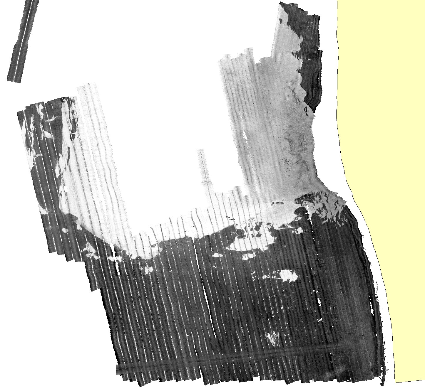
Browse_Graphic:
Browse_Graphic_File_Name:
Browse_Graphic_File_Description: Quick view image of the Tijuana River Delta backscatter data.
Browse_Graphic_File_Type: JPEG
Native_Data_Set_Environment:
Caris HIPS and SIPS (version 7.1.1 Service Pack 3) and ArcMap (ver. 10.3.1) on a Windows 7 computer.