Online Links:
Online Links:
| Value | Definition |
|---|---|
| ACU | Acoustic Properties |
| CMP | Sediment Composition |
| COL | Color |
| GTC | Geotechnical Properties |
| GRZ | Grain Size |
| TXR | Texture |
| TXG | Texture (Graphic) |
| LTH | Lithology |
| Range of values | |
|---|---|
| Minimum: | 0 |
| Maximum: | 100 |
| Units: | Percent |
| Resolution: | 1 |
| Range of values | |
|---|---|
| Minimum: | 0 |
| Maximum: | 100 |
| Units: | Percent |
| Resolution: | 1 |
| Range of values | |
|---|---|
| Minimum: | 0 |
| Maximum: | 100 |
| Units: | Percent |
| Resolution: | 1 |
| Range of values | |
|---|---|
| Minimum: | 0 |
| Maximum: | 100 |
| Units: | Percent |
| Resolution: | 1 |
| Range of values | |
|---|---|
| Minimum: | -12 |
| Maximum: | 12 |
| Units: | Phi |
| Resolution: | 0.1 |
| Range of values | |
|---|---|
| Minimum: | 0 |
| Maximum: | 6 |
| Units: | phi |
| Resolution: | 0.1 |
| Range of values | |
|---|---|
| Minimum: | 30 |
| Maximum: | 100 |
| Units: | Fuzzy membership |
| Resolution: | 1 |
| Value | Definition |
|---|---|
| (g)M | Slightly gravelly mud |
| (g)mS | Slightly gravelly muddy sand |
| (g)sM | Slightly gravelly sandy mud |
| (g)S | Slightly gravelly sand |
| G | Gravel |
| gM | Gravelly mud |
| gmS | Gravelly muddy sand |
| gS | Gravelly sand |
| M | Mud |
| mG | Muddy gravel |
| mS | Muddy sand |
| msG | Muddy sandy gravel |
| S | Sand |
| sG | Sandy gravel |
| sM | Sandy mud |
| H | Hard ground |
| Value | Definition |
|---|---|
| CLAYEY SILT | Sediment that is mostly silt with clay as the next most common component |
| SANDY SILT | Sediment that is mostly silt with sand as the next most common component |
| SAND SILT CLAY | Sediment with significant sand, silt, and clay |
| SILTY CLAY | Sediment that is mostly clay with silt as the next most common component |
| SAND | Sediment with greater than 80 percent in the 62 micron to 2 mm fraction |
| SILTY SAND | Sediment that is mostly sand with silt (greater than 20 percent) as the next most common component |
| SEDIMENT | Relative primary textural class |
| CLAYEY SAND | Relative primary textural class |
| CLAY | Relative primary textural class |
| SANDY CLAY | Relative primary textural class |
| SILT | Relative primary textural class |
| GRAVELLY SEDIMENT | Sediment with greater than 10 percent gravel, but less than 50 percent |
| GRAVEL | Sediment with nominal diameter coarser than 2mm |
| SEDIMENT | Relative primary textural class |
| Value | Definition |
|---|---|
| -99 | No data |
| Value | Definition |
|---|---|
| -99 | No data |
| Range of values | |
|---|---|
| Minimum: | 0 |
| Maximum: | 100 |
| Units: | Percent |
| Resolution: | 1 |
| Range of values | |
|---|---|
| Minimum: | 0 |
| Maximum: | 100 |
| Units: | Percent |
| Resolution: | 0.1 |
| Value | Definition |
|---|---|
| -99 | No data |
| Range of values | |
|---|---|
| Minimum: | 0 |
| Maximum: | Unknown |
| Units: | kPa |
| Resolution: | 1 |
| Value | Definition |
|---|---|
| -99 | No data |
| Value | Definition |
|---|---|
| -99 | No data |
| Access_Constraints | None |
|---|---|
| Use_Constraints | USGS-authored or produced data and information are in the public domain from the U.S. Government and are freely redistributable with proper metadata and source attribution. Please recognize and acknowledge the U.S. Geological Survey as the originator(s) of the dataset and in products derived from these data. This information is not intended for navigation purposes. |
| Data format: | Text file containing data input to usSEABED. Fields are comma separated values. First record of file contains field names. in format comma-delimited text Size: 13.3 |
|---|---|
| Network links: |
https://pubs.usgs.gov/ds/2006/182/data/pac_ext.txt https://pubs.usgs.gov/ds/2006/182/data_cata.html https://doi.org/10.3133/ds182 |
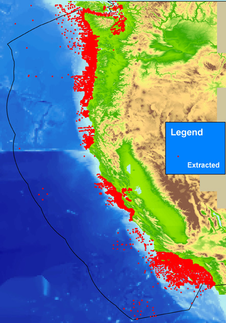
| Data format: | The SHP file contains the geospatial data. The SHX file contains the index of the geospatial data. The DBF file contains the attribute data in dBASE format. The PRJ file contains the coordinate system information (optional). The AVL file contains the legend information (optional). The SBN and SBX files contain the spatial index of the geospatial data (optional). in format shapefile (version 2005) ESRI point shapefile |
|---|---|
| Network links: |
https://pubs.usgs.gov/ds/2006/182/data/pac_ext.zip https://pubs.usgs.gov/ds/2006/182/data_cata.html https://doi.org/10.3133/ds182 |