TIDESTATIONS - Pacific Northwest Water-Level Stations and Tidal Datum Distributions

Metadata also available as - [Questions & Answers] - [Parseable text] - [XML]

Metadata:

Identification_Information:
Citation:
Citation_Information:
Originator: NOAA Center for Tsunami Research
Publication_Date: 2006
Title:
TIDESTATIONS - Pacific Northwest Water-Level Stations and Tidal Datum Distributions
Edition: 1
Geospatial_Data_Presentation_Form: vector digital data
Series_Information:
Series_Name: Data Series
Issue_Identification: 236
Publication_Information:
Publication_Place: Western Coastal and Marine Geology, Menlo Park, California
Publisher: U.S. Geological Survey, Coastal and Marine Geology Program
Online_Linkage: http://pubs.usgs.gov/ds/2006/236/download/tidestations.zip
Online_Linkage: http://pubs.usgs.gov/ds/2006/236/catalog.shtml
Larger_Work_Citation:
Citation_Information:
Originator: Florence L. Wong
Originator: Angie J. Venturato
Originator: Eric L. Geist
Publication_Date: 2006
Title:
Seaside, Oregon Tsunami Pilot Study -- Modernization of FEMA Flood Hazard Maps: GIS Data
Geospatial_Data_Presentation_Form: vector digital data
Series_Information:
Series_Name: Data Series
Issue_Identification: 236
Publication_Information:
Publication_Place: Western Coastal and Marine Geology, Menlo Park, California
Publisher: U.S. Geological Survey, Coastal and Marine Geology Program
Online_Linkage: http://pubs.usgs.gov/ds/2006/236/
Description:
Abstract:
This geospatial data set depicts the locations of National Ocean Service water-level stations to determine tidal datum distributions with the Seaside, Oregon, region.
Purpose:
This data set is one of a collection of spatially referenced digital files in a geographic information system related to the Seaside, Oregon, Tsunami Pilot Study.
Federal Emergency Management Agency (FEMA) Federal Insurance Rate Map (FIRM) guidelines do not currently exist for conducting and incorporating tsunami hazard assessments that reflect the substantial advances in tsunami research achieved in the last two decades (Tsunami Pilot Study Working Group, 2006). Therefore, as part of the FEMA Modernization Program, a Tsunami Pilot Study was carried out in the Seaside/Gearhart, Oregon, area to provide information from which tsunami mapping guidelines could be developed. This area was chosen because it is typical of coastal communities in the section of the Pacific Coast from Cape Mendocino to the Strait of Juan de Fuca. There was also considerable interest shown by state agencies and local stakeholders in mapping the tsunami threat to this region. The study was an interagency effort by scientists from the U.S. Geological Survey, the National Oceanic and Atmospheric Administration, the University of Southern California, and the Middle East Technical University. We present the GIS data from that report in this publication.
These data are intended for science researchers, students, policy makers, and the general public. The data can be used with geographic information systems (GIS) software to display geologic and oceanographic information.
Time_Period_of_Content:
Time_Period_Information:
Single_Date/Time:
Calendar_Date: 2004
Currentness_Reference: publication date
Status:
Progress: Complete
Maintenance_and_Update_Frequency: None planned
Spatial_Domain:
Bounding_Coordinates:
West_Bounding_Coordinate: -124.616670
East_Bounding_Coordinate: -123.766666
North_Bounding_Coordinate: 48.368330
South_Bounding_Coordinate: 40.766670
Keywords:
Theme:
Theme_Keyword_Thesaurus: USGS Metadata Identifier
Theme_Keyword: USGS:ef3c6af3-ac5c-4147-b334-9142b0f13b77
Theme:
Theme_Keyword_Thesaurus: None
Theme_Keyword: National Oceanic and Atmospheric Administration
Theme_Keyword: NOAA
Theme_Keyword: Center for Tsunami Research
Theme_Keyword: U.S. Geological Survey
Theme_Keyword: USGS
Theme_Keyword: Coastal and Marine Geology Program
Theme_Keyword: CMGP
Theme_Keyword: Western Coastal and Marine Geology
Theme_Keyword: WCMG
Theme_Keyword: point shapefile
Theme_Keyword: NOS water-level Stations
Theme_Keyword: tidal datum distribution
Theme_Keyword: station locations
Theme_Keyword: point shapefile
Theme:
Theme_Keyword_Thesaurus: USGS Thesaurus
Theme_Keyword: tsunamis
Theme_Keyword: geospatial datasets
Theme:
Theme_Keyword_Thesaurus: ISO 19115 Topic Category
Theme_Keyword: oceans
Theme_Keyword: environment
Theme_Keyword: geoscientificInformation
Place:
Place_Keyword_Thesaurus: Geographic Names Information System
Place_Keyword: Seaside
Place_Keyword: Oregon
Place_Keyword: Pacific Northwest
Place_Keyword: United States
Place_Keyword: USA
Place_Keyword: North America
Temporal:
Temporal_Keyword_Thesaurus: none
Temporal_Keyword: 1983
Temporal_Keyword: 2001
Access_Constraints: None.
Use_Constraints:
These data were created for the sole purpose of the Seaside, Oregon, Tsunami Pilot Study. It is not meant for navigational means. The National Oceanic and Atmospheric Administration makes no expressed or implied warranty regarding the accuracy of these data.
The act of distribution shall not constitute any such warranty, and no responsibility is assumed by the U.S. Geological Survey in the use of these data on any other system.
Public domain data from the U.S. Government are freely redistributable with proper metadata and source attribution. Please recognize the National Oceanic and Atmospheric Administration (NOAA) as the originator of the dataset.
Point_of_Contact:
Contact_Information:
Contact_Organization_Primary:
Contact_Organization: NOAA Center for Tsunami Research
Contact_Person: Angie J. Venturato
Contact_Address:
Address_Type: mailing address
Address: 7600 Sand Point Way NE
City: Seattle
State_or_Province: Washington
Postal_Code: 98115
Country: USA
Contact_Voice_Telephone: 206-526-6556
Contact_Electronic_Mail_Address: Angie.J.Venturato@noaa.gov
Browse_Graphic:
Browse_Graphic_File_Name: http://pubs.usgs.gov/ds/2006/236/metadata/tidestations.gif
Browse_Graphic_File_Description:
Map of the central Cascadia region showing the locations of Seaside and relevant tide stations
Browse_Graphic_File_Type: GIF
Data_Set_Credit:
NOAA National Ocean Service, NOAA National Geodetic Survey, NOAA Center for Tsunami Research
Native_Data_Set_Environment:
Microsoft Windows XP Version 5.1 (Build 2600) Service Pack 2; ESRI ArcCatalog 9.1.0.722
Cross_Reference:
Citation_Information:
Originator: Tsunami Pilot Study Working Group
Publication_Date: 2006
Title:
Seaside, Oregon Tsunami Pilot Study -- Modernization of FEMA Flood Hazard Maps
Edition: 1
Geospatial_Data_Presentation_Form: document
Series_Information:
Series_Name: Open-File Report
Issue_Identification: 2006-1234
Publication_Information:
Publication_Place: Menlo Park, California
Publisher: U.S. Geological Survey
Online_Linkage: http://pubs.usgs.gov/of/2006/1234/
Cross_Reference:
Citation_Information:
Originator: Venturato, A.J.
Publication_Date: 2005
Title:
A digital elevation model for Seaside, Oregon: Procedures, data sources, and analyses
Geospatial_Data_Presentation_Form: document
Publication_Information:
Publication_Place: Seattle, Washington
Publisher: Pacific Marine Environmental Laboratory
Other_Citation_Details: NOAA Tech Memo 2812
Online_Linkage: http://www.pmel.noaa.gov/pubs/PDF/vent2812/vent2812.pdf
Cross_Reference:
Citation_Information:
Originator: H.O. Mofjeld, A.J. Venturato, F.I. Gonzalez, and V.V. Titov
Publication_Date: 2004
Title: Background tides and sea level variations at Seaside, Oregon
Geospatial_Data_Presentation_Form: document
Publication_Information:
Publication_Place: Seattle, Washington
Publisher: Pacific Marine Environmental Laboratory
Other_Citation_Details: NOAA Tech Memo 2736
Online_Linkage: http://www.pmel.noaa.gov/pubs/PDF/mofj2736/mofj2736.pdf
Cross_Reference:
Citation_Information:
Originator: NOAA National Ocean Service
Publication_Date: 2004
Title: Water Level Station Benchmarks
Geospatial_Data_Presentation_Form: document
Publication_Information:
Publication_Place: Silver Spring, Maryland
Publisher: NOAA National Ocean Service
Other_Citation_Details:
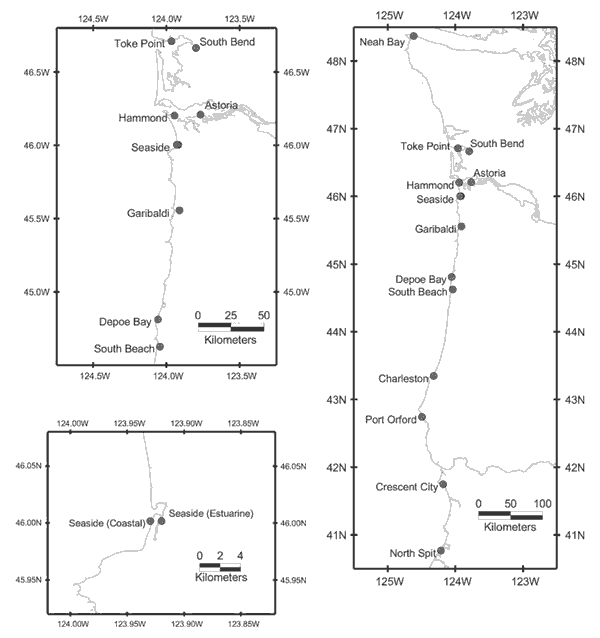
Benchmark information was obtained for 13 stations: Neah Bay, Toke Point, South Bend, Astoria, Hammond, Seaside, Garibaldi, Depoe Bay, South Beach, Charleston, Port Orford, Crescent City, and North Spit
Online_Linkage: http://www.tidesandcurrents.noaa.gov/
Cross_Reference:
Citation_Information:
Originator: NOAA National Geodetic Survey
Publication_Date: 2004
Title: Vertical geodetic control data
Geospatial_Data_Presentation_Form: vector digital data
Publication_Information:
Publication_Place: Silver Spring, Maryland
Publisher: NOAA National Geodetic Survey
Online_Linkage: http://www.ngs.noaa.gov/
Data_Quality_Information:
Attribute_Accuracy:
Attribute_Accuracy_Report:
These data contain attributes automatically generated by ESRI ArcGIS software and two user-defined attributes that were developed by NOAA National Ocean Service, National Geodetic Survey, and NOAA Center for Tsunami Research. Refer to cross references for more information.
Logical_Consistency_Report: Refer to cross references
Completeness_Report: Complete.
Positional_Accuracy:
Horizontal_Positional_Accuracy:
Horizontal_Positional_Accuracy_Report: Refer to cross references.
Vertical_Positional_Accuracy:
Vertical_Positional_Accuracy_Report: Refer to cross references.
Lineage:
Source_Information:
Source_Citation:
Citation_Information:
Originator: NOAA National Ocean Service
Publication_Date: 2004
Title: Water Level Station Benchmarks
Geospatial_Data_Presentation_Form: document
Online_Linkage: http://www.tidesandcurrents.noaa.gov/
Type_of_Source_Media: online
Source_Time_Period_of_Content:
Time_Period_Information:
Single_Date/Time:
Calendar_Date: 2004
Source_Currentness_Reference: publication date
Source_Citation_Abbreviation: nostides
Source_Contribution: tidal datum information and associated attributes
Source_Information:
Source_Citation:
Citation_Information:
Originator: National Geodetic Survey
Publication_Date: 2004
Title: Vertical Geodetic Control Data
Geospatial_Data_Presentation_Form: vector digital data
Online_Linkage: http://www.ngs.noaa.gov/
Type_of_Source_Media: online
Source_Time_Period_of_Content:
Time_Period_Information:
Single_Date/Time:
Calendar_Date: 2004
Source_Currentness_Reference: publication date
Source_Citation_Abbreviation: ngscontrol
Source_Contribution: geodetic datum information and associated attributes
Process_Step:
Process_Description:
Source data were used to create a table of coordinates and associated attributes. The table was imported to create a point shapefile. The data are discussed further in:
Mofjeld, H.O., et al. (2004): Background tides and sea level variations at Seaside, Oregon, NOAA Tech. Memo. 2736, 1-19.
Source_Used_Citation_Abbreviation: nostides
Source_Used_Citation_Abbreviation: ngscontrol
Process_Date: 2004
Source_Produced_Citation_Abbreviation: tidestations
Process_Step:
Process_Description:
Edited metadata to add keywords section with USGS persistent identifier as theme keyword. No data were changed.
Process_Date: 20201019
Process_Contact:
Contact_Information:
Contact_Organization_Primary:
Contact_Organization: U.S. Geological Survey
Contact_Person: VeeAnn A. Cross
Contact_Position: Marine Geologist
Contact_Address:
Address_Type: Mailing and Physical
Address: 384 Woods Hole Road
City: Woods Hole
State_or_Province: MA
Postal_Code: 02543-1598
Contact_Voice_Telephone: 508-548-8700 x2251
Contact_Facsimile_Telephone: 508-457-2310
Contact_Electronic_Mail_Address: vatnipp@usgs.gov
Process_Step:
Process_Description:
Edited metadata for minor typos and to bring it up to PCMSC standards, including adding USGS Thesaurus keyword terms. No data were changed.
Process_Date: 20211008
Process_Contact:
Contact_Information:
Contact_Organization_Primary:
Contact_Organization: U.S. Geological Survey
Contact_Person: Susan Cochran
Contact_Position: Geologist
Contact_Address:
Address_Type: Mailing and Physical
Address: 2885 Mission Street
City: Santa Cruz
State_or_Province: CA
Postal_Code: 95060
Contact_Voice_Telephone: 831-460-7545
Contact_Electronic_Mail_Address: scochran@usgs.gov
Spatial_Data_Organization_Information:
Direct_Spatial_Reference_Method: Vector
Point_and_Vector_Object_Information:
SDTS_Terms_Description:
SDTS_Point_and_Vector_Object_Type: Entity point
Point_and_Vector_Object_Count: 15
Spatial_Reference_Information:
Horizontal_Coordinate_System_Definition:
Geographic:
Latitude_Resolution: 1.000000
Longitude_Resolution: 1.000000
Geographic_Coordinate_Units: Decimal degrees
Geodetic_Model:
Horizontal_Datum_Name: North American Datum of 1983
Ellipsoid_Name: Geodetic Reference System 80
Semi-major_Axis: 6378137.000000
Denominator_of_Flattening_Ratio: 298.257222
Entity_and_Attribute_Information:
Detailed_Description:
Entity_Type:
Entity_Type_Label: tidestations
Entity_Type_Definition: name of shapefile
Entity_Type_Definition_Source: none
Attribute:
Attribute_Label: FID
Attribute_Definition: Internal feature number.
Attribute_Definition_Source: ESRI
Attribute_Domain_Values:
Unrepresentable_Domain:
Sequential unique whole numbers that are automatically generated.
Attribute:
Attribute_Label: Shape
Attribute_Definition: Feature geometry.
Attribute_Definition_Source: ESRI
Attribute_Domain_Values:
Unrepresentable_Domain: Coordinates defining the features.
Attribute:
Attribute_Label: ID
Attribute_Definition: user-defined identification number
Attribute_Definition_Source: none
Attribute_Domain_Values:
Enumerated_Domain:
Enumerated_Domain_Value: number
Enumerated_Domain_Value_Definition: user-defined identification value
Enumerated_Domain_Value_Definition_Source: none
Attribute:
Attribute_Label: NAME
Attribute_Definition: Water-level station name
Attribute_Definition_Source: NOS
Attribute_Domain_Values:
Unrepresentable_Domain: Feature defined by NOS
Attribute:
Attribute_Label: STATIONID
Attribute_Definition: Water-level station identification number
Attribute_Definition_Source: NOS
Attribute_Domain_Values:
Unrepresentable_Domain: Feature defined by NOS
Attribute:
Attribute_Label: STATE
Attribute_Definition: State in which station exists
Attribute_Definition_Source: none
Attribute_Domain_Values:
Unrepresentable_Domain: Feature defined by NOS
Attribute:
Attribute_Label: LATITUDE
Attribute_Definition: Latitude of water-level station
Attribute_Definition_Source: NOS
Attribute_Domain_Values:
Unrepresentable_Domain: Feature defined by NOS
Attribute:
Attribute_Label: LONGITUDE
Attribute_Definition: Longitude of water-level station
Attribute_Definition_Source: NOS
Attribute_Domain_Values:
Unrepresentable_Domain: Feature defined by NOS
Attribute:
Attribute_Label: DIST_KM
Attribute_Definition: Distance in kilometers from Seaside, Oregon
Attribute_Definition_Source: NOAA Center for Tsunami Research
Attribute_Domain_Values:
Range_Domain:
Range_Domain_Minimum: 0
Range_Domain_Maximum: 583
Attribute:
Attribute_Label: MAXOBS
Attribute_Definition: Maximum observed water-level
Attribute_Definition_Source: NOS
Attribute_Domain_Values:
Unrepresentable_Domain: Feature defined by NOS
Attribute:
Attribute_Label: MHHW
Attribute_Definition: Mean Higher High Water
Attribute_Definition_Source: NOS
Attribute_Domain_Values:
Unrepresentable_Domain: Feature defined by NOS
Attribute:
Attribute_Label: MHW
Attribute_Definition: Mean High Water
Attribute_Definition_Source: NOS
Attribute_Domain_Values:
Unrepresentable_Domain: Feature defined by NOS
Attribute:
Attribute_Label: MTL
Attribute_Definition: Mean Tide Level
Attribute_Definition_Source: NOS
Attribute_Domain_Values:
Unrepresentable_Domain: Feature defined by NOS
Attribute:
Attribute_Label: MSL
Attribute_Definition: Mean Sea Level
Attribute_Definition_Source: NOS
Attribute_Domain_Values:
Unrepresentable_Domain: Feature defined by NOS
Attribute:
Attribute_Label: MLW
Attribute_Definition: Mean Low Water
Attribute_Definition_Source: NOS
Attribute_Domain_Values:
Unrepresentable_Domain: Feature defined by NOS
Attribute:
Attribute_Label: NAVD88
Attribute_Definition: North American Vertical Datum of 1988
Attribute_Definition_Source: NGS
Attribute_Domain_Values:
Unrepresentable_Domain: Feature defined by NGS
Attribute:
Attribute_Label: NGVD29
Attribute_Definition: National Geodetic Vertical Datum of 1929
Attribute_Definition_Source: NGS
Attribute_Domain_Values:
Unrepresentable_Domain: Feature defined by NGS
Attribute:
Attribute_Label: MLLW
Attribute_Definition: Mean Lower Low Water
Attribute_Definition_Source: NOS
Attribute_Domain_Values:
Unrepresentable_Domain: Feature defined by NOS
Attribute:
Attribute_Label: MINOBS
Attribute_Definition: Minimum Observed Water Level
Attribute_Definition_Source: NOS
Attribute_Domain_Values:
Unrepresentable_Domain: Feature defined by NOS
Attribute:
Attribute_Label: SOURCE
Attribute_Definition: source of datum distributions
Attribute_Definition_Source: user-defined
Attribute_Domain_Values:
Enumerated_Domain:
Enumerated_Domain_Value: observed
Enumerated_Domain_Value_Definition: Datums based on observed water-level data
Enumerated_Domain_Value_Definition_Source: NOS
Attribute_Domain_Values:
Enumerated_Domain:
Enumerated_Domain_Value: interpolated
Enumerated_Domain_Value_Definition:
datum values based on values interpolated between other water-level stations
Enumerated_Domain_Value_Definition_Source: user-defined
Distribution_Information:
Distributor:
Contact_Information:
Contact_Organization_Primary:
Contact_Organization: U.S. Geological Survey
Contact_Address:
Address_Type: mailing address
Address: Information Services Box 25286
City: Denver
State_or_Province: Colorado
Postal_Code: 80225-0286
Country: USA
Contact_Voice_Telephone: 1-888-275-8747
Contact_Electronic_Mail_Address: infoservices@usgs.gov
Resource_Description: Downloadable Data: U.S. Geological Survey Data Series 236
Distribution_Liability:
Although these data have been used by the U.S. Geological Survey (USGS) and National Oceanic and Atmospheric Administration (NOAA) no warranty expressed or implied is made by the U.S. Geological Survey as to the accuracy of the data. The act of distribution shall not constitute any such warranty, and no responsibility is assumed by the USGS in the use of these data or related materials.
Any use of trade, product, or firm names is for descriptive purposes only and does not imply endorsement by the U.S. Government.
Standard_Order_Process:
Digital_Form:
Digital_Transfer_Information:
Format_Name: shapefile
Format_Version_Number: 9.1
Format_Specification: ArcGIS shapefile
File_Decompression_Technique: no compression applied
Transfer_Size: 0.020
Digital_Transfer_Option:
Online_Option:
Computer_Contact_Information: Access_Instructions: Data may be downloaded via the World Wide Web (WWW).
Fees: None.
Technical_Prerequisites:
These data are available in Environmental Systems Research Institute (ESRI) shapefile format. The user must have ArcGIS or ArcView 3.0 or greater software to read and process the data file. In lieu of ArcView or ArcGIS, the user may utilize another GIS application package capable of importing the data. A free data viewer, ArcExplorer, capable of displaying the data is available from ESRI at www.esri.com.
Metadata_Reference_Information:
Metadata_Date: 20211008
Metadata_Contact:
Contact_Information:
Contact_Organization_Primary:
Contact_Organization: NOAA Center for Tsunami Research
Contact_Person: Angie J. Venturato
Contact_Address:
Address_Type: mailing address
Address: 7600 Sand Point Way NE
City: Seattle
State_or_Province: Washington
Postal_Code: 98115
Country: USA
Contact_Voice_Telephone: 206-526-6556
Contact_Electronic_Mail_Address: Angie.J.Venturato@noaa.gov
Metadata_Standard_Name: Content Standard for Digital Geospatial Metadata
Metadata_Standard_Version: FGDC-STD-001-1998
Metadata_Time_Convention: local time
Metadata_Access_Constraints: None
Metadata_Use_Constraints: None

This page is <https://cmgds.marine.usgs.gov/catalog/pcmsc/SeriesReports/DS_DDS/DS_236/tidestations.shp.html>
Generated by mp version 2.9.50 on Wed Oct 13 09:08:57 2021