This part of DS 781 presents habitat data in the Offshore of Carpinteria map area, California. The vector data file is included in "Habitat_OffshoreCarpinteria.zip," which is accessible from
https://pubs.usgs.gov/ds/781/OffshoreCarpinteria/data_catalog_OffshoreCarpinteria.html. These data accompany the pamphlet and map sheets of Johnson, S.Y., Dartnell, P., Cochrane, G.R., Golden, N.E., Phillips, E.L., Ritchie, A.C., Kvitek, R.G., Greene, H.G., Endris, C.A., Seitz, G.G., Sliter, R.W., Erdey, M.D., Wong, F.L., Gutierrez, C.I., Krigsman, L.M., Draut, A.E., and Hart, P.E. (S.Y. Johnson and S.A. Cochran, eds.), 2013, California State Waters Map Series—Offshore of Carpinteria, California: U.S. Geological Survey Scientific Investigations Map 3261, 42 p., 10 sheets, scale 1:24,000,
https://doi.org/10.3133/sim3261.
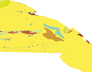
Potential marine benthic habitat maps were constructed using multibeam echosounder (MBES) bathymetry and backscatter data. The habitats were based on substrate types and documented or "ground truthed" using underwater video images and seafloor samples obtained by the USGS. These maps display various habitat types that range from flat, soft, unconsolidated sediment-covered seafloor to hard, deformed (folded), or highly rugose and differentially eroded bedrock exposures.
To expand geologic mapping to the seafloor within the California's State Waters, to update coastal geologic mapping, and to contribute to a uniform regional geologic database, which can be used geographic information systems. Additionally, to provide a geologic map for the public and geoscience community to aid in assessments and mitigation of geologic hazards in the Carpinteria coastal region and to provide sufficient geologic information for land-use and land-management decisions both onshore and offshore. These data are intended for science researchers, students, policy makers, and the general public. These data can be used with geographic information systems or other software. This information is not intended for navigational purposes.