This part of DS 781 presents data for the bathymetry map of the Offshore of Coal Oil Point map area, California. The raster data file is included in "Bathymetry_OffshoreCoalOilPoint.zip," which is accessible from
https://pubs.usgs.gov/ds/781/OffshoreCoalOilPoint/data_catalog_OffshoreCoalOilPoint.html. These data accompany the pamphlet and map sheets of Johnson, S.Y., Dartnell, P., Cochrane, G.R., Golden, N.E., Phillips, E.L., Ritchie, A.C., Kvitek, R.G., Dieter, B.E., Conrad, J.E., Lorenson, T.D., Krigsman, L.M., Greene, H.G., Endris, C.A., Seitz, G.G., Finlayson, D.P., Sliter, R.W., Wong, F.L., Erdey, M.D., Gutierrez, C.I., Leifer, I., Yoklavich, M.M., Draut, A.E., Hart, P.E., Hostettler, F.D., Peters, K.E., Kvenvolden, K.A., Rosenbauer, R.J., and Fong, G. (S.Y. Johnson and S.A. Cochran, eds.), 2014, California State Waters Map Series—Offshore of Coal Oil Point, California: U.S. Geological Survey Scientific Investigations Map 3302, pamphlet 57 p., 12 sheets, scale 1:24,000,
https://doi.org/10.3133/sim3302.
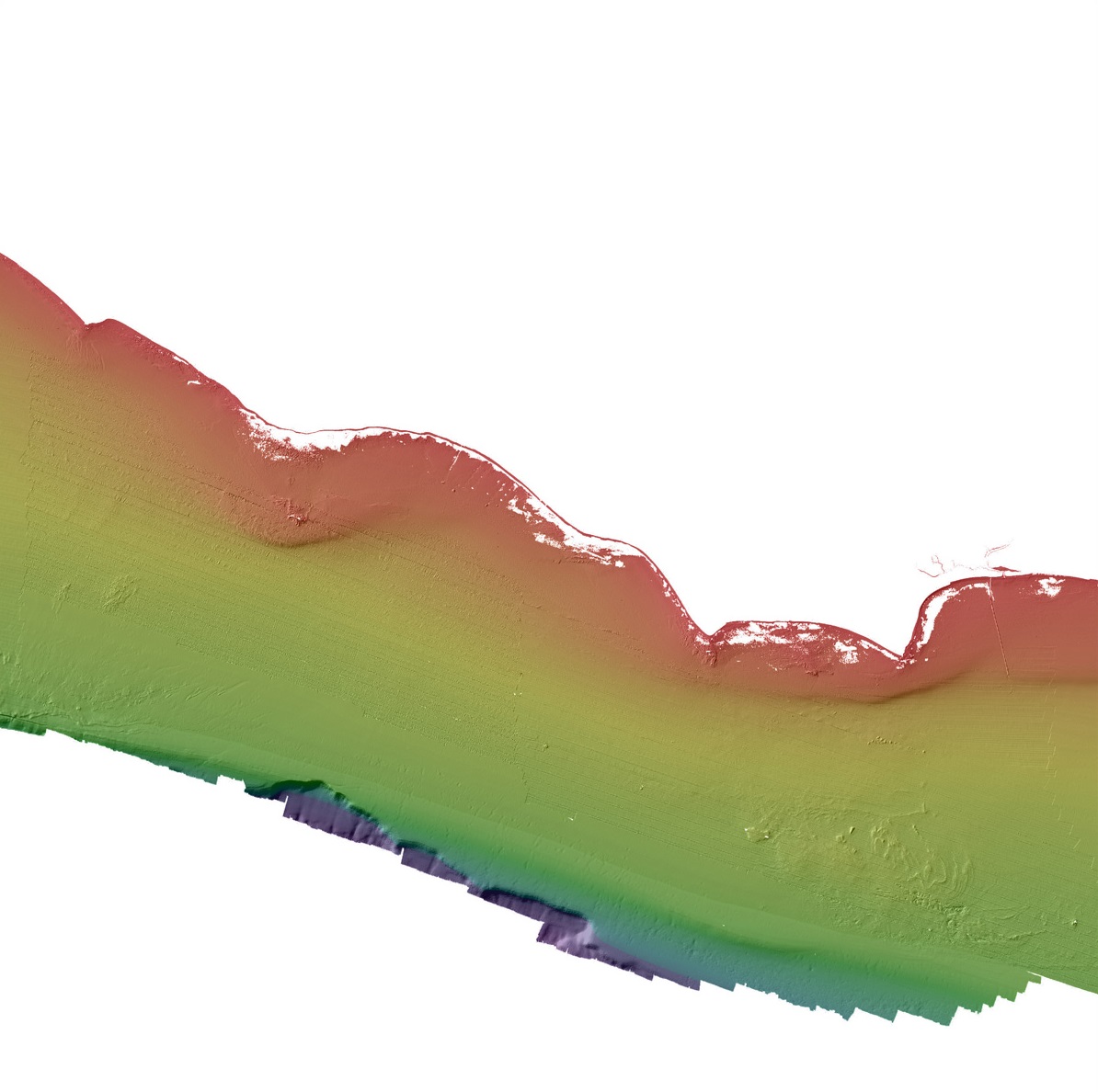
The bathymetry map of the Offshore of Coal Oil Point map area, California, was generated from bathymetry data collected by the U.S. Geological Survey (USGS), by California State University, Monterey Bay, Seafloor Mapping Lab (CSUMB), and by Fugro Pelagos. Most of the nearshore and shelf areas were mapped by the USGS in the summers of 2006, 2007, and 2008, using a combination of 117-kHz and 234.5-kHz SEA (AP) Ltd. SWATHplus-M phase-differencing sidescan sonars. A small area in the far-eastern nearshore and shelf was mapped by CSUMB in the summer of 2007, using a 244-kHz Reson 8101 multibeam echosounder. The outer shelf and slope were mapped by Fugro Pelagos in 2008, using a combination of 400-kHz Reson 7125, 240-kHz Reson 8101, and 100-kHz Reson 8111 multibeam echosounders. The nearshore bathymetry and coastal topography were also mapped by Fugro Pelagos in 2009 for the U.S. Army Corps of Engineers (USACE) Joint Lidar Bathymetry Technical Center of Expertise, using the SHOALS-1000T bathymetric-lidar and the Leica ALS60 topographic-lidar systems. All of these mapping missions combined to collect bathymetry from the 0-m isobath to beyond the 3-nautical-mile limit of California's State Waters.
To expand geologic mapping to the seafloor within the California's State Waters, to update coastal geologic mapping, and to contribute to a uniform regional geologic database, which can be used geographic information systems. Additionally, to provide a geologic map for the public and geoscience community to aid in assessments and mitigation of geologic hazards in the Coal Oil Point coastal region and to provide sufficient geologic information for land-use and land-management decisions both onshore and offshore. These data are intended for science researchers, students, policy makers, and the general public. These data can be used with geographic information systems or other software. This information is not intended for navigational purposes.