This part of DS 781 presents data for the bathymetry map of the Offshore of Santa Barbara map area, California. The raster data file is included in "Bathymetry_OffshoreSantaBarbara.zip," which is accessible from
https://pubs.usgs.gov/ds/781/OffshoreSantaBarbara/data_catalog_OffshoreSantaBarbara.html. These data accompany the pamphlet and map sheets of Johnson, S.Y., Dartnell, P., Cochrane, G.R., Golden, N.E., Phillips, E.L., Ritchie, A.C., Greene, H.G., Krigsman, L.M., Kvitek, R.G., Dieter, B.E., Endris, C.A., Seitz, G.G., Sliter, R.W., Erdey, M.E., Gutierrez, C.I., Wong, F.L., Yoklavich, M.M., Draut, A.E., Hart, P.E., and Conrad, J.E. (S.Y. Johnson and S.A. Cochran, eds.), 2013, California State Waters Map Series—Offshore of Santa Barbara, California: U.S. Geological Survey Scientific Investigations Map 3281, 45 p., 11 sheets, scale 1:24,000,
https://doi.org/10.3133/sim3281.
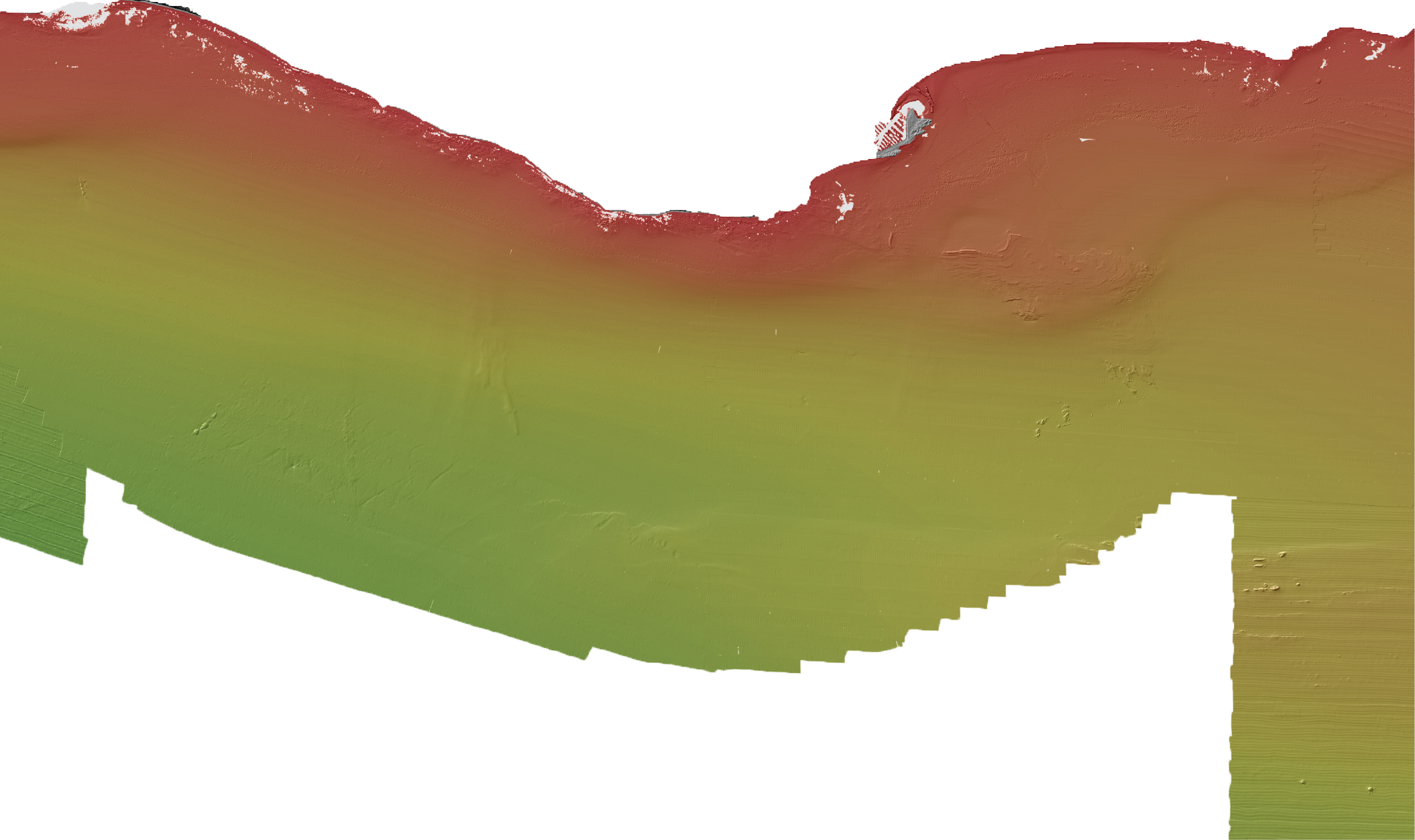
The bathymetry map of the Offshore of Santa Barbara map area, California, was generated from bathymetry data collected by California State University, Monterey Bay, Seafloor Mapping Lab (CSUMB), by the U.S. Geological Survey (USGS), and by Fugro Pelagos for the U.S. Army Corps of Engineers (USACE) Joint Lidar Bathymetry Technical Center of Expertise. Most of the offshore area was mapped by CSUMB in the summer of 2007, using a 244-kHz Reson 8101 multibeam echosounder. Smaller areas in the far-east nearshore, as well as further offshore to the west and in the southeast outer shelf area, were mapped by the USGS in 2005 and 2006, using a combination of 468-kHz (2005) and 117-kHz (2006) SEA (AP) Ltd. SWATHplus-M phase-differencing sidescan sonars. The nearshore bathymetry and coastal topography were mapped for USACE by Fugro Pelagos in 2009, using the SHOALS-1000T bathymetric-lidar and Leica ALS60 topographic-lidar systems. All these mapping missions combined to collect bathymetry from the 0-m isobath to beyond the 3-nautical-mile limit of California's State Waters. NOTE: The horizontal datum of this bathymetry data (NAD83) differs from the horizontal datum of other layers in this SIM (WGS84). Some bathymetry grids within this map area were projected horizontally from WGS84 to NAD83 using ESRI tools to be more consistent with the vertical reference of the North American Vertical Datum of 1988 (NAVD88).
To expand geologic mapping to the seafloor within the California's State Waters, to update coastal geologic mapping, and to contribute to a uniform regional geologic database, which can be used geographic information systems. Additionally, to provide a geologic map for the public and geoscience community to aid in assessments and mitigation of geologic hazards in the Santa Barbara coastal region and to provide sufficient geologic information for land-use and land-management decisions both onshore and offshore. These data are intended for science researchers, students, policy makers, and the general public. These data can be used with geographic information systems or other software. This information is not intended for navigational purposes.
Additional information about the USGS field activities from which some of these data were derived is available online at:
https://cmgds.marine.usgs.gov/fan_info.php?fan=Z206SC
https://cmgds.marine.usgs.gov/fan_info.php?fan=S105SC
Any use of trade, product, or firm names is for descriptive purposes only and does not imply endorsement by the U.S. Government.
Although this Federal Geographic Data Committee-compliant metadata file is intended to document the data set in nonproprietary form, as well as in Esri format, this metadata file may include some Esri-specific terminology.