Faults--Offshore of Santa Barbara, California

Metadata also available as - [Questions & Answers] - [Parseable text] - [XML]

Metadata:

Identification_Information:
Citation:
Citation_Information:
Originator: S.Y. Johnson
Originator: A.C. Ritchie
Originator: J.E. Conrad
Originator: E.L. Phillips
Publication_Date: 2013
Title: Faults--Offshore of Santa Barbara, California
Geospatial_Data_Presentation_Form: vector digital data
Series_Information:
Series_Name: Data Series
Issue_Identification: DS 781
Publication_Information:
Publication_Place: Reston, VA
Publisher: U.S. Geological Survey
Online_Linkage: https://doi.org/10.3133/ds781
Online_Linkage: Larger_Work_Citation:
Citation_Information:
Originator: Nadine E. Golden
Publication_Date: 2013
Title: California State Waters Map Series Data Catalog
Geospatial_Data_Presentation_Form: database
Series_Information:
Series_Name: Data Series
Issue_Identification: DS 781
Publication_Information:
Publication_Place: Reston, VA
Publisher: U.S. Geological Survey
Online_Linkage: https://doi.org/10.3133/ds781
Description:
Abstract:
This part of DS 781 presents fault data for the Offshore of Santa Barbara map area, California. The vector data file is included in "Faults_OffshoreSantaBarbara.zip," which is accessible from https://pubs.usgs.gov/ds/781/OffshoreSantaBarbara/data_catalog_OffshoreSantaBarbara.html. These data accompany the pamphlet and map sheets of Johnson, S.Y., Dartnell, P., Cochrane, G.R., Golden, N.E., Phillips, E.L., Ritchie, A.C., Greene, H.G., Krigsman, L.M., Kvitek, R.G., Dieter, B.E., Endris, C.A., Seitz, G.G., Sliter, R.W., Erdey, M.E., Gutierrez, C.I., Wong, F.L., Yoklavich, M.M., Draut, A.E., Hart, P.E., and Conrad, J.E. (S.Y. Johnson and S.A. Cochran, eds.), 2013, California State Waters Map Series—Offshore of Santa Barbara, California: U.S. Geological Survey Scientific Investigations Map 3281, 45 p., 11 sheets, scale 1:24,000, https://doi.org/10.3133/sim3281.
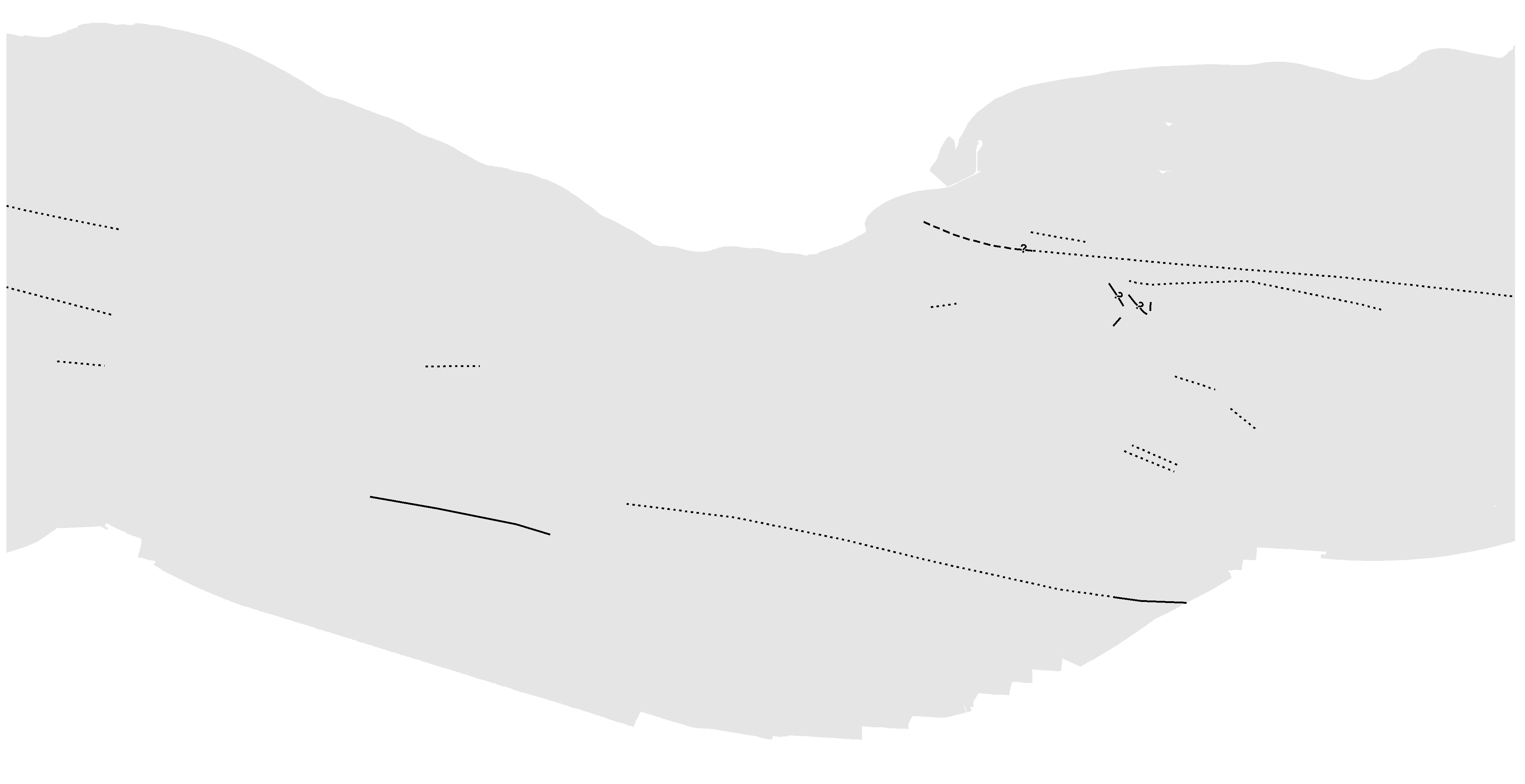
Faults in the Offshore of Santa Barbara map area are identified on seismic-reflection data based on abrupt truncation or warping of reflections and (or) juxtaposition of reflection panels with different seismic parameters such as reflection presence, amplitude, frequency, geometry, continuity, and vertical sequence. Faults were primarily mapped by interpretation of seismic reflection profile data (see field activity Z-3-07-SC). The seismic reflection profiles were collected in 2007.
Purpose:
To expand geologic mapping to the seafloor within the California's State Waters, to update coastal geologic mapping, and to contribute to a uniform regional geologic database, which can be used geographic information systems. Additionally, to provide a geologic map for the public and geoscience community to aid in assessments and mitigation of geologic hazards in the Santa Barbara coastal region and to provide sufficient geologic information for land-use and land-management decisions both onshore and offshore. These data are intended for science researchers, students, policy makers, and the general public. These data can be used with geographic information systems or other software. This information is not intended for navigational purposes.
Supplemental_Information:
Additional information about the USGS field activities from which these data were derived is available online at:
https://cmgds.marine.usgs.gov/fan_info.php?fan=Z307SC
Any use of trade, product, or firm names is for descriptive purposes only and does not imply endorsement by the U.S. Government.
Although this Federal Geographic Data Committee-compliant metadata file is intended to document the data set in nonproprietary form, as well as in Esri format, this metadata file may include some Esri-specific terminology.
Time_Period_of_Content:
Time_Period_Information:
Range_of_Dates/Times:
Beginning_Date: 2007
Ending_Date: 2007
Currentness_Reference: ground condition
Status:
Progress: Complete
Maintenance_and_Update_Frequency: none planned
Spatial_Domain:
Bounding_Coordinates:
West_Bounding_Coordinate: -119.816
East_Bounding_Coordinate: -119.6163
North_Bounding_Coordinate: 34.4839
South_Bounding_Coordinate: 34.3271
Keywords:
Theme:
Theme_Keyword_Thesaurus: USGS Metadata Identifier
Theme_Keyword: USGS:0119c099-0d19-47d5-9d2d-40ca576fbd1c
Theme:
Theme_Keyword_Thesaurus: ISO 19115 Topic Category
Theme_Keyword: geoscientificInformation
Theme_Keyword: environment
Theme_Keyword: oceans
Theme_Keyword: imageryBaseMapsEarthCover
Theme:
Theme_Keyword_Thesaurus: Marine Realms Information Bank (MRIB) keywords
Theme_Keyword: seabed
Theme_Keyword: marine geology
Theme_Keyword: structural geology
Theme_Keyword: fault
Theme:
Theme_Keyword_Thesaurus: USGS Thesaurus
Theme_Keyword: structural geology
Theme_Keyword: geologic structure
Theme_Keyword: faulting (geologic)
Theme_Keyword: marine geology
Theme_Keyword: sea-floor characteristics
Theme_Keyword: maps and atlases
Theme_Keyword: geospatial datasets
Theme:
Theme_Keyword_Thesaurus: None
Theme_Keyword: U.S. Geological Survey
Theme_Keyword: USGS
Theme_Keyword: Coastal and Marine Hazards and Resources Program
Theme_Keyword: CMHRP
Theme_Keyword: Pacific Coastal and Marine Science Center
Theme_Keyword: PCMSC
Theme:
Theme_Keyword_Thesaurus: Coastal and Marine Ecological Classification Standard (CMECS)
Theme_Keyword: Marine Nearshore Subtidal
Theme_Keyword: Marine Offshore Subtidal
Theme_Keyword: Transform Continental Margin
Theme_Keyword: Bight
Theme_Keyword: Borderland
Theme_Keyword: Continental/Island Shelf
Theme_Keyword: Rock Substrate
Theme_Keyword: Unconsolidated Mineral Substrate
Place:
Place_Keyword_Thesaurus: Geographic Names Information System (GNIS)
Place_Keyword: Santa Barbara Channel
Place_Keyword: Santa Barbara
Place_Keyword: Pacific Ocean
Place_Keyword: California
Place:
Place_Keyword_Thesaurus: Coastal and Marine Ecological Classification Standard (CMECS)
Place_Keyword: Southern California Bight Ecoregion
Stratum:
Stratum_Keyword_Thesaurus: Coastal and Marine Ecological Classification Standard (CMECS)
Stratum_Keyword: Substrate
Access_Constraints: None
Use_Constraints:
USGS-authored or produced data and information are in the public domain from the U.S. Government and are freely redistributable with proper metadata and source attribution. Please recognize the U.S. Geological Survey (USGS) and California State University, Monterey Bay, Seafloor Mapping Lab (CSUMB) as the originator(s) of the dataset and in products derived from these data. This information is not intended for navigation purposes.
Point_of_Contact:
Contact_Information:
Contact_Organization_Primary:
Contact_Organization:
U.S. Geological Survey, Pacific Coastal and Marine Science Center
Contact_Person: PCMSC Science Data Coordinator
Contact_Address:
Address_Type: mailing and physical
Address: 2885 Mission Street
City: Santa Cruz
State_or_Province: CA
Postal_Code: 95060-5792
Country: US
Contact_Voice_Telephone: 831-427-4747
Contact_Electronic_Mail_Address: pcmsc_data@usgs.gov
Browse_Graphic:
Browse_Graphic_File_Name: Browse_Graphic_File_Description: Faults in the Offshore of Santa Barbara map area.
Browse_Graphic_File_Type: JPEG
Native_Data_Set_Environment:
Microsoft Windows Server 2008 R2 Version 6.1 (Build 7601) Service Pack 1; ESRI ArcGIS 10.0.0.2414
Cross_Reference:
Citation_Information:
Originator: Samuel Y. Johnson
Originator: Peter Dartnell
Originator: Guy R. Cochrane
Originator: Nadine E. Golden
Originator: Eleyne L. Phillips
Originator: Andrew C. Ritchie
Originator: H. Gary Greene
Originator: Lisa M. Krigsman
Originator: Rikk G. Kvitek
Originator: Bryan E. Dieter
Originator: Charles A. Endris
Originator: Gordon G. Seitz
Originator: Ray W. Sliter
Originator: Mercedes D. Erdey
Originator: Carlos I. Gutierrez
Originator: Florence L. Wong
Originator: Mary M. Yoklavich
Originator: Amy E. Draut
Originator: Patrick E. Hart
Originator: James E. Conrad
Publication_Date: 2013
Title:
California State Waters Map Series--Offshore of Santa Barbara, California
Geospatial_Data_Presentation_Form: map
Series_Information:
Series_Name: Scientific Investigations Map
Issue_Identification: SIM 3281
Publication_Information:
Publication_Place: Reston, VA
Publisher: U.S. Geological Survey
Online_Linkage: https://doi.org/10.3133/sim3281
Data_Quality_Information:
Logical_Consistency_Report:
Map elements were visually checked for overshoots, undershoots, duplicate features, and other errors by the lead authors and by the GIS technician(s) who created the digital database. Review drafts of the map were reviewed internally by at least two other geologists for consistency with basic geologic principles and general conformity to USGS mapping standards.
Completeness_Report:
Data are complete: no offshore features that could be accurately identified and represented at the compilation scale of 1:24,000 were eliminated or generalized. The smallest area represented is approximately 100 square meters. All geospatial database elements are attributed.
Positional_Accuracy:
Horizontal_Positional_Accuracy:
Horizontal_Positional_Accuracy_Report:
Faults were primarily mapped by interpretation of seismic reflection profile data (see field activity Z-3-07-SC). Faults lines were digitized by heads-up screen digitization on to shot-point picks from seismic-line navigation data - each shot point has an associated lat/long in the survey data. Error is introduced from layback, as well as from interpretation of oblique features, so horizontal accuracy of fault location is estimated to be on the order of 10 to 20 meters.
Lineage:
Source_Information:
Source_Citation:
Citation_Information:
Originator: Ray W. Sliter
Originator: Peter J. Triezenberg
Originator: Patrick E. Hart
Originator: Amy E. Draut
Originator: William R. Normark
Originator: James E. Conrad
Publication_Date: 2008
Title:
High-resolution chirp and mini-sparker seismic-reflection data from the southern California continental shelf--Gaviota to Mugu Canyon
Geospatial_Data_Presentation_Form: seismic reflection profile section
Series_Information:
Series_Name: Open-File Report
Issue_Identification: 2008-1246
Publication_Information:
Publication_Place: Menlo Park, CA
Publisher: U.S. Geological Survey
Online_Linkage: https://doi.org/10.3133/ofr20081246
Type_of_Source_Media:
seismic data files (.sgy files) ASCII lat/long shot point files TIFF images of processed seismic lines
Source_Time_Period_of_Content:
Time_Period_Information:
Range_of_Dates/Times:
Beginning_Date: 20070912
Ending_Date: 20080701
Source_Currentness_Reference: ground condition
Source_Citation_Abbreviation: Sliter and others, 2008
Source_Contribution:
Digital seismic data from USGS field activity Z-3-07-SC used to interpret subsurface geologic structure
Process_Step:
Process_Description:
Faults were mapped onto shot lines based on the latitude and longitude of seismic picks from Sliter and others (2008).
Process_Date: 2010
Process_Step:
Process_Description:
Added Distribution_Information section to metadata to facilitate data download.
Process_Date: 20171005
Process_Contact:
Contact_Information:
Contact_Organization_Primary:
Contact_Organization: U.S. Geological Survey
Contact_Person: Alan O. Allwardt
Contact_Position: Contractor -- Information Specialist
Contact_Address:
Address_Type: mailing and physical address
Address: 2885 Mission Street
City: Santa Cruz
State_or_Province: CA
Postal_Code: 95060
Contact_Voice_Telephone: 831-460-7551
Contact_Facsimile_Telephone: 831-427-4748
Contact_Electronic_Mail_Address: aallwardt@usgs.gov
Process_Step:
Process_Description:
Keywords section of metadata optimized for discovery in USGS Coastal and Marine Geology Data Catalog.
Process_Date: 20171005
Process_Contact:
Contact_Information:
Contact_Organization_Primary:
Contact_Organization: U.S. Geological Survey
Contact_Person: Alan O. Allwardt
Contact_Position: Contractor -- Information Specialist
Contact_Address:
Address_Type: mailing and physical address
Address: 2885 Mission Street
City: Santa Cruz
State_or_Province: CA
Postal_Code: 95060
Contact_Voice_Telephone: 831-460-7551
Contact_Facsimile_Telephone: 831-427-4748
Contact_Electronic_Mail_Address: aallwardt@usgs.gov
Process_Step:
Process_Description:
Added keywords from Coastal and Marine Ecological Classification Standard (CMECS) to metadata.
Process_Date: 20180426
Process_Contact:
Contact_Information:
Contact_Organization_Primary:
Contact_Organization: U.S. Geological Survey
Contact_Person: Alan O. Allwardt
Contact_Position: Contractor -- Information Specialist
Contact_Address:
Address_Type: mailing and physical address
Address: 2885 Mission Street
City: Santa Cruz
State_or_Province: CA
Postal_Code: 95060
Contact_Voice_Telephone: 831-460-7551
Contact_Facsimile_Telephone: 831-427-4748
Contact_Electronic_Mail_Address: aallwardt@usgs.gov
Process_Step:
Process_Description:
Edited metadata to add keywords section with USGS persistent identifier as theme keyword. No data were changed.
Process_Date: 20201019
Process_Contact:
Contact_Information:
Contact_Organization_Primary:
Contact_Organization: U.S. Geological Survey
Contact_Person: VeeAnn A. Cross
Contact_Position: Marine Geologist
Contact_Address:
Address_Type: Mailing and Physical
Address: 384 Woods Hole Road
City: Woods Hole
State_or_Province: MA
Postal_Code: 02543-1598
Contact_Voice_Telephone: 508-548-8700 x2251
Contact_Facsimile_Telephone: 508-457-2310
Contact_Electronic_Mail_Address: vatnipp@usgs.gov
Process_Step:
Process_Description:
Performed minor edits to the metadata to correct typos. No data were changed
Process_Date: 20211014
Process_Contact:
Contact_Information:
Contact_Organization_Primary:
Contact_Organization: U.S. Geological Survey
Contact_Person: Susan A. Cochran
Contact_Position: Geologist
Contact_Address:
Address_Type: Mailing and Physical
Address: 2885 Mission Street
City: Santa Cruz
State_or_Province: CA
Postal_Code: 95060
Contact_Voice_Telephone: 831-460-7545
Contact_Electronic_Mail_Address: scochran@usgs.gov
Process_Step:
Process_Description:
Metadata was modified to bring up to current USGS PCMSC standards. USGS Thesaurus and keywords were added, information for accompanying Open-File Report added to Abstract and Cross Reference sections, Point of Contact and Metadata Contact information was updated, and Process Steps were refined. Information about the data available for download and different Network Resource Name links and details were given in the Standard Order Process section. Minor typos were corrected. No data information was changed. The metadata available from a harvester may supersede metadata bundled within a download file. Users are advised to compare the metadata dates to determine which metadata file is most recent.
Process_Date: 20230317
Process_Contact:
Contact_Information:
Contact_Person_Primary:
Contact_Person: Susan A Cochran
Contact_Organization:
U.S. Geological Survey, Pacific Coastal and Marine Science Center
Contact_Position: Geologist
Contact_Address:
Address_Type: mailing and physical address
Address: 2885 Mission Street
City: Santa Cruz
State_or_Province: CA
Postal_Code: 95060-5792
Country: USA
Contact_Voice_Telephone: (831) 460-7545
Contact_Electronic_Mail_Address: scochran@usgs.gov
Spatial_Data_Organization_Information:
Direct_Spatial_Reference_Method: Vector
Point_and_Vector_Object_Information:
SDTS_Terms_Description:
SDTS_Point_and_Vector_Object_Type: String
Point_and_Vector_Object_Count: 17
Spatial_Reference_Information:
Horizontal_Coordinate_System_Definition:
Planar:
Map_Projection:
Map_Projection_Name: WGS 1984 UTM Zone 11N
Transverse_Mercator:
Scale_Factor_at_Central_Meridian: 0.9996
Longitude_of_Central_Meridian: -117.0
Latitude_of_Projection_Origin: 0.0
False_Easting: 500000.0
False_Northing: 0.0
Planar_Coordinate_Information:
Planar_Coordinate_Encoding_Method: coordinate pair
Coordinate_Representation:
Abscissa_Resolution: 0.0001
Ordinate_Resolution: 0.0001
Planar_Distance_Units: Meter
Geodetic_Model:
Horizontal_Datum_Name: D WGS 1984
Ellipsoid_Name: WGS 1984
Semi-major_Axis: 6378137.0
Denominator_of_Flattening_Ratio: 298.257223563
Entity_and_Attribute_Information:
Detailed_Description:
Entity_Type:
Entity_Type_Label: Faults
Entity_Type_Definition: lines representing mapped faults
Entity_Type_Definition_Source: This report
Attribute:
Attribute_Label: OBJECTID
Attribute_Definition: Internal feature number.
Attribute_Definition_Source: ESRI
Attribute_Domain_Values:
Unrepresentable_Domain:
Sequential unique whole numbers that are automatically generated.
Attribute:
Attribute_Label: Shape
Attribute_Definition: Feature geometry.
Attribute_Definition_Source: ESRI
Attribute_Domain_Values:
Unrepresentable_Domain: Coordinates defining the features.
Attribute:
Attribute_Label: Label
Attribute_Definition: feature label
Attribute_Definition_Source: This report
Attribute_Domain_Values:
Unrepresentable_Domain: text field containing feature names if they are named
Attribute:
Attribute_Label: RuleID
Attribute_Definition: Representation rule identifier
Attribute_Definition_Source: This report
Attribute_Domain_Values:
Unrepresentable_Domain:
This field contains the representation rule in the ArcGIS file geodatabase that applied dashed or solid lines to faults. The line is dashed if faults are mapped in sediment and solid if they are mapped over rock or a visible scarp.
Attribute:
Attribute_Label: Shape_Length
Attribute_Definition: Length of feature in internal units.
Attribute_Definition_Source: ESRI
Attribute_Domain_Values:
Unrepresentable_Domain: Positive real numbers that are automatically generated.
Distribution_Information:
Distributor:
Contact_Information:
Contact_Organization_Primary:
Contact_Organization: U.S. Geological Survey
Contact_Address:
Address_Type: mailing and physical address
Address: 345 Middlefield Rd
City: Menlo Park
State_or_Province: CA
Postal_Code: 94025-3561
Country: USA
Contact_Voice_Telephone: (650) 329-4309
Resource_Description:
The .zip file (https://pubs.usgs.gov/ds/781/OffshoreSantaBarbara/data/Faults_OffshoreSantaBarbara.zip) includes the .aux, .dbf, .shp, .shx, .sbx, and .sbn files, as well as FGDC-compliant metadata for the faults data layer of Offshore of Santa Barbara, California, map area.
Distribution_Liability:
Unless otherwise stated, all data, metadata and related materials are considered to satisfy the quality standards relative to the purpose for which the data were collected. Although these data and associated metadata have been reviewed for accuracy and completeness and approved for release by the U.S. Geological Survey (USGS), no warranty expressed or implied is made regarding the display or utility of the data on any other system or for general or scientific purposes, nor shall the act of distribution constitute any such warranty.
Standard_Order_Process:
Digital_Form:
Digital_Transfer_Information:
Format_Name: shapefile
Format_Version_Number: ArcMap (version 10.0, ESRI, 2011)
Format_Specification:
Point, line, and polygon features are in shapefile format and are projected in UTM Zone 10 coordinates.
Format_Information_Content:
The .zip file includes the .aux, .dbf, .shp, .shx, .sbx, and .sbn files, as well as FGDC-compliant metadata for the faults data layer of the Offshore of Santa Barbara, California, map area.
File_Decompression_Technique: WinZip
Transfer_Size: 0.1
Digital_Transfer_Option:
Online_Option:
Computer_Contact_Information: Access_Instructions:
The first link will begin a direct download of the data. The second link is a landing page on which all of the downloadable data for a particular region are listed. The third link is a landing page for the entire data catalog.
Fees: none
Metadata_Reference_Information:
Metadata_Date: 20230317
Metadata_Contact:
Contact_Information:
Contact_Organization_Primary:
Contact_Organization:
U.S. Geological Survey, Pacific Coastal and Marine Science Center
Contact_Person: PCMSC Science Data Coordinator
Contact_Address:
Address_Type: mailing and physical
Address: 2885 Mission Street
City: Santa Cruz
State_or_Province: CA
Postal_Code: 95060-5792
Country: US
Contact_Voice_Telephone: 831-427-4747
Contact_Electronic_Mail_Address: pcmsc_data@usgs.gov
Metadata_Standard_Name: Content Standard for Digital Geospatial Metadata
Metadata_Standard_Version: FGDC-STD-001-1998
Metadata_Time_Convention: local time

This page is <https://cmgds.marine.usgs.gov/catalog/pcmsc/SeriesReports/DS_DDS/DS_781/SantaBarbara/Faults_OffshoreSantaBarbara_metadata.html>
Generated by mp version 2.9.51 on Tue Mar 21 18:02:07 2023