MONT95C - Bathymetry contours of the southern Monterey Bay area between Moss Landing and Monterey, California

Metadata also available as - [Outline] - [Parseable text] - [XML]

Frequently anticipated questions:


What does this data set describe?

Title:
MONT95C - Bathymetry contours of the southern Monterey Bay area between Moss Landing and Monterey, California
Abstract:
Derived contours at 10-m intervals are from data collected by the USGS with a multibeam (Simrad EM1000) sidescan sonar system in the southern Monterey Bay between Moss Landing and Monterey, California in 1995 (USGS Field Activity P1-95-MB). This is one of a collection of digital files of a geographic information system of spatially referenced data related to the USGS Coastal and Marine Geology Program Monterey Bay National Marine Sanctuary Project (see this and other older Monterey Bay USGS works archived at https://archive.usgs.gov/archive/sites/walrus.wr.usgs.gov/monterey/index.html.
Supplemental_Information:
Additional information about the field activities from which these data were derived is available online at:
https://cmgds.marine.usgs.gov/fan_info.php?fan=P195MB
Any use of trade, product, or firm names is for descriptive purposes only and does not imply endorsement by the U.S. Government.
Although this Federal Geographic Data Committee-compliant metadata file is intended to document the data set in nonproprietary form, as well as in Esri format, this metadata file may include some Esri-specific terminology.
  1. How might this data set be cited?
    Wong, Florence L., 2001, MONT95C - Bathymetry contours of the southern Monterey Bay area between Moss Landing and Monterey, California: Open-File Report 01-179, U.S. Geological Survey, Coastal and Marine Geology Program, Western Coastal and Marine Geology, Menlo Park, CA.

    Online Links:

    This is part of the following larger work.

    Wong, Florence L., and Eittreim, Stephen E., 2001, Continental Shelf GIS for the Monterey Bay National Marine Sanctuary: Open-File Report 01-179, U.S. Geological Survey, Coastal and Marine Geology Program, Western Region Coastal and Marine Geology, Menlo Park, CA.

    Online Links:

  2. What geographic area does the data set cover?
    West_Bounding_Coordinate: -121.994697
    East_Bounding_Coordinate: -121.820365
    North_Bounding_Coordinate: 36.777579
    South_Bounding_Coordinate: 36.604554
  3. What does it look like?
    https://pubs.usgs.gov/of/2001/0179/images/batmont95.gif (GIF)
    location map of MONT95NG, MONT95SG, MONT95C
  4. Does the data set describe conditions during a particular time period?
    Calendar_Date: 1995
    Currentness_Reference:
    ground condition
  5. What is the general form of this data set?
    Geospatial_Data_Presentation_Form: vector digital data
  6. How does the data set represent geographic features?
    1. How are geographic features stored in the data set?
      This is a Vector data set. It contains the following vector data types (SDTS terminology):
      • Complete chain (1555)
      • Point (4)
    2. What coordinate system is used to represent geographic features?
      Grid_Coordinate_System_Name: Universal Transverse Mercator
      Universal_Transverse_Mercator:
      UTM_Zone_Number: 10
      Transverse_Mercator:
      Scale_Factor_at_Central_Meridian: 0.999600
      Longitude_of_Central_Meridian: -123.000000
      Latitude_of_Projection_Origin: 0.000000
      False_Easting: 500000.000000
      False_Northing: 0.000000
      Planar coordinates are encoded using coordinate pair
      Abscissae (x-coordinates) are specified to the nearest 0.000032
      Ordinates (y-coordinates) are specified to the nearest 0.000032
      Planar coordinates are specified in meters
      The horizontal datum used is North American Datum of 1983.
      The ellipsoid used is Geodetic Reference System 80.
      The semi-major axis of the ellipsoid used is 6378137.000000.
      The flattening of the ellipsoid used is 1/298.257222.
  7. How does the data set describe geographic features?
    mont95c
    ArcInfo interchange file containing contour information. (Source: Producer defined)
    FID
    Internal feature number. (Source: ESRI) Sequential unique whole numbers that are automatically generated.
    Shape
    Feature geometry. (Source: ESRI) Coordinates defining the features.
    FNODE#
    Internal node number for the beginning of an arc (from-node). (Source: ESRI) Whole numbers that are automatically generated.
    TNODE#
    Internal node number for the end of an arc (to-node). (Source: ESRI) Whole numbers that are automatically generated.
    LPOLY#
    Internal node number for the left polygon. (Source: ESRI) Whole numbers that are automatically generated.
    RPOLY#
    Internal node number for the right polygon. (Source: ESRI) Whole numbers that are automatically generated.
    LENGTH
    Length of feature in internal units. (Source: ESRI) Positive real numbers that are automatically generated.
    Range of values
    Minimum:0.3
    Maximum:4565
    Units:meters
    MONT95C#
    Internal feature number. (Source: ESRI) Sequential unique whole numbers that are automatically generated.
    MONT95C-ID
    User-defined feature number. (Source: ESRI) Sequential unique whole numbers that are automatically generated.
    CONTOUR
    Depth contour interval in meters. Recorded as negative values. (Source: USGS)
    Range of values
    Minimum:-250
    Maximum:-10
    Units:meters
    Resolution:10
    Entity_and_Attribute_Overview:
    Attributes of bathymetry contour data MONT95C
    
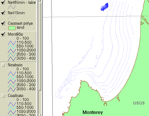
     CONTOUR    -10 to -250 m by 10-m intervals; mean -80 m
     LENGTH     0.3 to 4565 m; mean 249 m
    
    
    Entity_and_Attribute_Detail_Citation: none

Who produced the data set?

  1. Who are the originators of the data set? (may include formal authors, digital compilers, and editors)
    • Florence L. Wong
  2. Who also contributed to the data set?
  3. To whom should users address questions about the data?
    U.S. Geological Survey, Pacific Coastal and Marine Science Center
    Attn: PCMSC Science Data Coordinator
    2885 Mission Street
    Santa Cruz, CA
    US

    831-427-4747 (voice)
    pcmsc_data@usgs.gov

Why was the data set created?

These data are intended for science researchers, students, policy makers, and the general public. The data can be used with geographic information systems (GIS) software to display geologic and oceanographic information about the shallower areas of the Monterey Bay National Marine Sanctuary.

How was the data set created?

  1. From what previous works were the data drawn?
  2. How were the data generated, processed, and modified?
    Date: 1998 (process 1 of 4)
    Images processed with MIPS system. Converted to ArcInfo grids from which shaded relief and contours were derived.
    Date: 27-Mar-2001 (process 2 of 4)
    First draft of metadata created by F.L. Wong using a modified version of FGDCMETA.AML on ARC/INFO data set MONT95NG
    Date: 03-Dec-2019 (process 3 of 4)
    Edits were made to bring the metadata up to current PCMSC standards including standardizing authors' names, adding a doi# link, correcting typos, refining keywords, correcting missing and incomplete tags, and using current access and distribution liability statements. Point of Contact and Metadata Contact information sections were changed to static PCMSC contact information. No data were changed. Users are advised to compare the metadata date of this file to any similar file to ensure they are using the most recent version. Person who carried out this activity:
    Susan A Cochran
    U.S. Geological Survey, Pacific Coastal and Marine Science Center
    2885 Mission St.
    Santa Cruz, CA
    United States

    831-460-7545 (voice)
    scochran@usgs.gov
    Date: 19-Oct-2020 (process 4 of 4)
    Edited metadata to add keywords section with USGS persistent identifier as theme keyword. No data were changed. Person who carried out this activity:
    U.S. Geological Survey
    Attn: VeeAnn A. Cross
    Marine Geologist
    384 Woods Hole Road
    Woods Hole, MA

    508-548-8700 x2251 (voice)
    508-457-2310 (FAX)
    vatnipp@usgs.gov
  3. What similar or related data should the user be aware of?

How reliable are the data; what problems remain in the data set?

  1. How well have the observations been checked?
    Not available.
  2. How accurate are the geographic locations?
    Not determined
  3. How accurate are the heights or depths?
  4. Where are the gaps in the data? What is missing?
    Complete
  5. How consistent are the relationships among the observations, including topology?
    Chain-node topology present.

How can someone get a copy of the data set?

Are there legal restrictions on access or use of the data?
Access_Constraints None
Use_Constraints USGS-authored or produced data and information are in the public domain from the U.S. Government and are freely redistributable with proper metadata and source attribution. Please recognize and acknowledge the U.S. Geological Survey as the originator(s) of the dataset and in products derived from these data. This information is not intended for navigation purposes.
  1. Who distributes the data set? (Distributor 1 of 1)
    United States Geological Survey (USGS)
    Coastal and Marine Geology (CMG)
    Menlo Park, CA
    USA

    (650) 329-5327 (voice)
  2. What's the catalog number I need to order this data set? Downloadable Data
  3. What legal disclaimers am I supposed to read?
    Unless otherwise stated, all data, metadata and related materials are considered to satisfy the quality standards relative to the purpose for which the data were collected. Although these data and associated metadata have been reviewed for accuracy and completeness and approved for release by the U.S. Geological Survey (USGS), no warranty expressed or implied is made regarding the display or utility of the data on any other system or for general or scientific purposes, nor shall the act of distribution constitute any such warranty.
  4. How can I download or order the data?

Who wrote the metadata?

Dates:
Last modified: 19-Oct-2020
Metadata author:
U.S. Geological Survey, Pacific Coastal and Marine Science Center
Attn: PCMSC Science Data Coordinator
2885 Mission Street
Santa Cruz, CA
US

831-427-4747 (voice)
pcmsc_data@usgs.gov
Metadata standard:
Content Standard for Digital Geospatial Metadata (FGDC-STD-001-1998)

This page is <https://cmgds.marine.usgs.gov/catalog/pcmsc/SeriesReports/OFR/OFR_01-179/mont95c.e00.faq.html>
Generated by mp version 2.9.51 on Thu Jan 12 12:36:51 2023