SCAV2OBS -- Assorted visual observations of benthic habitat from ROV and SCUBA dives in the Channel Islands National Marine Sanctuary. (UTM 10N, NAD83)

Metadata also available as - [Outline] - [Parseable text] - [XML]

Frequently anticipated questions:


What does this data set describe?

Title:
SCAV2OBS -- Assorted visual observations of benthic habitat from ROV and SCUBA dives in the Channel Islands National Marine Sanctuary. (UTM 10N, NAD83)
Abstract:
Point based visual observations of benthic habitat from a variety of SCUBA and ROV dives. Unknown postitional accuracy. Some video data maintained by Russ Vetter, National Marine Fisheries Service, Southwest Fisheries Science Center.
  1. How might this data set be cited?
    Cochrane, Guy R., and Gabel, Greg S., 2004, SCAV2OBS -- Assorted visual observations of benthic habitat from ROV and SCUBA dives in the Channel Islands National Marine Sanctuary. (UTM 10N, NAD83): Open-File Report 2005-1170, U.S. Geological Survey, Pacific Coastal and Marine Science Center, Santa Cruz, CA.

    Online Links:

    This is part of the following larger work.

    Cochrane, Guy R., Conrad, James E., Reid, Jane A., Fangman, Sarah, and Golden, Nadine, 2005, Nearshore Benthic Habitat GIS for the Channel Islands National Marine Sanctuary and Southern California State Fisheries Reserves, Volume II Edition: 1.0: Open-File Report 2005-1170, U.S. Geological Survey, Pacific Coastal and Marine Science Center, Santa Cruz, CA.

    Online Links:

  2. What geographic area does the data set cover?
    West_Bounding_Coordinate: -119.06259918
    East_Bounding_Coordinate: -118.95246887
    North_Bounding_Coordinate: 34.0845108
    South_Bounding_Coordinate: 34.0202713
  3. What does it look like?
    http://pubs.usgs.gov/of/2005/1170/images/scav2obs.jpg (JPEG)
    Image showing location and distribution of observations in the area of Anacapa and Santa Cruz Island
  4. Does the data set describe conditions during a particular time period?
    Beginning_Date: 1998
    Ending_Date: 2004
    Currentness_Reference:
    ground condition
  5. What is the general form of this data set?
    Geospatial_Data_Presentation_Form: vector digital data
  6. How does the data set represent geographic features?
    1. How are geographic features stored in the data set?
      This is a Vector data set. It contains the following vector data types (SDTS terminology):
      • Point (1261)
    2. What coordinate system is used to represent geographic features?
      Grid_Coordinate_System_Name: Universal Transverse Mercator
      Universal_Transverse_Mercator:
      UTM_Zone_Number: 10
      Transverse_Mercator:
      Scale_Factor_at_Central_Meridian: 0.999600
      Longitude_of_Central_Meridian: -123.000000
      Latitude_of_Projection_Origin: 0.000000
      False_Easting: 500000.000000
      False_Northing: 0.000000
      Planar coordinates are encoded using coordinate pair
      Abscissae (x-coordinates) are specified to the nearest .000016
      Ordinates (y-coordinates) are specified to the nearest .000016
      Planar coordinates are specified in meters
      The horizontal datum used is North American Datum of 1983.
      The ellipsoid used is Geodetic ReferenceSystem 80.
      The semi-major axis of the ellipsoid used is 6378137.
      The flattening of the ellipsoid used is 1/298.2572222.
  7. How does the data set describe geographic features?
    Entity_and_Attribute_Overview:
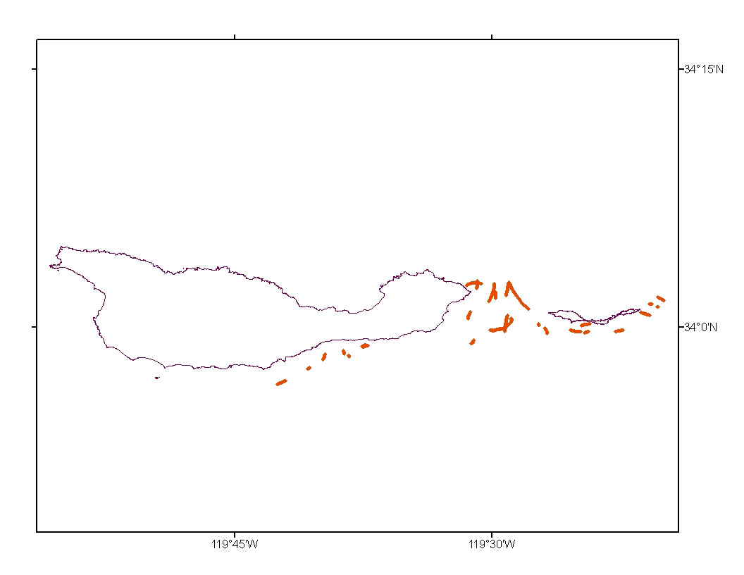
    s504scobs Fields:
    
    NAME		ALIAS	TYPE	LENGTH	PRECISION	SCALE	NUMBER_FORMAT
    FID	  	FID	ObjectID     4          0           0	            -
    Shape  	  	-     	Point        -          -           -               -
    CODE      	CODE   	String     254          0           0               -
    pr_sub   	pre_sub String     254          0           0               -
    sec_sub		sec_sub String     254          0           0               -
    slope		slope	Double     10          10           0         Numeric
    complexity   complexity	String     254          0           0               -
    biomass		biomass	String	   254		0	    0		    -
    observation  observation	String	   254          0           0               -
    comment		comment	String	   254          0           0               -
    Line		Line	String	   254          0           0               -
    Tape		Tape	String	   254          0           0               -
    JD		JD	Double      10         10           0         Numeric
    UTC		UTC     String     254          0           0               -
    LAT		LAT	Double      19         18          11         Numeric
    LON 		LON     Double      19         18          11         Numeric
    HED		HED     Double      19         18          11	      Numeric
    SOG		SOG     Double      19         18          11         Numeric
    cruised   	cruised String      50          0           0               -
    OBSERVER   	observerString      50          0           0               -
    
    Entity_and_Attribute_Detail_Citation: None

Who produced the data set?

  1. Who are the originators of the data set? (may include formal authors, digital compilers, and editors)
    • Guy R. Cochrane
    • Greg S. Gabel
  2. Who also contributed to the data set?
    Native_Data_Set_Environment SunOS, 5.8, sun4u UNIX; ArcInfo versions 8.0.2, 9.0
  3. To whom should users address questions about the data?
    U.S. Geological Survey, Pacific Coastal and Marine Science Center
    Attn: PCMSC Science Data Coordinator
    2885 Mission Street
    Santa Cruz, CA
    US

    831-427-4747 (voice)
    pcmsc_data@usgs.gov

Why was the data set created?

These data are intended for science researchers, students, policy makers, and the general public. The data can be used with geographic information systems (GIS) software to display geologic and oceanographic information.

How was the data set created?

  1. From what previous works were the data drawn?
  2. How were the data generated, processed, and modified?
    Date: 19-Oct-2020 (process 1 of 2)
    Edited metadata to add keywords section with USGS persistent identifier as theme keyword. No data were changed. Person who carried out this activity:
    U.S. Geological Survey
    Attn: VeeAnn A. Cross
    Marine Geologist
    384 Woods Hole Road
    Woods Hole, MA

    508-548-8700 x2251 (voice)
    508-457-2310 (FAX)
    vatnipp@usgs.gov
    Date: 21-Oct-2021 (process 2 of 2)
    Edited metadata to add USGS Thesaurus keywords and perform minor edits to bring the metadata up to current PCMSC standards. No data were changed. The metadata available from a harvester may supersede metadata bundled within a download file. Users are advised to compare the metadata dates to determine which metadata file is most recent. Person who carried out this activity:
    U.S. Geological Survey
    Attn: Susan Cochran
    Geologist
    2885 Mission Street
    Santa Cruz, CA

    831-460-7545 (voice)
    scochran@usgs.gov
  3. What similar or related data should the user be aware of?

How reliable are the data; what problems remain in the data set?

  1. How well have the observations been checked?
    Visual observations of variable unknown accuracy
  2. How accurate are the geographic locations?
    Highly variable on the order of 10 meters.
  3. How accurate are the heights or depths?
  4. Where are the gaps in the data? What is missing?
    Observations made without uniform protocol.
  5. How consistent are the relationships among the observations, including topology?
    Point features present.

How can someone get a copy of the data set?

Are there legal restrictions on access or use of the data?
Access_Constraints: None
Use_Constraints:
USGS-authored or produced data and information are in the public domain from the U.S. Government and are freely redistributable with proper metadata and source attribution. Please recognize and acknowledge the U.S. Geological Survey as the originators of the dataset and in products derived from these data.
  1. Who distributes the data set? (Distributor 1 of 1)
    Guy R. Cochrane
    U.S. Geological Survey
    Geophysicist
    2885 Mission Street
    Santa Cruz, CA
    USA

    (831) 427-4754 (voice)
    (831) 427-4748 (FAX)
    gcochrane@usgs.gov
  2. What's the catalog number I need to order this data set? Downloadable Data
  3. What legal disclaimers am I supposed to read?
    Although these data have been used by the U.S. Geological Survey (USGS), U.S. Department of the Interior (DOI), no warranty expressed or implied is made by the U.S. Geological Survey as to the accuracy of the data. The act of distribution shall not constitute any such warranty, and no responsibility is assumed by the USGS in the use of these data or related materials.
    Any use of trade, product, or firm names is for descriptive purposes only and does not imply endorsement by the U.S. Government.
  4. How can I download or order the data?
    • Availability in digital form:
      Data format: The SHP file contains the geospatial data. The SHX file contains the index of the geospatial data. The DBF file contains the attribute data in dBase format. The PRJ file contains the coordinate system information (optional). The AVL file contains the legend information (optional). The SBN and SBX files contain the spatial index of the geospatial data (optional). The XML file contains the metadata describing the data set <data set name>.shp.xml. An ASCII version of the metadata file. A browse graphic showing the data layer coverage and extent (optional). in format shapefile (version 3.3) ESRI Shapefile Format Size: 0.078
      Network links: http://pubs.usgs.gov/of/2005/1170/observations/scav2obs.tgz
      http://pubs.usgs.gov/of/2005/1170/catalog.html
      https://doi.org/10.3133/ofr20051170
    • Cost to order the data: None

  5. What hardware or software do I need in order to use the data set?
    These data are available in Environmental Systems Research Institute (ESRI) shapefile format. The user must have ArcGIS or ArcView 3.0 or greater software to read and process the data file. In lieu of ArcView or ArcGIS, the user may utilize another GIS application package capable of the importing data. A free data viewer, arcexplorer, capable of displaying the data is available from ESRI at www.esri.com.

Who wrote the metadata?

Dates:
Last modified: 21-Oct-2021
Metadata author:
U.S. Geological Survey, Pacific Coastal and Marine Science Center
Attn: PCMSC Science Data Coordinator
2885 Mission Street
Santa Cruz, CA
US

831-427-4747 (voice)
pcmsc_data@usgs.gov
Metadata standard:
Content Standard for Digital Geospatial Metadata (FGDC-STD-001-1998)

This page is <https://cmgds.marine.usgs.gov/catalog/pcmsc/SeriesReports/OFR/OFR_2005-1170/scav2obs.shp.faq.html>
Generated by mp version 2.9.50 on Fri Oct 22 09:18:53 2021