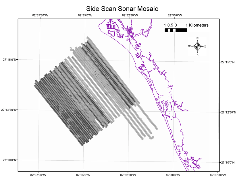
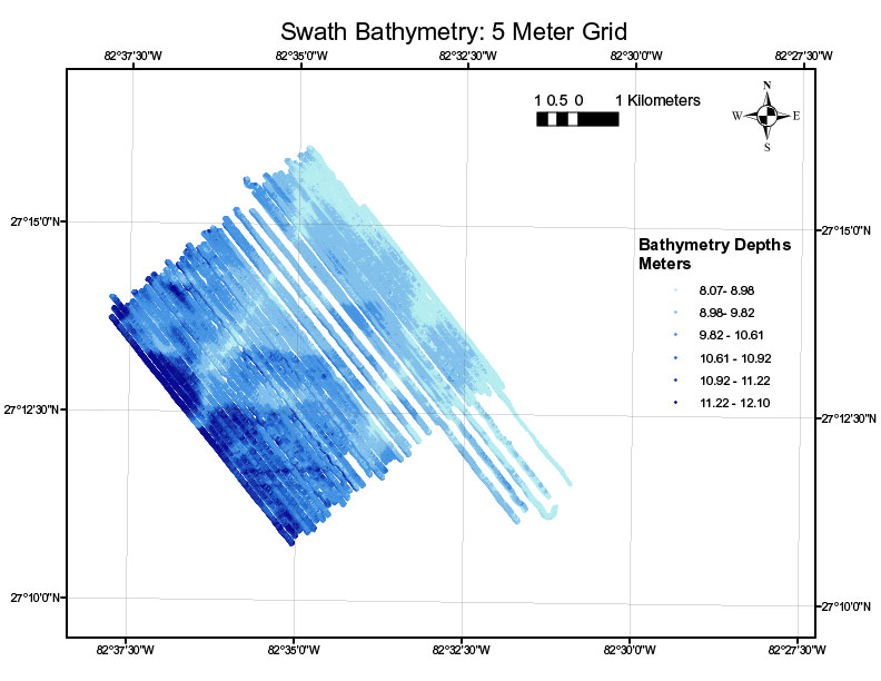
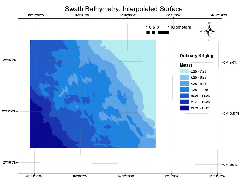
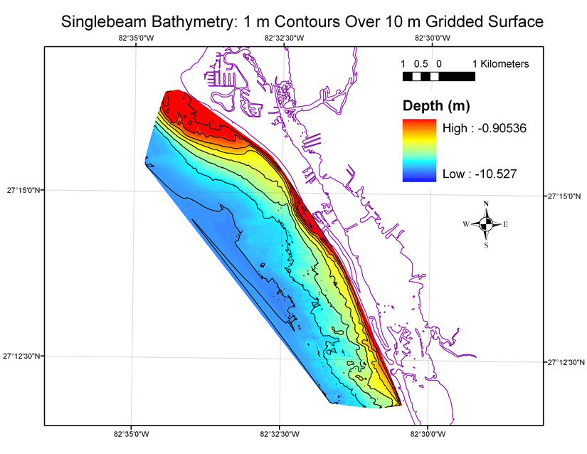
Archive of side scan sonar and bathymetry data collected during USGS cruise 06FSH01 offshore of Siesta Key, Florida, May 2006.
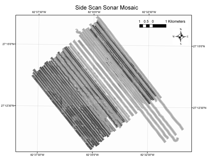
This data set contains swath bathymetric data collected during USGS cruise 06FSH01 aboard the R/V G.K. Gilbert. A side scan sonar, bathymetric, and high-resolution seismic-reflection survey was conducted off Sarasota, FL to describe the relationship between the sediments and morphology of the inner shelf and adjacent shoreface. These data are part of the Florida Shelf Habitat (FLaSH) map project.
For more information on the seismic surveys see
http://walrus.wr.usgs.gov/infobank/g/g106fl/html/g-1-06
-fl.meta.html
These data are also available via GeoMapApp (
http://www.geomapapp.org/) and Virtual Ocean (
http://www.virtualocean.org/) earth science exploration and visualization applications.
In May of 2006, the U.S. Geological Survey conducted a geophysical survey offshore of Siesta Key, FL, as part of the USGS Florida Shelf Habitat (FLaSH) study, a multiagency benthic habitat mapping project. For more information refer to
http://coastal.er.usgs.gov/flash/index.html. This report serves as an archive of the processed side scan sonar mosaic, processed singlebeam and swath bathymetry images, processed x,y,z swath bathymetry data, trackline maps, navigation files, GIS files, Field Activity Collection System (FACS) logs, observer's logbook, and formal FGDC metadata. Scanned images of the handwritten FACS logs and handwritten science logbook (12 MB) are also provided as PDF files. Gridded and interpolated surface digital images of the bathymetry are also provided. Refer to the Acronyms page for expansion of acronyms and abbreviations used in this report.The USGS Florida Integrated Science Center (FISC) - St. Petersburg assigns a unique identifier to each cruise or field activity. For example, 06FSH01 tells us the data were collected in 2006 for the Florida Shelf Habitat (FLaSH) study and the data were collected during the first field activity for that project in that calendar year. Refer to
http://walrus.wr.usgs.gov/infobank/programs/html/definition/activity.html for a detailed description of the method used to assign the field activity ID.Aboard the R/V G.K. Gilbert, side scan sonar and interferometric swath bathymetry data were collected simultaneously along the tracklines. The side scan sonar towfish was towed behind the vessel close to the seafloor. The interferometric swath transducer was pole mounted to the ship's hull. See the digital FACS equipment log (13 KB) for details about the acquisition equipment used. Both raw data sets were stored digitally and processed using CARIS software in the St. Petersburg office. For more detailed information on processing refer to the Equipment and Processing page. Post-processing of the swath data set revealed a motion artifact which is attributed to movement of the pole in relation to the boat. Due to scheduling constraints, the survey was forced to take place in less than ideal weather conditions, which caused a reduction in data quality. The rough seas contributed to both the movement of the pole and the very high noise base seen in the amplitude data.In addition, singlebeam bathymetry was collected aboard the R/V Streeterville using SANDS, which is a singlebeam acoustic sounding GPS-based hydrographic data collection and processing system. Differential boat position was recorded using GPS referenced to a land-based benchmark which is occupied throughout the survey. Boat position, boat motion (heave, pitch, and roll), and depth readings are collected and stored in real time on the vessel and are later merged with the DGPS information using time correlations. For more detailed information on processing refer to the Equipment and Processing page. CHIRP data were also collected during the survey and are archived separately in Data Series 254 and can be downloaded at
http://pubs.usgs.gov/ds/2007/254.