ATM Coastal Topography--Texas, 2001: UTM Zone 14

Metadata also available as - [Questions & Answers] - [Parseable text] - [XML]

Metadata:

Identification_Information:
Citation:
Citation_Information:
Originator: U.S. Geological Survey
Publication_Date: 2009
Title: ATM Coastal Topography--Texas, 2001: UTM Zone 14
Edition: first
Geospatial_Data_Presentation_Form: remote-sensing image
Series_Information:
Series_Name: U.S. Geological Survey Data Series
Issue_Identification: 448
Publication_Information:
Publication_Place: St. Petersburg, FL
Publisher: U.S. Geological Survey
Online_Linkage: http://pubs.usgs.gov/ds/448/
Description:
Abstract:
A first-surface elevation map was produced cooperatively from remotely sensed, geographically referenced elevation measurements by the U.S. Geological Survey (USGS) and National Aeronautics and Space Administration (NASA). Elevation measurements were collected over the area using the NASA Airborne Topographic Mapper (ATM), a scanning lidar system that measures high-resolution topography of the land surface. The ATM system is deployed on a Twin Otter or P-3 Orion aircraft and incorporates a green-wavelength laser operating at pulse rates of 2 to 10 kilohertz. Measurements from the laser-ranging device are coupled with data acquired from inertial navigation system (INS) attitude sensors and differentially corrected global positioning system (GPS) receivers to measure topography of the surface at accuracies of +/-15 centimeters.
For more information on Lidar science and the Experimental Advanced Airborne Research Lidar (EAARL) system and surveys, see http://ngom.usgs.gov/dsp/overview/index.php and http://ngom.usgs.gov/dsp/tech/eaarl/index.php .
Purpose:
The purpose of this project is to produce highly detailed and accurate elevation maps of a portion of the Texas coastline within UTM zone 14 for natural-resource managers and research scientists.
Supplemental_Information:
Raw lidar data are not in a format that is generally usable by resource managers and scientists. Converting dense lidar elevation data into a readily usable format without loss of essential information requires specialized processing. The U.S. Geological Survey's Coastal and Marine Geology Program (CMGP) has developed custom software to convert raw lidar data into a GIS-compatible map product to be provided to GIS specialists, managers, and scientists. The primary tool used in the conversion process is Advanced Lidar Processing System (ALPS), a multi-tiered processing system developed by a USGS-NASA collaborative project. The zero crossing of the second derivative (that is, detection of local maxima) is used to detect "first surface" topography. Statistical filtering, known as the Random Consensus Filter (RCF), is used to remove false bottom returns and other outliers from the ATM topography data. The filter uses a grid of non-overlapping square cells (buffer) of user-defined size overlaid onto the original point cloud. The user also defines the vertical tolerance (vertical width) based on the topographic complexity and point sampling density of the data. The maximum allowable elevation range within a cell is established by this vertical tolerance. An iterative process searches for the maximum concentration of points within the vertical tolerance, and removes those points outside of the tolerance (Nayegandhi and others, 2009). These data are converted to the North American Datum of 1983 and the North American Vertical Datum of 1988 (using the GEOID03 model). The files are in the Quarter-Quad tiling format, and the exact tile location is contained in the filename at ########_fs, where ####### is the Quarter-Quad tile ID.The development of custom software for creating these data products has been supported by the USGS CMG Program's Decision Support for Coastal Parks, Sanctuaries, and Preserves Project. Processed data products are used by the USGS CMG Program's National Assessments of Coastal Change Hazards Project to quantify the vulnerability of shorelines to coastal change hazards such as severe storms, sea-level rise, and shoreline erosion and retreat.
Time_Period_of_Content:
Time_Period_Information:
Multiple_Dates/Times:
Single_Date/Time:
Calendar_Date: 20011012
Single_Date/Time:
Calendar_Date: 20011013
Currentness_Reference: ground condition
Status:
Progress: Complete
Maintenance_and_Update_Frequency: None planned
Spatial_Domain:
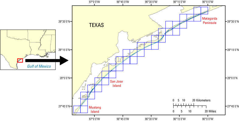
Bounding_Coordinates:
West_Bounding_Coordinate: -97.25
East_Bounding_Coordinate: -96
North_Bounding_Coordinate: 28.75
South_Bounding_Coordinate: 27.5
Keywords:
Theme:
Theme_Keyword_Thesaurus: USGS Metadata Identifier
Theme_Keyword: USGS:30768e48-0ed6-4d94-be26-19786bf388be
Theme:
Theme_Keyword_Thesaurus: http://remotesensing.usgs.gov/
Theme_Keyword: Airborne Lidar Processing System
Theme_Keyword: ALPS
Theme_Keyword: DEM
Theme_Keyword: Digital Elevation Model
Theme_Keyword: ATM
Theme_Keyword: Airborne Topographic Mapper
Theme_Keyword: laser altimetry
Theme_Keyword: lidar
Theme_Keyword: remote sensing
Theme_Keyword: topography
Theme:
Theme_Keyword_Thesaurus: Data Categories for Marine Planning
Theme_Keyword: distributions
Theme_Keyword: bathymetry and elevation
Theme:
Theme_Keyword_Thesaurus: Marine Realms Information Bank (MRIB) Keywords
Theme_Keyword: altimetry
Theme_Keyword: topographic mapping
Theme:
Theme_Keyword_Thesaurus: USGS Thesaurus
Theme_Keyword: LIDAR
Theme_Keyword: topography
Theme_Keyword: digital elevation models
Place:
Place_Keyword_Thesaurus: http://nationalmap.gov/
Place_Keyword: Texas
Place_Keyword: UTM zone 14
Place_Keyword: Gulf of Mexico
Stratum:
Stratum_Keyword_Thesaurus: http://lidar.cr.usgs.gov/
Stratum_Keyword: First Surface
Temporal:
Temporal_Keyword_Thesaurus: http://www.esri.com/news/arcuser/1104/temporal.html
Temporal_Keyword: 2001
Access_Constraints: None
Use_Constraints:
The U.S. Geological Survey and National Aeronautics and Space Administration request to be acknowledged as originators of the dataset in future products or derivative research.
Point_of_Contact:
Contact_Information:
Contact_Person_Primary:
Contact_Person: Amar Nayegandhi
Contact_Organization: Jacobs Technology, U.S. Geological Survey, FISC
Contact_Position: Computer Scientist
Contact_Address:
Address_Type: mailing and physical address
Address: 600 4th Street South
City: St. Petersburg
State_or_Province: FL
Postal_Code: 33701
Country: USA
Contact_Voice_Telephone: 727-803-8747 (x3026)
Contact_Electronic_Mail_Address: anayegandhi@usgs.gov
Contact_Electronic_Mail_Address: jbrock@usgs.gov
Hours_of_Service: M-F, 8:00-5:00 EST
Browse_Graphic:
Browse_Graphic_File_Name: http://pubs.usgs.gov/ds/448/html/images/TEXA_14.jpg
Browse_Graphic_File_Description: ATM Coastal Topography--Texas, 2001: UTM Zone 14
Browse_Graphic_File_Type: JPG
Data_Set_Credit:
Acknowledgment of the U.S. Geological Survey, Florida Integrated Science Center, as a data source would be appreciated in products developed from these data, and such acknowledgment as is standard for citation and legal practices for data source is expected. Sharing of new data layers developed directly from these data would also be appreciated by the U.S. Geological Survey staff. Users should be aware that comparisons with other datasets for the same area from other time periods may be inaccurate due to inconsistencies resulting from changes in photointerpretation, mapping conventions, and digital processes over time. These data are not legal documents and are not to be used as such.
Security_Information:
Security_Classification_System: Unclassified
Security_Classification: Unclassified
Security_Handling_Description: None
Native_Data_Set_Environment:
Microsoft Windows XP Version 5.1 (Build 2600) Service Pack 2; ESRI ArcMap 9.2.2.1350
Data_Quality_Information:
Attribute_Accuracy:
Attribute_Accuracy_Report:
The expected accuracy of the measured variables is as follows: attitude within 0.07 degree, 3-centimeter nominal laser ranging accuracy, and vertical elevation accuracy of +/-15 centimeters for the topographic surface. Quality checks are built into the data-processing software.
Logical_Consistency_Report:
The files are in the Quarter-Quad tiling format, and the exact tile location is contained in the filename at ########_fs, where ####### is the Quarter-Quad tile ID.See the DOQQ naming convention document in the 'extras' directory.
Completeness_Report:
Several regions of the dataset are labeled as "No Data," which corresponds to a cell value of -32767 meters in the GeoTIFF file. These "No Data" areas are a result of the survey not covering a particular region, optical water depth of greater than 1.5 Secchi disc depths, or the manual removal of lidar processing artifacts. Please note that this metadata file is a sample and therefore does not include valid bounding coordinates.
Positional_Accuracy:
Horizontal_Positional_Accuracy:
Horizontal_Positional_Accuracy_Report:
Raw elevation measurements have been determined to be within 1 meter in horizontal accuracy.
Vertical_Positional_Accuracy:
Vertical_Positional_Accuracy_Report:
Elevations of the DEM are vertically consistent with the point elevation data, +/-15 centimeters.
Lineage:
Process_Step:
Process_Description:
The data are collected using a Twin Otter aircraft. The NASA Airborne Topographic Mapper (ATM) laser scanner collects the data using a green-wavelength raster scanning laser. The data are stored on hard drives and archived at the U.S. Geological Survey's FISC office in St. Petersburg, FL, and the NASA office at Wallops Flight Facility in Virginia. The navigational data are processed at Wallops Flight Facility. The navigational and raw data are then downloaded into the Advanced Lidar Processing System (ALPS). Data are converted from units of time to x,y,z points for elevation. The derived surface data can then be converted into raster data (GeoTIFFs).
Process_Date: 20090204
Process_Contact:
Contact_Information:
Contact_Person_Primary:
Contact_Person: Amar Nayegandhi
Contact_Organization:
Jacobs Technology, U.S. Geological Survey, FISC, St. Petersburg, FL
Contact_Position: Computer Scientist
Contact_Address:
Address_Type: mailing and physical address
Address: 600 4th Street South
City: St. Petersburg
State_or_Province: FL
Postal_Code: 33701
Country: USA
Contact_Voice_Telephone: 727-803-8747 (x3026)
Contact_Electronic_Mail_Address: anayegandhi@usgs.gov
Hours_of_Service: M-F, 8:00-5:00 EST
Process_Step:
Process_Description: Metadata imported into ArcCatalog from XML file.
Process_Date: 20090204
Process_Contact:
Contact_Information:
Contact_Person_Primary:
Contact_Person: Xan Yates
Contact_Organization:
Jacobs Technology, U.S. Geological Survey, FISC, St. Petersburg, FL
Contact_Position: GIS/Image Analyst/Metadata Specialist
Contact_Address:
Address_Type: mailing and physical address
Address: 600 4th Street South
City: St. Petersburg
State_or_Province: FL
Postal_Code: 33701
Country: USA
Contact_Voice_Telephone: 727-803-8747 (x3086)
Hours_of_Service: M-F, 9:00-5:30 EST
Process_Step:
Process_Description:
Keywords section of metadata optimized for discovery in USGS Coastal and Marine Geology Data Catalog.
Process_Date: 20170124
Process_Contact:
Contact_Information:
Contact_Organization_Primary:
Contact_Organization: U.S. Geological Survey
Contact_Person: Alan O. Allwardt
Contact_Position: Contractor -- Information Specialist
Contact_Address:
Address_Type: mailing and physical address
Address: 2885 Mission Street
City: Santa Cruz
State_or_Province: CA
Postal_Code: 95060
Contact_Voice_Telephone: 831-460-7551
Contact_Facsimile_Telephone: 831-427-4748
Contact_Electronic_Mail_Address: aallwardt@usgs.gov
Process_Step:
Process_Description:
Added keywords section with USGS persistent identifier as theme keyword.
Process_Date: 20201013
Process_Contact:
Contact_Information:
Contact_Organization_Primary:
Contact_Organization: U.S. Geological Survey
Contact_Person: VeeAnn A. Cross
Contact_Position: Marine Geologist
Contact_Address:
Address_Type: Mailing and Physical
Address: 384 Woods Hole Road
City: Woods Hole
State_or_Province: MA
Postal_Code: 02543-1598
Contact_Voice_Telephone: 508-548-8700 x2251
Contact_Facsimile_Telephone: 508-457-2310
Contact_Electronic_Mail_Address: vatnipp@usgs.gov
Spatial_Data_Organization_Information:
Indirect_Spatial_Reference: Quater-Quadrangle
Direct_Spatial_Reference_Method: Raster
Raster_Object_Information:
Raster_Object_Type: Pixel
Spatial_Reference_Information:
Horizontal_Coordinate_System_Definition:
Planar:
Grid_Coordinate_System:
Grid_Coordinate_System_Name: Universal Transverse Mercator
Universal_Transverse_Mercator:
UTM_Zone_Number: 14
Transverse_Mercator:
Scale_Factor_at_Central_Meridian: 0.999600
Longitude_of_Central_Meridian: -99.000000
Latitude_of_Projection_Origin: 0.000000
False_Easting: 500000.000000
False_Northing: 0.000000
Planar_Coordinate_Information:
Planar_Coordinate_Encoding_Method: row and column
Coordinate_Representation:
Abscissa_Resolution: 4.000000
Ordinate_Resolution: 4.000000
Planar_Distance_Units: meters
Geodetic_Model:
Horizontal_Datum_Name: North American Datum of 1983
Ellipsoid_Name: Geodetic Reference System 80
Semi-major_Axis: 6378137.000000
Denominator_of_Flattening_Ratio: 298.257222
Vertical_Coordinate_System_Definition:
Altitude_System_Definition:
Altitude_Datum_Name: North American Vertical Datum of 1988
Altitude_Resolution: 0.15 meters
Altitude_Distance_Units: meters
Altitude_Encoding_Method:
Explicit elevation coordinate included with horizontal coordinates
Entity_and_Attribute_Information:
Overview_Description:
Entity_and_Attribute_Overview:
This Digital Elevation Model is a GeoTIFF. It is raster data consisting of cells. Each cell has an elevation value associated with it. The input parameters for the Random Consensus Filter (RCF) were: grid cell size/buffer = 25 meters x 25 meters; vertical tolerance/vertical width = 1200 centimeters.
Entity_and_Attribute_Detail_Citation:
The variables measured by ATM are distance between aircraft and GPS satellites (meters), attitude information (roll, pitch, heading in degrees), scan angle (degrees), second of the epoch (seconds), and 1-nanosecond time-resolved return intensity waveform (digital counts). Z value is referenced to orthometric elevations derived from National Geodetic Survey Geoid Model, GEOID03.
Distribution_Information:
Distributor:
Contact_Information:
Contact_Organization_Primary:
Contact_Organization: U.S. Geological Survey
Contact_Person: Project Manager
Contact_Position: Project Manager
Contact_Address:
Address_Type: mailing address
Address: 600 4th Street South
City: St. Petersburg
State_or_Province: FL
Postal_Code: 33701
Country: USA
Contact_Voice_Telephone: 727-803-8747 (x3026)
Hours_of_Service: M-F, 8:00-5:00 EST
Resource_Description: DS 448
Distribution_Liability:
This DVD publication was prepared by an agency of the United States Government. Although these data have been processed successfully on a computer system at the U.S. Geological Survey, no warranty expressed or implied is made regarding the display or utility of the data on any other system, nor shall the act of distribution imply any such warranty. The U.S. Geological Survey shall not be held liable for improper or incorrect use of the data described and (or) contained herein. Reference herein to any specific commercial product, process, or service by trade name, trademark, manufacturer, or otherwise does not constitute or imply its endorsement, recommendation, or favoring by the United States Government or any agency thereof.
Standard_Order_Process:
Digital_Form:
Digital_Transfer_Information:
Format_Name: TIFF
Format_Version_Number: 2
Format_Specification: GeoTIFF
Digital_Transfer_Option:
Online_Option:
Computer_Contact_Information:
Network_Address:
Access_Instructions: Data can be downloaded via the World Wide Web (WWW)
Offline_Option:
Offline_Media: DVD
Recording_Format: DVD
Fees: Vary
Ordering_Instructions: Contact U.S. Geological Survey
Turnaround: Vary
Custom_Order_Process: Contact U.S. Geological Survey for details.
Available_Time_Period:
Time_Period_Information:
Multiple_Dates/Times:
Single_Date/Time:
Calendar_Date: 20011012
Single_Date/Time:
Calendar_Date: 20011013
Metadata_Reference_Information:
Metadata_Date: 20211109
Metadata_Contact:
Contact_Information:
Contact_Organization_Primary:
Contact_Organization:
United States Geological Survey, St. Petersburg Coastal and Marine Science Center
Contact_Person: SPCMSC Data Management Group
Contact_Address:
Address_Type: mailing and physical address
Address: 600 4th Street South
City: St. Petersburg
State_or_Province: Florida
Postal_Code: 33701
Country: US
Contact_Voice_Telephone: 727-502-8000
Contact_Electronic_Mail_Address: gs-g-spcmsc_data_inquiries@usgs.gov
Metadata_Standard_Name: Content Standard for Digital Geospatial Metadata
Metadata_Standard_Version: FGDC-STD-001-1998

This page is <https://cmgds.marine.usgs.gov/catalog/spcmsc/ds-448metadata.html>
Generated by mp version 2.9.50 on Tue Nov 9 16:47:42 2021