Citation:
Citation_Information:
Originator: U.S. Geological Survey
Publication_Date: 2006
Title: Biscayne National Park LIDAR GeoTIFF
Edition: First
Geospatial_Data_Presentation_Form: remote-sensing image
Series_Information:
Series_Name: Biscayne National Park USGS-NPS-NASA EAARL Submarine Topography
Issue_Identification: 1118
Publication_Information:
Publication_Place: St. Petersburg, FL
Publisher: USGS
Other_Citation_Details:
The USGS, in cooperation with the National Park Service (NPS) and the National Aeronautics and Space Administration (NASA), provide the coastal management community with digital elevation products. The USGS processes aircraft lidar data provided by NASA, develops software tools and algorithms to use and analyze the data, and makes products available to the coastal management community.
Online_Linkage: http://pubs.usgs.gov/of/2006/1118/start.htm
Description:
Abstract:
Lidar is a remote sensing technique that uses laser light to detect, range, or identify remote objects based on light reflected by the object or emitted through it subsequent fluorescence. Airborne ranging lidar is now being applied in coastal environments to produce accurate, cost-efficient elevation datasets with high data density. The USGS in cooperation with NASA and NPS is using airborne lidar to measure the submerged topography of the north Florida reef tract; secondarily, the data will be assessed for its potential in terms of benthic characterization. Elevation measurements were collected over Biscayne National Park using the NASA Experimental Advanced Airborne Research Lidar (EAARL), a pulsed laser ranging system mounted onboard an aircraft to measure subaerial and submarine coastal topography. With the NASA EAARL lidar system, submarine data is generally acquired to a maximum of approximately 1.5 secchi depths (a measure of water clarity). The system uses a high frequency laser beam directed at the earth's surface through an opening in the bottom of the aircraft's fuselage. The laser system records the time difference between emission of the laser beam and the reception of the reflected laser signal in the aircraft. The Experimental Advanced Airborne Research Lidar, developed by the National Aeronautics and Space Administration (NASA) Wallops Flight Facility (WFF) in Virginia, measures ground elevation with a vertical resolution of roughly 15 centimeters. A sampling rate of up to 3 kHz results in an extremely dense spatial elevation data set. The EAARL system is typically flown at 300 m altitude AGL, resulting in a 240 m swath for each flightline. Data collection occurred with approximately 50% overlap between flightlines, resulting in about one laser sounding per square meter. The data were processed by the USGS Center for Coastal and Watershed Studies to produce 1meter resolution raster images that can be easily ingested into a Geographic Information System (GIS). The data were organized as 2 km by 2 km data tiles in 32bit floatingpoint integer GeoTiff format.
For more information on Lidar science and the Experimental Advanced Airborne Research Lidar (EAARL) system and surveys, see
http://ngom.usgs.gov/dsp/overview/index.php and
http://ngom.usgs.gov/dsp/tech/eaarl/index.php .
One objective of this research is the creation of techniques for the surveying of coral reefs for the purposes of habitat mapping, ecological monitoring, change detection, and event assessment (e.g., bleaching, hurricanes, disease outbreaks, etc.). As part of this project, data from an innovative instrument developed at NASA Wallops Flight Facility, the NASA Experimental Airborne Advanced Research Lidar (EAARL), was used. This sensor has the potential to make significant contributions in this realm for measuring water depth and conducting cross-environment surveys. High spectral resolution, water-column correction, and low costs were found to be key factors in providing accurate and affordable imagery to managers of coastal tropical habitats.
Supplemental_Information:
Raw lidar data is not in a format that is generally usable by Park Service resource managers and scientists for scientific analysis. Converting dense lidar elevation data into a readily usable format without loss of essential information requires specialized processing. The USGS converts raw lidar data into a GIS-compatible map product to be provided to National Park Service GIS specialists, managers, and scientists. The primary tool used in the conversion process is Airborne Lidar Processing System (ALPS), a multi-tiered processing system developed by a USGS/NASA collaborative project for the use of subaerial and submarine lidar in coastal change assessment. Specialized processing algorithms are used to convert raw waveform lidar data acquired by the EAARL to georeferenced spot (x,y,z) returns for submarine topography. These data are then converted to the NAD83 horizontal and NAVD88 vertical datum (using the Geoid 99 model). The final products are 2x2-km map tiles written out in a standard geotiff format with associated metadata information. These tiles are created for visual interpretation and regional quantitative analysis. Metadata files include the standard FGDC format.The flights over Biscayne National Park constituted the first survey of a coral reef ecosystem using the NASA EAARL instrument. An acquisition artifact, a subtle NW/SE striation perpendicular to the flight line, is present in some data tiles. Subsequent refinements in the acquisition and processing of the data have substantially reduced the presence of these artifacts in datasets derived from later surveys.
Time_Period_of_Content:
Time_Period_Information:
Range_of_Dates/Times:
Beginning_Date: 20010710
Ending_Date: 20020809
Currentness_Reference: ground condition
Status:
Progress: Complete
Maintenance_and_Update_Frequency: Unknown
Spatial_Domain:
Bounding_Coordinates:
West_Bounding_Coordinate: -80.195200
East_Bounding_Coordinate: -80.114667
North_Bounding_Coordinate: 25.467404
South_Bounding_Coordinate: 25.323164
Keywords:
Theme:
Theme_Keyword_Thesaurus: USGS Metadata Identifier
Theme_Keyword: USGS:2a720262-d2a3-4f27-8ac9-2675141394bd
Theme:
Theme_Keyword_Thesaurus: ISO 19115 Topic Category
Theme_Keyword: elevation
Theme:
Theme_Keyword_Thesaurus: None
Theme_Keyword: LIDAR
Theme_Keyword: Experimental Advanced Airborne Research Lidar
Theme_Keyword: digital elevation model
Theme_Keyword: elevation change
Theme_Keyword: laser altimetry
Theme_Keyword: derived surface
Theme_Keyword: coastal resource management
Theme_Keyword: submerged topography
Theme_Keyword: Airborne Lidar Processing System
Theme_Keyword: benthic cover types
Theme_Keyword: bare earth elevations
Theme:
Theme_Keyword_Thesaurus: Data Categories for Marine Planning
Theme_Keyword: distributions
Theme_Keyword: bathymetry and elevation
Theme:
Theme_Keyword_Thesaurus: Marine Realms Information Bank (MRIB) Keywords
Theme_Keyword: altimetry
Theme_Keyword: topographic mapping
Theme:
Theme_Keyword_Thesaurus: USGS Thesaurus
Theme_Keyword: LIDAR
Theme_Keyword: topography
Theme_Keyword: digital elevation models
Place:
Place_Keyword_Thesaurus: None
Place_Keyword: Biscayne National Park
Place_Keyword: Atlantic Coast
Place_Keyword: Florida
Place_Keyword: United States East Coast
Place_Keyword: Northern Florida Reef Tract
Place_Keyword: Coastal Florida
Access_Constraints:
Any use of these data signifies a user's agreement to comprehension and compliance of the USGS Standard Disclaimer. Ensure all portions of metadata are read and clearly understood before using these data in order to protect both user and USGS interests. See section 6.3 Distribution Liability.
Use_Constraints:
Although the USGS is making these data sets available to others who may find the data of value, USGS does not warrant, endorse, or recommend the use of these data for any given purpose. The user assumes the entire risk related to the use of these data. These data sets are not for navigational purposes. USGS is providing these data "as is", and USGS disclaims any and all warranties, whether expressed or implied, including (without limitation) any implied warranties of merchantability or fitness for a particular purpose. In no event will USGS be liable to you or to any third party for any direct, indirect, incidental, consequential, special, or exemplary damages or lost profits resulting from any use or misuse of these data.Acknowledgement of the U.S. Geological Survey Center for Coastal and Watershed Studies as a data source would be appreciated in products developed from these data, and such acknowledgement as is standard for citation and legal practices for data source is expected by users of this data. Sharing new data layers developed directly from these data would also be appreciated by USGS staff. Users should be aware that comparisons with other data sets for the same area from other time periods may be inaccurate due to inconsistencies resulting from changes in photo interpretation, mapping conventions, and digital processes over time. These data are not legal documents and are not to be used as such.
Point_of_Contact:
Contact_Information:
Contact_Person_Primary:
Contact_Person: Dr. John C. Brock
Contact_Organization:
United States Geological Survey, Center for Coastal and Watershed Studies
Contact_Position: Research Oceanographer
Contact_Address:
Address_Type: mailing and physical address
Address: 600 4th Street South
City: St. Petersburg
State_or_Province: Florida
Postal_Code: 33701
Country: USA
Contact_Voice_Telephone: 727 803-8747 ext3088
Contact_Facsimile_Telephone: 727 803-2031
Contact_Electronic_Mail_Address: [email protected]
Hours_of_Service: Monday-Friday, 8-5, EST
Browse_Graphic:
Browse_Graphic_File_Name:
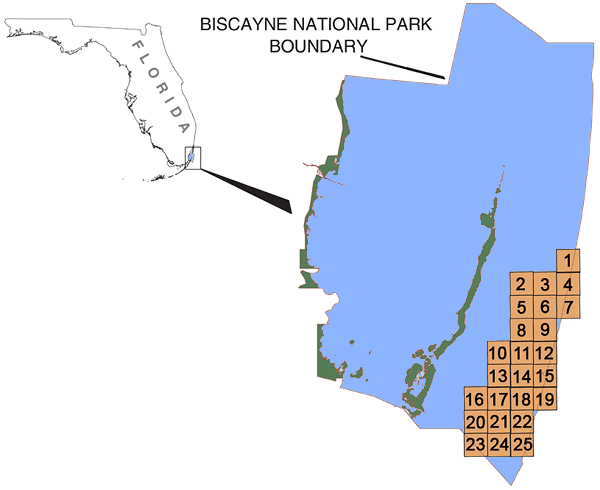
Browse_Graphic_File_Description: Biscayne National Park
Browse_Graphic_File_Type: GIF
Data_Set_Credit:
The USGS Center for Coastal and Watershed Studies would like to acknowledge NASA Goddard Space Flight Center for their cooperation and assistance in the development of the data. The National Park Service also contributed by editing the lidar tiles to remove processing artifacts.
Native_Data_Set_Environment:
Microsoft Windows 2000 Version 5.0 (Build 2195) Service Pack 4; ESRI ArcCatalog 8.3.0.800
Cross_Reference:
Citation_Information:
Originator:
Brock, J.C.; Wright, C.W.; Sallenger, A.H; Krabill, W.B., and Swift, R.N
Publication_Date: 2003
Title:
Basis and Methods of NASA Airborne Topographic Mapper Lidar Surveys for Coastal Studies
Geospatial_Data_Presentation_Form: journal article
Publication_Information:
Publication_Place: West Palm Beach, FL; Miami, FL; St. Petersburg, FL
Publisher:
Journal of Coastal Research, Proceedings of the Seventh International Conference on Remote Sensing for Marine and Coastal Environments, US Geological Survey
Cross_Reference:
Citation_Information:
Originator: Wright, C.W. and J. Brock
Publication_Date: 2002
Title:
EAARL: A lidar for mapping shallow coral reefs and other coastal environments
Edition: 20-22, May 2002
Geospatial_Data_Presentation_Form: proceedings article
Publication_Information:
Publication_Place: West Palm Beach, FL; Miami, FL; St. Petersburg, FL
Publisher:
Journal of Coastal Research, Proceedings of the Seventh International Conference on Remote Sensing for Marine and Coastal Environments, US Geological Survey
Cross_Reference:
Citation_Information:
Originator: John Brock and Asbury Sallenger, US Geological Survey
Publication_Date: 2001
Title:
Airborne Topographic Lidar Mapping for Coastal Science and Resource Management
Geospatial_Data_Presentation_Form: USGS Open File Report
Publication_Information:
Publication_Place: West Palm Beach, FL; Miami, FL; St. Petersburg, FL
Publisher:
Journal of Coastal Research, Proceedings of the Seventh International Conference on Remote Sensing for Marine and Coastal Environments, US Geological Survey
Cross_Reference:
Citation_Information:
Originator:
Nayegandhi, A.; Brock, J.C.; Wright, C.W.; Clayton, T.D.; Mosher, L.A.
Publication_Date: 20040523
Title:
Processing and Filtering 'Bare Earth' Topographic Data Acquired by NASA's Experimental Advanced Airborne Research Lidar (EAARL)
Geospatial_Data_Presentation_Form: CD-ROM
Other_Citation_Details:
Published as Abstract and Presented at the ASPRS Annual Conference, Denver, CO, May 23-28, 2004. Proceedings on CDROM.
Cross_Reference:
Citation_Information:
Originator: Nayegandhi, A.; Brock, J.C.; Wright C.W.
Publication_Date: 20090220
Title:
Small-footprint, waveform-resolving lidar estimation of submerged and sub-canopy topography in coastal environments.
Geospatial_Data_Presentation_Form: In Preparation
Other_Citation_Details: In Preparation.