EAARL Topography-Fire Island National Seaashore

Metadata also available as - [Questions & Answers] - [Parseable text] - [XML]

Metadata:

Identification_Information:
Citation:
Citation_Information:
Originator: U.S. Geological Survey
Publication_Date: 2007
Title: EAARL Topography-Fire Island National Seaashore
Geospatial_Data_Presentation_Form: remote-sensing image
Series_Information:
Series_Name: Open File Report
Issue_Identification: 1007
Online_Linkage: http://pubs.usgs.gov/of/2007/1007/start.html
Description:
Abstract:
A first return elevation map (also known as a Digital Elevation Model or DEM) of Fire Island National Seashore was produced from remotely-sensed, geographically-referenced elevation measurements in cooperation with the U.S. Geological Survey (USGS), National Air and Space Administration (NASA), and the National Park Service (NPS). Elevation measurements were collected over the area using the NASA Experimental Advanced Airborne Research Lidar (EAARL), a pulsed laser ranging system mounted onboard an aircraft to measure ground elevation, vegetation canopy, and coastal topography. The system uses high frequency laser beams directed at the earth's surface through an opening in the bottom of the aircraft's fuselage. The laser system records the time difference between emission of the laser beam and the reception of the reflected laser signal in the aircraft. The plane travels over the target area at approximately 50 meters per second at an elevation of approximately 300 m. The EAARL, developed by NASA at Wallops Flight Facility in Virginia, measures ground elevation with a vertical resolution of 15 centimeters. A sampling rate of 3 kHz or higher results in an extremely dense spatial elevation data set. Over 100 kilometers of coastline can be easily surveyed within a 3- to 4-hour mission time period. When subsequent elevation maps for an area are analyzed, they provide a useful tool to make management decisions regarding land development.
For more information on Lidar science and the Experimental Advanced Airborne Research Lidar (EAARL) system and surveys, see http://ngom.usgs.gov/dsp/overview/index.php and http://ngom.usgs.gov/dsp/tech/eaarl/index.php .
Purpose:
The purpose of this project was to produce a highly detailed and accurate first return digital elevation map of Fire Island National Seashore for use as a management tool and to make this map available to natural resource managers.
Supplemental_Information:
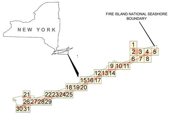
Raw lidar data is not in a format that is generally usable by Park Service resource managers and scientists for scientific analysis. Converting dense lidar elevation data into a readily usable format without loss of essential information requires specialized processing. The USGS converts raw lidar data into a GIS-compatible map product to be provided to National Park Service GIS specialists, managers, and scientists. The primary tool used in the conversion process is Airborne Lidar Processing System (ALPS), a multi-tiered processing system developed by a USGS/NASA collaborative project. Specialized processing algorithms are used to convert raw waveform lidar data acquired by the EAARL to georeferenced spot (x,y,z) returns for "first surface" and "bald earth" topography. These data are then converted to the North American Datum of 1983 and the North American Vertical Datum of 1988 (using the Geoid 03 model). Each file contains data located in a 2 km by 2 km tile where the upper left bound can be quickly assessed through the file name. The first number in the filename (e######) is the left most UTM easting coordinate in meters, the second number (n#######) is the top most UTM northing coordinate in meters, and the third number (##) is the UTM zone the tile is located.
Time_Period_of_Content:
Time_Period_Information:
Single_Date/Time:
Calendar_Date: 20050425
Currentness_Reference: ground condition
Status:
Progress: Complete
Maintenance_and_Update_Frequency: None planned
Spatial_Domain:
Bounding_Coordinates:
West_Bounding_Coordinate: -73.237872
East_Bounding_Coordinate: -72.760761
North_Bounding_Coordinate: 40.783611
South_Bounding_Coordinate: 40.627676
Keywords:
Theme:
Theme_Keyword_Thesaurus: USGS Metadata Identifier
Theme_Keyword: USGS:2c14e2a7-b530-45b9-aee7-fe22c02ca723
Theme:
Theme_Keyword_Thesaurus: ISO 19115 Topic Category
Theme_Keyword: elevation
Theme:
Theme_Keyword_Thesaurus: None
Theme_Keyword: LIDAR
Theme_Keyword: Experimental Advanced Airborne Research Lidar
Theme_Keyword: EAARL
Theme_Keyword: Digital Elevation Model
Theme_Keyword: elevation change
Theme_Keyword: laser altimetry
Theme_Keyword: derived surface
Theme_Keyword: resource management
Theme_Keyword: first return elevation
Theme_Keyword: ALPS
Theme_Keyword: Airborne Lidar Processing System
Theme:
Theme_Keyword_Thesaurus: Data Categories for Marine Planning
Theme_Keyword: distributions
Theme_Keyword: bathymetry and elevation
Theme:
Theme_Keyword_Thesaurus: Marine Realms Information Bank (MRIB) Keywords
Theme_Keyword: altimetry
Theme_Keyword: topographic mapping
Theme:
Theme_Keyword_Thesaurus: USGS Thesaurus
Theme_Keyword: LIDAR
Theme_Keyword: topography
Theme_Keyword: digital elevation models
Place:
Place_Keyword_Thesaurus: None
Place_Keyword: Fire Island
Place_Keyword: New York
Access_Constraints:
Any use of these data signifies a user's agreement to comprehension and compliance of the USGS Standard Disclaimer. Ensure all portions of metadata are read and clearly understood before using these data in order to protect both user and USGS interests. See section 6.3 Distribution Liability.
Use_Constraints:
Although the USGS is making these data sets available to others who may find the data of value, USGS does not warrant, endorse, or recommend the use of this data for any given purpose. The user assumes the entire risk related to the use of these data.
Point_of_Contact:
Contact_Information:
Contact_Person_Primary:
Contact_Person: Dr. John C Brock
Contact_Organization:
United States Geological Survey, Center for Coastal and Watershed Studies
Contact_Position: Physical Oceanographer
Contact_Address:
Address_Type: mailing and physical address
Address: 600 4th Street South
City: Saint Petersburg
State_or_Province: FL
Postal_Code: 33701
Country: USA
Contact_Voice_Telephone: 727 803-8747 ext3088
Contact_Facsimile_Telephone: 727 803-2031
Contact_Electronic_Mail_Address: jbrock@usgs.gov
Hours_of_Service: Monday-Friday, 8-5, EST
Browse_Graphic:
Browse_Graphic_File_Name: http://pubs.usgs.gov/of/2007/1007/images/fiis_fs.gif
Browse_Graphic_File_Description: EAARL Topography-Fire Island National Seaashore
Browse_Graphic_File_Type: GIF
Data_Set_Credit:
USGS is providing these data "as is", and USGS disclaims any and all warranties, whether expressed or implied, including (without limitation) any implied warranties of merchantability or fitness for a particular purpose. In no event will USGS be liable to you or to any third party for any direct, indirect, incidental, consequential, special, or exemplary damages or lost profits resulting from any use or misuse of these data. Acknowledgement of the U.S. Geological Survey Center for Coastal and Watershed Studies as a data source would be appreciated in products developed from these data, and such acknowledgement as is standard for citation and legal practices for data source is expected by users of this data. Sharing new data layers developed directly from these data would also be appreciated by USGS staff. Users should be aware that comparisons with other data sets for the same area from other time periods may be inaccurate due to inconsistencies resulting from changes in photo interpretation, mapping conventions, and digital processes over time. These data are not legal documents and are not to be used as such.
Native_Data_Set_Environment:
Microsoft Windows XP Version 5.1 (Build 2600) Service Pack 2; ESRI ArcCatalog 9.1.0.780
Data_Quality_Information:
Attribute_Accuracy:
Attribute_Accuracy_Report:
The expected accuracy of the measured variables are as follows: attitude within 0.07 degree, 3-cm nominal ranging accuracy, and vertical elevation accuracy of +/-15 cm for the topographic surface. Quality checks are built into the data-processing software.
Logical_Consistency_Report:
Each file contains data located in a 2-km by 2-km tile, where the upper-left bound can be assessed quickly through the file name. The first 3 numbers in the file name represent the left-most UTM easting coordinate (e###000) in meters, the next 4 numbers represent the top-most UTM northing coordinate (n####000) in meters, and the last 2 numbers (##) represent the UTM zone in which the tile is located (for example, ba_e123_n4567_20).
Completeness_Report:
Several regions of the dataset are labeled as "No Data", which corresponds to a cell value of -100 m in the GeoTiff file. These "No Data" areas are a result of the survey not covering a particular region, optical water depth of greater than 1.5 Secchi disc depths, or the manual removal of lidar processing artifacts.
Positional_Accuracy:
Horizontal_Positional_Accuracy:
Horizontal_Positional_Accuracy_Report:
Raw elevation measurements have been determined to be within 1 meter horizontal accuracy.
Vertical_Positional_Accuracy:
Vertical_Positional_Accuracy_Report:
Elevations of the DEM are vertically consistent with the point elevation data, +/-15 cm.
Lineage:
Process_Step:
Process_Description:
The data are collected using a Cessna 310 aircraft. The NASA Experimental Advanced Airborne Research Lidar (EAARL) laser scanner collects the data using a green (532nm) raster scanning laser, while a digital camera acquires a visual record of the flight. The data are stored on hard drives and archived at the USGS office in St. Petersburg and the NASA office at Wallops Flight Facility. The navigational data are processed at Wallops Flight Facility. The navigational and raw data are then downloaded into the Airborne Lidar Processing System (ALPS). Data are converted from units of time to x,y,z points for elevation. The derived surface data can then be converted into raster data (geotiffs).
Process_Date: 20060201
Process_Contact:
Contact_Information:
Contact_Person_Primary:
Contact_Person: Amar Nayegandhi
Contact_Organization: ETI Professionals, Inc. Contracted with US Geological Survey
Contact_Position: Computer Scientist
Contact_Address:
Address_Type: mailing and physical address
Address: 600 4th Street South
City: St. Petersburg
State_or_Province: Florida
Postal_Code: 33701
Country: USA
Contact_Voice_Telephone: 727-803-8747
Hours_of_Service: 8:00am to 5:00pm Monday thru Friday, EST
Contact_Instructions: Call Survey for Details
Process_Step:
Process_Description:
The raster dataset was opened in ERDAS IMAGINE for editing. An Area of Interest (AOI) polygon was drawn around regions of poor data quality. Poor data quality was determined visually by locating gaps in the data as well as artifacts of the lidar processing. Pixels within the AOI polygons were given a raster value of -100 to correspond with other areas of No Data.
Process_Date: 20060701
Process_Contact:
Contact_Information:
Contact_Person_Primary:
Contact_Person: Judd Patterson
Contact_Organization:
National Park Service South Florida/Caribbean Network Inventory and Monitoring Program
Contact_Position: Research Assistant
Contact_Address:
Address_Type: mailing and physical address
Address: 18001 Old Cutler Rd
Address: Suite 419
City: Miami
State_or_Province: Florida
Postal_Code: 33157
Country: USA
Contact_Voice_Telephone: (305) 252-0347
Contact_Facsimile_Telephone: (305) 253-0463
Process_Step:
Process_Description: Metadata imported.
Process_Date: 20060701
Process_Step:
Process_Description:
Keywords section of metadata optimized for discovery in USGS Coastal and Marine Geology Data Catalog.
Process_Date: 20170124
Process_Contact:
Contact_Information:
Contact_Organization_Primary:
Contact_Organization: U.S. Geological Survey
Contact_Person: Alan O. Allwardt
Contact_Position: Contractor -- Information Specialist
Contact_Address:
Address_Type: mailing and physical address
Address: 2885 Mission Street
City: Santa Cruz
State_or_Province: CA
Postal_Code: 95060
Contact_Voice_Telephone: 831-460-7551
Contact_Facsimile_Telephone: 831-427-4748
Contact_Electronic_Mail_Address: aallwardt@usgs.gov
Process_Step:
Process_Description:
Added keywords section with USGS persistent identifier as theme keyword.
Process_Date: 20201013
Process_Contact:
Contact_Information:
Contact_Organization_Primary:
Contact_Organization: U.S. Geological Survey
Contact_Person: VeeAnn A. Cross
Contact_Position: Marine Geologist
Contact_Address:
Address_Type: Mailing and Physical
Address: 384 Woods Hole Road
City: Woods Hole
State_or_Province: MA
Postal_Code: 02543-1598
Contact_Voice_Telephone: 508-548-8700 x2251
Contact_Facsimile_Telephone: 508-457-2310
Contact_Electronic_Mail_Address: vatnipp@usgs.gov
Spatial_Data_Organization_Information:
Indirect_Spatial_Reference: Tiling Index
Direct_Spatial_Reference_Method: Raster
Raster_Object_Information:
Raster_Object_Type: Pixel
Row_Count: 2001
Column_Count: 2001
Vertical_Count: 1
Spatial_Reference_Information:
Horizontal_Coordinate_System_Definition:
Planar:
Grid_Coordinate_System:
Grid_Coordinate_System_Name: Universal Transverse Mercator
Universal_Transverse_Mercator:
UTM_Zone_Number: 18
Transverse_Mercator:
Scale_Factor_at_Central_Meridian: 0.999600
Longitude_of_Central_Meridian: -75.000000
Latitude_of_Projection_Origin: 0.000000
False_Easting: 500000.000000
False_Northing: 0.000000
Planar_Coordinate_Information:
Planar_Coordinate_Encoding_Method: row and column
Coordinate_Representation:
Abscissa_Resolution: 1.000000
Ordinate_Resolution: 1.000000
Planar_Distance_Units: meters
Geodetic_Model:
Horizontal_Datum_Name: North American Datum of 1983
Ellipsoid_Name: Geodetic Reference System 80
Semi-major_Axis: 6378137.000000
Denominator_of_Flattening_Ratio: 298.257222
Vertical_Coordinate_System_Definition:
Altitude_System_Definition:
Altitude_Datum_Name: North American Vertical Datum of 1988
Altitude_Resolution: 15 cm
Altitude_Distance_Units: meters
Altitude_Encoding_Method:
Explicit elevation coordinate included with horizontal coordinates
Entity_and_Attribute_Information:
Overview_Description:
Entity_and_Attribute_Overview:
This Digital Elevation Model is an Geotiff derived from point data. It is raster data consisting of cells. Each cell has an elevation value associated with it. Cell size is 1 meter by 1 meter.
Entity_and_Attribute_Detail_Citation:
The variables measured by EAARL are: distance between aircraft and GPS satellites (m), attitude information (roll, pitch, heading in degrees), scan angle (degrees), second of the epoch (sec), and 1-ns time-resolved return intensity waveform (digital counts). Z value is referenced to orthometric elevations derived from National Geodetic Survey Geoid Model, Geoid03.
Distribution_Information:
Distributor:
Contact_Information:
Contact_Person_Primary:
Contact_Person: Jerry Butcher
Contact_Organization: USGS: Center for Coastal and Watershed Studies
Contact_Position: Windows System Administrator
Contact_Address:
Address_Type: mailing address
Address: 600 4th Street South
City: Saint Petersburg
State_or_Province: FL
Postal_Code: 33701
Country: USA
Contact_Voice_Telephone: 727-803-8747 x3049
Resource_Description: Lidar DEM (Fire Island)
Distribution_Liability:
The United States Geological Survey shall not be held liable for improper or incorrect use of the data described and/or contained herein. These data and related graphics are not legal documents and are not intended to be used as such.The information contained in these data is dynamic and may change over time. The data are not better than the original sources from which they were derived. It is the responsibility of the data user to use the data appropriately and consistent within the limitations of geospatial data in general and these data in particular. The related graphics are intended to aid the data user in acquiring relevant data; it is not appropriate to use the related graphics as data.The United States Geological Survey gives no warranty, expressed or implied, as to the accuracy, reliability, or completeness of these data. It is strongly recommended that these data are directly acquired from an USGS server and not indirectly through other sources which may have changed the data in some way. Although these data have been processed successfully on a computer system at the United States Geological Survey, no warranty expressed or implied is made regarding the utility of the data on another system or for general or scientific purposes, nor shall the act of distribution constitute any such warranty. This disclaimer applies both to individual use of the data and aggregate use with other data.
Standard_Order_Process:
Digital_Form:
Digital_Transfer_Information:
Format_Name: GeoTIFF
Format_Version_Date: 2007
Format_Specification: GeoTIFF
Digital_Transfer_Option:
Online_Option:
Computer_Contact_Information:
Network_Address:
Access_Instructions: Data can be downloaded via the World Wide Web (WWW)
Offline_Option:
Offline_Media: DVD
Recording_Format: DVD
Fees: Vary
Ordering_Instructions: Contact U.S. Geological Survey.
Turnaround: Vary
Custom_Order_Process: Call USGS for Details
Metadata_Reference_Information:
Metadata_Date: 20211109
Metadata_Contact:
Contact_Information:
Contact_Organization_Primary:
Contact_Organization:
United States Geological Survey, St. Petersburg Coastal and Marine Science Center
Contact_Person: SPCMSC Data Management Group
Contact_Address:
Address_Type: mailing and physical address
Address: 600 4th Street South
City: St. Petersburg
State_or_Province: Florida
Postal_Code: 33701
Country: US
Contact_Voice_Telephone: 727-502-8000
Contact_Electronic_Mail_Address: gs-g-spcmsc_data_inquiries@usgs.gov
Metadata_Standard_Name: Content Standard for Digital Geospatial Metadata
Metadata_Standard_Version: FGDC-STD-001-1998

This page is <https://cmgds.marine.usgs.gov/catalog/spcmsc/of2007-1007metadata.html>
Generated by mp version 2.9.50 on Tue Nov 9 16:47:42 2021