Citation:
Citation_Information:
Originator: U.S. Geological Survey
Publication_Date: 2007
Title: EAARL Submarine Topography-Northern Florida Keys Reef Tract
Edition: First
Geospatial_Data_Presentation_Form: remote-sensing image
Series_Information:
Series_Name: Open File Report
Issue_Identification: 2007-1432
Publication_Information:
Publication_Place: FISC St. Petersburg
Publisher: USGS
Other_Citation_Details:
The USGS, in cooperation with the National Park Service (NPS) and the National Aeronautics and Space Administration (NASA), provide the coastal management community with digital elevation products. The USGS processes aircraft lidar data provided by NASA, develops software tools and algorithms to use and analyze the data, and makes products available to the coastal management community.
Online_Linkage: http://pubs.usgs.gov/of/2007/1432/start.html
Description:
Abstract:
Lidar is a remote sensing technique that uses laser light to detect, range, or identify remote objects based on light reflected by the object or emitted through its subsequent fluorescence. Airborne ranging lidar is now being applied in coastal environments to produce accurate, cost-efficient elevation datasets with high spatial density. The USGS, in cooperation with NASA and NPS, is using airborne lidar to measure the submerged topography of the Northern Florida Keys Reef Tract (NFKRT); secondarily, the data will be assessed for its potential in terms of benthic characterization. Elevation measurements were collected over the NFKRT using the NASA Experimental Advanced Airborne Research Lidar (EAARL), a pulsed laser ranging system mounted onboard an aircraft to measure subaerial and submarine topography. The system uses a high frequency laser beam directed at the earth's surface through an opening in the bottom of the aircraft's fuselage. The laser system records the time difference between emission of the laser beam and the reception of the reflected laser signal in the aircraft. The EAARL system, developed by the NASA Wallops Flight Facility (WFF) in Virginia, measures ground elevation with a vertical resolution of roughly 15 centimeters. A sampling rate of up to 3 kHz results in an extremely dense spatial elevation data set. The EAARL system is typically flown at 300 m altitude AGL, resulting in a 240 m swath for each flightline. Data collection occurred with approximately 50% overlap between flightlines, resulting in about one laser sounding per square meter. The data were processed by the USGS, Florida Integrated Science Center (FISC] St. Petersburg office to produce 1 meter resolution raster images that can be easily ingested into a Geographic Information System (GIS). The data were organized as 2 km by 2 km data tiles in 32 bit floating-point integer GeoTIFF format.
For more information on Lidar science and the Experimental Advanced Airborne Research Lidar (EAARL) system and surveys, see
http://ngom.usgs.gov/dsp/overview/index.php and
http://ngom.usgs.gov/dsp/tech/eaarl/index.php .
One objective of this research is the creation of techniques for the surveying of submerged topography for the purposes of habitat mapping, ecological monitoring, change detection, and event assessment (e.g., hurricanes and extreme storm events). As part of this project, data from NASA EAARL were used. This sensor has the potential to make significant contributions in this realm for measuring shallow water depth and conducting cross-environment surveys. High spectral resolution and low costs were found to be key factors in providing accurate and affordable imagery to managers of coastal tropical habitats.
Supplemental_Information:
Raw lidar data is not in a format that is generally usable by Park Service resource managers and scientists for scientific analysis. Converting dense lidar elevation data into a readily usable format without loss of essential information requires specialized processing. The USGS converts raw lidar data into a GIS-compatible map product to be provided to NPS GIS specialists, managers, and scientists. The primary tool used in the conversion process is Airborne Lidar Processing System (ALPS), a multi-tiered processing system developed by a USGS/NASA collaborative project for the generation of subaerial and submarine lidar topographic products. Specialized processing algorithms are used to convert raw waveform lidar data acquired by the EAARL to geo-referenced spot (x,y,z) returns for submarine topography. These data are then converted to the North American (Horizontal ) Datum of 1983 (NAD83) and the North American Vertical Datum of 1988 (NAVD88, using the Geoid 03 model). The final products are 2x2-km map tiles written out in a standard GeoTIFF format with associated metadata information. These tiles are created for visual interpretation and regional quantitative analysis. Metadata files include the standard FGDC format.
Time_Period_of_Content:
Time_Period_Information:
Multiple_Dates/Times:
Single_Date/Time:
Calendar_Date: 20010710
Single_Date/Time:
Calendar_Date: 20010904
Single_Date/Time:
Calendar_Date: 20020802
Currentness_Reference: ground condition
Status:
Progress: Complete
Maintenance_and_Update_Frequency: As needed
Spatial_Domain:
Bounding_Coordinates:
West_Bounding_Coordinate: -80.295593
East_Bounding_Coordinate: -80.155585
North_Bounding_Coordinate: 25.305434
South_Bounding_Coordinate: 25.143099
Keywords:
Theme:
Theme_Keyword_Thesaurus: USGS Metadata Identifier
Theme_Keyword: USGS:5cd6fc67-9f04-4037-80e8-11568dd98df1
Theme:
Theme_Keyword_Thesaurus: ISO 19115 Topic Category
Theme_Keyword: elevation
Theme:
Theme_Keyword_Thesaurus: None
Theme_Keyword:
Lidar, Experimental Advanced Airborne Research Lidar, digital elevation model, elevation change, laser altimetry, derived surface, coastal resource management, Airborne Lidar Processing System, benthic cover types, submarine elevations
Theme:
Theme_Keyword_Thesaurus: Data Categories for Marine Planning
Theme_Keyword: distributions
Theme_Keyword: bathymetry and elevation
Theme:
Theme_Keyword_Thesaurus: Marine Realms Information Bank (MRIB) Keywords
Theme_Keyword: altimetry
Theme_Keyword: topographic mapping
Theme:
Theme_Keyword_Thesaurus: USGS Thesaurus
Theme_Keyword: LIDAR
Theme_Keyword: topography
Theme_Keyword: digital elevation models
Place:
Place_Keyword_Thesaurus: None
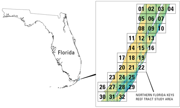
Place_Keyword: Northern Florida Keys Reef Tract
Place_Keyword: Florida
Place_Keyword: Florida Keys
Place_Keyword: United States East Coast
Stratum:
Stratum_Keyword_Thesaurus: None
Stratum_Keyword: submarine topography
Access_Constraints:
Any use of these data signifies a user's agreement to comprehension and compliance of the USGS Standard Disclaimer. Ensure all portions of metadata are read and clearly understood before using these data in order to protect both user and USGS interests. See section 6.3 Distribution Liability.
Use_Constraints:
Although the USGS is making these data sets available to others who may find the data of value, USGS does not warrant, endorse, or recommend the use of these data for any given purpose. The user assumes the entire risk related to the use of these data. These data sets are not for navigational purposes. USGS is providing these data "as is", and USGS disclaims any and all warranties, whether expressed or implied, including (without limitation) any implied warranties of merchantability or fitness for a particular purpose. In no event will USGS be liable to you or to any third party for any direct, indirect, incidental, consequential, special, or exemplary damages or lost profits resulting from any use or misuse of these data.Acknowledgement of the U.S. Geological Survey FISC - St. Petersburg as a data source would be appreciated in products developed from these data, and such acknowledgement as is standad for citation and legal practices for data source is expected by users of this data set. Sharing new data layers developed directly from these data would also be appreciated by USGS staff. Users should be aware that comparisons with other data sets for the same area from other time periods may be inaccurate due to inconsistencies resulting from changes in photo interpretation, mapping conventions, and digital processes over time. These data are not legal documents and are not to be used as such.
Point_of_Contact:
Contact_Information:
Contact_Organization_Primary:
Contact_Organization:
United States Geological Survey, Florida Integrated Science Center
Contact_Person: Dr. John C. Brock
Contact_Position: Research Oceanographer
Contact_Address:
Address_Type: mailing and physical address
Address: 600 4th Street South
City: St. Petersburg
State_or_Province: Florida
Postal_Code: 33701
Country: USA
Contact_Voice_Telephone: (727) 803-8747 ext3088
Contact_Facsimile_Telephone: (727) 803-2031
Contact_Electronic_Mail_Address: [email protected]
Hours_of_Service: 8am to 5pm M-F EST
Browse_Graphic:
Data_Set_Credit:
The USGS Florida Integrated Science Center, St. Petersburg, FL would like to acknowledge NASA Goddard Space Flight Center and the National Park Service for their cooperation and assistance in the aquisition and processing of the data. The National Park Service also contributed by cleaning the LIDAR dataset in preparation for map production.
Native_Data_Set_Environment:
Microsoft Windows XP Version 5.1 (Build 2600) Service Pack 2; ESRI ArcCatalog 9.2.1.1332
Cross_Reference:
Citation_Information:
Originator:
Brock, J.C.; Wright, C.W.; Sallenger, A.H; Krabill, W.B., and Swift
Publication_Date: 2003
Title:
Basis and Methods of NASA Airborne Topographic Mapper Lidar Surveys for Coastal Studies
Geospatial_Data_Presentation_Form: journal article
Publication_Information:
Publication_Place: West Palm Beach, FL
Publisher: Journal of Coastal Research
Cross_Reference:
Citation_Information:
Originator: Wright, C.W. and Brock, J.C.
Publication_Date: 2002
Title:
EAARL: A lidar for mapping shallow coral reefs and other coastal environments
Geospatial_Data_Presentation_Form: Proceedings Article
Publication_Information:
Publication_Place: Miami, FL
Publisher:
Proceedings of the Seventh International Conference on Remote Sensing for Marine and Coastal Environments
Cross_Reference:
Citation_Information:
Originator: John Brock and Asbury Sallenger
Publication_Date: 2001
Title:
Airborne Topographic Lidar Mapping for Coastal Science and Resource Management
Geospatial_Data_Presentation_Form: USGS Open File Report
Publication_Information:
Publication_Place: St. Petersburg
Publisher: U.S. Geological Survey
Cross_Reference:
Citation_Information:
Originator: Nayegandhi, A., Brock, J.C., Wright, C.W., OConnell, M.O., 2006
Publication_Date: 2006
Title:
Evaluating a small-footprint, waveform-resolving lidar over coastal vegetation communities
Geospatial_Data_Presentation_Form: USGS Open File Report
Publication_Information:
Publication_Place: Maryland
Publisher: Photogrammetric Engineering and Remote Sensing