Contoured Bathymetry for Lake Maurepas, Louisiana (MAURCONT)

Metadata also available as - [Questions & Answers] - [Parseable text] - [XML]

Metadata:

Identification_Information:
Citation:
Citation_Information:
Originator: U.S. Geological Survey
Originator: Laura Hayes
Originator: Jamey Reid
Publication_Date: 2003
Title: Contoured Bathymetry for Lake Maurepas, Louisiana (MAURCONT)
Edition: 1.0
Geospatial_Data_Presentation_Form: vector digital data
Series_Information:
Series_Name: Digital Data Series
Issue_Identification: 79
Publication_Information:
Publication_Place: Woods Hole Coastal and Marine Science Center, Woods Hole, MA
Publisher: U.S. Geological Survey, Coastal and Marine Geology Program
Online_Linkage: https://doi.org/10.3133/ds79
Online_Linkage: http://pubs.usgs.gov/dds/dds79/HTMLDOCS/catalog.htm
Online_Linkage: Larger_Work_Citation:
Citation_Information:
Originator: S.J. Williams
Originator: J.M. Reid
Originator: V. Cross
Originator: C. Polloni
Publication_Date: 2003
Title:
Coastal Erosion and Wetland Change in Louisiana: Selected USGS Products
Edition: 1.0
Series_Information:
Series_Name: Digital Data Series
Issue_Identification: 79
Publication_Information:
Publication_Place: Reston, VA
Publisher: U.S. Geological Survey
Online_Linkage: http://pubs.usgs.gov/dds/dds79/
Description:
Abstract:
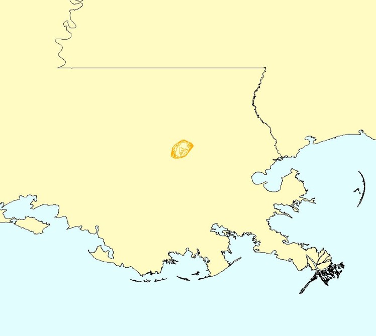
This is the contoured bathymetry for Lake Maurepas created for USGS Professional Paper 1634 by Laura Hayes using Vertical Mapper.
Purpose:
This data set was created in order to serve as part of the background map layers for data visualization in the sediment database section of USGS Professional Paper 1634.
Supplemental_Information:
This data layer was obtained from USGS Professional Paper 1634 (2002) with no associated metadata. Metadata has been created for use of the data layer in this publication.
Time_Period_of_Content:
Time_Period_Information:
Single_Date/Time:
Calendar_Date: 2002
Currentness_Reference: publication date
Status:
Progress: Complete
Maintenance_and_Update_Frequency: None planned
Spatial_Domain:
Bounding_Coordinates:
West_Bounding_Coordinate: -90.593951
East_Bounding_Coordinate: -90.387551
North_Bounding_Coordinate: 30.342339
South_Bounding_Coordinate: 30.171507
Keywords:
Theme:
Theme_Keyword_Thesaurus: USGS Metadata Identifier
Theme_Keyword: USGS:a55315be-59d4-4da0-a18a-5e4453472390
Theme:
Theme_Keyword_Thesaurus: None
Theme_Keyword: U.S. Geological Survey
Theme_Keyword: USGS
Theme_Keyword: Coastal and Marine Geology Program
Theme_Keyword: CMGP
Theme_Keyword: Woods Hole Science Center
Theme_Keyword: bathymetry
Theme_Keyword: polyline shapefile
Theme_Keyword: bathymetric contours
Theme:
Theme_Keyword_Thesaurus: ISO 19115 Topic Category
Theme_Keyword: inlandWaters
Theme_Keyword: elevation
Theme:
Theme_Keyword_Thesaurus: USGS Thesaurus
Theme_Keyword: bathymetry
Theme_Keyword: contouring
Theme_Keyword: lakebed characteristics
Theme_Keyword: geospatial datasets
Place:
Place_Keyword_Thesaurus: None
Place_Keyword: Louisiana
Place_Keyword: Lake Maurepas
Place_Keyword: North America
Place_Keyword: United States
Access_Constraints: None
Use_Constraints:
The U.S. Geological Survey must be referenced as the orignators of the dataset in any future products derived from these data. Bathymetry is not to be used for navigational purposes.
Point_of_Contact:
Contact_Information:
Contact_Person_Primary:
Contact_Person: Jamey M. Reid
Contact_Organization: U.S. Geological Survey
Contact_Position: IT Specialist (Data Management)
Contact_Address:
Address_Type: mailing and physical address
Address: 384 Woods Hole Road
City: Woods Hole
State_or_Province: MA
Postal_Code: 02543-1598
Contact_Voice_Telephone: 508-548-8700 x2204
Contact_Facsimile_Telephone: 508-457-2310
Contact_Electronic_Mail_Address: jreid@usgs.gov
Browse_Graphic:
Browse_Graphic_File_Name: Browse_Graphic_File_Description: Contoured Bathymetry for Lake Maurepas
Browse_Graphic_File_Type: JPEG
Data_Set_Credit:
Laura Hayes, U.S. Geological Survey, for creating the data layer.
Native_Data_Set_Environment:
Microsoft Windows XP Version 5.1 (Build 2600) Service Pack 2; ESRI ArcCatalog 9.0.0.535
Cross_Reference:
Citation_Information:
Originator: Frank Manheim, editor
Originator: Laura Hayes, editor
Publication_Date: 2002
Title:
Lake Pontchartrain Basin: Bottom Sediments and Related Environmental Resources
Geospatial_Data_Presentation_Form: vector digital data
Series_Information:
Series_Name: USGS Professional Paper
Issue_Identification: 1634
Publication_Information:
Publication_Place: Reston, VA
Publisher: U.S. Geological Survey
Online_Linkage: http://pubs.usgs.gov/pp/p1634/
Data_Quality_Information:
Logical_Consistency_Report:
No additional checks for topological consistency were performed on the data.
Completeness_Report: Information unavailable from original metadata.
Lineage:
Source_Information:
Source_Citation:
Citation_Information:
Originator: NOAA
Publication_Date: Unknown
Title: NOAA Navigation Chart 11369
Type_of_Source_Media: chart
Source_Time_Period_of_Content:
Time_Period_Information:
Single_Date/Time:
Calendar_Date: Unknown
Source_Currentness_Reference: Information unavailable from original metadata.
Source_Citation_Abbreviation: NOAA Navigation Chart 11369
Source_Contribution: Sounding values in meters and feet
Process_Step:
Process_Description:
Lake Maurepas bathymetry (soundings in meters and feet) was digitized using NOAA navigation chart 11369.
Source_Used_Citation_Abbreviation: NOAA navigation chart 11369
Process_Date: Unknown
Source_Produced_Citation_Abbreviation: maurbath.tab
Process_Contact:
Contact_Information:
Contact_Organization_Primary:
Contact_Organization: U.S. Geological Survey
Contact_Person: Laura Hayes
Contact_Position: Cartographer
Contact_Address:
Address_Type: mailing and physical address
Address: Woods Hole Field Center
Address: 384 Woods Hole Road
City: Woods Hole
State_or_Province: MA
Postal_Code: 02543-1598
Country: USA
Contact_Address:
Address_Type: mailing and physical address
Address: Water Resources Division
Address: 361 Commerce Way
City: Pembroke
State_or_Province: NH
Postal_Code: 03275-3719
Country: USA
Contact_Voice_Telephone: 508-548-8700
Contact_Voice_Telephone: 603-226-7835
Contact_Facsimile_Telephone: 508-457-2310
Contact_Facsimile_Telephone: 603-226-7894
Contact_Electronic_Mail_Address: lhayes@usgs.gov
Contact_Instructions:
This work was completed while at the USGS, Woods Hole Field Center. Laura is now at USGS, Water Resources Division in Pembroke, New Hampshire.
Process_Step:
Process_Description: Maurepas bathymetry was contoured using Vertical Mapper.
Source_Used_Citation_Abbreviation: maurbath.tab
Process_Date: Unknown
Source_Produced_Citation_Abbreviation: maurcont.tab
Process_Contact:
Contact_Information:
Contact_Person_Primary:
Contact_Person: Laura Hayes
Contact_Organization: U.S. Geological Survey
Contact_Position: Cartographer
Contact_Address:
Address_Type: mailing and physical address
Address: Woods Hole Field Center
Address: 384 Woods Hole Road
City: Woods Hole
State_or_Province: MA
Postal_Code: 02543-1598
Country: USA
Contact_Address:
Address_Type: mailing and physical address
Address: Water Resources Division
Address: 361 Commerce Way
City: Pembroke
State_or_Province: NH
Postal_Code: 03275-3719
Country: USA
Contact_Voice_Telephone: 508-548-8700
Contact_Voice_Telephone: 603-226-7835
Contact_Facsimile_Telephone: 508-457-2310
Contact_Facsimile_Telephone: 603-226-7894
Contact_Electronic_Mail_Address: lhayes@usgs.gov
Contact_Instructions:
This work was completed while at the USGS, Woods Hole Field Center. Laura is now at USGS, Water Resources Division in Pembroke, New Hampshire.
Process_Step:
Process_Description:
This file was generated as a .tab file in MapInfo and then exported to MapInfo Interchange Format (.mif and .mid).
Source_Used_Citation_Abbreviation: maurcont.tab
Process_Date: Unknown
Source_Produced_Citation_Abbreviation: maurcont.mif
Source_Produced_Citation_Abbreviation: maurcont.mid
Process_Contact:
Contact_Information:
Contact_Person_Primary:
Contact_Person: Laura Hayes
Contact_Organization: U.S. Geological Survey
Contact_Position: Cartographer
Contact_Address:
Address_Type: mailing and physical address
Address: Woods Hole Field Center
Address: 384 Woods Hole Road
City: Woods Hole
State_or_Province: MA
Postal_Code: 02543-1598
Country: USA
Contact_Voice_Telephone: 508-548-8700
Contact_Electronic_Mail_Address: lhayes@usgs.gov
Contact_Instructions:
This work was completed while at the USGS, Woods Hole Field Center. Laura is now at USGS, Water Resources Division in Pembroke, New Hampshire.
Process_Step:
Process_Description:
The MapInfo Interchange Format (.mif and .mid) file was converted to an ArcView shapefile (.shp).
Source_Used_Citation_Abbreviation: maurcont.mif
Source_Used_Citation_Abbreviation: maurcont.mid
Process_Date: Unknown
Source_Produced_Citation_Abbreviation: maurcont.shp
Source_Produced_Citation_Abbreviation: maurcont.shx
Source_Produced_Citation_Abbreviation: maurcont.dbf
Process_Contact:
Contact_Information:
Contact_Organization_Primary:
Contact_Organization: U.S. Geological Survey
Contact_Person: Laura Hayes
Contact_Position: Cartographer
Contact_Address:
Address_Type: mailing and physical address
Address: Woods Hole Field Center
Address: 384 Woods Hole Road
City: Woods Hole
State_or_Province: MA
Postal_Code: 02543-1598
Country: USA
Contact_Address:
Address_Type: mailing and physical address
Address: Water Resources Division
Address: 361 Commerce Way
City: Pembroke
State_or_Province: NH
Postal_Code: 03275-3719
Country: USA
Contact_Voice_Telephone: 508-548-8700
Contact_Voice_Telephone: 603-226-7835
Contact_Facsimile_Telephone: 508-457-2310
Contact_Facsimile_Telephone: 603-226-7894
Contact_Electronic_Mail_Address: lhayes@usgs.gov
Contact_Instructions:
This work was completed while at the USGS, Woods Hole Field Center. Laura is now at USGS, Water Resources Division in Pembroke, New Hampshire.
Process_Step:
Process_Description:
Edits to the metadata were made to fix any errors that MP v 2.9.34 flagged. This is necessary to enable the metadata to be successfully harvested for various data catalogs. In some cases, this meant adding text "Information unavailable" or "Information unavailable from original metadata" for those required fields that were left blank. Other minor edits were probably performed (title, publisher, publication place, etc.). Added the online link to the data in the distribution section. Fixed a typo in the title. Added an online link to the cross-reference. The source information was incomplete and had to be modified to meet the standard. Minor fixes to the attribute format for some attributes were needed. The metadata date (but not the metadata creator) was edited to reflect the date of these changes. The metadata available from a harvester may supersede metadata bundled within a download file. Compare the metadata dates to determine which metadata file is most recent.
Process_Date: 20161108
Process_Contact:
Contact_Information:
Contact_Organization_Primary:
Contact_Organization: U.S. Geological Survey
Contact_Person: VeeAnn A. Cross
Contact_Position: Marine Geologist
Contact_Address:
Address_Type: Mailing and Physical
Address: 384 Woods Hole Road
City: Woods Hole
State_or_Province: MA
Postal_Code: 02543
Contact_Voice_Telephone: 508-548-8700 x2251
Contact_Facsimile_Telephone: 508-457-2310
Contact_Electronic_Mail_Address: vatnipp@usgs.gov
Process_Step:
Process_Description: USGS Thesaurus keywords added to the keyword section.
Process_Date: 20180720
Process_Contact:
Contact_Information:
Contact_Organization_Primary:
Contact_Organization: U.S. Geological Survey
Contact_Person: VeeAnn A. Cross
Contact_Position: Marine Geologist
Contact_Address:
Address_Type: Mailing and Physical
Address: 384 Woods Hole Road
City: Woods Hole
State_or_Province: MA
Postal_Code: 02543-1598
Contact_Voice_Telephone: 508-548-8700 x2251
Contact_Facsimile_Telephone: 508-457-2310
Contact_Electronic_Mail_Address: vatnipp@usgs.gov
Process_Step:
Process_Description: Crossref DOI link was added as the first link in the metadata.
Process_Date: 20191115
Process_Contact:
Contact_Information:
Contact_Organization_Primary:
Contact_Organization: U.S. Geological Survey
Contact_Person: VeeAnn A. Cross
Contact_Position: Marine Geologist
Contact_Address:
Address_Type: Mailing and Physical
Address: 384 Woods Hole Road
City: Woods Hole
State_or_Province: MA
Postal_Code: 02543-1598
Contact_Voice_Telephone: 508-548-8700 x2251
Contact_Facsimile_Telephone: 508-457-2310
Contact_Electronic_Mail_Address: vatnipp@usgs.gov
Process_Step:
Process_Description:
Added keywords section with USGS persistent identifier as theme keyword.
Process_Date: 20200908
Process_Contact:
Contact_Information:
Contact_Organization_Primary:
Contact_Organization: U.S. Geological Survey
Contact_Person: VeeAnn A. Cross
Contact_Position: Marine Geologist
Contact_Address:
Address_Type: Mailing and Physical
Address: 384 Woods Hole Road
City: Woods Hole
State_or_Province: MA
Postal_Code: 02543-1598
Contact_Voice_Telephone: 508-548-8700 x2251
Contact_Facsimile_Telephone: 508-457-2310
Contact_Electronic_Mail_Address: vatnipp@usgs.gov
Spatial_Data_Organization_Information:
Direct_Spatial_Reference_Method: Vector
Point_and_Vector_Object_Information:
SDTS_Terms_Description:
SDTS_Point_and_Vector_Object_Type: String
Point_and_Vector_Object_Count: 367
Spatial_Reference_Information:
Horizontal_Coordinate_System_Definition:
Geographic:
Latitude_Resolution: 0.000001
Longitude_Resolution: 0.000001
Geographic_Coordinate_Units: Decimal degrees
Geodetic_Model:
Horizontal_Datum_Name: North American Datum of 1983
Ellipsoid_Name: Geodetic Reference System 80
Semi-major_Axis: 6378137.000000
Denominator_of_Flattening_Ratio: 298.257222
Entity_and_Attribute_Information:
Detailed_Description:
Entity_Type:
Entity_Type_Label: maurcont
Entity_Type_Definition: Information unavailable from original metadata.
Entity_Type_Definition_Source: Information unavailable from original metadata.
Attribute:
Attribute_Label: FID
Attribute_Definition: Internal feature number.
Attribute_Definition_Source: ESRI
Attribute_Domain_Values:
Unrepresentable_Domain:
Sequential unique whole numbers that are automatically generated.
Attribute:
Attribute_Label: Shape
Attribute_Definition: Feature geometry.
Attribute_Definition_Source: ESRI
Attribute_Domain_Values:
Unrepresentable_Domain: Coordinates defining the features.
Attribute:
Attribute_Label: MAURCONT_I
Attribute_Definition: Information unavailable from original metadata.
Attribute_Definition_Source: Information unavailable from original metadata.
Attribute_Domain_Values:
Unrepresentable_Domain: Information unavailable from original metadata.
Attribute:
Attribute_Label: DEPTH_M
Attribute_Definition: Depth, meters
Attribute_Definition_Source: Information unavailable from original metadata.
Attribute_Domain_Values:
Unrepresentable_Domain: Information unavailable from original metadata.
Attribute:
Attribute_Label: DEPTH_FT
Attribute_Definition: Depth, feet
Attribute_Definition_Source: Information unavailable from original metadata.
Attribute_Domain_Values:
Unrepresentable_Domain: Information unavailable from original metadata.
Distribution_Information:
Distributor:
Contact_Information:
Contact_Organization_Primary:
Contact_Organization: U.S. Geological Survey
Contact_Person: Jamey M. Reid
Contact_Position: IT Specialist (Data Management)
Contact_Address:
Address_Type: mailing and physical address
Address: USGS, Woods Hole Field Center
Address: 384 Woods Hole Road
City: Woods Hole
State_or_Province: MA
Postal_Code: 02543-1598
Country: USA
Contact_Voice_Telephone: 508-548-8700 x2204
Contact_Facsimile_Telephone: 508-457-2310
Contact_Electronic_Mail_Address: jreid@usgs.gov
Resource_Description: Downloadable Data
Distribution_Liability:
Although this data set has been used by the U.S. Geological Survey (USGS), no warranty, express or implied, is made by the USGS as to the accuracy of the data and/or related materials. The act of distribution shall not constitute any such warranty, and no responsibility is assumed by the USGS in the use of these data or related materials.
Standard_Order_Process:
Digital_Form:
Digital_Transfer_Information:
Format_Name: Shapefile
Transfer_Size: 0.342
Digital_Transfer_Option:
Online_Option:
Computer_Contact_Information:
Fees: none
Technical_Prerequisites:
The data are available in Environmental Systems Research Institute (ESRI) shapefile format. The user must have ArcGIS® or ArcView® 3.0 or greater software to read and process the data file. In lieu of ArcView or ArcGIS, the user may utilize another GIS application package capable of importing data. A free data viewer, arcexplorer, capable of displaying the data is available from ESRI at www.esri.com.
Metadata_Reference_Information:
Metadata_Date: 20220707
Metadata_Contact:
Contact_Information:
Contact_Organization_Primary:
Contact_Organization: U.S. Geological Survey
Contact_Person: Jamey M. Reid
Contact_Position: IT Specialist (Data Management)
Contact_Address:
Address_Type: mailing and physical address
Address: USGS, Woods Hole Field Center
Address: 384 Woods Hole Road
City: Woods Hole
State_or_Province: MA
Postal_Code: 02543-1598
Country: USA
Contact_Voice_Telephone: 508-548-8700 x2204
Contact_Facsimile_Telephone: 508-457-2310
Contact_Electronic_Mail_Address: whsc_data_contact@usgs.gov
Contact_Instructions:
The metadata contact email address is a generic address in the event the metadata contact is no longer with the USGS or the email is otherwise invalid.
Metadata_Standard_Name: FGDC Content Standards for Digital Geospatial Metadata
Metadata_Standard_Version: FGDC-STD-001-1998
Metadata_Time_Convention: local time
Metadata_Access_Constraints: None
Metadata_Use_Constraints: None

This page is <https://cmgds.marine.usgs.gov/catalog/whcmsc/data_series/DDS-79/maurcont.shp.html>
Generated by mp version 2.9.51 on Thu Jul 14 11:37:39 2022