usSEABED PaRSed data for the entire U.S. Atlantic Coast (ATL_PRS)

Metadata also available as - [Outline] - [Parseable text] - [XML]

Frequently anticipated questions:


What does this data set describe?

Title:
usSEABED PaRSed data for the entire U.S. Atlantic Coast (ATL_PRS)
Abstract:
This data layer is a point coverage of known sediment samplings, inspections and probings from the usSEABED data collection and integrated using the software system dbSEABED. This data layer represents the parsed (PRS) output of the dbSEABED mining software. It contains the results of parsing descriptions in the data resources. The PRS data is less precise because it comes from word-based descriptions, but will include information on outsized elements, consolidation that are not usually in EXT data.
Supplemental_Information:
The usSEABED database is a work-in-progress. Updates will be completed as additional information becomes available, and/or significant changes to the data mining software are completed.
  1. How might this data set be cited?
    U.S. Geological Survey, and Colorado, University of, 2005, usSEABED PaRSed data for the entire U.S. Atlantic Coast (ATL_PRS):.

    Online Links:

    This is part of the following larger work.

    Reid, J.M., Reid, J.A., Jenkins, C.J., Hastings, M.E., Williams, S.J., and Poppe, L.J., 2005, usSEABED: Atlantic Coast Offshore Surficial Sediment Data Release: Data Series 118, U.S. Geological Survey, Reston, VA.

    Online Links:

  2. What geographic area does the data set cover?
    West_Bounding_Coordinate: -81.983000
    East_Bounding_Coordinate: -65.000000
    North_Bounding_Coordinate: 46.086670
    South_Bounding_Coordinate: 23.530000
  3. What does it look like?
    https://pubs.usgs.gov/ds/2005/118/data/atl_prs.jpg (JPEG)
    Image map showing extent of data layer coverage
  4. Does the data set describe conditions during a particular time period?
    Calendar_Date: 2005
    Currentness_Reference:
    publication date
  5. What is the general form of this data set?
    Geospatial_Data_Presentation_Form: vector digital data
  6. How does the data set represent geographic features?
    1. How are geographic features stored in the data set?
      This is a Vector data set. It contains the following vector data types (SDTS terminology):
      • Entity point (83832)
    2. What coordinate system is used to represent geographic features?
      Horizontal positions are specified in geographic coordinates, that is, latitude and longitude. Latitudes are given to the nearest 0.00001. Longitudes are given to the nearest 0.00001. Latitude and longitude values are specified in Decimal degrees. The horizontal datum used is North American Datum of 1983.
      The ellipsoid used is Geodetic Reference System 80.
      The semi-major axis of the ellipsoid used is 6378137.000000.
      The flattening of the ellipsoid used is 1/298.257222.
  7. How does the data set describe geographic features?
    atl_prs
    Shapefile Attribute Table (Source: ESRI)
    FID
    Internal feature number. (Source: ESRI) Sequential unique whole numbers that are automatically generated.
    Shape
    Feature geometry. (Source: ESRI) Coordinates defining the features.
    LATITUDE
    Latitude coordinate of sample location (Source: source data)
    Range of values
    Minimum:9999
    Maximum:9999
    Units:decimal degrees
    LONGITUDE
    Longitude coordinate of sample location (Source: source data)
    Range of values
    Minimum:9999
    Maximum:9999
    Units:decimal degrees
    WATERDEPTH
    measured water depth for site (usually uncorrected) (Source: source data)
    Range of values
    Minimum:9999
    Maximum:9999
    Units:meters
    SAMPLETOP
    measured subbottom depth information for each point sample (Source: Information unavailable from original metadata.)
    Range of values
    Minimum:9999
    Maximum:9999
    Units:meters
    SAMPLEBASE
    measured subbottom depth information for each point sample (Source: Information unavailable from original metadata.)
    Range of values
    Minimum:9999
    Maximum:9999
    Units:meters
    SITENAME
    Survey or laboratory code for site (non-unique) (Source: Information unavailable from original metadata.) Information unavailable from original metadata.
    DATASETKEY
    Unique sequential numeric key to SRC file (Source: dbSEABED processing software) Information unavailable from original metadata.
    SITEKEY
    Unique sequential numeric key to SRC file (Source: dbSEABED processing software) Information unavailable from original metadata.
    SAMPLEKEY
    Unique sequential numeric key to SRC file (Source: dbSEABED processing software) Information unavailable from original metadata.
    SAMPLER
    Equipment used to collect samples (Source: Original data source) Information unavailable from original metadata.
    DATATYPES
    Type of data that were used to derive values held in characterization (Source: Information unavailable from original metadata.)
    ValueDefinition
    ACUAcoustic Properties
    CMPSediment Composition
    COLColor
    GTCGeotechnical Properties
    GRZGrain Size
    TXRTexture
    TXGTexture (Graphic)
    LTHLithology
    GRAVEL
    Gravel grainsize fraction (Source: Original data source)
    Range of values
    Minimum:0
    Maximum:100
    Units:percent
    Resolution:1
    SAND
    Sand grainsize fraction (Source: Original data source)
    Range of values
    Minimum:0
    Maximum:100
    Units:percent
    Resolution:1
    MUD
    Mud grainsize fraction (Source: Original data source)
    Range of values
    Minimum:0
    Maximum:100
    Units:percent
    Resolution:1
    CLAY
    Clay grainsize fraction (Source: Original data source)
    Range of values
    Minimum:0
    Maximum:100
    Units:percent
    Resolution:1
    GRAINSIZE
    Phi characteristic grainsize (Source: Information unavailable from original metadata.)
    Range of values
    Minimum:-7.3
    Maximum:12
    Units:phi
    Resolution:0.1
    SORTING
    Phi grainsize dispersion; standard deviation sorting only (Source: Information unavailable from original metadata.)
    Range of values
    Minimum:0
    Maximum:6
    Units:phi
    Resolution:0.1
    SEABEDCLS
    Seabed class; (Facies) with the maximum Fuzzy Membership value > 30% (Source: dbSEABED processing software) Information unavailable from original metadata.
    CLSMSHP
    Class membership; fuzzy membership (%) of above Class (Facies) (Source: dbSEABED processing software) Information unavailable from original metadata.
    FOLKCODE
    Grainsize classification (Source: Folk, Andrews, and Lewis, 1970)
    ValueDefinition
    (g)Mslightly gravelly mud
    (g)mSslightly gravelly muddy sand
    (g)sMslightly gravelly sandy mud
    (g)Sslightly gravelly sand
    Ggravel
    gMgravelly mud
    gmSgravelly muddy sand
    gSgravelly sand
    MMud
    mGmuddy gravel
    mSmuddy sand
    msGmuddy sandy gravel
    Ssand
    sGsandy gravel
    sMsandy mud
    SHEPARDCOD
    Shepard code; grain size classification (Source: Information unavailable from original metadata.)
    ValueDefinition
    CLAYEY SILTSediment that is mostly silt with clay as the next most common component
    SANDY SILTInformation unavailable from original metadata.
    SAND SILT CLAYSand with significant (greater than 20 percent) silt
    SILTY CLAYSediment that is mostly clay with silt as the next most common component
    SANDSediment with greater than 80 percent in the 62 micron to 2 mm fraction
    SILTY SANDSediment that is mostly sand with silt (greater than 20 percent) as the next most common component
    SEDIMENTInformation unavailable from original metadata.
    CLAYEY SANDInformation unavailable from original metadata.
    CLAYInformation unavailable from original metadata.
    SANDY CLAYInformation unavailable from original metadata.
    SILTInformation unavailable from original metadata.
    GRAVELLY SEDIMENTSediment with greater than 10 percent gravel, but less than 50 percent
    GRAVELInformation unavailable from original metadata.
    ROCKMSHP
    Rock membership; fuzzy membership (%) reflecting percent exposure of rock (Source: dbSEABED processing software)
    ValueDefinition
    -99no data
    WEEDMSHP
    Weed membership; fuzzy membership (%) reflecting percent abundance of seaweed and seagrass (Source: dbSEABED processing software)
    ValueDefinition
    -99no data
    CARBONATE
    Carbonate, including finest to coarsest sampled fractions (Source: Information unavailable from original metadata.) Information unavailable from original metadata.
    MUNSLCODE
    Munsell color code (Source: GSA Rock-Color Chart, 1991) non-unique code based on HVC (Hue, Value, Chroma)
    ORGCARBON
    organic carbon in the sample (Source: Information unavailable from original metadata.)
    Range of values
    Minimum:0
    Maximum:100
    Units:percent
    LGSHEARSTR
    Undrained compressive shear strength, Log10 of KiloPascals (Source: dbSEABED processing software)
    ValueDefinition
    -99no data
    POROSITY
    Void volume (Source: dbSEABED processing software)
    Range of values
    Minimum:9999
    Maximum:9999
    Units:percent
    PWAVEVEL
    Compressional wave velocity (Source: dbSEABED processing software)
    Range of values
    Minimum:9999
    Maximum:9999
    Units:meters/second
    ROUGHNESS
    A coded output representing the V:H of the roughness element with greatest aspect ratio (Source: dbSEABED processing software)
    Range of values
    Minimum:9999
    Maximum:9999
    Units:values expressed as (rounded) integer log2 of V and H in cm
    LGCRSHST
    Log Critical Shear Stress, Log10 of Tau in kPa, being the Shear Stress required to initiate easily observable erosion and transport, whether by traction or suspension (Source: Information unavailable from original metadata.)
    Range of values
    Minimum:9999
    Maximum:9999
    Units:kPa
    SAMPLEPHAS
    Sample Phase; records whether the results are for the whole, bulk sediment or just to some special part (Source: dbSEABED processing software)
    Range of values
    Minimum:9999
    Maximum:9999
    Units:Output as a word-based description that may involve numerics. This field will need to be selected against when GIS mappings of the bulk sedient characters are being mapped. Only blank entries should be included in such a mapping.
    Entity_and_Attribute_Overview:
    Values of -99 for any field are indications that there was no data available.
    Entity_and_Attribute_Detail_Citation: U.S. Geological Survey

Who produced the data set?

  1. Who are the originators of the data set? (may include formal authors, digital compilers, and editors)
    • U.S. Geological Survey
    • University of Colorado
  2. Who also contributed to the data set?
    We thank the following interns for their assistance in data entry, coding, and data testing: Viness Ubert, Emma Mitchell, Emily Denham and Shea Quinn.
  3. To whom should users address questions about the data?
    Jeff Williams
    U.S. Geological Survey
    Geologist
    384 Woods Hole Road
    Woods Hole, MA
    USA

    (508) 548-8700 x2383 (voice)
    (508) 457-2310 (FAX)
    jwilliams@usgs.gov

Why was the data set created?

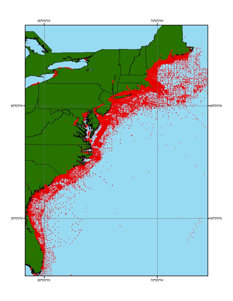
To build a digital mapping of the character of the seabed on regional, national and global scales. These data are intended for science researchers, students, policy makers, and the general public. The data can be used with geographic information systems (GIS) software to display geologic and oceanographic information.

How was the data set created?

  1. From what previous works were the data drawn?
  2. How were the data generated, processed, and modified?
    Date: unknown (process 1 of 5)
    Sourc data are point locations, descriptions and analystical data on many different types of sediment and rock materials and benthos.
    Date: 26-Jan-2017 (process 2 of 5)
    Edits to the metadata were made to fix any errors that MP v 2.9.36 flagged. This is necessary to enable the metadata to be successfully harvested for various data catalogs. In some cases, this meant adding text "Information unavailable" or "Information unavailable from original metadata" for those required fields that were left blank. Other minor edits were probably performed (title, publisher, publication place, etc.). Fixed a link in the distribution section. Moved the minimal source information provided to a process step. In attributes with range domains, a value of 9999 was entered in the minimum and maximum values to indicate the original metadata did not contain the required information. Minor fixes to the attribute format for some attributes were needed. Attempted to modify http to https where appropriate. The metadata date (but not the metadata creator) was edited to reflect the date of these changes. The metadata available from a harvester may supersede metadata bundled within a download file. Compare the metadata dates to determine which metadata file is most recent. Person who carried out this activity:
    U.S. Geological Survey
    Attn: VeeAnn A. Cross
    Marine Geologist
    384 Woods Hole Road
    Woods Hole, MA

    508-548-8700 x2251 (voice)
    508-457-2310 (FAX)
    vatnipp@usgs.gov
    Date: 26-Apr-2018 (process 3 of 5)
    Keywords added to metadata support discovery in the USGS Coastal and Marine Geology Data Catalog. Person who carried out this activity:
    U.S. Geological Survey
    Attn: Alan O. Allwardt
    Contractor -- Information Specialist
    2885 Mission Street
    Santa Cruz, CA

    831-460-7551 (voice)
    831-427-4748 (FAX)
    aallwardt@usgs.gov
    Date: 31-Jan-2019 (process 4 of 5)
    Fixed a broken link and added the DOI link. Person who carried out this activity:
    U.S. Geological Survey
    Attn: VeeAnn A. Cross
    Marine Geologist
    384 Woods Hole Road
    Woods Hole, MA

    508-548-8700 x2251 (voice)
    508-457-2310 (FAX)
    vatnipp@usgs.gov
    Date: 08-Sep-2020 (process 5 of 5)
    Added keywords section with USGS persistent identifier as theme keyword. Person who carried out this activity:
    U.S. Geological Survey
    Attn: VeeAnn A. Cross
    Marine Geologist
    384 Woods Hole Road
    Woods Hole, MA

    508-548-8700 x2251 (voice)
    508-457-2310 (FAX)
    vatnipp@usgs.gov
  3. What similar or related data should the user be aware of?

How reliable are the data; what problems remain in the data set?

  1. How well have the observations been checked?
    Accuracy of each attribute is dependent on the accuracy of the lineage data.
  2. How accurate are the geographic locations?
    Locational accuracy is dependent on the accuracy of the navigational technique from the individual data sources and may vary widely (e.g., from 0.005km (differential GPS) in more recent surveys to greater than 2 km based on radar, Loran, or dead reckoning in older surveys.) Users of the data should use their own criteria for assessing the accuracy of the locations.
  3. How accurate are the heights or depths?
    Locational accuracy is dependent on the accuracy of the navigational technique from the individual data sources. Users of the data should use their own criteria for assessing the accuracy of the locations.
  4. Where are the gaps in the data? What is missing?
    Additional useable data may exist in this area; the authors appreciate any information and leads.
  5. How consistent are the relationships among the observations, including topology?
    Data in usSEABED are based on the observations and analyses of others, filtered through a unifying and mining software. Each source report varies in type of information/data recorded and format. Only those observations that are recorded can be filtered and mined; only presence (not absence) or information can be noted.

How can someone get a copy of the data set?

Are there legal restrictions on access or use of the data?
Access_Constraints: None
Use_Constraints:
Public domain data from the U.S. Government are freely redistributable with proper metadata and source attribution. Please recognize the U.S. Geological Survey (USGS) as the source of this information.
  1. Who distributes the data set? (Distributor 1 of 1)
    U.S. Geological Survey
    Attn: Brian Buczkowski
    Core Curator and Data Management Specialist
    384 Woods Hole Rd.
    Woods Hole, MA
    USA

    (508) 548-8700 x2361 (voice)
    (508) 457-2310 (FAX)
    bbuczkowski@usgs.gov
  2. What's the catalog number I need to order this data set? Downloadable Data
  3. What legal disclaimers am I supposed to read?
    Although this data set has been used by the U.S. Geological Survey (USGS), no warranty, expressed or implied, is made by the USGS as to the accuracy of the data and/or related materials. The act of distribution shall not constitute any such warranty, and no responsibility is assumed by the USGS in the use of these data or related materials. Trade, firm, or product names and other references to non-USGS products and services are provided for information only and do not constitute endorsement or warranty, express or implied, by the USGS, USDOI, or U.S. Government, as to their suitability, content, usefulness, functioning, completeness, or accuracy.
  4. How can I download or order the data?
    • Availability in digital form:
      Data format: Text file containing data input to usSEABED. Fields are comma separated values. First record of file contains field names. in format ASCII Size: 13.3
      Network links: https://pubs.usgs.gov/ds/2005/118/data/ATL_PRS.TXT
      https://pubs.usgs.gov/ds/2005/118/htmldocs/data_cata.htm
      Data format: The SHP file contains the geospatial data. The SHX file contains the index of the geospatial data. The DBF file contains the attribute data in dBASE format. The PRJ file contains the coordinate system information (optional). The AVL file contains the legend information (optional). The SBN and SBX files contain the spatial index of the geospatial data (optional). The XML file contains the metadata describing the data set <data set name>.shp.xml. An ASCII version of the metadata file. A browse graphic showing the data layer coverage and extent (optional). in format SHP (version Information unavailable from original metadata.) ESRI Shapefile
      Network links: https://pubs.usgs.gov/ds/2005/118/data/atl_prs.zip
      https://pubs.usgs.gov/ds/2005/118/htmldocs/data_cata.htm
    • Cost to order the data: None

  5. What hardware or software do I need in order to use the data set?
    These data are available in Environmental Systems Research Institute (ESRI) shapefile format. The user must have ArcGIS or ArcView 3.0 or greater software to read and process the data file. In lieu of ArcView or ArcGIS, the user may utilize another GIS application package capable of importing the data. A free data viewer, arcexplorer, capable of displaying the data is available from ESRI at www.esri.com.

Who wrote the metadata?

Dates:
Last modified: 11-Nov-2021
Metadata author:
U.S. Geological Survey
Attn: Jamey Reid
384 Woods Hole Rd.
Woods Hole, MA
USA

(508) 548-8700 (voice)
(508) 457-2310 (FAX)
whsc_data_contact@usgs.gov
Contact_Instructions:
The metadata contact email address is a generic address in the event the metadata contact is no longer with the USGS
Metadata standard:
FGDC Content Standards for Digital Geospatial Metadata (FGDC-STD-001-1998)

This page is <https://cmgds.marine.usgs.gov/catalog/whcmsc/data_series/DS-118/atl_prs.shp.faq.html>
Generated by mp version 2.9.50 on Mon Nov 15 14:24:34 2021