Sound velocity profile locations collected by the U.S. Geological Survey offshore of Fire Island, NY in 2011 (Geographic, WGS 84, Esri Point Shapefile)

Metadata also available as - [Questions & Answers] - [Parseable text] - [XML]

Metadata:

Identification_Information:
Citation:
Citation_Information:
Originator: U.S. Geological Survey
Publication_Date: 2015
Title:
Sound velocity profile locations collected by the U.S. Geological Survey offshore of Fire Island, NY in 2011 (Geographic, WGS 84, Esri Point Shapefile)
Edition: 1.0
Geospatial_Data_Presentation_Form: vector digital data
Series_Information:
Series_Name: data release
Issue_Identification: DOI:10.5066/F75X2704
Publication_Information:
Publication_Place:
Woods Hole Coastal and Marine Science Center, Woods Hole, Massachusetts
Publisher: U.S. Geological Survey, Coastal and Marine Geology Program
Online_Linkage: https://doi.org/10.5066/F75X2704
Online_Linkage: Online_Linkage: Larger_Work_Citation:
Citation_Information:
Originator: Jane F. Denny
Originator: William C. Schwab
Originator: Wayne E. Baldwin
Originator: Emile Bergeron
Originator: Eric Moore
Publication_Date: 2015
Title:
High-resolution geophysical data collected offshore of Fire Island, New York in 2011, USGS Field Activity 2011-005-FA
Edition: 1.0
Series_Information:
Series_Name: data release
Issue_Identification: DOI:10.5066/F75X2704
Publication_Information:
Publication_Place: Reston, VA
Publisher: U.S. Geological Survey
Online_Linkage: https://doi.org/10.5066/F75X2704
Description:
Abstract:
The U.S. Geological Survey (USGS) mapped approximately 336 square kilometers of the lower shoreface and inner-continental shelf offshore of Fire Island, New York in 2011 using interferometric sonar and high-resolution chirp seismic-reflection systems. These spatial data support research on the Quaternary evolution of the Fire Island coastal system and provide baseline information for research on coastal processes along southern Long Island. For more information about the WHCMSC Field Activity, see https://cmgds.marine.usgs.gov/fan_info.php?fan=2011-005-FA.
Purpose:
This shapefile contains 135 sound velocity profile collected with an Odim Brooke Ocean MVP30 by the U.S. Geological Survey during USGS field activity 2011-005-FA. Sound velocity profiles are acquired in order to measure the speed of sound in the water column during survey operations. This information is used to help correct any refraction artifacts that may be present within the swath bathymetric data due to unaccounted for changes in the speed of sound throughout the water column.
Time_Period_of_Content:
Time_Period_Information:
Range_of_Dates/Times:
Beginning_Date: 20110520
Ending_Date: 20110529
Currentness_Reference: ground condition
Status:
Progress: Complete
Maintenance_and_Update_Frequency: None planned
Spatial_Domain:
Bounding_Coordinates:
West_Bounding_Coordinate: -73.275904
East_Bounding_Coordinate: -72.767001
North_Bounding_Coordinate: 40.748474
South_Bounding_Coordinate: 40.583662
Keywords:
Theme:
Theme_Keyword_Thesaurus: USGS Metadata Identifier
Theme_Keyword: USGS:64cc37f2-0fcf-4d47-8eab-57948ed374d5
Theme:
Theme_Keyword_Thesaurus: None
Theme_Keyword: USGS
Theme_Keyword: U.S. Geological Survey
Theme_Keyword: CMGP
Theme_Keyword: Coastal and Marine Geology Program
Theme_Keyword: WHCMSC
Theme_Keyword: Woods Hole Coastal and Marine Science Center
Theme_Keyword: Marine Geology
Theme_Keyword: field activity number 2011-005-FA
Theme_Keyword: sound velocity profiles
Theme_Keyword: svp
Theme_Keyword: Odim Brooke Ocean MVP30
Theme_Keyword: M/V Scarlett Isabella
Theme_Keyword: point shapefile
Theme_Keyword: location
Theme_Keyword: swath bathymetry
Theme_Keyword: PNG Images
Theme_Keyword: ASVP files
Theme_Keyword: Kongsberg ASCII format (asvp)
Theme:
Theme_Keyword_Thesaurus: ISO 19115 Topic Category
Theme_Keyword: oceans
Theme_Keyword: location
Theme_Keyword: geoscientificInformation
Theme:
Theme_Keyword_Thesaurus: USGS Thesaurus
Theme_Keyword: sound velocity
Theme_Keyword: navigational data
Theme_Keyword: geospatial datasets
Place:
Place_Keyword_Thesaurus: None
Place_Keyword: North America
Place_Keyword: United States
Place_Keyword: New York
Place_Keyword: Fire Island
Place_Keyword: Fire Island National Seashore
Access_Constraints: none
Use_Constraints:
Public domain data from the U.S. Government are freely redistributable with proper metadata and source attribution. Please recognize the U.S. Geological Survey as the originator of the dataset.
Point_of_Contact:
Contact_Information:
Contact_Person_Primary:
Contact_Person: Jane F. Denny
Contact_Organization: U.S. Geological Survey
Contact_Position: Geologist
Contact_Address:
Address_Type: mailing and physical address
Address: 384 Woods Hole Road
City: Woods Hole
State_or_Province: Massachusetts
Postal_Code: 02543
Country: USA
Contact_Voice_Telephone: 508-548-8700 x 2311
Contact_Facsimile_Telephone: 508-457-2310
Contact_Electronic_Mail_Address: jdenny@usgs.gov
Browse_Graphic:
Browse_Graphic_File_Name: Browse_Graphic_File_Description:
Image showing the location of sound velocity profiles collected by the U.S. Geological Survey on the inner-continental shelf offshore of Fire Island, NY, 2011.
Browse_Graphic_File_Type: JPEG
Native_Data_Set_Environment:
Microsoft Windows Vista Version 6.1 (Build 7601) Service Pack 1; ESRI ArcCatalog 9.3.1.1850
Cross_Reference:
Citation_Information:
Originator: William C. Schwab
Originator: Wayne E. Baldwin
Originator: Cheryl J. Hapke
Originator: Erika E. Lentz
Originator: Paul T. Gayes
Originator: Jane F. Denny
Originator: Jeffrey H. List
Originator: John C. Warner
Publication_Date: 2013
Title:
Geologic Evidence for Onshore Sediment Transport from the Inner Continental Shelf: Fire Island, New York
Edition: 1.0
Geospatial_Data_Presentation_Form: document
Series_Information:
Series_Name: Journal of Coastal Research
Issue_Identification: Volume 29, Issue 3, pp. 526-544.
Publication_Information:
Publication_Place: Florida, USA
Publisher: Coastal Education and Research Foundation, Inc.
Online_Linkage: http://dx.doi.org/10.2112/JCOASTRES-D-12-00160.1
Cross_Reference:
Citation_Information:
Originator: David S. Foster
Originator: Ann B. Swift
Originator: William C. Schwab
Publication_Date: 1999
Title:
Stratigraphic Framework Maps of the nearshore area of southern Long Island from Fire Island to Montauk Point, NY
Edition: 1.0
Geospatial_Data_Presentation_Form: document
Series_Information:
Series_Name: Open-File Report
Issue_Identification: 99-559
Publication_Information:
Publication_Place: Reston, VA
Publisher: U.S. Geological Survey
Online_Linkage: https://pubs.usgs.gov/of/1999/of99-559/
Cross_Reference:
Citation_Information:
Originator: William C. Schwab
Originator: E. Robert Thieler
Originator: Jane F. Denny
Originator: William W. Danforth
Originator: Jenna C. Hill
Publication_Date: 2000
Title:
Seafloor sediment distribution off southern Long Island, New York
Edition: 1.0
Geospatial_Data_Presentation_Form: document
Series_Information:
Series_Name: Open-File Report
Issue_Identification: 00-243
Publication_Information:
Publication_Place: Reston, VA
Publisher: U.S. Geological Survey
Online_Linkage: https://pubs.usgs.gov/of/2000/of00-243/
Cross_Reference:
Citation_Information:
Originator: W.C. Schwab
Originator: J.F. Denny
Originator: W.E. Baldwin
Publication_Date: 2014
Title:
Maps Showing Bathymetry and Modern Sediment Thickness on the Inner Continental Shelf Offshore of Fire Island, New York, Pre-Hurricane Sandy
Edition: 1.0
Geospatial_Data_Presentation_Form: document
Series_Information:
Series_Name: Open File Report
Issue_Identification: 2014-1203
Publication_Information:
Publication_Place: Reston, VA
Publisher: U.S. Geological Survey
Other_Citation_Details:
This publication contains the backscatter image generated from data collected during WHCMSC field activity 2011-005-FA.
Online_Linkage: https://pubs.usgs.gov/of/2014/1203/
Cross_Reference:
Citation_Information:
Originator: W.C. Schwab
Originator: W.E. Baldwin
Originator: J.F. Denny
Publication_Date: 2014
Title:
Maps Showing the Change in Modern Sediment Thickness on the Inner Continental Shelf Offshore of Fire Island, New York, Between 1996-97 and 2011
Edition: 1.0
Geospatial_Data_Presentation_Form: document
Series_Information:
Series_Name: Open File Report
Issue_Identification: 2014-1238
Publication_Information:
Publication_Place: Reston, VA
Publisher: U.S. Geological Survey
Online_Linkage: https://pubs.usgs.gov/of/2014/1238/
Cross_Reference:
Citation_Information:
Originator: William C. Schwab
Originator: Wayne E. Baldwin
Originator: Jane F. Denny
Originator: Cheryl J. Hapke
Originator: Paul T. Gayes
Originator: Jeffrey H. List
Originator: John C. Warner
Publication_Date: 2014
Title:
Modification of the Quaternary stratigraphic framework of the inner-continental shelf by Holocene marine transgression: An example offshore of Fire Island, New York
Edition: 1.0
Geospatial_Data_Presentation_Form: document
Series_Information:
Series_Name: Marine Geology
Issue_Identification: Volume 355
Publication_Information:
Publication_Place: Amsterdam, Netherlands
Publisher: Elsevier B.V.
Online_Linkage: http://dx.doi.org/10.1016/j.margeo.2014.06.011
Cross_Reference:
Citation_Information:
Originator: Goff, J.A.
Originator: Flood, R.D.
Originator: Austin, J.A.
Originator: Schwab, W.C.
Originator: Christensen, B.
Originator: Browne, C.M.
Originator: Denny, J.F.
Originator: Baldwin, W.E.
Publication_Date: 2015
Title:
The impact of Hurricane Sandy on the shoreface and inner shelf of Fire Island, New York: Large bedform migration and limited erosion
Edition: 1.0
Geospatial_Data_Presentation_Form: document
Series_Information:
Series_Name: Continental Shelf Research
Issue_Identification: v. 98, pp. 13-25
Publication_Information:
Publication_Place: Amsterdam, Netherlands
Publisher: Elsevier B.V.
Online_Linkage: http://dx.doi.org/10.1016/j.csr.2015.03.001
Data_Quality_Information:
Logical_Consistency_Report:
All sound velocity profile data were collected during USGS field activity 2011-005-FA using an Odim Brooke Ocean MVP30. Quality control was conducted during processing of the data; any spurious data were removed.
Completeness_Report:
This shapefile contains 135 sound velocity profiles collected JD140 (05/20/2011) - JD149 (05/29/2011) during USGS field activity 2011-005-FA. No sound velocity profiles were collected after JD149 due to a system failure of the Odim Brooke Ocean MVP30. Only SWATHPlus interferometric sonar lines L1f1 - L47F5 were processed using the 135 acquired sound velocity profiles.
Positional_Accuracy:
Horizontal_Positional_Accuracy:
Horizontal_Positional_Accuracy_Report:
Navigation was acquired with Differential Global Positioning System and Wide Area Augmentation System (DGPS+WAAS). The DGPS antenna was located on the port-side of the acquisition van and data were recorded within HYPACK (www.hypack.com). Ship location was used for the sound velocity deployments. The MVP30 sound velocity profiler is autonomously deployed while the vessel is underway and is computer controlled through a smart winch and deployment system. Deployment positions are recorded from DGPS. DGPS accuracy is 1 to 3 meters, depending on the distance from a US Coast Guard coastal repeater station. However, offsets from the location of deployment at the smart winch and the DGPS antenna were not measured. The horizontal accuracy of the sound velocity locations is considered to be +/- 25 meters.
Lineage:
Source_Information:
Source_Citation:
Citation_Information:
Originator: U.S. Geological Survey
Publication_Date: Unpublished Material
Title: Sound Velocity Profile Data
Type_of_Source_Media: disc
Source_Time_Period_of_Content:
Time_Period_Information:
Range_of_Dates/Times:
Beginning_Date: 20110520
Ending_Date: 20110529
Source_Currentness_Reference: ground condition
Source_Citation_Abbreviation: none
Source_Contribution:
Survey: Survey lines were run at an average speed of 5 knots. Lines 1 through 27 were run at a 75-m line spacing to achieve full coverage of the seafloor in a priority area of interest in the nearshore, in water depths less than 15 meters. Lines 28 through 109 were run at a 150-m line spacing, with the exception of tie lines (lines 52 through 60, 65 through 67, 89 through 92), which were run at approximately a 2-km line spacing. Sonar: Swath-bathymetric and acoustic-backscatter data were acquired with a SEA, Ltd., SWATHplus-M interferometric sonar operating at a frequency of 234 kHz and a variable range (increased or decreased manually depending on water depth). The system was operated with a transmit power: 80 percent, 4096 samples per channel, and a variable range (increased or decreased depending on water depth). The SWATHplus-M was mounted on the port side of the M/V Scarlett Isabella during survey operations. A Coda Octopus F180R Attitude and Positioning system recorded ship motion (heave, pitch, roll, and yaw). These data were transmitted via network connection to the SWATHplus-M acquisition software. The Octopus F180R Inertial Measurement Unit (IMU) was mounted directly above the SEA SWATHplus-M transducers, to minimize lever arm offsets that can lead to positioning errors. The F180R uses two L1 antennas for position and heading accuracy. The antennas are mounted on a rigid horizontal pole, positioned at the top of the sidemount, with a horizontal separation of 1 meter and are offset from the IMU in a forward/aft configuration. The forward offset of the primary antenna from the IMU is 0.5 meters, with no port/starboard offset. Sound Velocity Profiles: 135 sound velocity profiles were acquired during survey operations at roughly 1 to 3 hour intervals using an Odim Brooke Ocean MVP30 motion vessel profiler. The MVP30 failed during survey operations. Sound velocity profiles were only collected during JD140 through 149 (lines 1 through 47).
Process_Step:
Process_Description:
135 Sound velocity profiles were collected every 1-3 hours using an Odim Brooke Ocean Moving Vessel Profiler (MVP30) (see http://www.brooke-ocean.com/mvp_main.html for details). A computer controlled smart winch and deployment system allows the free fall fish to be deployed while the vessel is underway at a user specified time interval. A Sitex DepthFinder informs the MVP of the approximate water depth at time of deployment to ensure that the fish does not make contact with the seafloor. The sound velocity data are written to Kongsberg SIS format ASCII files (.asvp and *.asc). Jane F. Denny performed this and all subsequent process steps.
Process_Date: 2011
Process_Contact:
Contact_Information:
Contact_Person_Primary:
Contact_Person: Jane F. Denny
Contact_Organization: U.S. Geological Survey
Contact_Position: Geologist
Contact_Address:
Address_Type: mailing and physical address
Address: 384 Woods Hole Road
City: Woods Hole
State_or_Province: MA
Postal_Code: 02543
Country: USA
Contact_Voice_Telephone: 508-548-8700 x2311
Contact_Facsimile_Telephone: 508-457-2310
Contact_Electronic_Mail_Address: jdenny@usgs.gov
Process_Step:
Process_Description:
The ASVP data are parsed to comma-delimited text format using an AWK script, maintaining the header information (filename, date, time, location, depth and speed of sound). 
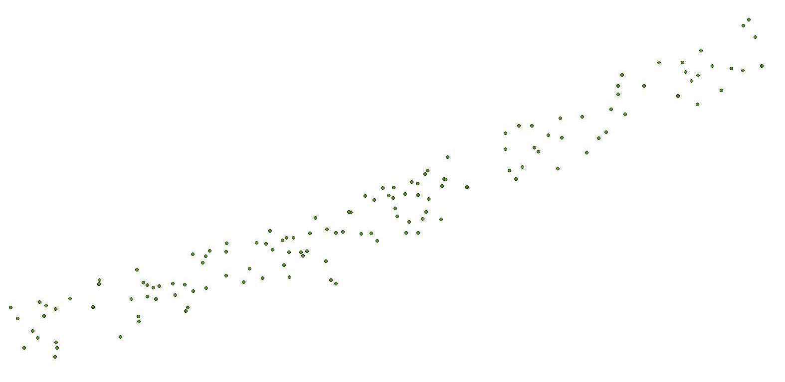
The ASC data, containing only depth and speed of sound, were imported to Microsoft Excel (2010) where individual plots were generated for each sound velocity profile and saved as PNG files. Depth in meters is plotted along the Y-axis and speed of sound in meters per second is plotted along the X-axis of each graph.
Process_Date: 2014
Process_Step:
Process_Description:
The location of each sound velocity profile in eastings and northings (UTM, Zone 18N, meters, WGS84) was saved to a comma-separated value file (*.csv) along with file name, date, position, depth and julian day. Proj (version 4.6.1) was used to convert the eastings and northings to latitude and longitude. Awk and paste were used to merge the proj output with the original comma-separated value file, creating a new csv file containing filename, date, time, position, depth and julian day.
Process_Date: 2014
Process_Step:
Process_Description:
The text file (*.csv) was imported into ArcGIS 9.3 using Tools - Add XY Data and converted to an event theme. The event theme was then saved to a point shapefile and the projection was defined as Geographic Coordinate System, WGS84 (GCS_WGS_1984). The following fields were manually added to the attribute table: survey, Acq_System, and Ship.
Process_Date: 2014
Process_Step:
Process_Description:
The online links to the data were updated to reflect the new server hosting the data. Additionally, other small edits could be made to the metadata, such as modifying http to https where appropriate. The metadata date (but not the metadata creator) was edited to reflect the date of these changes.
Process_Date: 20170418
Process_Contact:
Contact_Information:
Contact_Organization_Primary:
Contact_Organization: U.S. Geological Survey
Contact_Person: VeeAnn A. Cross
Contact_Position: Marine Geologist
Contact_Address:
Address_Type: Mailing and Physical
Address: 384 Woods Hole Road
City: Woods Hole
State_or_Province: MA
Postal_Code: 02543-1598
Contact_Voice_Telephone: 508-548-8700 x2251
Contact_Facsimile_Telephone: 508-457-2310
Contact_Electronic_Mail_Address: vatnipp@usgs.gov
Process_Step:
Process_Description: USGS Thesaurus keywords added to the keyword section.
Process_Date: 20180720
Process_Contact:
Contact_Information:
Contact_Organization_Primary:
Contact_Organization: U.S. Geological Survey
Contact_Person: VeeAnn A. Cross
Contact_Position: Marine Geologist
Contact_Address:
Address_Type: Mailing and Physical
Address: 384 Woods Hole Road
City: Woods Hole
State_or_Province: MA
Postal_Code: 02543-1598
Contact_Voice_Telephone: 508-548-8700 x2251
Contact_Facsimile_Telephone: 508-457-2310
Contact_Electronic_Mail_Address: vatnipp@usgs.gov
Process_Step:
Process_Description:
Added keywords section with USGS persistent identifier as theme keyword.
Process_Date: 20200908
Process_Contact:
Contact_Information:
Contact_Organization_Primary:
Contact_Organization: U.S. Geological Survey
Contact_Person: VeeAnn A. Cross
Contact_Position: Marine Geologist
Contact_Address:
Address_Type: Mailing and Physical
Address: 384 Woods Hole Road
City: Woods Hole
State_or_Province: MA
Postal_Code: 02543-1598
Contact_Voice_Telephone: 508-548-8700 x2251
Contact_Facsimile_Telephone: 508-457-2310
Contact_Electronic_Mail_Address: vatnipp@usgs.gov
Spatial_Data_Organization_Information:
Direct_Spatial_Reference_Method: Vector
Point_and_Vector_Object_Information:
SDTS_Terms_Description:
SDTS_Point_and_Vector_Object_Type: Entity point
Point_and_Vector_Object_Count: 135
Spatial_Reference_Information:
Horizontal_Coordinate_System_Definition:
Geographic:
Latitude_Resolution: 0.000001
Longitude_Resolution: 0.000001
Geographic_Coordinate_Units: Decimal degrees
Geodetic_Model:
Horizontal_Datum_Name: D_WGS_1984
Ellipsoid_Name: WGS_1984
Semi-major_Axis: 6378137.000000
Denominator_of_Flattening_Ratio: 298.257224
Entity_and_Attribute_Information:
Detailed_Description:
Entity_Type:
Entity_Type_Label: 2011-005-FA_mvp
Entity_Type_Definition: sound velocity profiles
Entity_Type_Definition_Source: U.S. Geological Survey
Attribute:
Attribute_Label: FID
Attribute_Definition: Internal feature number.
Attribute_Definition_Source: ESRI
Attribute_Domain_Values:
Unrepresentable_Domain:
Sequential unique whole numbers that are automatically generated.
Attribute:
Attribute_Label: Shape
Attribute_Definition: Feature geometry.
Attribute_Definition_Source: ESRI
Attribute_Domain_Values:
Unrepresentable_Domain: Coordinates defining the features.
Attribute:
Attribute_Label: File
Attribute_Definition:
Sound velocity profile location number, listed as MVP_XXXX, where XXXX is the location identifier.
Attribute_Definition_Source: U.S. Geological Survey
Attribute_Domain_Values:
Unrepresentable_Domain: String up to 254 characters.
Attribute:
Attribute_Label: Year
Attribute_Definition: Calendar year sound velocity profile was collected.
Attribute_Definition_Source: U.S. Geological Survey
Attribute_Domain_Values:
Enumerated_Domain:
Enumerated_Domain_Value: 2011
Enumerated_Domain_Value_Definition: Calendar Year.
Enumerated_Domain_Value_Definition_Source: U.S. Geological Survey
Attribute:
Attribute_Label: Month
Attribute_Definition: Month of the year sound velocity profile was collected.
Attribute_Definition_Source: U.S. Geological Survey
Attribute_Domain_Values:
Enumerated_Domain:
Enumerated_Domain_Value: 5
Enumerated_Domain_Value_Definition: Fifth month of the calendar year (May, 2011)
Enumerated_Domain_Value_Definition_Source: U.S. Geological Survey
Attribute:
Attribute_Label: Day
Attribute_Definition: Day of the week sound velocity profile was collected.
Attribute_Definition_Source: U.S. Geological Survey
Attribute_Domain_Values:
Range_Domain:
Range_Domain_Minimum: 20
Range_Domain_Maximum: 29
Attribute_Units_of_Measure: Day of the week.
Attribute:
Attribute_Label: Hour
Attribute_Definition:
Time of the sound velocity profile in Hours of 24 hour day, UTC.
Attribute_Definition_Source: U.S. Geological Survey
Attribute_Domain_Values:
Range_Domain:
Range_Domain_Minimum: 0
Range_Domain_Maximum: 23
Attribute_Units_of_Measure: hours of 24-hour day
Attribute:
Attribute_Label: Minute
Attribute_Definition: Time of sound velocity profile listed in Minutes, UTC.
Attribute_Definition_Source: U.S. Geological Survey
Attribute_Domain_Values:
Range_Domain:
Range_Domain_Minimum: 0
Range_Domain_Maximum: 59
Attribute_Units_of_Measure: Minutes (0 - 60)
Attribute:
Attribute_Label: Latitude
Attribute_Definition:
Y coordinate of sound velocity profile locations in decimal degrees (Geographic, WGS 84)
Attribute_Definition_Source: U.S. Geological Survey
Attribute_Domain_Values:
Range_Domain:
Range_Domain_Minimum: 40.583662
Range_Domain_Maximum: 40.748474
Attribute_Units_of_Measure: decimal degrees
Attribute:
Attribute_Label: Longitude
Attribute_Definition:
X coordinate of sound velocity profile location in decimal degrees (Geographic, WGS 84)
Attribute_Definition_Source: U.S. Geological Survey
Attribute_Domain_Values:
Range_Domain:
Range_Domain_Minimum: -73.275904
Range_Domain_Maximum: -72.767001
Attribute_Units_of_Measure: decimal degrees
Attribute:
Attribute_Label: Depth
Attribute_Definition: Water depth at sound velocity profile location, in meters.
Attribute_Definition_Source: U.S. Geological Survey
Attribute_Domain_Values:
Range_Domain:
Range_Domain_Minimum: 9.03
Range_Domain_Maximum: 24.01
Attribute_Units_of_Measure: depth, in meters
Attribute:
Attribute_Label: JD
Attribute_Definition: Julian Day during which sonar data were collected (2011)
Attribute_Definition_Source: U.S. Geological Survey
Attribute_Domain_Values:
Range_Domain:
Range_Domain_Minimum: 140
Range_Domain_Maximum: 149
Attribute_Units_of_Measure:
Julian day is the integer number representing the interval of time in days since January 1 of the year of collection.
Attribute:
Attribute_Label: Survey
Attribute_Definition:
WHCMSC field activity identifier (e.g. "2011-005-FA" where 2011 is the survey year, 005 is survey number of that year, and FA is Field Activity)
Attribute_Definition_Source: U.S. Geological Survey
Attribute_Domain_Values:
Unrepresentable_Domain: String up to 30 characters.
Attribute:
Attribute_Label: Acq_System
Attribute_Definition: System used to collect the sound velocity profiles
Attribute_Definition_Source: U.S. Geological Survey
Attribute_Domain_Values:
Unrepresentable_Domain: String up to 30 characters.
Attribute:
Attribute_Label: Ship
Attribute_Definition: Survey vessel name.
Attribute_Definition_Source: U.S. Geological Survey
Attribute_Domain_Values:
Unrepresentable_Domain: String up to 30 characters.
Overview_Description:
Entity_and_Attribute_Overview:
The ASVP (Kongsberg ASCII file format) files associated with this shapefile are raw field data. That is, these files were generated directly from the Odim Brooke Ocean MVP30. These data were used to generate graphs (PNG format) showing the speed of sound in meters per second (x-axis) with water depth in meters (y-axis) for each sound velocity profile location. The graphs are bundled in the zip file (2011-005-FA_mvp.zp). The format of the ASVP files is as follows: Heading: SoundVelocity 1.00 filename (XXX), date/time ( YYYMMDDHHMM) latitude (decimal degrees) longitude (decimal degrees) Date start ( YYYMMDDHHMM), Date stop ( YYYMMDDHHMM), MVP, P, Julian Day) followed by depth (meters) speed of sound (meters per second), where MVP, P designates the system.
Entity_and_Attribute_Detail_Citation: U.S. Geological Survey
Distribution_Information:
Distributor:
Contact_Information:
Contact_Person_Primary:
Contact_Person: Jane F. Denny
Contact_Organization: U.S. Geological Survey
Contact_Position: Geologist
Contact_Address:
Address_Type: mailing and physical address
Address: 384 Woods Hole Road
City: Woods Hole
State_or_Province: Massachusetts
Postal_Code: 02543
Country: USA
Contact_Voice_Telephone: 508-548-8700 x 2311
Contact_Facsimile_Telephone: 508-457-2311
Contact_Electronic_Mail_Address: jdenny@usgs.gov
Resource_Description:
2011-005-FA_mvp.zip - contains PNG images of sound velocity profiles and ascii data files in asvp format (Kongsberg ASCII file format).
Distribution_Liability:
Neither the U.S. Government, the Department of the Interior, nor the USGS, nor any of their employees, contractors, or subcontractors, make any warranty, express or implied, nor assume any legal liability or responsibility for the accuracy, completeness, or usefulness of any information, apparatus, product, or process disclosed, nor represent that its use would not infringe on privately owned rights. The act of distribution shall not constitute any such warranty, and no responsibility is assumed by the USGS in the use of these data or related materials. Any use of trade, product, or firm names is for descriptive purposes only and does not imply endorsement by the U.S. Government.
Standard_Order_Process:
Digital_Form:
Digital_Transfer_Information:
Format_Name: Shapefile
Format_Version_Number: ArcGIS 9.3
Format_Specification: Esri point shapefile
Format_Information_Content:
This zip file contains data available in Esri shapefile forma, PNG images of graphs of the sound velocity profile, and ASVP (ASCII) files of the raw field data collected by the USGS offshore of Fire Island, NY, 2011. This also includes associated metadata.
File_Decompression_Technique: Use WinZip, 7zip, Peazip or pkUnzip
Transfer_Size: 1.7
Digital_Transfer_Option:
Online_Option:
Computer_Contact_Information: Access_Instructions: Data can be downloaded via the Internet
Digital_Form:
Digital_Transfer_Information:
Format_Name: PNG
Format_Version_Number: 1.0
Format_Specification: PNG Image Format
Format_Information_Content:
This zip file contains data available in Esri shapefile forma, PNG images of graphs of the sound velocity profile, and ASVP (ASCII) files of the raw field data collected by the USGS offshore of Fire Island, NY, 2011. This also includes associated metadata.
File_Decompression_Technique: Use WinZip, 7zip, Peazip or pkUnzip
Transfer_Size: 1.7
Digital_Transfer_Option:
Online_Option:
Computer_Contact_Information: Access_Instructions: Data can be downloaded via the Internet
Digital_Form:
Digital_Transfer_Information:
Format_Name: ASVP
Format_Version_Number: 1.0
Format_Specification: ASVP Kongsberg ASCII file format
Format_Information_Content:
This zip file contains data available in Esri shapefile forma, PNG images of graphs of the sound velocity profile, and ASVP (ASCII) files of the raw field data collected by the USGS offshore of Fire Island, NY, 2011. This also includes associated metadata.
File_Decompression_Technique: Use WinZip, 7zip, Peazip or pkUnzip
Transfer_Size: 1.7
Digital_Transfer_Option:
Online_Option:
Computer_Contact_Information: Access_Instructions: Data can be downloaded via the Internet
Fees: none
Custom_Order_Process: none
Technical_Prerequisites:
This zip file contains data available in Esri shapefile format, PNG images of graphs of the sound velocity profile, and ASVP (ASCII) files of the raw field data. The zip file also contains associated metadata. The user must have read and process the data file.
Metadata_Reference_Information:
Metadata_Date: 20200908
Metadata_Contact:
Contact_Information:
Contact_Person_Primary:
Contact_Person: Jane F. Denny
Contact_Organization: U.S. Geological Survey
Contact_Position: Geologist
Contact_Address:
Address_Type: mailing and physical address
Address: 384 Woods Hole Road
City: Woods Hole
State_or_Province: Massachusetts
Postal_Code: 02543
Country: USA
Contact_Voice_Telephone: 508-548-8700 x2311
Contact_Facsimile_Telephone: 508-457-2310
Contact_Electronic_Mail_Address: jdenny@usgs.gov
Metadata_Standard_Name: FGDC Content Standards for Digital Geospatial Metadata
Metadata_Standard_Version: FGDC-STD-001-1998
Metadata_Time_Convention: local time

This page is <https://cmgds.marine.usgs.gov/catalog/whcmsc/field_activities/2011_005_fa/2011-005-FA_mvp.html>
Generated by mp version 2.9.50 on Tue Sep 21 18:20:14 2021