Online Links:
Online Links:
| Range of values | |
|---|---|
| Minimum: | 716121.24 |
| Maximum: | 723342.094 |
| Units: | meters |
| Resolution: | 0.001 |
| Range of values | |
|---|---|
| Minimum: | 4568659.535 |
| Maximum: | 4585212.87 |
| Units: | meters |
| Resolution: | 0.001 |
| Range of values | |
|---|---|
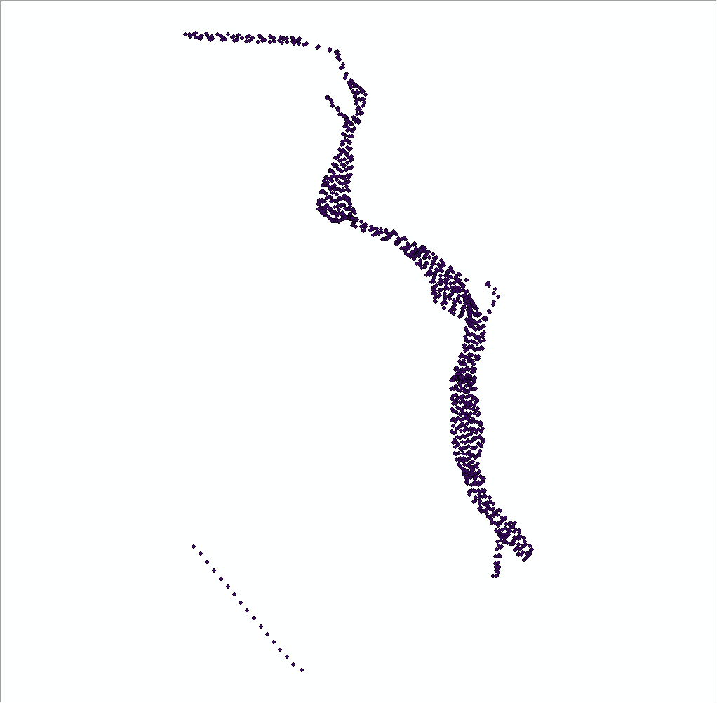
| Minimum: | -72.415081 |
| Maximum: | -72.33367 |
| Units: | decimal degrees |
| Resolution: | 0.000001 |
| Range of values | |
|---|---|
| Minimum: | 41.23972 |
| Maximum: | 41.389369 |
| Units: | decimal degrees |
| Resolution: | 0.000001 |
| Range of values | |
|---|---|
| Minimum: | 1 |
| Maximum: | 9173 |
| Units: | shot number |
| Resolution: | 1 |
| Range of values | |
|---|---|
| Minimum: | 2012 |
| Maximum: | 2012 |
| Units: | Calendar year |
| Resolution: | 1 |
spatialite_tool -e -shp 2012-024-FA_SeismicShot500 -d ./2012-024-FA-SQLdb.sqlite -t SeisSht500_pt -g geom_500 -c CP1252 -s 4326 --type POINT
ogr2ogr -f "CSV" 2012-024-FA_424_shotunique.csv 2012-024-FA-SQLdb.sqlite -dsco SPATIALITE=yes -sql "SELECT * FROM SeisUnique_pt"
ogr2ogr -f "CSV" 2012-024-FA_424_shot500.csv 2012-024-FA-SQLdb.sqlite -dsco SPATIALITE=yes -sql "SELECT * FROM SeisSht500_pt"
The file '2012-024-FA_424_shotunique.csv', which is provided in the zip-compressed package of the 500-shot shapefile '2012-024-FA_SeismicShot500.zip', contains the unique navigation. The file '2012-024-FA_424_shot500.csv, in the same zip file, contains the beginning, ending, and 500 shot interval positions.
Online Links:
Online Links:
Online Links:
| Access_Constraints | None |
|---|---|
| Use_Constraints | Public domain data from the U.S. Government are freely redistributable with proper metadata and source attribution. Please recognize the U.S. Geological Survey as the source of this information. |
| Data format: | Zip file containing (1) shotpoint navigation (at 500 shot interval with first and last shot) in CSV text format; (2) a unique shot CSV text file; and (3) first/last/every-500-shot navigation for EdgeTech 424 chirp seismic-reflection data collected by the U.S. Geological Survey in the Connecticut River in Esri Shapefile format. This also includes associated metadata. in format SHP (version SpatiaLite ver. 4.1.1) point shapefile Size: 1.8 |
|---|---|
| Network links: |
https://cmgds.marine.usgs.gov/data/field-activity-data/2012-024-FA/data/seismics/2012-024-FA_SeismicShot500.zip https://doi.org/10.5066/F7PG1Q7V https://cmgds.marine.usgs.gov/data/field-activity-data/2012-024-FA/ |
| Data format: | Zip file containing (1) shotpoint navigation (at 500 shot interval with first and last shot) in CSV text format; (2) a unique shot CSV text file; and (3) first/last/every-500-shot navigation for EdgeTech 424 chirp seismic-reflection data collected by the U.S. Geological Survey in the Connecticut River in Esri Shapefile format. This also includes associated metadata. in format CSV (version SpatiaLite ver. 4.1.1) Comma Separated Value Size: 0.05 |
|---|---|
| Network links: |
https://cmgds.marine.usgs.gov/data/field-activity-data/2012-024-FA/data/seismics/2012-024-FA_SeismicShot500.zip https://doi.org/10.5066/F7PG1Q7V https://cmgds.marine.usgs.gov/data/field-activity-data/2012-024-FA/ |