Survey lines along which seismic reflection data were collected in 2012 by the U.S. Geological Survey in the Connecticut River during field activity 2012-024-FA (Polyline Shapefile)

Metadata also available as - [Outline] - [Parseable text] - [XML]

Frequently anticipated questions:


What does this data set describe?

Title:
Survey lines along which seismic reflection data were collected in 2012 by the U.S. Geological Survey in the Connecticut River during field activity 2012-024-FA (Polyline Shapefile)
Abstract:
A geophysical and geological survey was conducted at the mouth of the Connecticut River from Old Saybrook to Essex, Connecticut, in September 2012. Approximately 230 linear kilometers of digital Chirp subbottom (seismic-reflection) and 234-kilohertz interferometric sonar (bathymetric and backscatter) data were collected along with sediment samples, riverbed photographs, and (or) video at 88 sites within the geophysical survey area. Sediment grab samples were collected at 72 of the 88 sampling sites, video was acquired at 68 sites, and photographs of the river bottom were taken at 38 sites. These survey data are used to characterize the riverbed by identifying sediment-texture and riverbed morphology. More information can be found on the web page for the Woods Hole Coastal and Marine Science Center field activity: https://cmgds.marine.usgs.gov/fan_info.php?fan=2012-024-FA. Data collected during the 2012 survey can be obtained here: https://doi.org/10.5066/F7PG1Q7V.
Supplemental_Information:
Each profile image can be hotlinked to its corresponding trackline navigation contained within the polyline shapefile '2012-024-FA_SeismicTracklines.shp'. Even 500 shot index markers along the top of the PNG images correlate to the positions of 500 shot intervals within the point shapefile '2012-024-FA_SeismicShot500.shp'.The trackline and shotpoint shapefiles can be found online at https://doi.org/10.5066/F7PG1Q7V
  1. How might this data set be cited?
    U.S. Geological Survey, 2017, Survey lines along which seismic reflection data were collected in 2012 by the U.S. Geological Survey in the Connecticut River during field activity 2012-024-FA (Polyline Shapefile): data release DOI:10.5066/F7PG1Q7V, U.S. Geological Survey, Coastal and Marine Geology Program, Woods Hole Coastal and Marine Science Center, Woods Hole, Massachusetts.

    Online Links:

    This is part of the following larger work.

    Ackerman, Seth D., Foster, David S., Moore, Eric M., Irwin, Barry J., Blackwood, Dann S., and Sherwood, Christopher R., 2017, High-Resolution Geophysical and Sampling Data Collected at the Mouth of the Connecticut River, Old Saybrook to Essex, Connecticut, 2012: data release DOI:10.5066/F7PG1Q7V, U.S. Geological Survey, Reston, VA.

    Online Links:

    Other_Citation_Details:
    Suggested citation: Ackerman S.D., Foster D.S., Moore E.M., Irwin B.J., Blackwood D.S., and Sherwood, C.R., 2017, High-resolution geophysical and sampling data collected at the mouth of the Connecticut River, Old Saybrook to Essex, Connecticut, 2012: U.S. Geological Survey data release, https://doi.org/10.5066/F7PG1Q7V.
  2. What geographic area does the data set cover?
    West_Bounding_Coordinate: -72.415081
    East_Bounding_Coordinate: -72.333670
    North_Bounding_Coordinate: 41.389389
    South_Bounding_Coordinate: 41.239720
  3. What does it look like?
    https://cmgds.marine.usgs.gov/data/field-activity-data/2012-024-FA/data/seismics/2012-024-FA_SeismicTracklines_browse.jpg (JPEG)
    EdgeTech 424 trackline navigation in the Connecticut River.
  4. Does the data set describe conditions during a particular time period?
    Beginning_Date: 15-Sep-2012
    Ending_Date: 20-Sep-2012
    Currentness_Reference:
    ground condition of survey dates: 20120915-20120920; no sonar data were collected on 20120918; no seismic data were collected on 20120921; see Completeness_Report for more information
  5. What is the general form of this data set?
    Geospatial_Data_Presentation_Form: vector digital data
  6. How does the data set represent geographic features?
    1. How are geographic features stored in the data set?
      This is a Vector data set. It contains the following vector data types (SDTS terminology):
      • String (160)
    2. What coordinate system is used to represent geographic features?
      Horizontal positions are specified in geographic coordinates, that is, latitude and longitude. Latitudes are given to the nearest 0.000001. Longitudes are given to the nearest 0.000001. Latitude and longitude values are specified in Decimal degrees. The horizontal datum used is D_WGS_1984.
      The ellipsoid used is WGS_1984.
      The semi-major axis of the ellipsoid used is 6378137.000000.
      The flattening of the ellipsoid used is 1/298.257224.
  7. How does the data set describe geographic features?
    2012-024-FA_SeismicTracklines
    Trackline for seismic profiles (Source: U.S. Geological Survey)
    FID
    Internal feature number (Source: Esri) Sequential unique whole numbers that are automatically generated
    Shape
    Feature geometry. (Source: Esri) Coordinates defining the features
    LineName
    Name of seismic data file (Source: U.S. Geological Survey) String up to 6 characters
    ImageName
    Name of seismic profile image used as hyperlink. ImageName is in the format YYYY-###-FA_LineName.png, where YYYY-###-FA is the field activity number. (Source: U.S. Geological Survey) String up to 25 characters
    Shot_st
    First shot number in seismic profile (Source: U.S. Geological Survey)
    Range of values
    Minimum:1
    Maximum:1
    Units:shot
    Resolution:1
    Shot_end
    Last shot number in seismic profile (Source: U.S. Geological Survey)
    Range of values
    Minimum:258
    Maximum:9173
    Units:shot
    Resolution:1
    Year
    Calendar year data were collected (Source: U.S. Geological Survey)
    Range of values
    Minimum:2012
    Maximum:2012
    Units:Calendar year
    Resolution:1
    DayUTC_st
    Start Julian day and start time of day data were collected where Julian day is the integer number representing the interval of time in days since January 1 of the year of collection and time is in hours, minutes, and seconds. (Source: U.S. Geological Survey) String up to 12 characters
    DayUTC_end
    End Julian day and end time of day data were collected where Julian day is the integer number representing the interval of time in days since January 1 of the year of collection. (Source: U.S. Geological Survey) String up to 12 characters
    SurveyID
    WHCMSC field activity identifier in the new style (e.g. "2012-024-FA" where 2012 is the survey year, 024 is survey number of that year, and FA is Field Activity); Note the old style of this would be represented as "12024" (Source: USGS) String up to 11 characters
    VehicleID
    Name of the survey vessel used for data collection (Source: USGS) String up to 10 characters
    DeviceID
    Name of the sonar device used to collect seismic-reflection data (Source: USGS) String up to 12 characters
    Length_km
    Length of the seismic survey line in kilometers (UTM Zone 18N, WGS84) as calculated in the SQLite database. (Source: USGS)
    Range of values
    Minimum:0.167
    Maximum:3.879
    Entity_and_Attribute_Overview:
    These tracklines, in conjunction with the seismic shotpoints (500 shot and unique), can be used with the PNG seismic reflection images. These tracklines can be hyperlinked to the corresponding PNG seismic reflection images in ArcGIS. The 500 shot point intervals correspond to the x-axis ticks on the PNG images.
    Entity_and_Attribute_Detail_Citation: U.S. Geological Survey

Who produced the data set?

  1. Who are the originators of the data set? (may include formal authors, digital compilers, and editors)
    • U.S. Geological Survey
  2. Who also contributed to the data set?
  3. To whom should users address questions about the data?
    Seth Ackerman
    U.S. Geological Survey
    Geologist
    384 Woods Hole Rd.
    Woods Hole, MA
    USA

    508-548-8700 x2315 (voice)
    508-457-2310 (FAX)
    sackerman@usgs.gov

Why was the data set created?

The seismic data associated with these navigation tracklines are used to define the riverbed morphology as part of a mapping project in the Connecticut River. This dataset contains trackline navigation for approximately 230 km of EdgeTech 424 chirp seismic-reflection data collected by the U.S. Geological Survey during USGS survey 2012-024-FA. The seismic data associated with these navigation tracklines are used to define the riverbed morphology.

How was the data set created?

  1. From what previous works were the data drawn?
    raw data (source 1 of 1)
    U.S. Geological Survey, Unpublished Material, raw seismic navigation.

    Type_of_Source_Media: disc
    Source_Contribution:
    Seismic-reflection data acquisition 2012-024-FA: Seismic profile data were collected using an EdgeTech 424 subbottom profiling system (frequency modulation swept frequency 4-24 kHz) which was towed from the starboard side of the R/V Rafael. Chesapeake Technologies' SonarWiz 5 acquisition software (version 5.05.0015) was used to control the EdgeTech 3100 portable topside unit, digitally log trace data in SEG-Y rev. 1 format (IEEE floating point), and record GPS navigation coordinates to the SEG-Y trace headers (in arcseconds of latitude and longitude, multiplied by a scalar of 100). During the survey, data were acquired using a 200 milliseconds (ms) shot rate with a 5 ms transit pulse length, logging 60 ms of data per trace. A swept frequency spectrum of 4-24 kHz was used for the entire survey, selectable via SonarWiz communicating with the EdgeTech 3100 topside controller. DGPS navigation was supplied by a Hemisphere receiver with the antenna mounted on the aft of the R/V Rafael's cabin just port of the centerline. Cable layback is 4 meters, depth below water line 0.5 meters. GPS offset from sheave: x=2.38m, y=0.62m, z=0. These values were entered into SonarWiz starting with line l8f2 (see note in horizontal position accuracy above). Seismic-reflection data were processed using SIOSEIS (2011) and Seismic Unix (Cohen and Stockwell, 2011).
  2. How were the data generated, processed, and modified?
    Date: Sep-2012 (process 1 of 7)
    SIOSEIS (version 2010.2.25) was used to read SEG-Y files, renumber shots starting from one, and write out new SEG-Y files. The original shot numbers, which were assigned by SonarWiz sequentially over the duration of an acquisition session despite SEG-Y file changes, are preserved in the raw SEG-Y data. This process step and all subsequent process steps were performed by the same person - Seth Ackerman, unless otherwise noted. Person who carried out this activity:
    Seth Ackerman
    U.S. Geological Survey
    Geologist
    384 Woods Hole Rd.
    Woods Hole, MA
    USA

    508-548-8700 x2315 (voice)
    508-457-2310 (FAX)
    sackerman@usgs.gov
    Date: Sep-2012 (process 2 of 7)
    The script Read424 (using Seismic Unix version 4.2) was used to read renumbered SEG-Y files, write a Seismic Unix file, and extract SEG-Y trace header information, including shot number, longitude, latitude, year, Julian day, and time of day (UTC). Geographic coordinates (WGS84) were converted to UTM zone 18 coordinates (WGS 84) using Proj (version 4.6.0). Header information from each SEG-Y file was saved to CSV text files after an AWK (no version) filter was used to maintain the first and last shots, shots at multiples of 500, and shots with unique navigation coordinates. End shots and shots at multiples of 500 may not have unique navigation coordinates. A 500 shot interval was chosen because it corresponds to the annotation interval provided along the top of the seismic-reflection profile PNG images. In the process of extracting the navigation from the SEG-Y files and saving it to the CSV files, a temporary plot is made to visually check the navigation fixes and identify if there are any issues or extreme outliers.
    Date: 22-Sep-2012 (process 3 of 7)
    As noted in the Logical Consistency and Completeness Reports above; there was an acquisition error where no navigation was being written to the SEGY header for survey lines L1-L16 for the EdgeTech 424 system. The navigation for lines L1-L16 were manually processed to create unique and 500-shot point CSV files similar to those that were generated by the Read424 script for the rest of the EdgeTech 424 survey data as described in the previous process step. Data from the Read424 process described above provided the time, shot number and line name for each survey line (L1-L16). Then a series of ad hoc AWK scripts and some manually editing was used to:
    1. parse and reformat the DEV 0 (Hemisphere DGPS) POS data messages from the HYPACK navigation files associated with L1-L16
    2. join the HYPACK navigation data with the output from the Read424 script for lines L1-L16
    3. convert the Easting/Northing coordinates to latitude/longitude (using Proj; version 4.6.0), reformat the data to match the other unique and 500-shot CSV files. Person who carried out this activity:
    David Foster
    U.S. Geological Survey
    Geologist
    384 Woods Hole Rd.
    Woods Hole, MA
    USA

    508-548-8700 x2271 (voice)
    508-457-2310 (FAX)
    dfoster@usgs.gov
    Date: 24-Oct-2016 (process 4 of 7)
    A Python script 424intoSQL12024.py, originally written by Wayne Baldwin, is used to import the CSV text files containing navigation information into the SpatialLite (version 4.3.0a) enabled SQLite (version 3.7.9) database. The geographic locations for each shot point were used to create point and line feature geometries in the SQL database. Additional survey information is populated in the SQL database including identifiers for the survey name, vessel, and seismic equipment used.
    Date: 14-Jun-2017 (process 5 of 7)
    An Esri polyline shapefile was exported directly from the SQLite database using spatialite_tools (ver. 4.1.1).
    spatialite_tool -e -shp 2012-024-FA_SWATHPlusTracklines -d ./2012-024-FA-SQLdb.sqlite -t SubxTrack_ln -g geom_subxt -c CP1252 -s 4326 --type LINESTRING
    
    Date: 29-Sep-2017 (process 6 of 7)
    XTools Pro (version 12.0) for ArcGIS desktop was used (Table Operations - Table Restructure) to clean up the attribute headings in the polyline shapefile's attribute table. The ImageName field was updated to reflect the renamed seismic image names with the field activity prepended to the line name.
    Date: 08-Sep-2020 (process 7 of 7)
    Added keywords section with USGS persistent identifier as theme keyword. Person who carried out this activity:
    U.S. Geological Survey
    Attn: VeeAnn A. Cross
    Marine Geologist
    384 Woods Hole Road
    Woods Hole, MA

    508-548-8700 x2251 (voice)
    508-457-2310 (FAX)
    vatnipp@usgs.gov
  3. What similar or related data should the user be aware of?
    Cohen, Jack, and Stockwell, John, 2011, CWP/SU: Seismic Un*x Release No. 4.2: Center for Wave Phenomena - Colorado School of Mines, Golden, CO.

    Online Links:

    Henkart, Paul, 2011, SIOSEIS: Scripps Institution of Oceanography, University of California - San Diego, LaJolla, CA.

    Online Links:

    Norris, Michael W., and Faichney, Alan K., 2002, SEGY Rev.1 Data Exchange Format 1: Society of Exploration Geophysicists, Tulsa, OK.

    Online Links:


How reliable are the data; what problems remain in the data set?

  1. How well have the observations been checked?
  2. How accurate are the geographic locations?
    Field activity 2012-024-FA: The EdgeTech 424 subbottom profiling system was towed from a starboard-side davit on the R/V Rafael. The navigation for these data were acquired with an Hemisphere Differential Global Positioning System (DGPS) receiver and an antenna mounted on the aft of the R/V Rafael's cabin just port of the centerline. All DGPS data are referenced to WGS84. The SonarWiz 5 acquisition software (version 5.05.0015) logged the navigation coordinates (in arcseconds) to individual trace headers. Layback of 4 meters was accounted for in the acquisition software. The GPS offset to the sheave was x=2.38m, y=0.62m, z=0 but this offset was not set in the acquisition software for lines l1f1 thru l8f1. Beginning with l8f2 all offsets are accounted for in the acquisition software. See note in completeness report about the missing shots from the end of lines L1-L16 that account for, on average, 15 meters of missing navigation for those survey lines. For the remaining survey lines (and for the properly recorded navigation in lines L1-L16), based on previous similar survey parameters, the resulting positional accuracy of the seismic shotpoints is assumed to be better than 10 m; probably on the order of 3-5 meters.
  3. How accurate are the heights or depths?
  4. Where are the gaps in the data? What is missing?
    Sections of survey data where navigation was recorded but no seismic data were logged are not included. No seismic data were collected during the patch test for the SWATHPlus system and there was no seismic data collected on the transit line 160. Time gaps occurred during this field activity where no surveying was done due equipment problems (Tuesday 18Sept; JD262). On Friday 21Sept (JD265), the last day of the geophysical surveying, only the SWATHPlus sonar was run, no seismic data were collected. Due to the acquisition software error described above for lines L1-L16, the last several shot locations were not recoverable and therefore this dataset of seismic tracklines are truncated by the missing shots for L1-L16. The average number of missing shots in these 16 survey lines is 30 shots (min:5; max:100) which, at a survey speed of 5 knots, corresponds to approximately 15 meters that these tracklines may be cut short by (min:2.5m; max:51m). The remaining lines (L17 to the end of the survey) have the navigation properly acquired in the SEG-Y header and therefore the number of shots is properly represented in the corresponding PNG images.
  5. How consistent are the relationships among the observations, including topology?
    Any spurious data points were removed during processing. For each seismic trackline there is one seismic-profile image that is hyperlinked by the field 'ImageName'. No duplicates exist. Due to the an acquisition software error where the GPS positions were not being written to the SEGY header, the navigation for lines L1-L16 had to be taken from HYPACK navigation files and inserted into the seismic SEG-Y files during post-processing. For each of these survey lines (L1-L16), the HYPACK navigation logging was stopped prior to stopping the seismic acquisition system and therefore the SEG-Y navigation contains several fewer navigation fixes than shots that were recorded in the seismic SEG-Y files (and consequently the resulting PNG images). The remaining lines (L17 and later) have the navigation properly acquired in the SEG-Y header. L1 was collected in Long Island Sound, outside of the Connecticut River (and outside the study area for this project), while testing and calibrating the swath sonar. It is included in this dataset because it was collected in an area of interest to another USGS research project. Small navigation anomalies can be seen in several of the seismic tracklines where the survey vessel went under the Interstate-95 bridge that crosses the Connecticut River.

How can someone get a copy of the data set?

Are there legal restrictions on access or use of the data?
Access_Constraints None
Use_Constraints Public domain data from the U.S. Government are freely redistributable with proper metadata and source attribution. Please recognize the U.S. Geological Survey as the source of this information.
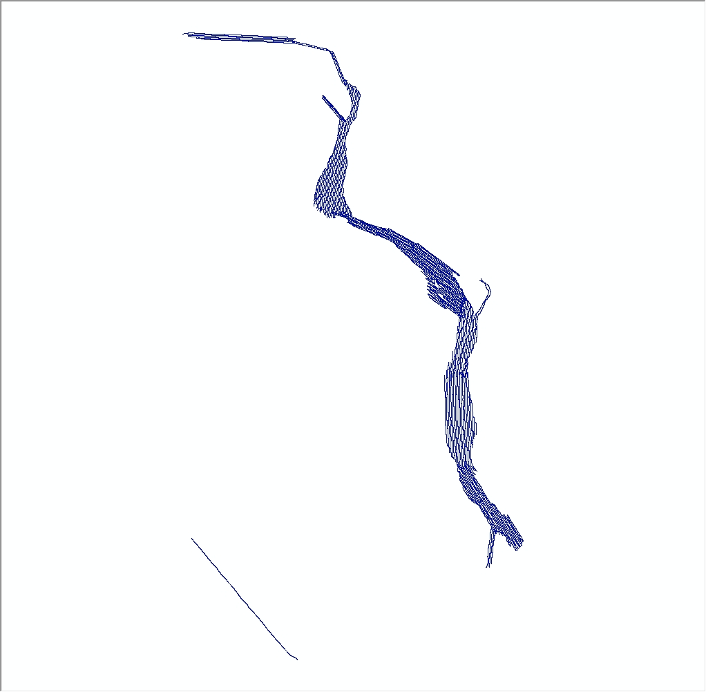
  1. Who distributes the data set? (Distributor 1 of 1)
    Seth Ackerman
    U.S. Geological Survey, Woods Hole Science Center
    Geologist
    384 Woods Hole Rd.
    Woods Hole, MA
    USA

    508-548-8700 x2315 (voice)
    sackerman@usgs.gov
  2. What's the catalog number I need to order this data set? USGS data release 2012-024-FA seismic trackline navigation from the Connecticut River. The zip file contains a shapefile (2012-024-FA_SeismicTracklines.shp), browse graphic (2012-024-FA_SeismicTracklines_browse.jpg) and metadata files in standard formats.
  3. What legal disclaimers am I supposed to read?
    Neither the U.S. Government, the Department of the Interior, nor the USGS, nor any of their employees, contractors, or subcontractors, make any warranty, express or implied, nor assume any legal liability or responsibility for the accuracy, completeness, or usefulness of any information, apparatus, product, or process disclosed, nor represent that its use would not infringe on privately owned rights. The act of distribution shall not constitute any such warranty, and no responsibility is assumed by the USGS in the use of these data or related materials. Any use of trade, product, or firm names is for descriptive purposes only and does not imply endorsement by the U.S. Government.
  4. How can I download or order the data?
  5. What hardware or software do I need in order to use the data set?
    This zip file contains data available in shapefile format. The zip file also contains associated metadata. The user must have software to read and process the data file. Free geospatial data viewers can be found online.

Who wrote the metadata?

Dates:
Last modified: 18-Mar-2024
Metadata author:
Seth Ackerman
U.S. Geological Survey
Geologist
384 Woods Hole Rd.
Woods Hole, MA
USA

508-548-8700 x2315 (voice)
508-457-2310 (FAX)
whsc_data_contact@usgs.gov
Contact_Instructions:
The metadata contact email address is a generic address in the event the person is no longer with USGS. (updated on 20240318)
Metadata standard:
FGDC Content Standards for Digital Geospatial Metadata (FGDC-STD-001-1998)

This page is <https://cmgds.marine.usgs.gov/catalog/whcmsc/field_activities/2012_024_fa/2012-024-FA_SeismicTracklines.faq.html>
Generated by mp version 2.9.51 on Wed Apr 24 13:53:35 2024