This grid represents interpolated swath interferometric bathymetry data at 5-m resolution. Quality control and data processing were conducted to remove spurious points and reduce sound speed artifacts (refraction). Soundings from the surveys were processed and edited using Computer Aided Resource Information System (CARIS) Hydrographic Information Processing System (HIPS; versions 9.0.14 and 9.0.19). Although the soundings were edited, small data spikes may still exist.
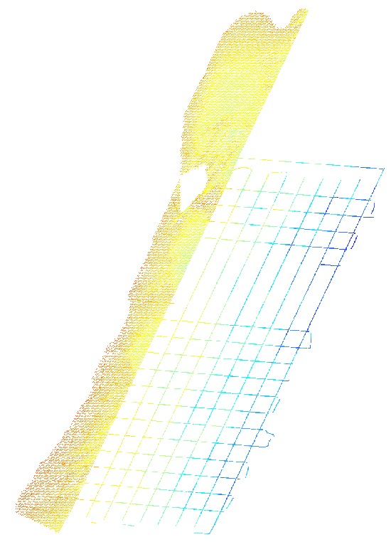
Survey line bathymetry data that were collected within the Delmarva survey area were incorporated in this grid. The survey did not acquire complete coverage bathymetry data, as distance between adjacent survey lines was too great for overlapping swaths, resulting in gaps between survey lines. Interpolation was used to fill nadir gaps, but not gaps between survey lines.
Horizontal_Positional_Accuracy:
Horizontal_Positional_Accuracy_Report:
Navigation data were acquired in WGS 84 coordinate system with an Applanix Wavemaster POS MV, which blends Global Navigation Satellite Systems (GNSS) with acceleration data from a Motion Reference Unit (MRU) and GPS azimuthal heading. The POS MV uses a dual antenna array with a designated primary and secondary antenna. Positions from the primary (forward) Applanix antenna were sent via Ethernet satellite link (from a KVH Mini-VSAT Broadband receiver) to shore stations in MD and VA. Returned Radio Technical Commission for Maritime Services (RTCM) 3.1 position corrections were passed through to the Applanix Wavemaster and applied to the Submetrix System for Real Time Kinematic (RTK) position solutions (accurate to less than 1 m, horizontally). Backup Differential Global Positioning System + Wide Area Augmentation System (DGPS+WAAS), which is accurate to within 2 m horizontally, were acquired using an Ashtech Proflex 800. Positional offsets from the primary antenna to the MRU were corrected within the BathySwath acquisition software.
Vertical_Positional_Accuracy:
Vertical_Positional_Accuracy_Report:
Vertical accuracy of the raw data based on system specifications may be approximately 1 percent of water depth (0.1 to 0.4 m within the survey area). However, overall vertical accuracies on the order of 50 cm or better are assumed based on the following considerations: The Applanix Wavemaster POS MV Attitude and Positioning system, used to correct for vessel roll, pitch, heave, and yaw, has a theoretical vertical accuracy of a few mm. Tidal offsets were corrected to Mean Lower Low Water (MLLW) using a Zone Tidal Model supplied by the Hydrographic Planning Team at NOAA's National Ocean Service. Zone Tidal Models must conform to the International Hydrographic Organization (IHO) standards, which are within 30 cm vertical accuracy. Numerous sound speed profiles (more than 500) were acquired with a Brooke Ocean MVP30 moving vessel profiler and an Applied Microsystems Minos (SVP) hand-deployed velocimeter to minimize acoustic refraction artifacts in the bathymetry data. Sound speed data were entered into the BathySwath acquisition software to model the sound speed structure of the water column. Gridding algorithms and cell sizes for these data could introduce errors as great as 3 m along the edges of the data. Changes in ship draft due to water and fuel usage were not considered.
Source_Information:
Source_Citation:
Citation_Information:
Originator: U.S. Geological Survey
Publication_Date: Unpublished Material
Title: raw interferometric data in .sxr format
Geospatial_Data_Presentation_Form: raster digital data
Type_of_Source_Media: disc
Source_Time_Period_of_Content:
Time_Period_Information:
Range_of_Dates/Times:
Beginning_Date: 20150610
Ending_Date: 20150714
Source_Currentness_Reference:
ground condition; data were not collected on 20150628 (transition between Legs 1 and 2 of the survey).
Source_Citation_Abbreviation: raw bathymetry
Source_Contribution:
USGS used a 234 kHz Systems Engineering and Assessment Ltd. (SEA) SWATHplus-M (now Bathyswath) interferometric sonar pole-mounted on the port side of the M/V Scarlett Isabella. Survey lines were run at an average speed of 5 knots and were spaced 200 m apart in the nearshore to approximately 3-km apart in the offshore. Full data coverage was obtained for sidescan sonar data, but not for bathymetric data. The SEA BathySwath operates at a variable range (increased or decreased manually depending on water depth, but generally 85 m on both sides). The system was operated with a transmit power of 80 percent, a transmit length of 43 cycles, and 4096 samples per channel. Sound-velocity profiles were collected continuously with an ODIM MVP30 moving vessel profiler from 20150610 to 20150704 (JD 161-185) at which point the MVP30 was not recovered from cast number: MVP30_0724. The remaining sound speed profiles on 20150704 through 20150714 (JD 185 - 195) were collected with an Applied Microsystems Minos (SVP) hand-deployed velocimeter. Tides were corrected using a zone tidal model with observed tides from gauges in Atlantic City, NJ; Lewes, DE; Chesapeake Bay-Bridge-Tunnel, VA; and Duck, NC.
Process_Step:
Process_Description:
Each raw SWATHplus bathymetric sonar file (.sxr) was converted to a processed file (.sxp) using SWATHplus Processor (vers. 3.10.6.0). This software can import a nearly unlimited number of sound speed profiles and makes the process of recreating .sxp files much easier if the data need reprocessing. During the conversion process, sound speed profiles were used to minimize potential refraction artifacts from fluctuations in the speed of sound within the water column. Several bathymetric filters were applied to remove erroneous soundings and reduce the density of the data. Bathymetric filtering typically included low amplitude (100 percent), range (0-4 m), box (3-50 m depth, 1.5-75 m horizontal), median (window size 5), alongtrack 1 (depth difference of 5 m, window size 5 m, and learn rate of 0.7), alongtrack 2 (depth difference of 1.5 m, window size 1 m, and learn rate of 0.9), and mean filters (0.25 m). These represent the typical parameters used for the majority of the USGS surveys although the values may have been adjusted slightly for specific parts of the survey area.
Process_Date: 20150714
Process_Contact:
Contact_Information:
Contact_Organization_Primary:
Contact_Organization: U.S. Geological Survey
Contact_Person: William W. Danforth
Contact_Position: Geologist
Contact_Address:
Address_Type: mailing and physical address
Address: 384 Woods Hole Rd.
City: Woods Hole
State_or_Province: MA
Postal_Code: 02543-1598
Contact_Voice_Telephone: 508-548-8700 x2274
Contact_Facsimile_Telephone: 508-457-2310
Contact_Electronic_Mail_Address: bdanforth@usgs.gov
Process_Step:
Process_Description:
A new CARIS HIPS project (vers. 9.0.14) was created with projection information set to Universal Transverse Mercator (UTM) Zone 18N, WGS 84. A vessel configuration file was created in CARIS for the Scarlett Isabella survey vessel, which included vendor specified uncertainty values for each of the survey sensors. Each BathySwath reprocessed file (sxp) was imported to the new CARIS project using the Import/Conversion Wizard. A 5-m resolution Bathymetry Associated with Statistical Error (BASE) surface was created from the files for each Julian day. The BASE surface for each day was reviewed for any inconsistencies or data anomalies. Navigation was reviewed and edited as needed using the navigation editor tool. Beam-to-beam slopes and across-track angle filters were applied to the soundings line by line. The refraction editor was used to adjust sound speed values in areas where velocimeter data did not adequately correct depth profiles obviously influenced by local anomalies in speed of sound through the water column.
Process_Date: 20150714
Process_Contact:
Contact_Information:
Contact_Organization_Primary:
Contact_Organization: U.S. Geological Survey
Contact_Person: William W. Danforth
Contact_Position: Geologist
Contact_Address:
Address_Type: mailing and physical address
Address: 384 Woods Hole Rd.
City: Woods Hole
State_or_Province: MA
Postal_Code: 02543-1598
Contact_Voice_Telephone: 508-548-8700 x2274
Contact_Facsimile_Telephone: 508-457-2310
Contact_Electronic_Mail_Address: bdanforth@usgs.gov
Process_Step:
Process_Description:
Tide corrections (to MLLW) were applied within CARIS (version 9.0.14) using a discrete tidal-zoning model (DTZ) developed by NOAA/NOS's Hydrographic Planning Team (Huang, personal communication, 2010). The DTZ model corrects differences in tidal phase and amplitude between the survey area and observations made at NOS tide gauges at Atlantic City, NJ (8534720), Lewes, DE (8557380), Chesapeake Bay-Bridge-Tunnel, VA (8638863) and Duck NC (8651370). The tidal zone model was imported into CARIS (version: HIPS and SIPS 9.0.14) as a zone definition file (ZDF) and the observed tide data were loaded as CARIS .tid format files. Following tide correction, each line was re-merged and a BASE surface for the entire survey areas was computed to incorporate the MLLW observed tide information. Additional swath editing was done in CARIS using the swath and area based editors to remove additional inconsistencies and minimize survey artifacts.
Process_Date: 20160201
Process_Contact:
Contact_Information:
Contact_Organization_Primary:
Contact_Organization: U.S. Geological Survey
Contact_Person: Edward M. Sweeney
Contact_Position: Physical Scientist
Contact_Address:
Address_Type: mailing and physical address
Address: 384 Woods Hole Rd.
City: Woods Hole
State_or_Province: MA
Postal_Code: 02543-1598
Contact_Voice_Telephone: 508-548-8700 x2256
Contact_Facsimile_Telephone: 508-457-2310
Contact_Electronic_Mail_Address: emsweeney@usgs.gov
Process_Step:
Process_Description:
A Combined Uncertainty and Bathymetric Estimator (CUBE) surface was created in CARIS (version 9.0.19) after the survey using the uncertainty specifications of the survey instruments included in the vessel configuration file. Total Propagated Uncertainty (TPU) was calculated for each of the survey lines and the survey data was re-merged. The CUBE surface was created using IHO S-44 Order, Special Order specifications, with a Density and Locale Disambiguation method as a CUBE parameter. A nearest neighbor interpolation was performed on the CUBE surface in CARIS using a 3 x 3 matrix size (minimum: 6 node neighbors) to fill in some of the nadir gaps and empty grid cells. The CARIS HIPS interpolated CUBE surface was exported as a 5-m horizontal resolution 32-bit GeoTIFF (UTM Zone 18N, WGS 84) from CARIS, with pixel values (depths) ranging from -4.154 to -35.407 m. The GeoTIFF was imported into ArcGIS (version 10.3.1) and a corresponding world file was created using the EXPORT RASTER WORLD FILE tool. The TFW world file was created with the same prefix as the GeoTIFF and with .tfw extension.
Process_Date: 20160202
Process_Contact:
Contact_Information:
Contact_Organization_Primary:
Contact_Organization: U.S. Geological Survey
Contact_Person: Edward M. Sweeney
Contact_Position: Physical Scientist
Contact_Address:
Address_Type: mailing and physical address
Address: 384 Woods Hole Rd.
City: Woods Hole
State_or_Province: MA
Postal_Code: 02543-1598
Contact_Voice_Telephone: 508-548-8700 x2256
Contact_Facsimile_Telephone: 508-457-2310
Contact_Electronic_Mail_Address: emsweeney@usgs.gov
Process_Step:
Process_Description:
The online links to the data were updated to reflect the new server hosting the data. Additionally, other small edits could be made to the metadata, such as modifying http to https where appropriate. The metadata date (but not the metadata creator) was edited to reflect the date of these changes.
Process_Date: 20170419
Process_Contact:
Contact_Information:
Contact_Organization_Primary:
Contact_Organization: U.S. Geological Survey
Contact_Person: VeeAnn A. Cross
Contact_Position: Marine Geologist
Contact_Address:
Address_Type: Mailing and Physical
Address: 384 Woods Hole Road
City: Woods Hole
State_or_Province: MA
Postal_Code: 02543-1598
Contact_Voice_Telephone: 508-548-8700 x2251
Contact_Facsimile_Telephone: 508-457-2310
Contact_Electronic_Mail_Address: vatnipp@usgs.gov
Process_Step:
Process_Description: USGS Thesaurus keywords added to the keyword section.
Process_Date: 20180720
Process_Contact:
Contact_Information:
Contact_Organization_Primary:
Contact_Organization: U.S. Geological Survey
Contact_Person: VeeAnn A. Cross
Contact_Position: Marine Geologist
Contact_Address:
Address_Type: Mailing and Physical
Address: 384 Woods Hole Road
City: Woods Hole
State_or_Province: MA
Postal_Code: 02543-1598
Contact_Voice_Telephone: 508-548-8700 x2251
Contact_Facsimile_Telephone: 508-457-2310
Contact_Electronic_Mail_Address: vatnipp@usgs.gov
Process_Step:
Process_Description:
Added keywords section with USGS persistent identifier as theme keyword.
Process_Date: 20200908
Process_Contact:
Contact_Information:
Contact_Organization_Primary:
Contact_Organization: U.S. Geological Survey
Contact_Person: VeeAnn A. Cross
Contact_Position: Marine Geologist
Contact_Address:
Address_Type: Mailing and Physical
Address: 384 Woods Hole Road
City: Woods Hole
State_or_Province: MA
Postal_Code: 02543-1598
Contact_Voice_Telephone: 508-548-8700 x2251
Contact_Facsimile_Telephone: 508-457-2310
Contact_Electronic_Mail_Address: vatnipp@usgs.gov