Station and data summary for data collected on Stellwagen Bank during U.S. Geological Survey field activity 2017-043-FA, aboard the R/V Auk, Aug. 22 and 23, 2017 (geographic, WGS84)

Metadata also available as - [Outline] - [Parseable text] - [XML]

Frequently anticipated questions:


What does this data set describe?

Title:
Station and data summary for data collected on Stellwagen Bank during U.S. Geological Survey field activity 2017-043-FA, aboard the R/V Auk, Aug. 22 and 23, 2017 (geographic, WGS84)
Abstract:
This field activity is part of an effort to map geologic substrates of the Stellwagen Bank National Marine Sanctuary region off Boston, Massachusetts. The overall goal is to develop high-resolution (1:25,000-scale) interpretive maps, based on multibeam sonar data and seabed sampling, showing surficial geology and seabed sediment dynamics. The data collected in this study will aid research on the ecology of fish and invertebrate species that inhabit the region. On August 22 and 23, 2017, the U.S. Geological Survey, in collaboration with the Stellwagen Bank National Marine Sanctuary, conducted a research cruise aboard the Sanctuary’s Research Vessel Auk, visiting 39 locations within the sanctuary. A customized Van Veen grab sampler (SEABOSS) equipped with a video camera and a conductivity, temperature, and depth (CTD) instrument was deployed in drift mode to collect sediment for grain-size analysis, video imagery of the seabed, and measurements of water column properties.
Supplemental_Information:
Additional information regarding this field activity is available from https://cmgds.marine.usgs.gov/fan_info.php?fan=2017-043-FA.
  1. How might this data set be cited?
    Valentine, Page C., 2018, Station and data summary for data collected on Stellwagen Bank during U.S. Geological Survey field activity 2017-043-FA, aboard the R/V Auk, Aug. 22 and 23, 2017 (geographic, WGS84): data release DOI:10.5066/P9A57QWI, U.S. Geological Survey, Coastal and Marine Geology Program, Woods Hole Coastal and Marine Science Center, Woods Hole, MA.

    Online Links:

    This is part of the following larger work.

    Valentine, Page C., and Cross, VeeAnn A., 2018, Sea-Floor Sediment Samples, Seabed Imagery, and CTD Instrument Data Collected on Stellwagen Bank in August 2017, U.S. Geological Survey Field Activity 2017-043-FA: data release DOI:10.5066/P9A57QWI, U.S. Geological Survey, Reston, VA.

    Online Links:

    Other_Citation_Details:
    Suggested citation: Valentine, P.C., and Cross, V.A., 2018, Sea-floor sediment samples, seabed imagery, and CTD instrument data collected on Stellwagen Bank in August 2017, U.S. Geological Survey Field Activity 2017-043-FA: U.S. Geological Survey data release, https://doi.org/10.5066/P9A57QWI.
  2. What geographic area does the data set cover?
    West_Bounding_Coordinate: 70.226370
    East_Bounding_Coordinate: 70.408960
    North_Bounding_Coordinate: 42.194880
    South_Bounding_Coordinate: 42.084520
  3. What does it look like?
    https://cmgds.marine.usgs.gov/data/field-activity-data/2017-043-FA/data/samples/2017-043-FA_station_data_summary_browse.jpg (JPEG)
    Browse graphic showing the station locations.
  4. Does the data set describe conditions during a particular time period?
    Beginning_Date: 22-Aug-2017
    Ending_Date: 23-Aug-2017
    Currentness_Reference:
    ground condition of when data were collected.
  5. What is the general form of this data set?
    Geospatial_Data_Presentation_Form: tabular and vector digital data
  6. How does the data set represent geographic features?
    1. How are geographic features stored in the data set?
      This is a Point data set. It contains the following vector data types (SDTS terminology):
      • point (39)
    2. What coordinate system is used to represent geographic features?
      Horizontal positions are specified in geographic coordinates, that is, latitude and longitude. Latitudes are given to the nearest 0.00001. Longitudes are given to the nearest 0.00001. Latitude and longitude values are specified in Decimal degrees. The horizontal datum used is D_WGS_1984.
      The ellipsoid used is WGS_1984.
      The semi-major axis of the ellipsoid used is 6378137.000000.
      The flattening of the ellipsoid used is 1/298.257224.
      Vertical_Coordinate_System_Definition:
      Depth_System_Definition:
      Depth_Datum_Name: local surface
      Depth_Resolution: 1
      Depth_Distance_Units: meters
      Depth_Encoding_Method: Attribute values
  7. How does the data set describe geographic features?
    cruise station and data summary in Excel spreadsheet format
    Each Excel spreadsheet has a header (in row 1) explaining the columns of information, row 2 has the header names, and row 3 has header names that are appropriate for incorporation into a GIS (shorter names, no punctuation). The spreadsheet gives basic station information (location, cruise, occupation date and time), as well as additional information indicating what data were collected at each location. (Source: U.S. Geological Survey)
    FIELD_NO
    USGS station: Sample or station name or number as assigned in the field by the Chief Scientist. (Source: U.S. Geological Survey) Character set. Although numeric, stations could have a decimal number indicating a reoccupation of a station.
    DEPTH_M
    Water depth, m: Depth in meters of the station based on the ship echosounder. Recorded in the log book at the time of deployment of the SEABOSS. The values were rounded to the nearest meter to account for ship motion. (Source: U.S. Geological Survey)
    Range of values
    Minimum:20
    Maximum:66
    Units:meters
    VESSEL
    Vessel name: The name of the ship that the field activity used for the cruise. (Source: U.S. Geological Survey) Character string.
    CRUISE_ID
    WHCMSC field activity number: Name or number of cruise on which sample collected. The cruise identifier is in the format YYYY-XXX where YYYY is the survey year, and XXX is the survey number of that year. (Source: U.S. Geological Survey) Character string.
    UTC_DATE
    Date, UTC: The date of the row of data collection based on UTC (coordinated universal time) time. In the Excel spreadsheet, the date has the format of D-M-YYYY where DD is the numeric day, M is the month abbreviation, and YYYY is the year. The date is based on the deployment of the SEABOSS or the plankton tow. (Source: U.S. Geological Survey) Character string.
    UTC_JD
    Julian Day, UTC: Julian day is the integer number representing the interval of time in days since January 1 of the year of collection. Based on the date in UTC time at the time of deployment of the SEABOSS or the plankton tow. (Source: U.S. Geological Survey) Text field presented as a number.
    UTC_JDTIME
    Station occupation date and time, DDD:HH:MM:SS, UTC: Station occupation date and time with Julian day and time in UTC. The format is DDD:HH:MM:SS where DDD is the Julian day, HH is hour, MM is minutes, and SS is seconds. Julian day is the integer number representing the interval of time in days since January 1 of the year of collection. This time corresponds to when the sediment sample was collected (if one was collected). If a sediment sample was not collected, this time represents the end of the video drift. In the case of a plankton tow, this represents the start of the tow. (Source: U.S. Geological Survey) Text field presented as a number.
    TIMEZONE
    Study area time zone: The time zone the study area falls in. (Source: U.S. Geological Survey)
    ValueDefinition
    EDTEastern Daylight Time. To derive EDT, subtract 4 hours from the UTC time.
    ESTEastern Standard Time. To derive EST, subtract 5 hours from the UTC time.
    STA_LAT
    Station location, Lat N, decimal degrees: Latitude coordinate of the station, in decimal-degrees, of station location. South latitude recorded as negative values. The position represents the location of the sediment sample (if collected), which usually occurred at the end of the video drift. If a sediment sample was not collected, the position represents the end of the video drift or the start of the plankton tow. (Source: U.S. Geological Survey)
    Range of values
    Minimum:42.08452
    Maximum:42.19488
    Units:decimal degrees
    STA_LON
    Station location, Lon W, decimal degrees: Longitude coordinate of the station, in decimal degrees, of station location. West longitude is recorded as negative values. The position represents the location of the sediment sample (if collected), which usually occurred at the end of the video drift. If a sediment sample was not collected, the position represents the end of the video drift or the start of the plankton tow. (Source: U.S. Geological Survey)
    Range of values
    Minimum:-70.40896
    Maximum:-70.22637
    Units:decimal degrees
    STIME_VID
    Video drift start time, UTC, HHMMSS: Start time of the video drift when the SEABOSS reached the seabed, in UTC time in HHMMSS. (Source: U.S. Geological Survey) Text field presented as a number.
    ETIME_VID
    Video drift end time, UTC, HHMMSS: End time of the video drift when the SEABOSS left the seabed, in UTC time in HHMMSS. (Source: U.S. Geological Survey) Text field presented as a number.
    SLAT_VID
    Video drift start Lat N, decimal degrees: Latitude coordinate of the start of the video drift once it reaches the seabed, in decimal-degrees, of station location. South latitude recorded as negative values. (Source: U.S. Geological Survey)
    Range of values
    Minimum:42.08464
    Maximum:42.19382
    Units:decimal degrees
    SLON_VID
    Video drift start Lon W, decimal degrees: Longitude coordinate of the start of the video drift once it reaches the seabed, in decimal degrees, of station location. West longitude is recorded as negative values. (Source: U.S. Geological Survey)
    Range of values
    Minimum:-70.40896
    Maximum:-70.22653
    Units:decimal degrees
    ELAT_VID
    Video drift end Lat N, decimal degrees: Latitude coordinate of the end of the video drift, in decimal-degrees, of station location. South latitude recorded as negative values. A value of nd indicates no video drift end location because no drift. Video acquired while sampling only. (Source: U.S. Geological Survey)
    Range of values
    Minimum:42.08452
    Maximum:42.19406
    Units:decimal degrees
    ELON_VID
    Video drift end Lon W, decimal degrees: Longitude coordinate of the end of the video drift, in decimal degrees, of station location. West longitude is recorded as negative values. A value of nd indicates no video drift end location because no drift. Video acquired while sampling only. (Source: U.S. Geological Survey)
    Range of values
    Minimum:-70.40896
    Maximum:-70.22637
    Units:decimal degrees
    SAMP_LAT
    Sediment sample location, Lat N, decimal degrees: Latitude coordinate of the sediment sample location, in decimal-degrees, of station location. South latitude recorded as negative values. A value of 9999 indicates no sample location because no sample was collected. (Source: U.S. Geological Survey)
    Range of values
    Minimum:42.08452
    Maximum:42.19386
    Units:decimal degrees
    SAMP_LON
    Sediment sample location, Lon W, decimal degrees: Longitude coordinate of the sediment sample location, in decimal degrees, of station location. West longitude is recorded as negative values. A value of 9999 indicates no sample location because no sample was collected. (Source: U.S. Geological Survey)
    Range of values
    Minimum:-70.40896
    Maximum:-70.22637
    Units:decimal degrees
    VIDEO
    Video imagery collected: The value of this attribute indicates if seabed video was recorded at the station. The value "y" indicates that video was recorded, "n" indicates no video was recorded. (Source: U.S. Geological Survey) Boolean character set.
    VIDEOFG
    Video frame grabs collected: The value of this attribute indicates if a video frame was recorded at the station. The value "y" indicates that a frame was recorded, "n" indicates no frame was recorded. (Source: U.S. Geological Survey) Boolean character set.
    CTD_PR
    CTD profile data collected: The value of this attribute indicates if a CTD cast was taken and data collected. The value "y" indicates that a CTD cast and data were collected, "n" indicates no CTD cast was taken. (Source: U.S. Geological Survey) Boolean character set.
    SEDSAMP
    Sediment sample collected: The value of this attribute indicates if a seabed sample was taken at the station. The value "y" indicates that a sample was taken, "n" indicates no sample was taken. (Source: U.S. Geological Survey) Boolean character set.
    SEDSAMPPH
    Sediment sample photo collected: The value of this attribute indicates if a seabed sample photo was taken of the sample on the deck of the ship. The value "y" indicates that a photo was taken, "n" indicates no photo was taken. (Source: U.S. Geological Survey) Boolean character set.
    AREA
    Region: General geographic area of data collection. This can be an abbreviation - such as SBNMS for Stellwagen Bank National Marine Sanctuary. (Source: U.S. Geological Survey) Character string.
    Entity_and_Attribute_Overview:
    The attribute label is the abbreviated label that is more compatible with importing the dataset into a GIS and is also the first row of the CSV file. The first part of the attribute definition is the longer label of the column that is in the second row of the Excel spreadsheet.
    When converted to a shapefile, two additional columns are created by the software: FID and Shape. The FID is a unique number automatically assigned to each record within the file. The Shape field contains the feature geometry of each record in the shapefile format.
    Additionally, the Excel spreadsheet has the following information in the first row describing the spreadsheet.
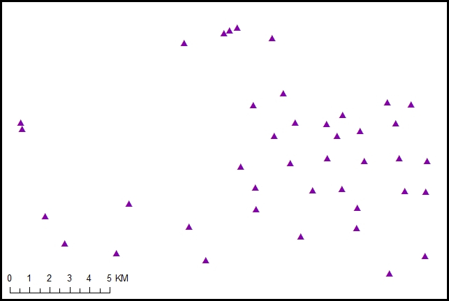
    [Cruise station and data summary: column A, USGS station number; column B, water depth, meters; column C, vessel name; column D, WHCMSC field activity number; column E, date, UTC; column F, Julian Day, UTC; column G, station occupation date and time, UTC (for Eastern Daylight Time subtract 4 hours; for Eastern Standard Time, subtract 5 hours); column H, study area time zone; column I, station location, latitude north, decimal degrees; column J, station location, longitude west, decimal degrees (station location is the sample location, if collected; otherwise it is the video drift end location); column K, video drift start time, UTC; column L, video drift end time, UTC; column M, start of video drift, latitude north, decimal degrees; column M, start of video drift, longitude west, decimal degrees; column O, end of video drift, latitude north, decimal degrees; column P, end of video drift, longitude west, decimal degrees; column Q, sediment sample location, latitude north, decimal degrees; column R, sediment sample location, longitude west, decimal degrees; column S, video imagery collected; column T, video frame grabs; column U, CTD profile collected; column V, sediment sample collected; column W, sediment sample photo; column X, geographic region [abbreviations: DDD, Julian Day; EDT, Eastern Daylight Time; EST, Eastern Standard Time; H, hour; M, minute; S, second; PT, plankton tow; lat, latitude; lon, longitude; WHCMSC, USGS Woods Hole Coastal and Marine Science Center; SBNMS, Stellwagen Bank National Marine Sanctuary; UTC, coordinated universal time (Greenwich Mean Time, ZULU time); y, yes; n, no; 9999, no sample location because no sample collected] Note: Stations 4634PT and 4674PT are plankton tows; time and location were recorded in the log book as a courtesy to a non-USGS scientist sharing the cruise; station location is at start of the plankton tow; tow start and end times and locations are recorded in columns K to P.
    Entity_and_Attribute_Detail_Citation: U.S. Geological Survey

Who produced the data set?

  1. Who are the originators of the data set? (may include formal authors, digital compilers, and editors)
    • Page C. Valentine
  2. Who also contributed to the data set?
  3. To whom should users address questions about the data?
    U.S. Geological Survey
    Attn: Page C. Valentine
    Research Geologist
    384 Woods Hole Rd.
    Woods Hole, MA
    USA

    (508) 548-8700 x2239 (voice)
    (508) 457-2310 (FAX)
    pvalentine@usgs.gov

Why was the data set created?

The record of data acquired at each station provides water depths, times, and coordinates of video imagery and samples collected at each station to aid in the interpretation and mapping of seabed substrate types. This data file indicates what data are available for the interpretation at each station.

How was the data set created?

  1. From what previous works were the data drawn?
  2. How were the data generated, processed, and modified?
    Date: 2017 (process 1 of 5)
    Sediment sampling methods:
    As a part of the process of mapping the sea floor, the USGS developed the SEABed Observation and Sampling System (SEABOSS) to collect samples and video and photographic images of the seabed to aid in the interpretation of seabed sonar imagery. A modified Van Veen sediment grab sampler is mounted in the center of the SEABOSS frame, which ensures the sampler is properly oriented on the seabed when a sample is collected. Before deployment, the sampler bucket's jaws are opened by collapsing the extended arms to a near-horizontal position and locking them in place with two catches. The sampler operates passively to sample the seabed; it is not spring loaded.
    To collect a sediment sample, the SEABOSS frame was lowered gently onto the seabed, reducing tension on the cable, which caused the two locking catches to be automatically released by gravity. As the cable was retrieved, the grab sampler's arms were pulled upward, closing the bucket around the sediment, and the SEABOSS was lifted off the seabed.
    The SEABOSS was retrieved and set upon a wooden platform that kept the sampler bucket and camera systems above the deck. The sampler's arms were held in the upright position manually or by tension on the cable, the two doors on the upper side of the bucket were opened, and the sediment was removed. For this project, the upper 2 cm of sediment, representing the surface of the seabed, were removed with a rectangular shovel 2-cm deep and stored in a plastic bag for grain-size analysis. The remaining sediment was dumped into a tray on the deck below the sampler and discarded, after which the sampler was washed in preparation for sampling at the next site. Further information on the SEABOSS can be found in Valentine and others (2000).
    Grain-size analyses of the sediment samples were performed at the USGS Woods Hole Coastal and Marine Science Center in Woods Hole, Massachusetts, by using a standard suite of analytical methods (Poppe and others, 2014). This laboratory has been in operation since 1963 and has analyzed many thousands of sediment samples collected by the USGS in New England.
    
    
    Video methods and data availability:
    Seabed video images were collected using two battery-operated, high-definition (1920 x 1080 pixels) GoPro digital video cameras mounted on the USGS SEABed Observation and Sampling System (SEABOSS). The SEABOSS system also had a Seaviewer, high-definition (1920 x 720 pixels), digital camera attached to it with a live feed to the surface. It was mounted a little higher on the frame and was used to observe obstacles, like gill nets and lobster gear, in order to avoid entanglement. In case of camera failure, the additional cameras provided backup video, which was needed for stations 4656 and 4662.
    As the SEABOSS drifted over the seabed, the cameras imaged the seabed at a rate of 60 frames per second from an altitude of ~1 meter. Lighting was provided by two, battery-operated Keldan LED video lights. Each light provided a light flux of up to 9000 lumens at a correlated color temperature of 5000 kelvins. Two parallel red lasers mounted 20 centimeters apart provided a scale in the video images.
    Video imagery includes the launch and recovery of the SEABOSS, transit through the water column, and the drift over the seabed. The duration of individual video files ranges from 4 to 10 minutes. Video files are archived in .MP4 format, except for station 4656 where the video file was recorded in .mov format by the Seaviewer camera. Video files range in size from 0.9 to 5.0 gigabytes. These video files are not part of this data release.
    The position (lat/lon) and time of the start of the video drift was recorded (from the navigation receiver) by hand in the log book at the time of the deployment of the SEABOSS, when it reached the seabed, when a grab sample was attempted, and when it left the seabed. Latitude and longitude positions recorded by hand in the log book were later adjusted by reference to the data recorded in the GPS navigation file. Video was recorded during the descent through the water column (1-2 minutes), during the drift over the seabed, and during the ascent to the surface.
    
    
    Photos:
    No still photos of the seabed were acquired during this field activity. Video frame grabs were recorded to show typical images of the seabed. These images are available from the Larger Work citation.
    
    
    The station position (lat/lon) represents the location of the sediment sample (if collected). If a sediment sample was not collected, the station position represents the end of the video drift.
    
    
    Water depth was determined using a Simrad ES60, 120 kHz, single beam echosounder using a 120-25 transducer, which detects the seabed to a depth of 800 m. Depth values (from the echo sounder monitor) and position (lat/lon) values (from the navigation receiver) were recorded in a log book at the time of deployment of the SEABOSS. Depth values were rounded to the nearest meter to account for ship motion. Person who carried out this activity:
    U.S. Geological Survey
    Attn: Page C. Valentine
    Research Geologist
    384 Woods Hole Rd.
    Woods Hole, MA
    USA

    (508) 548-8700 x2239 (voice)
    (508) 457-2310 (FAX)
    pvalentine@usgs.gov
    Date: 2017 (process 2 of 5)
    This information was entered into an Excel (2013) spreadsheet, with a column for each piece of information as described in the entity and attribute section of the metadata. The first row is an explanation header, the second row contains descriptive column headers, and the third row contains brief column headers that are compatible with importing the data into a GIS. Person who carried out this activity:
    U.S. Geological Survey
    Attn: Page C. Valentine
    Research Geologist
    384 Woods Hole Rd.
    Woods Hole, MA
    USA

    (508) 548-8700 x2239 (voice)
    (508) 457-2310 (FAX)
    pvalentine@usgs.gov
    Date: 2017 (process 3 of 5)
    The spreadsheet was opened in Excel (2013). The first row (the explanation header) and the second row (descriptive column headers) were deleted and the third row (brief column headers that are compatible with importing the data into a GIS) was retained. Then the spreadsheet was exported as an MS-DOS CSV file. Person who carried out this activity:
    U.S. Geological Survey
    Attn: Page C. Valentine
    Research Geologist
    384 Woods Hole Rd.
    Woods Hole, MA
    USA

    (508) 548-8700 x2239 (voice)
    (508) 457-2310 (FAX)
    pvalentine@usgs.gov
    Date: 08-Jan-2018 (process 4 of 5)
    Using ArcGIS 10.3.1, the CSV file was converted to a shapefile within ArcMap using File - Add Data - Add XY data. The CSV file was selected, with the x-coordinate set to STA_LON and the y-coordinate set to STA_LAT. The coordinate system of the input coordinates was set to the geographic coordinate system GCS_WGS_1984. Once the event theme was added to ArcMap, the data were then converted to a shapefile by right-clicking on the event theme - Data - Export Data. All of the features were exported using the layer's source data for the coordinate system. The output shapefile was set to 2017-043-FA_station_data_summary.shp. Person who carried out this activity:
    U.S. Geological Survey
    Attn: VeeAnn A. Cross
    Marine Geologist
    384 Woods Hole Road
    Woods Hole, MA

    508-548-8700 x2251 (voice)
    508-457-2310 (FAX)
    vatnipp@usgs.gov
    Date: 08-Sep-2020 (process 5 of 5)
    Added keywords section with USGS persistent identifier as theme keyword. Person who carried out this activity:
    U.S. Geological Survey
    Attn: VeeAnn A. Cross
    Marine Geologist
    384 Woods Hole Road
    Woods Hole, MA

    508-548-8700 x2251 (voice)
    508-457-2310 (FAX)
    vatnipp@usgs.gov
  3. What similar or related data should the user be aware of?
    Blackwood, D.S., and Parolski, K.F., 2001, Seabed observation and sampling system: Sea Technology v. 42, no. 2, p.39-43.

    Valentine, P., Blackwood, D., and Parolski, K., 2000, Seabed observation and sampling system: U.S. Geological Survey Fact Sheet FS-142-00, U.S. Geological Survey, Reston, VA.

    Online Links:


How reliable are the data; what problems remain in the data set?

  1. How well have the observations been checked?
  2. How accurate are the geographic locations?
    The location information for stations was acquired from a satellite navigation receiver (Furuno satellite compass SC-30, GPS receiver) at two second intervals with a horizontal accuracy of 10 m. The navigation antenna is located 5.3 m forward of the SEABOSS deployment location. This offset was not accounted for in the navigation acquisition (navigation fixes represent antenna location).
  3. How accurate are the heights or depths?
    Water depth was determined using a Simrad ES60, 120 kHz, single beam echosounder using a 120-25 transducer, which detects the seabed to a depth of 800 m. Depth values were rounded to the nearest meter to account for ship motion and recorded in the log book. Tide corrections were not applied to the depth values.
  4. Where are the gaps in the data? What is missing?
    These station locations and data collection information represent all the information pertinent to the 2017-043-FA field activity. This represents information for all the stations occupied during the cruise.
  5. How consistent are the relationships among the observations, including topology?
    The same information was recorded for each station occupied. The locations (latitude and longitude values) are based on information recorded in the cruise log book and later adjusted by reference to the data recorded in the GPS navigation file. Two stations occupied were plankton tow stations, with no SEABOSS deployment - therefore no samples, video, seabed images, or sample images. These stations have "PT" in the station name (4634 PT and 4674 PT). The sediment sample locations have values carried out to 5 decimal places. The information given to (and therefore returned from) the analysis lab only had 4 decimal places, so there is a slight difference between the values in this data file and those in the 2017-043-FA_sedsamps data file available from the larger work citation.

How can someone get a copy of the data set?

Are there legal restrictions on access or use of the data?
Access_Constraints None.
Use_Constraints Not to be used for navigation.
  1. Who distributes the data set? (Distributor 1 of 1)
    U.S. Geological Survey
    Attn: Page C. Valentine
    Research Geologist
    384 Woods Hole Rd.
    Woods Hole, MA
    USA

    (508) 548-8700 x2239 (voice)
    (508) 457-2310 (FAX)
    pvalentine@usgs.gov
  2. What's the catalog number I need to order this data set? 2017-043-FA_station_summary.zip contains the Excel spreadsheet with the station summary information (2017-043-FA_station_data_summary.xlsx), a CSV file of the same information with a GIS compatible header row (2017-043-FA_station_data_summary.csv), and the shapefile created from the CSV file (2017-043-FA_station_data_summary.shp) and the other files associated with a shapefile. The zip file also contains the browse graphic (2017-043-FA_station_data_summary_browse.jpg) and the FGDC CSDGM metadata in TXT, XML, and HTML formats.
  3. What legal disclaimers am I supposed to read?
    Neither the U.S. Government, the Department of the Interior, nor the USGS, nor any of their employees, contractors, or subcontractors, make any warranty, express or implied, nor assume any legal liability or responsibility for the accuracy, completeness, or usefulness of any information, apparatus, product, or process disclosed, nor represent that its use would not infringe on privately owned rights. The act of distribution shall not constitute any such warranty, and no responsibility is assumed by the USGS in the use of these data or related materials. Any use of trade, product, or firm names is for descriptive purposes only and does not imply endorsement by the U.S. Government.
  4. How can I download or order the data?
  5. What hardware or software do I need in order to use the data set?
    The zip file contains data in XLSX, CSV and Esri shapefile formats. The user must have software capable of uncompressing the zip file and reading the data formats.

Who wrote the metadata?

Dates:
Last modified: 18-Mar-2024
Metadata author:
U.S. Geological Survey
Attn: VeeAnn A. Cross
Marine Geologist
384 Woods Hole Rd.
Woods Hole, MA

508-548-8700 x2251 (voice)
508-457-2310 (FAX)
whsc_data_contact@usgs.gov
Contact_Instructions:
The metadata contact email address is a generic address in the event the person is no longer with USGS. (updated on 20240318)
Metadata standard:
FGDC Content Standards for Digital Geospatial Metadata (FGDC-STD-001-1998)

This page is <https://cmgds.marine.usgs.gov/catalog/whcmsc/field_activities/2017_043_fa/2017-043-FA_station_data_summary_meta.faq.html>
Generated by mp version 2.9.51 on Wed Apr 24 13:53:37 2024