Citation:
Citation_Information:
Originator: Lawrence J. Poppe
Originator: Mary E. Hastings
Publication_Date: 2003
Title:
Maine Inner Continental Shelf Sediment Data (BARNHARDT shapefile)
Edition: 1.0
Geospatial_Data_Presentation_Form: vector digital data
Series_Information:
Series_Name: Open-File Report
Issue_Identification: 03-001
Publication_Information:
Publication_Place: Woods Hole Coastal and Marine Science Center, Woods Hole, MA
Publisher: U. S. Geological Survey, Coastal and Marine Geology Program
Online_Linkage: https://doi.org/10.3133/ofr031
Online_Linkage:
Online_Linkage: http://pubs.usgs.gov/of/2003/of03-001/htmldocs/data.htm
Larger_Work_Citation:
Citation_Information:
Originator: L.J. Poppe
Originator: V.F. Paskevich
Originator: S.J. Williams
Originator: M.E. Hastings
Originator: J.T. Kelley
Originator: D.F. Belknap
Originator: L.G. Ward
Originator: D.M. Fitzgerald
Originator: P.F. Larsen
Publication_Date: 2003
Title:
Surficial Sediment Data from the Gulf of Maine, Georges Bank, and vicinity: a GIS Compilation
Edition: 1.0
Series_Information:
Series_Name: Open-File Report
Issue_Identification: 03-001
Publication_Information:
Publication_Place: Reston, VA
Publisher: U. S. Geological Survey
Other_Citation_Details: 1 CD-ROM
Online_Linkage: http://pubs.usgs.gov/of/2003/of03-001/
Description:
Abstract:
Surficial geologic maps play and important role in understanding the present sea floor and the processes that shape it. Between 1984 and 1991, over 1,700 bottom sample stations were occupied in the northwestern Gulf of Maine. Although the data were originally collected for a variety of research projects, contracts, and graduate student theses, they were eventually compiled as part of a Maine Geological Survey and University of Maine program to map the inner continental shelf of this region.
Purpose:
The purpose of this data layer is to make available a subset of a data set produced by the Maine Geological Survey and the University of Maine. This subset contains information for those samples with raw grain size data, and which are located on the inner continental shelf from the northwestern Gulf of Maine.
Time_Period_of_Content:
Time_Period_Information:
Single_Date/Time:
Calendar_Date: 1998
Currentness_Reference: publication date
Status:
Progress: Complete
Maintenance_and_Update_Frequency: None planned
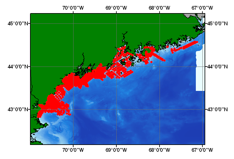
Spatial_Domain:
Bounding_Coordinates:
West_Bounding_Coordinate: -70.812833
East_Bounding_Coordinate: -67.129700
North_Bounding_Coordinate: 44.578314
South_Bounding_Coordinate: 42.833833
Keywords:
Theme:
Theme_Keyword_Thesaurus: USGS Metadata Identifier
Theme_Keyword: USGS:1477ea4a-0981-48db-9429-f3505adc9a6b
Theme:
Theme_Keyword_Thesaurus: None
Theme_Keyword: U.S. Geological Survey
Theme_Keyword: USGS
Theme_Keyword: University of Maine
Theme_Keyword: Maine Geological Survey
Theme_Keyword: Woods Hole Science Center
Theme_Keyword: sediment
Theme_Keyword: texture
Theme_Keyword: lithology
Theme_Keyword: gravel
Theme_Keyword: sand
Theme_Keyword: silt
Theme_Keyword: clay
Theme_Keyword: mud
Theme_Keyword: Open-File Report 03-001
Theme_Keyword: Coastal and Marine Geology Program
Theme_Keyword: CMGP
Theme_Keyword: sediment classification
Theme_Keyword: surficial classification
Theme_Keyword: point shapefile
Theme_Keyword: points
Theme_Keyword: Geographic Information System
Theme_Keyword: GIS
Theme_Keyword: WHSC
Theme:
Theme_Keyword_Thesaurus: ISO 19115 Topic Category
Theme_Keyword: oceans
Theme_Keyword: location
Theme_Keyword: geoscientificInformation
Theme:
Theme_Keyword_Thesaurus: USGS Thesaurus
Theme_Keyword: grain-size analysis
Theme_Keyword: navigational data
Theme_Keyword: geospatial datasets
Theme_Keyword: sea-floor characteristics
Theme_Keyword: marine geology
Place:
Place_Keyword_Thesaurus: None
Place_Keyword: U.S. East Coast
Place_Keyword: Gulf of Maine
Place_Keyword: Atlantic
Place_Keyword: Inner Continental Shelf
Place_Keyword: New England
Access_Constraints: None
Use_Constraints:
Public domain data from the U.S. Government are freely redistributable with proper metadata and source attribution. Please recognize the U.S. Geological Survey (USGS) as the source of this information.
Point_of_Contact:
Contact_Information:
Contact_Person_Primary:
Contact_Person: Lawrence J. Poppe
Contact_Organization: U.S. Geological Survey
Contact_Position: Geologist
Contact_Address:
Address_Type: mailing and physical address
Address: 384 Woods Hole Road
City: Woods Hole
State_or_Province: MA
Postal_Code: 02543-1598
Country: USA
Contact_Voice_Telephone: (508) 548-8700 x2314
Contact_Facsimile_Telephone: (508) 457-2310
Contact_Electronic_Mail_Address: [email protected]
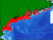
Browse_Graphic:
Browse_Graphic_File_Name:
Browse_Graphic_File_Description:
Thumbnail image showing extent and distribution of data layer coverage.
Browse_Graphic_File_Type: GIF
Browse_Graphic:
Browse_Graphic_File_Name:
Browse_Graphic_File_Description:
Image map showing extent and distribution of data layer coverage.
Browse_Graphic_File_Type: GIF
Data_Set_Credit:
Please review the cross reference information for the original data set credit to Kelley and others (1998), and Larry Poppe for creating this ArcView shapefile.
Native_Data_Set_Environment:
Microsoft Windows XP Version 5.1 (Build 2600) Service Pack 2; ESRI ArcCatalog 9.2.2.1350
Cross_Reference:
Citation_Information:
Originator: J.T. Kelley
Originator: W.A. Barnhardt
Originator: D.F. Belknap
Originator: S.M. Dickson
Originator: A.R. Kelley
Publication_Date: 1998
Title:
The Seafloor Revealed: The Geology of the Northwestern Gulf of Maine Inner Continental Shelf
Edition: 1.0
Series_Information:
Series_Name: Maine Geological Survey Open-File
Issue_Identification: 96-6, 55 p.
Publication_Information:
Publication_Place: Augusta, ME
Publisher: Maine Geological Survey, Department of Conservation
Cross_Reference:
Citation_Information:
Originator: W.A. Barnhardt
Originator: J.T. Kelley
Originator: S.M. Dickson
Originator: D.F. Belknap
Originator: A.R. Kelley
Publication_Date: 1996
Title: Surficial Geology of the Maine Inner Continental Shelf
Edition: 1.0
Series_Information:
Series_Name: Maine Geological Survey Map Series
Issue_Identification: scale 1:100,000
Publication_Information:
Publication_Place: Augusta, ME
Publisher: Maine Geological Survey