Citation:
Citation_Information:
Originator: Peter Larsen
Originator: Polly Hastings
Originator: Lawrence Poppe
Publication_Date: 2003
Title:
Sediment Data Produced by the Bigelow Laboratory (BIGELOW shapefile)
Edition: 1.0
Geospatial_Data_Presentation_Form: vector digital data
Series_Information:
Series_Name: Open-File Report
Issue_Identification: 03-001
Publication_Information:
Publication_Place: Woods Hole Coastal and Marine Science Center, Woods Hole, MA
Publisher: U. S. Geological Survey, Coastal and Marine Geology Program
Online_Linkage: https://doi.org/10.3133/ofr031
Online_Linkage:
Online_Linkage: http://pubs.usgs.gov/of/2003/of03-001/htmldocs/data.htm
Larger_Work_Citation:
Citation_Information:
Originator: L.J. Poppe
Originator: V.F. Paskevich
Originator: S.J. Williams
Originator: M.E. Hastings
Originator: J.T. Kelley
Originator: D.F. Belknap
Originator: L.G. Ward
Originator: D.M. Fitzgerald
Originator: P.F. Larsen
Publication_Date: 2003
Title:
Surficial Sediment Data from the Gulf of Maine, Georges Bank, and vicinity: a GIS Compilation
Edition: 1.0
Series_Information:
Series_Name: Open-File Report
Issue_Identification: 03-001
Publication_Information:
Publication_Place: Reston, VA
Publisher: U. S. Geological Survey
Other_Citation_Details: 1 CD-ROM
Online_Linkage: http://pubs.usgs.gov/of/2003/of03-001/
Description:
Abstract:
The data in this layer are from a number of published and unpublished sets produced by the Bigelow Laboratory. The source projects were conducted primarily to examine contaminant (e.g. trace metals, PAHs) distributions, but also produced sediment textural data. The data were originally converted into digital format for inclusion in the Gulf of Maine Contaminated Sediments Database.
Purpose:
The purpose of this data layer is to make available a subset of a data set produced by the Bigelow Laboratory of Boothbay Harbor, Maine. This subset contains information for those samples with sediment grain-size data, and which are located on the inner continental shelf from the northwestern Gulf of Maine.
Time_Period_of_Content:
Time_Period_Information:
Single_Date/Time:
Calendar_Date: 1983
Currentness_Reference: publication date
Status:
Progress: Complete
Maintenance_and_Update_Frequency: None planned
Spatial_Domain:
Bounding_Coordinates:
West_Bounding_Coordinate: -70.296670
East_Bounding_Coordinate: -65.673330
North_Bounding_Coordinate: 44.466670
South_Bounding_Coordinate: 41.976670
Keywords:
Theme:
Theme_Keyword_Thesaurus: USGS Metadata Identifier
Theme_Keyword: USGS:db34b7bf-71f7-4fb3-a5da-e2888d771736
Theme:
Theme_Keyword_Thesaurus: None
Theme_Keyword: U.S. Geological Survey
Theme_Keyword: USGS
Theme_Keyword: Woods Hole Science Center
Theme_Keyword: Bigelow Laboratory
Theme_Keyword: Sediment
Theme_Keyword: texture
Theme_Keyword: lithology
Theme_Keyword: gravel
Theme_Keyword: sand
Theme_Keyword: silt
Theme_Keyword: clay
Theme_Keyword: fines
Theme_Keyword: statistics
Theme_Keyword: classification
Theme_Keyword: Open-File Report 03-001
Theme_Keyword: Coastal and Marine Geology Program
Theme_Keyword: CMGP
Theme_Keyword: sediment classification
Theme_Keyword: surficial classification
Theme_Keyword: point shapefile
Theme_Keyword: points
Theme_Keyword: Geographic Information System
Theme_Keyword: GIS
Theme_Keyword: WHSC
Theme:
Theme_Keyword_Thesaurus: ISO 19115 Topic Category
Theme_Keyword: oceans
Theme_Keyword: location
Theme_Keyword: geoscientificInformation
Theme:
Theme_Keyword_Thesaurus: USGS Thesaurus
Theme_Keyword: grain-size analysis
Theme_Keyword: navigational data
Theme_Keyword: geospatial datasets
Theme_Keyword: sea-floor characteristics
Theme_Keyword: marine geology
Place:
Place_Keyword_Thesaurus: None
Place_Keyword: U.S. East Coast
Place_Keyword: New England
Place_Keyword: Maine
Place_Keyword: Gulf of Maine
Place_Keyword: continental shelf
Place_Keyword: United States
Place_Keyword: USA
Place_Keyword: North America
Access_Constraints: None
Use_Constraints:
Public domain data from the U.S. Government are freely redistributable with proper metadata and source attribution. Please recognize the U.S. Geological Survey (USGS) as the source of this information.
Point_of_Contact:
Contact_Information:
Contact_Person_Primary:
Contact_Person: Lawrence J. Poppe
Contact_Organization: U.S. Geological Survey
Contact_Position: Geologist
Contact_Address:
Address_Type: mailing and physical address
Address: 384 Woods Hole Road
City: Woods Hole
State_or_Province: MA
Postal_Code: 02543-1598
Country: USA
Contact_Voice_Telephone: (508) 548-8700 x2314
Contact_Facsimile_Telephone: (508) 457-2310
Contact_Electronic_Mail_Address: [email protected]
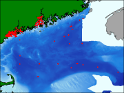
Browse_Graphic:
Browse_Graphic_File_Name:
Browse_Graphic_File_Description:
Thumbnail image showing extent and distribution of data layer coverage.
Browse_Graphic_File_Type: GIF
Browse_Graphic:
Browse_Graphic_File_Name:
Browse_Graphic_File_Description:
Image map showing extent and distribution of data layer coverage.
Browse_Graphic_File_Type: GIF
Data_Set_Credit:
Please review the cross reference information for the original data set credits, and Larry Poppe for creating this ArcView shapefile.
Native_Data_Set_Environment:
Microsoft Windows XP Version 5.1 (Build 2600) Service Pack 2; ESRI ArcCatalog 9.2.2.1350
Cross_Reference:
Citation_Information:
Originator: P.F. Larsen
Originator: V. Zdanowicz
Originator: A.C. Johnson
Originator: L.F. Doggert
Publication_Date: 1983
Title:
Trace metals in New England marine sediments: Casco Bay Maine, in relation to other sites
Edition: 1.0
Series_Information:
Series_Name: Chemical Ecology
Issue_Identification: v. 1, p. 191-200
Cross_Reference:
Citation_Information:
Originator: P.F. Larsen
Originator: A.C. Johnson
Originator: L.F. Doggert
Publication_Date: 1983
Title:
Environmental benchmark studies in Casco Bay-Portland Harbor, Maine, April 1980
Edition: 1.0
Series_Information:
Series_Name: NOAA Technical Memorandum
Issue_Identification: Report No. NMFS-F/NEC-19, 173 p.
Cross_Reference:
Citation_Information:
Originator: P.F. Larsen
Originator: D.F. Gadbois
Originator: A.C. Johnson
Originator: L.F. Doggert
Publication_Date: 1983
Title:
Distribution of polycyclic aromatic hydrocarbons in surficial sediments of Casco Bay, Maine
Edition: 1.0
Series_Information:
Series_Name: Bulletin Environmental Contamination Toxicology
Issue_Identification: v. 30, p. 530-535.
Cross_Reference:
Citation_Information:
Originator: P.F. Larsen
Originator: A.C. Johnson
Publication_Date: 1983
Title: Sediment quality studies in Casco Bay and Penobscot Bay, Maine
Edition: 1.0
Series_Information:
Series_Name: Bigelow Laboratory Technical Report
Issue_Identification: No. 33, 56 p.
Cross_Reference:
Citation_Information:
Originator: P.F. Larsen
Originator: V. Zdanowicz
Originator: A.C. Johnson
Publication_Date: 1983
Title:
Trace metal distributions in surficial sediments of Penobscot bay, Maine
Edition: 1.0
Series_Information:
Series_Name: Bulletin Environmental Contamination Toxicology
Issue_Identification: v. 31, p. 566-573.
Cross_Reference:
Citation_Information:
Originator: A.C. Johnson
Originator: D.F. Gadbois
Originator: P.F. Larsen
Originator: A.W. Humason
Publication_Date: 1985
Title:
The distribution of PAHs in surficial sediments of Penobscot Bay (Maine, USA) in relation to possible sources and to other sites worldwide
Edition: 1.0
Series_Information:
Series_Name: Marine Environmental Research
Issue_Identification: v. 15, p. 1-16.
Cross_Reference:
Citation_Information:
Originator: P.F. Larsen
Originator: D.F. Gadbois
Originator: A.C. Johnson
Publication_Date: 1986
Title:
Polycyclic aromatic hydrocarbons in Gulf of Maine sediments: distribution and mode of transport
Edition: 1.0
Series_Information:
Series_Name: Marine Environmental Research
Issue_Identification: v. 18, p.231-244.
Cross_Reference:
Citation_Information:
Originator: P.F. Larsen
Publication_Date: 1985
Title:
A review of five years of sediment quality investigations in the Gulf of Maine
Edition: 1.0
Series_Information:
Series_Name: Bigelow Laboratory Technical Report
Issue_Identification: No. 50, 86 p.
Cross_Reference:
Citation_Information:
Originator: P.F. Larsen
Originator: H.E. Gaudette
Publication_Date: 1995
Title:
Spatial and temporal aspects of sedimentary trace metal concentrations in mid-coast Maine
Edition: 1.0
Series_Information:
Series_Name: Marine Pollution Bulletin
Issue_Identification: v. 30, p. 437-444.
Cross_Reference:
Citation_Information:
Originator: P.F. Larsen
Publication_Date: 1991
Title:
Results of a seasonal survey of trace metals and polycyclic aromatic hydrocarbons in Casco Bay, Maine
Edition: 1.0
Series_Information:
Series_Name: Bigelow Laboratory Technical Report
Issue_Identification: No. 87, 29 p.
Cross_Reference:
Citation_Information:
Originator: P.F. Larsen
Originator: V.S. Vdanowicz
Originator: D.F. Gadbois
Originator: A.C. Johnson
Publication_Date: unknown
Title:
Trends in sediment concentrations of trace metals and polycyclic aromatic hydrocarbons following the introduction of sewage treatment in Casco Bay, Maine
Edition: 1.0
Cross_Reference:
Citation_Information:
Originator: P.F. Larsen
Originator: D.F. Gadbois
Originator: A.C. Johnson
Originator: L.F. Doggert
Publication_Date: 1983
Title: PCB monitoring in the Casco Bay regionof the Gulf of Maine
Edition: 1.0
Series_Information:
Series_Name: Marine Pollution Bulletin
Issue_Identification: v. 14, p. 32.
Cross_Reference:
Citation_Information:
Originator: P.F. Larsen
Originator: D.F. Gadbois
Originator: A.C. Johnson
Originator: R.F. Maney
Publication_Date: 1984
Title:
On the appearance of PCBs in the surficial sediments of Casco Bay, Maine
Edition: 1.0
Series_Information:
Series_Name: Marine Pollution Bulletin
Issue_Identification: v. 15, p. 452-453.
Cross_Reference:
Citation_Information:
Originator: P.F. Larsen
Originator: D.F. Gadbois
Originator: A.C. Johnson
Publication_Date: 1984
Title:
Sediment PCB distribution in the Penobscot Bay region of the Gulf of Maine
Edition: 1.0
Series_Information:
Series_Name: Marine Pollution Bulletin
Issue_Identification: v. 15, p. 34-35.
Cross_Reference:
Citation_Information:
Originator: P.F. Larsen
Originator: D.F. Gadbois
Originator: A.C. Johnson
Publication_Date: 1985
Title:
Observations on the distribution of PCBs in deepwater sediments of the Gulf of Maine
Edition: 1.0
Series_Information:
Series_Name: Marine Pollution Bulletin
Issue_Identification: v. 16, p. 439-442.
Cross_Reference:
Citation_Information:
Originator: Geochemical and Environmental Research Group
Publication_Date: 1992
Title: Assessment of sediment contamination in Casco Bay
Edition: 1.0
Series_Information:
Series_Name: GERG Technical Report
Issue_Identification: No. 92-157