Citation:
Citation_Information:
Originator: Lawrence J. Poppe
Publication_Date: Unpublished Material
Title: Fluvial-Marine Interactions, Maine (BUYNEVICH01 shapefile)
Edition: 1.0
Geospatial_Data_Presentation_Form: vector digital data
Series_Information:
Series_Name: Open-File Report
Issue_Identification: 03-001
Publication_Information:
Publication_Place: Woods Hole Coastal and Marine Science Center, Woods Hole, MA
Publisher: U.S. Geological Survey, Coastal and Marine Geology Program
Online_Linkage: https://doi.org/10.3133/ofr031
Online_Linkage:
Online_Linkage: http://pubs.usgs.gov/of/2003/of03-001/htmldocs/data.htm
Larger_Work_Citation:
Citation_Information:
Originator: L.J. Poppe
Originator: V.F. Paskevich
Originator: S.J. Williams
Originator: M.E. Hastings
Originator: J.T. Kelley
Originator: D.F. Belknap
Originator: L.G. Ward
Originator: D.M. Fitzgerald
Originator: P.F. Larsen
Publication_Date: 2003
Title:
Surficial Sediment Data from the Gulf of Maine, Georges Bank, and vicinity: a GIS Compilation
Edition: 1.0
Series_Information:
Series_Name: Open-File Report
Issue_Identification: 03-001
Publication_Information:
Publication_Place: Reston, VA
Publisher: U.S. Geological Survey
Other_Citation_Details: 1 CD-ROM
Online_Linkage: http://pubs.usgs.gov/of/2003/of03-001/
Description:
Abstract:
Grab samples and cores were collected as part of a study of the fluvial-marine interaction in the system comprised by the Kennebec River, Androscoggin River, Merrymeeting Bay, and Kennebec Rver Estuary. Processes controlling the Holocene evolution of the popham Barrier were also examined.
Purpose:
The purpose of this data layer is to make available a digital subset of a data set produced by I. Buynevich as part of a Ph.D. dissertation from Boston University.
Time_Period_of_Content:
Time_Period_Information:
Single_Date/Time:
Calendar_Date: 20030113
Currentness_Reference: publication date
Status:
Progress: Complete
Maintenance_and_Update_Frequency: None planned
Spatial_Domain:
Bounding_Coordinates:
West_Bounding_Coordinate: -69.956667
East_Bounding_Coordinate: -69.749670
North_Bounding_Coordinate: 44.034167
South_Bounding_Coordinate: 43.717500
Keywords:
Theme:
Theme_Keyword_Thesaurus: USGS Metadata Identifier
Theme_Keyword: USGS:9281eafe-9590-41d1-b30c-0948ca46a1d9
Theme:
Theme_Keyword_Thesaurus: None
Theme_Keyword: U.S. Geological Survey
Theme_Keyword: USGS
Theme_Keyword: Woods Hole Science Center
Theme_Keyword: Boston University
Theme_Keyword: fluvial
Theme_Keyword: marine
Theme_Keyword: sediment
Theme_Keyword: texture
Theme_Keyword: grain size
Theme_Keyword: gravel
Theme_Keyword: sand
Theme_Keyword: mud
Theme_Keyword: Coastal and Marine Geology Program
Theme_Keyword: CMGP
Theme:
Theme_Keyword_Thesaurus: ISO 19115 Topic Category
Theme_Keyword: oceans
Theme_Keyword: location
Theme_Keyword: geoscientificInformation
Theme:
Theme_Keyword_Thesaurus: USGS Thesaurus
Theme_Keyword: grain-size analysis
Theme_Keyword: navigational data
Theme_Keyword: geospatial datasets
Theme_Keyword: sea-floor characteristics
Theme_Keyword: marine geology
Place:
Place_Keyword_Thesaurus: None
Place_Keyword: U.S. East Coast
Place_Keyword: Atlantic
Place_Keyword: Gulf of Maine
Place_Keyword: Androscoggin River
Place_Keyword: Kennebec River Estuary
Place_Keyword: Kennebec River
Place_Keyword: Merrymeeting Bay
Place_Keyword: Maine
Place_Keyword: United States
Place_Keyword: USA
Place_Keyword: North America
Access_Constraints: None
Use_Constraints:
Public domain data from the U.S. Government are freely redistributable with proper metadata and source attribution. Please recognize the U.S. Geological Survey (USGS) as the source of this information.
Point_of_Contact:
Contact_Information:
Contact_Organization_Primary:
Contact_Organization: U.S. Geological Survey
Contact_Person: Lawrence J. Poppe
Contact_Position: Geologist
Contact_Address:
Address_Type: mailing and physical address
Address: USGS
Address: 384 Woods Hole Road
City: Woods Hole
State_or_Province: MA
Postal_Code: 02543
Country: USA
Contact_Voice_Telephone: (508) 548-8700 x2314
Contact_Facsimile_Telephone: (508) 457-2310
Contact_Electronic_Mail_Address: [email protected]
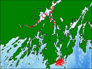
Browse_Graphic:
Browse_Graphic_File_Name:
Browse_Graphic_File_Description:
Thumbnail image showing location and extent of dataset coverage.
Browse_Graphic_File_Type: GIF
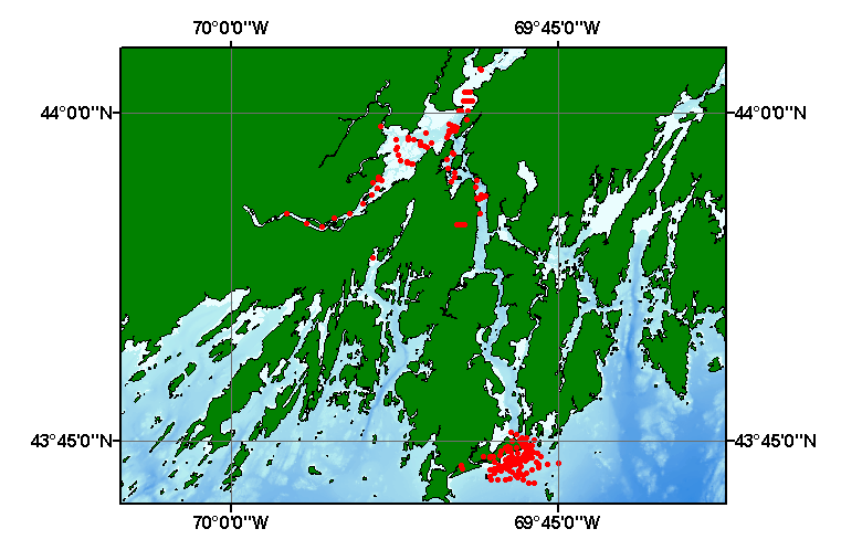
Browse_Graphic:
Browse_Graphic_File_Name:
Browse_Graphic_File_Description:
Image map showing location and coverage extent of the data layer.
Browse_Graphic_File_Type: GIF
Data_Set_Credit:
Please review the cross reference information for the original data set credits, and Larry Poppe for creating this ArcView shapefile.
Native_Data_Set_Environment:
Microsoft Windows XP Version 5.1 (Build 2600) Service Pack 2; ESRI ArcCatalog 9.2.2.1350
Cross_Reference:
Citation_Information:
Originator: I.V. Buynevich
Publication_Date: 2001
Title:
Fluvial-marine interaction and Holocene evolution of sandy barriers along an indented paraglacial coastline
Edition: 1.0
Series_Information:
Series_Name: Ph.D. Dissertation
Issue_Identification: 317 p.
Publication_Information:
Publication_Place: Boston, MA
Publisher: Boston University