Citation:
Citation_Information:
Originator: Larry Ward
Originator: Lawrence J. Poppe
Publication_Date: 2003
Title: Portsmouth Naval Yard Sediment Data (JOHNSTON94 shapefile)
Edition: 1.0
Geospatial_Data_Presentation_Form: vector digital data
Series_Information:
Series_Name: Open-File Report
Issue_Identification: 03-001
Publication_Information:
Publication_Place: Woods Hole Coastal and Marine Science Center, Woods Hole, MA
Publisher: U. S. Geological Survey, Coastal and Marine Geology Program
Online_Linkage: https://doi.org/10.3133/ofr031
Online_Linkage:
Online_Linkage: http://pubs.usgs.gov/of/2003/of03-001/htmldocs/data.htm
Larger_Work_Citation:
Citation_Information:
Originator: L.J. Poppe
Originator: V.F. Paskevich
Originator: S.J. Williams
Originator: M.E. Hastings
Originator: J.T. Kelley
Originator: D.F. Belknap
Originator: L.G. Ward
Originator: D.M. Fitzgerald
Originator: P.F. Larsen
Publication_Date: 2003
Title:
Surficial Sediment Data from the Gulf of Maine, Georges Bank, and vicinity: a GIS Compilation
Edition: 1.0
Series_Information:
Series_Name: Open-File Report
Issue_Identification: 03-001
Publication_Information:
Publication_Place: Reston, VA
Publisher: U. S. Geological Survey
Other_Citation_Details: 1 CD-ROM
Online_Linkage: http://pubs.usgs.gov/of/2003/of03-001/
Description:
Abstract:
The sediment data presented in this data layer were from an ecological study sited near the Portsmouth Naval Shipyard, Kittery, Maine. The analog data were originally converted into digital form for inclusion in a Gulf of Maine Contaminated Sediments Database.
Purpose:
The purpose of this data layer is to release a digital version of the data published in Johnston (1994).
Time_Period_of_Content:
Time_Period_Information:
Single_Date/Time:
Calendar_Date: 1994
Currentness_Reference: publication date
Status:
Progress: Complete
Maintenance_and_Update_Frequency: None planned
Spatial_Domain:
Bounding_Coordinates:
West_Bounding_Coordinate: -70.764028
East_Bounding_Coordinate: -70.640972
North_Bounding_Coordinate: 43.134639
South_Bounding_Coordinate: 43.068194
Keywords:
Theme:
Theme_Keyword_Thesaurus: USGS Metadata Identifier
Theme_Keyword: USGS:80863d61-227a-494f-9640-61bbb577c363
Theme:
Theme_Keyword_Thesaurus: None
Theme_Keyword: U.S. Geological Survey
Theme_Keyword: USGS
Theme_Keyword: Woods Hole Science Center
Theme_Keyword: UNH
Theme_Keyword: University of New Hamshire
Theme_Keyword: sediment
Theme_Keyword: texture
Theme_Keyword: sand
Theme_Keyword: gravel
Theme_Keyword: silt
Theme_Keyword: clay
Theme_Keyword: Open-File Report 03-001
Theme_Keyword: Coastal and Marine Geology Program
Theme_Keyword: CMGP
Theme_Keyword: sediment classification
Theme_Keyword: surficial classification
Theme_Keyword: pint shapefile
Theme_Keyword: points
Theme_Keyword: GIS
Theme_Keyword: Geographic Information System
Theme:
Theme_Keyword_Thesaurus: ISO 19115 Topic Category
Theme_Keyword: oceans
Theme_Keyword: location
Theme_Keyword: geoscientificInformation
Theme:
Theme_Keyword_Thesaurus: USGS Thesaurus
Theme_Keyword: grain-size analysis
Theme_Keyword: navigational data
Theme_Keyword: geospatial datasets
Theme_Keyword: sea-floor characteristics
Theme_Keyword: marine geology
Place:
Place_Keyword_Thesaurus: None
Place_Keyword: Portsmouth Naval Yard
Place_Keyword: Kittery
Place_Keyword: Maine
Place_Keyword: New England
Place_Keyword: Gulf of Maine
Place_Keyword: Atlantic
Place_Keyword: U.S. East Coast
Access_Constraints: None
Use_Constraints:
Public domain data from the U.S. Government are freely redistributable with proper metadata and source attribution. Please recognize the U.S. Geological Survey (USGS) as the source of this information.
Point_of_Contact:
Contact_Information:
Contact_Person_Primary:
Contact_Person: Lawrence J. Poppe
Contact_Organization: U.S. Geological Survey
Contact_Position: Geologist
Contact_Address:
Address_Type: mailing and physical address
Address: 384 Woods Hole Road
City: Woods Hole
State_or_Province: MA
Postal_Code: 02543-1598
Country: USA
Contact_Voice_Telephone: (508) 548-8700 x2314
Contact_Facsimile_Telephone: (508) 457-2310
Contact_Electronic_Mail_Address: [email protected]
Browse_Graphic:
Browse_Graphic_File_Name:
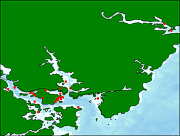
Browse_Graphic_File_Description:
Thumbnail image showing extent and distribution of data layer coverage.
Browse_Graphic_File_Type: GIF
Browse_Graphic:
Browse_Graphic_File_Name:
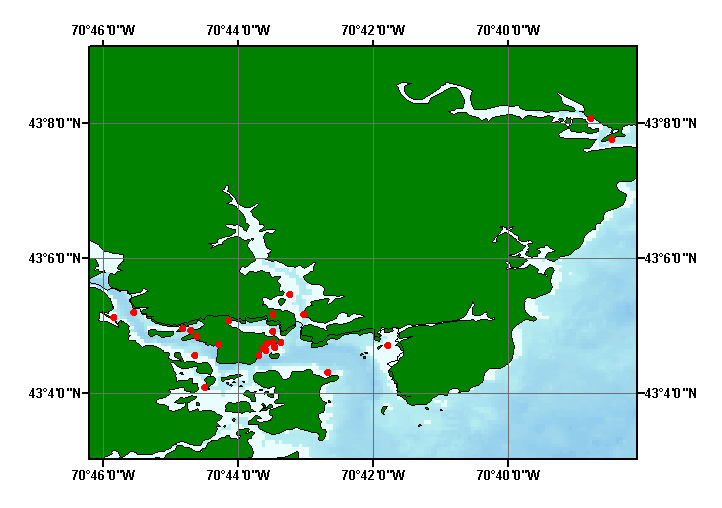
Browse_Graphic_File_Description:
Image map showing extent and distribution of data layer coverage.
Browse_Graphic_File_Type: GIF
Data_Set_Credit:
Please view the cross reference information for the original data set credit to Johnston (1994). Larry Ward (UNH) for entering the data from the source report, and Larry Poppe for creating the ArcView shapefile.
Native_Data_Set_Environment:
Microsoft Windows XP Version 5.1 (Build 2600) Service Pack 2; ESRI ArcCatalog 9.2.2.1350
Cross_Reference:
Citation_Information:
Originator: R.K. Johnston
Originator: W.R. Munns
Originator: F.T. Short
Originator: H.A. Walker
Publication_Date: 1994
Title:
Estuarine Ecological Risk Assessment for Portsmouth Naval Yard, Kittery, Maine
Edition: 1.0
Series_Information:
Series_Name: U.S. Navey Technical Report
Issue_Identification: Phase 1: Problem Formulation, TR 16276
Publication_Information:
Publication_Place: Naval Command, Control, and Ocean Surveillence Center
Publisher: RDT&E Division