Citation:
Citation_Information:
Originator: Lawrence J. Poppe
Publication_Date: 2003
Title:
Sediment Data from the Kennebec/Androscoggin River System (LARSEN02 shapefile)
Edition: 1.0
Geospatial_Data_Presentation_Form: vector digital data
Series_Information:
Series_Name: Open-File Report
Issue_Identification: 03-001
Publication_Information:
Publication_Place: Woods Hole Coastal and Marine Science Center, Woods Hole, MA
Publisher: U. S. Geological Survey, Coastal and Marine Geology Program
Online_Linkage: https://doi.org/10.3133/ofr031
Online_Linkage:
Online_Linkage: http://pubs.usgs.gov/of/2003/of03-001/htmldocs/data.htm
Larger_Work_Citation:
Citation_Information:
Originator: L.J. Poppe
Originator: V.F. Paskevich
Originator: S.J. Williams
Originator: M.E. Hastings
Originator: J.T. Kelley
Originator: D.F. Belknap
Originator: L.G. Ward
Originator: D.M. Fitzgerald
Originator: P.F. Larsen
Publication_Date: 2003
Title:
Surficial Sediment Data from the Gulf of Maine, Georges Bank, and vicinity: a GIS Compilation
Edition: 1.0
Series_Information:
Series_Name: Open-File Report
Issue_Identification: 03-001
Publication_Information:
Publication_Place: Reston, VA
Publisher: U. S. Geological Survey
Other_Citation_Details: 1 CD-ROM
Online_Linkage: http://pubs.usgs.gov/of/2003/of03-001/
Description:
Abstract:
The data in this layer are from an unpublished report produced by the Bigelow Laboratory. The source project was conducted primarily to examine contaminant distributions, but also produced sediment textural data. The data presented in this layer were not part of the Gulf of Maine Contaminated Sediments Database.
Purpose:
The purpose of this data layer is to make available a subset of a data set produced by P. Larsen and H. Gaudette of the Bigelow Laboratory of Boothbay Harbor, Maine. This subset contains information for those samples with sediment grain-size data, and which are located in the Kennebec/Androscoggin River system of Maine.
Time_Period_of_Content:
Time_Period_Information:
Single_Date/Time:
Calendar_Date: 2002
Currentness_Reference: publication date
Status:
Progress: Complete
Maintenance_and_Update_Frequency: None planned
Spatial_Domain:
Bounding_Coordinates:
West_Bounding_Coordinate: -69.931040
East_Bounding_Coordinate: -69.725760
North_Bounding_Coordinate: 44.271630
South_Bounding_Coordinate: 43.790260
Keywords:
Theme:
Theme_Keyword_Thesaurus: USGS Metadata Identifier
Theme_Keyword: USGS:cd09a3cd-0ded-43bd-a22d-18e8139cf57e
Theme:
Theme_Keyword_Thesaurus: None
Theme_Keyword: U.S. Geological Survey
Theme_Keyword: USGS
Theme_Keyword: Bigelow Laboratory
Theme_Keyword: Woods Hole Science Center
Theme_Keyword: WHSC
Theme_Keyword: rivers
Theme_Keyword: sediment
Theme_Keyword: texture
Theme_Keyword: sand
Theme_Keyword: silt
Theme_Keyword: clay
Theme_Keyword: grain size
Theme_Keyword: Open-File Report 03-001
Theme_Keyword: Coastal and Marine Geology Program
Theme_Keyword: CMGP
Theme_Keyword: sediment classification
Theme_Keyword: surficial classification
Theme_Keyword: point shapefile
Theme_Keyword: points
Theme_Keyword: GIS
Theme_Keyword: Geographic Information System
Theme:
Theme_Keyword_Thesaurus: ISO 19115 Topic Category
Theme_Keyword: oceans
Theme_Keyword: location
Theme_Keyword: geoscientificInformation
Theme:
Theme_Keyword_Thesaurus: USGS Thesaurus
Theme_Keyword: grain-size analysis
Theme_Keyword: navigational data
Theme_Keyword: geospatial datasets
Theme_Keyword: sea-floor characteristics
Theme_Keyword: marine geology
Place:
Place_Keyword_Thesaurus: None
Place_Keyword: Maine
Place_Keyword: Kenebec River
Place_Keyword: Androscoggin River
Place_Keyword: New England
Place_Keyword: Muddy River
Place_Keyword: Cathance River
Place_Keyword: Eastern River
Place_Keyword: Merrymeeting Bay
Place_Keyword: Abagadasset River
Place_Keyword: U.S. East Coast
Access_Constraints: None
Use_Constraints:
Public domain data from the U.S. Government are freely redistributable with proper metadata and source attribution. Please recognize the U.S. Geological Survey (USGS) as the source of this information.
Point_of_Contact:
Contact_Information:
Contact_Person_Primary:
Contact_Person: Lawrence J. Poppe
Contact_Organization: U.S. Geological Survey
Contact_Position: Geologist
Contact_Address:
Address_Type: mailing and physical address
Address: 384 Woods Hole Road
City: Woods Hole
State_or_Province: MA
Postal_Code: 02543-1598
Country: USA
Contact_Voice_Telephone: (508) 548-8700 x2314
Contact_Facsimile_Telephone: (508) 457-2310
Contact_Electronic_Mail_Address: [email protected]
Browse_Graphic:
Browse_Graphic_File_Name:
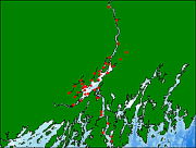
Browse_Graphic_File_Description:
Thumbnail image showing extent and distribution of data layer coverage.
Browse_Graphic_File_Type: GIF
Browse_Graphic:
Browse_Graphic_File_Name:
Browse_Graphic_File_Description:
Image map showing extent and distribution of data layer coverage.
Browse_Graphic_File_Type: GIF
Data_Set_Credit:
Please review the cross reference information for the original data set credits, and Larry Poppe for creating this ArcView shapefile.
Native_Data_Set_Environment:
Microsoft Windows XP Version 5.1 (Build 2600) Service Pack 2; ESRI ArcCatalog 9.2.2.1350
Cross_Reference:
Citation_Information:
Originator: P.F. Larsen
Originator: H.E. Gaudette
Publication_Date: 2002
Title:
Spatial and temporal aspects of sedimentary contaminant concentrations in the tidal portions of the Kennebec/Androscoggin River systems
Edition: 1.0
Series_Information:
Series_Name: Report
Issue_Identification:
Report to the Surface Water Ambient Toxics Monitoring Program, Maine Department of Environmental Protection
Publication_Information:
Publication_Place: West Boothbay Harbor, ME
Publisher: Bgelow Laboratory for Ocean Sciences