Citation:
Citation_Information:
Originator: Lawrence J. Poppe
Publication_Date: 2003
Title:
Sediments of Narragansett Bay acquired in 1960 (MCMASTER60 shapefile)
Edition: 1.0
Geospatial_Data_Presentation_Form: vector digital data
Series_Information:
Series_Name: Open-File Report
Issue_Identification: 03-001
Publication_Information:
Publication_Place: Woods Hole Coastal and Marine Science Center, Woods Hole, MA
Publisher: U. S. Geological Survey, Coastal and Marine Geology Program
Online_Linkage: https://doi.org/10.3133/ofr031
Online_Linkage:
Online_Linkage: http://pubs.usgs.gov/of/2003/of03-001/htmldocs/data.htm
Larger_Work_Citation:
Citation_Information:
Originator: L.J. Poppe
Originator: V.F. Paskevich
Originator: S.J. Williams
Originator: M.E. Hastings
Originator: J.T. Kelley
Originator: D.F. Belknap
Originator: L.G. Ward
Originator: D.M. Fitzgerald
Originator: P.F. Larsen
Publication_Date: 2003
Title:
Surficial Sediment Data from the Gulf of Maine, Georges Bank, and vicinity: a GIS Compilation
Edition: 1.0
Series_Information:
Series_Name: Open-File Report
Issue_Identification: 03-001
Publication_Information:
Publication_Place: Reston, VA
Publisher: U. S. Geological Survey
Other_Citation_Details:
Data is released via CD-ROM media. This digital publication may also be available via the web at pubs.usgs.gov
Online_Linkage: http://pubs.usgs.gov/of/2003/of03-001
Description:
Abstract:
Gravel, sand, silt, and clay contents were determined for samples from Narragansett Bay and the adjacent Rhode Island Shelf. In the Narragansett Bay system, clayey silt and sand-silt-clay are the most abundant sediments. Sand is abundant locally and on the inner shelf. In general, toward the lower passages of the Bay the sediments show a progressive change to coarser textures.
Purpose:
The purpose of this data layer is to release a digital version of the sediment data used in the interpretations published by McMaster (1960).
Time_Period_of_Content:
Time_Period_Information:
Single_Date/Time:
Calendar_Date: 1960
Currentness_Reference: publication date
Status:
Progress: Complete
Maintenance_and_Update_Frequency: None planned
Spatial_Domain:
Bounding_Coordinates:
West_Bounding_Coordinate: -71.441700
East_Bounding_Coordinate: -71.162000
North_Bounding_Coordinate: 41.766700
South_Bounding_Coordinate: 41.434000
Keywords:
Theme:
Theme_Keyword_Thesaurus: USGS Metadata Identifier
Theme_Keyword: USGS:644d04d3-07c5-4fd2-8f42-6dd9271f6d84
Theme:
Theme_Keyword_Thesaurus: None
Theme_Keyword: U.S. Geological Survey
Theme_Keyword: USGS
Theme_Keyword: Coastal and Marine Geology Program
Theme_Keyword: CMGP
Theme_Keyword: Woods Hole Science Center
Theme_Keyword: WHSC
Theme_Keyword: GIS
Theme_Keyword: sediment
Theme_Keyword: gravel
Theme_Keyword: sand
Theme_Keyword: silt
Theme_Keyword: clay
Theme_Keyword: texture
Theme_Keyword: National Assessment of Marine Sand and Gravel Resources
Theme_Keyword: Open-File Report 03-001
Theme_Keyword: sediment classification
Theme_Keyword: surficial classification
Theme_Keyword: point shapefile
Theme_Keyword: points
Theme_Keyword: Geographic Information System
Theme:
Theme_Keyword_Thesaurus: ISO 19115 Topic Category
Theme_Keyword: oceans
Theme_Keyword: location
Theme_Keyword: geoscientificInformation
Theme:
Theme_Keyword_Thesaurus: USGS Thesaurus
Theme_Keyword: grain-size analysis
Theme_Keyword: navigational data
Theme_Keyword: geospatial datasets
Theme_Keyword: sea-floor characteristics
Theme_Keyword: marine geology
Place:
Place_Keyword_Thesaurus: None
Place_Keyword: Narragansett Bay
Place_Keyword: Rhode Island
Place_Keyword: Providence, RI
Place_Keyword: Mount Hope Bay
Place_Keyword: Greenwich Bay
Place_Keyword: New England
Place_Keyword: U.S. East Coast
Place_Keyword: Atlantic Ocean
Access_Constraints: None
Use_Constraints:
Public domain data from the U.S. Government are freely redistributable with proper metadata and source attribution. Please recognize the U.S. Geological Survey (USGS) as the source of this information.
Point_of_Contact:
Contact_Information:
Contact_Person_Primary:
Contact_Person: Lawrence J. Poppe
Contact_Organization: U.S. Geologcal Survey
Contact_Position: Geologist
Contact_Address:
Address_Type: mailing and physical address
Address: 384 Woods Hole Road
City: Woods Hole
State_or_Province: MA
Postal_Code: 02543-1598
Country: USA
Contact_Voice_Telephone: (508) 548-8700 x2314
Contact_Facsimile_Telephone: (508) 457-2310
Contact_Electronic_Mail_Address: [email protected]
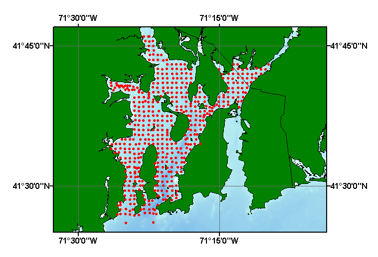
Browse_Graphic:
Browse_Graphic_File_Name:
Browse_Graphic_File_Description:
Thumbnail image showing extent and distribution of data layer coverage.
Browse_Graphic_File_Type: GIF
Browse_Graphic:
Browse_Graphic_File_Name:
Browse_Graphic_File_Description:
Image map showing extent and distribution of data layer coverage.
Browse_Graphic_File_Type: GIF
Data_Set_Credit:
Please review the cross reference information for the original data set credit to R.L. McMaster. Larry Poppe for entering the data from the source report and creating the ArcView shapefile.
Native_Data_Set_Environment:
Microsoft Windows XP Version 5.1 (Build 2600) Service Pack 2; ESRI ArcCatalog 9.2.2.1350
Cross_Reference:
Citation_Information:
Originator: R.L. McMaster
Publication_Date: 1960
Title:
Sediments of Narragansett Bay and Rhode Island Sound, Rhode Island
Edition: 1.0
Series_Information:
Series_Name: Journal of Sedimentary Petrology
Issue_Identification: v. 30, no. 2, p. 249-274.