Citation:
Citation_Information:
Originator: Lawrence J. Poppe
Publication_Date: 2003
Title: Sediments of Boston Harbor acquired in 1968 (MENCHER shapefile)
Edition: 1.0
Geospatial_Data_Presentation_Form: vector digital data
Series_Information:
Series_Name: Open-File Report
Issue_Identification: 03-001
Publication_Information:
Publication_Place: Woods Hole Coastal and Marine Science Center, Woods Hole, MA
Publisher: U. S. Geological Survey, Coastal and Marine Geology Program
Online_Linkage: https://doi.org/10.3133/ofr031
Online_Linkage:
Online_Linkage: http://pubs.usgs.gov/of/2003/of03-001/htmldocs/data.htm
Larger_Work_Citation:
Citation_Information:
Originator: L.J. Poppe
Originator: V.F. Paskevich
Originator: S.J. Williams
Originator: M.E. Hastings
Originator: J.T. Kelley
Originator: D.F. Belknap
Originator: L.G. Ward
Originator: D.M. Fitzgerald
Originator: P.F. Larsen
Publication_Date: 2003
Title:
Surficial Sediment Data from the Gulf of Maine, Georges Bank, and vicinity: a GIS Compilation
Edition: 1.0
Series_Information:
Series_Name: Open-File Report
Issue_Identification: 03-001
Publication_Information:
Publication_Place: Reston, VA
Publisher: U. S. Geological Survey
Other_Citation_Details: 1 CD-ROM
Online_Linkage: http://pubs.usgs.gov/of/2003/of03-001/
Description:
Abstract:
A study was made of the composition, grain-size distribution, and organic content of grab samples collected from Boston Harbor. In general, the coarsest mean sizes occur in the channels scoured by dredging or tidal action, and the finest in areas where no dredging has occurred and where tidal velocities are at a minimum.
Purpose:
The purpose of this data layer is to release a digital version of the grain-size data released in the publication Mencher et al. (1968).
Time_Period_of_Content:
Time_Period_Information:
Single_Date/Time:
Calendar_Date: 1968
Currentness_Reference: publication date
Status:
Progress: Complete
Maintenance_and_Update_Frequency: None planned
Spatial_Domain:
Bounding_Coordinates:
West_Bounding_Coordinate: -71.046330
East_Bounding_Coordinate: -70.930780
North_Bounding_Coordinate: 42.353610
South_Bounding_Coordinate: 42.272490
Keywords:
Theme:
Theme_Keyword_Thesaurus: USGS Metadata Identifier
Theme_Keyword: USGS:bbec189e-7d36-45fa-98cc-d0979879ba26
Theme:
Theme_Keyword_Thesaurus: None
Theme_Keyword: U.S. Geological Survey
Theme_Keyword: USGS
Theme_Keyword: Coastal and Marine Geology Program
Theme_Keyword: CMGP
Theme_Keyword: Woods Hole Science Center
Theme_Keyword: WHSC
Theme_Keyword: sediments
Theme_Keyword: shapefile
Theme_Keyword: mean
Theme_Keyword: grain-size
Theme_Keyword: Open-File Report 03-001
Theme_Keyword: GIS
Theme_Keyword: sediment classification
Theme_Keyword: surficial classification
Theme_Keyword: point shapefile
Theme_Keyword: points
Theme:
Theme_Keyword_Thesaurus: ISO 19115 Topic Category
Theme_Keyword: oceans
Theme_Keyword: location
Theme_Keyword: geoscientificInformation
Theme:
Theme_Keyword_Thesaurus: USGS Thesaurus
Theme_Keyword: navigational data
Theme_Keyword: geospatial datasets
Theme_Keyword: sea-floor characteristics
Theme_Keyword: marine geology
Place:
Place_Keyword_Thesaurus: None
Place_Keyword: Boston Harbor
Place_Keyword: New England
Place_Keyword: Boston
Place_Keyword: U.S. East Coast
Place_Keyword: Atlantic Ocean
Access_Constraints: None
Use_Constraints:
Public domain data from the U.S. Government are freely redistributable with proper metadata and source attribution. Please recognize the U.S. Geological Survey (USGS) as the source of this information.
Point_of_Contact:
Contact_Information:
Contact_Person_Primary:
Contact_Person: Lawrence J. Poppe
Contact_Organization: U.S. Geological Survey
Contact_Position: Geologist
Contact_Address:
Address_Type: mailing and physical address
Address: 384 Woods Hole Road
City: Woods Hole
State_or_Province: MA
Postal_Code: 02543-1598
Country: USA
Contact_Voice_Telephone: (508) 548-8700 x2314
Contact_Facsimile_Telephone: (508) 457-2310
Contact_Electronic_Mail_Address: [email protected]
Browse_Graphic:
Browse_Graphic_File_Name:
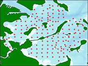
Browse_Graphic_File_Description:
Thumbnail image showing extent and distribution of data layer coverage.
Browse_Graphic_File_Type: GIF
Browse_Graphic:
Browse_Graphic_File_Name:
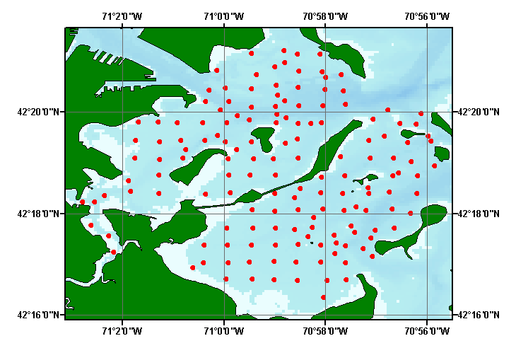
Browse_Graphic_File_Description:
Image map showing extent and distribution of data layer coverage.
Browse_Graphic_File_Type: GIF
Data_Set_Credit:
Please view the cross reference for the data set credit to Mencher et al. (1968). Larry Poppe for entering the data from the source report and creating the ArcView shapefile.
Native_Data_Set_Environment:
Microsoft Windows XP Version 5.1 (Build 2600) Service Pack 2; ESRI ArcCatalog 9.2.2.1350
Cross_Reference:
Citation_Information:
Originator: Ely Mencher
Originator: R.A. Copeland
Originator: H. Payson
Publication_Date: 1968
Title: Surficial Sediments of Boston Harbor, Massachusetts
Edition: 1.0
Series_Information:
Series_Name: Journal of Sedimentary Petrology
Issue_Identification: v. 38, no. 1, p. 79-86.