Citation:
Citation_Information:
Originator: Lawrence J. Poppe
Publication_Date: 2003
Title:
Massachusetts Water Resources Administration Sediment Data for Boston Harbor and Massachusetts Bay acquired in 1993 - 1995 (MWRA shapefile)
Edition: 1.0
Geospatial_Data_Presentation_Form: vector digital data
Series_Information:
Series_Name: Open-File Report
Issue_Identification: 03-001
Publication_Information:
Publication_Place: Woods Hole Coastal and Marine Science Center, Woods Hole, MA
Publisher: U. S. Geological Survey, Coastal and Marine Geology Program
Online_Linkage: https://doi.org/10.3133/ofr031
Online_Linkage:
Online_Linkage: http://pubs.usgs.gov/of/2003/of03-001/htmldocs/data.htm
Larger_Work_Citation:
Citation_Information:
Originator: L.J. Poppe
Originator: V.F. Paskevich
Originator: S.J. Williams
Originator: M.E. Hastings
Originator: J.T. Kelley
Originator: D.F. Belknap
Originator: L.G. Ward
Originator: D.M. Fitzgerald
Originator: P.F. Larsen
Publication_Date: 2003
Title:
Surficial Sediment Data from the Gulf of Maine, Georges Bank, and vicinity: a GIS Compilation
Edition: 1.0
Series_Information:
Series_Name: Open-File Report
Issue_Identification: 03-001
Publication_Information:
Publication_Place: Reston, VA
Publisher: U. S. Geological Survey
Other_Citation_Details: 1 CD-ROM
Online_Linkage: http://pubs.usgs.gov/of/2003/of03-001/
Description:
Abstract:
The samples in this dataset were collected and analyzed under the direction of the Massachusetts Water Resources Administration. The data were generated to study the effects of the Boston sewage outflow. Data were previously incorporated into the USGS's Gulf of Maine Contaminated Sediments Database.
Purpose:
The purpose of this data layer is to release a digital version of the data published in Blake et al. (1993), Coats et al. (1994), Coats (1995), and Kropp and Diaz (1995) for interpretation of textural distributions.
Time_Period_of_Content:
Time_Period_Information:
Range_of_Dates/Times:
Beginning_Date: 1993
Ending_Date: 1995
Currentness_Reference: publication date
Status:
Progress: Complete
Maintenance_and_Update_Frequency: None planned
Spatial_Domain:
Bounding_Coordinates:
West_Bounding_Coordinate: -71.045830
East_Bounding_Coordinate: -70.000180
North_Bounding_Coordinate: 42.658830
South_Bounding_Coordinate: 41.897830
Keywords:
Theme:
Theme_Keyword_Thesaurus: USGS Metadata Identifier
Theme_Keyword: USGS:5c6be21a-5403-49ae-b155-08f19516e86d
Theme:
Theme_Keyword_Thesaurus: None
Theme_Keyword: U.S. Geological Survey
Theme_Keyword: USGS
Theme_Keyword: Woods Hole Science Center
Theme_Keyword: WHSC
Theme_Keyword: MWRA
Theme_Keyword: Massachusetts Water Resources Administration
Theme_Keyword: sediment
Theme_Keyword: texture
Theme_Keyword: grain size
Theme_Keyword: gravel
Theme_Keyword: sand
Theme_Keyword: silt
Theme_Keyword: clay
Theme_Keyword: fines
Theme_Keyword: classification
Theme_Keyword: Open-File Report 03-001
Theme_Keyword: Coastal and Marine Geology Program
Theme_Keyword: CMGP
Theme_Keyword: Gulf of Maine Contaminated Sediments Database
Theme_Keyword: surficial sediments
Theme_Keyword: sediment classification
Theme_Keyword: surficial classification
Theme_Keyword: point shapefile
Theme_Keyword: points
Theme_Keyword: GIS
Theme:
Theme_Keyword_Thesaurus: ISO 19115 Topic Category
Theme_Keyword: oceans
Theme_Keyword: location
Theme_Keyword: geoscientificInformation
Theme:
Theme_Keyword_Thesaurus: USGS Thesaurus
Theme_Keyword: grain-size analysis
Theme_Keyword: navigational data
Theme_Keyword: geospatial datasets
Theme_Keyword: sea-floor characteristics
Theme_Keyword: marine geology
Place:
Place_Keyword_Thesaurus: None
Place_Keyword: Boston Harbor
Place_Keyword: Massachusetts Bay
Place_Keyword: Boston
Place_Keyword: Massachusetts
Place_Keyword: U.S. East Coast
Access_Constraints: None
Use_Constraints:
Public domain data from the U.S. Government are freely redistributable with proper metadata and source attribution. Please recognize the U.S. Geological Survey (USGS) as the source of this information.
Point_of_Contact:
Contact_Information:
Contact_Person_Primary:
Contact_Person: Lawrence J. Poppe
Contact_Organization: U.S. Geological Survey
Contact_Position: Geologist
Contact_Address:
Address_Type: mailing and physical address
Address: 384 Woods Hole Road
City: Woods Hole
State_or_Province: MA
Postal_Code: 02543-1598
Country: USA
Contact_Voice_Telephone: (508) 548-8700 x2314
Contact_Facsimile_Telephone: (508) 457-2310
Contact_Electronic_Mail_Address: [email protected]
Browse_Graphic:
Browse_Graphic_File_Name:
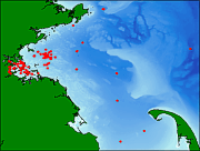
Browse_Graphic_File_Description:
Thumbnail image showing extent and distribution of data layer coverage.
Browse_Graphic_File_Type: GIF
Browse_Graphic:
Browse_Graphic_File_Name:
Browse_Graphic_File_Description:
Image map showing extent and distribution of data layer coverage.
Browse_Graphic_File_Type: GIF
Data_Set_Credit:
Please view the cross reference information for the original data set credits, and Larry Poppe for creating the ArcView shapefile.
Native_Data_Set_Environment:
Microsoft Windows XP Version 5.1 (Build 2600) Service Pack 2; ESRI ArcCatalog 9.2.2.1350
Cross_Reference:
Citation_Information:
Originator: M.R. Buchholtz ten Brink
Originator: F.T. Manheim
Originator: E.L. Mecray
Originator: M.E. Hastings
Originator: J.M. Currence
Originator: J.W. Harrington
Originator: T.J. Fredette
Originator: S.H. Jones
Originator: M.L. Liebman
Originator: P.F. Larsen
Originator: W.S. Leo
Originator: B.W. Tripp
Originator: G.T. Wallace
Originator: L.G. Ward
Publication_Date: 2003
Title: Contaminated Sediments Database for the Gulf of Maine
Edition: 1.0
Series_Information:
Series_Name: U.S. Geological Survey Open-File Report
Issue_Identification: 02-403
Publication_Information:
Publication_Place: Reston, VA
Publisher: U.S. Geological Survey