Online Links:
Online Links:
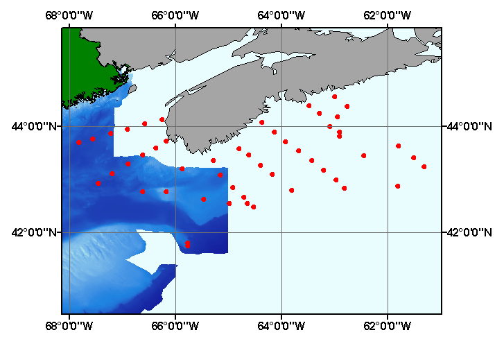
| Range of values | |
|---|---|
| Minimum: | 41.750 |
| Maximum: | 44.5670 |
| Units: | Decimal Degrees |
| Resolution: | 0.001 |
| Range of values | |
|---|---|
| Minimum: | -67.817 |
| Maximum: | -61.300 |
| Units: | Decimal Degrees |
| Resolution: | 0.001 |
| Range of values | |
|---|---|
| Minimum: | 26 |
| Maximum: | 1038 |
| Units: | meters |
| Resolution: | 1 |
| Range of values | |
|---|---|
| Minimum: | 0 |
| Maximum: | 98 |
| Units: | percent |
| Resolution: | 1 |
| Range of values | |
|---|---|
| Minimum: | 0 |
| Maximum: | 100 |
| Units: | percent |
| Resolution: | 1 |
| Range of values | |
|---|---|
| Minimum: | 0 |
| Maximum: | 99 |
| Units: | percent |
| Resolution: | 1 |
| Value | Definition |
|---|---|
| PEZZETTA1962 | Information unavailable from original metadata. |
Please review the cross reference information for the original data set credit to Pezzetta (1962), and Polly Hastings for entering the data from the source report, and Larry Poppe for creating the ArcView shapefile.
The purpose of this data layer is to provide a digital version of the sediment data published in Pezzetta (1962).
Are there legal restrictions on access or use of the data?Access_Constraints: None
Use_Constraints:Public domain data from the U.S. Government are freely redistributable with proper metadata and source attribution. Please recognize the U.S. Geological Survey (USGS) as the source of this information.
Although these data have been used by the U.S. Geological Survey (USGS), U.S. Department of the Interior (DOI), no warranty expressed or implied is made by the U.S. Geological Survey as to the accuracy of the data. The act of distribution shall not constitute any such warranty, and no responsibility is assumed by the USGS in the use of these data or related materials. Any use of trade, product, or firm names is for descriptive purposes only and does not imply endorsement by the U.S. Government.
| Data format: | Five files (pezzetta.shp, pezzetta.dbf, pezzetta.shx, pezzetta.sbx, pezzetta.sbn) comprising the ArcView point shapefile components, 'prj' and 'avl' files, metadata text file and browse graphic. in format SHP (version 3.2) ESRI point shapefile Size: 0.05 |
|---|---|
| Network links: |
http://pubs.usgs.gov/of/2003/of03-001/data/seddata/pezzetta/pezzetta.zip |
| Media you can order: |
CD-ROM
(Density 650
Mbytes)
(format ISO 9660)
Note: The user must have a computer system with a CD-ROM available. To browse the information contained on this CD-ROM, the user must have a current WWW browser available. The user must also have software installed on their computer to unzip the archived file. |
These data are available in Environmental Systems Research Institute (ESRI) shapefile format. The user must have ArcGIS or ArcView 3.0 or greater software to read and process the data file. In lieu of ArcView or ArcGIS, the user may utilize another GIS application package capable of importing the data. A free data viewer, ArcExplorer, capable of displaying the data is available from ESRI at www.esri.com.