Citation:
Citation_Information:
Originator: Lawrence J. Poppe
Publication_Date: 2003
Title: Boston Harbor and approaches samples (WILLETT72 shapefile
Edition: 1.0
Geospatial_Data_Presentation_Form: vector digital data
Series_Information:
Series_Name: Open-File Report
Issue_Identification: 03-001
Publication_Information:
Publication_Place: Woods Hole Coastal and Marine Science Center, Woods Hole, MA
Publisher: U. S. Geological Survey, Coastal and Marine Geology Program
Online_Linkage: https://doi.org/10.3133/ofr031
Online_Linkage:
Online_Linkage: http://pubs.usgs.gov/of/2003/of03-001/htmldocs/data.htm
Larger_Work_Citation:
Citation_Information:
Originator: L.J. Poppe
Originator: V.F. Paskevich
Originator: S.J. Williams
Originator: M.E. Hastings
Originator: J.T. Kelley
Originator: D.F. Belknap
Originator: L.G. Ward
Originator: D.M. Fitzgerald
Originator: P.F. Larsen
Publication_Date: 2003
Title:
Surficial Sediment Data from the Gulf of Maine, Georges Bank, and Vicinity: a GIS Compilation
Edition: 1.0
Series_Information:
Series_Name: Open-File Report
Issue_Identification: 03-001
Publication_Information:
Publication_Place: Reston, VA
Publisher: U. S. Geological Survey
Other_Citation_Details: 1 CD-ROM
Online_Linkage: http://pubs.usgs.gov/of/2003/of03-001
Description:
Abstract:
Boston Harbor (and its approaches) is a glacially carved, tidally dominated estuary in western Massachusetts Bay. Characterized by low river discharge and significant human impact, the harbor is typical of many bays and estuaries along the New England coast. The sands and gravels that floor Massachusetts Bay and the Harbor approaches are relict glacial sediments. However, fine-grained sediments are accumulating in areas of lower energy.
Purpose:
The purpose of this data set is to release a digital version of the data contained in Willett (1972)
Time_Period_of_Content:
Time_Period_Information:
Single_Date/Time:
Calendar_Date: 1972
Currentness_Reference: publication date
Status:
Progress: Complete
Maintenance_and_Update_Frequency: None planned
Spatial_Domain:
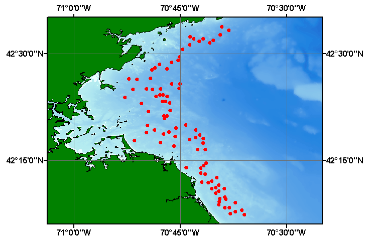
Bounding_Coordinates:
West_Bounding_Coordinate: -70.878820
East_Bounding_Coordinate: -70.599270
North_Bounding_Coordinate: 42.564340
South_Bounding_Coordinate: 42.121880
Keywords:
Theme:
Theme_Keyword_Thesaurus: USGS Metadata Identifier
Theme_Keyword: USGS:704894bf-6080-43a4-abae-0f6337e1379f
Theme:
Theme_Keyword_Thesaurus: None
Theme_Keyword: U.S. Geological Survey
Theme_Keyword: USGS
Theme_Keyword: Coastal and Marine Geology Program
Theme_Keyword: CMGP
Theme_Keyword: sediment classification
Theme_Keyword: sedimentary environment
Theme_Keyword: Open-File Report 03-001
Theme_Keyword: texture
Theme_Keyword: surficial classification
Theme_Keyword: point shapefile
Theme_Keyword: points
Theme_Keyword: GIS
Theme_Keyword: Geographic Information System
Theme:
Theme_Keyword_Thesaurus: ISO 19115 Topic Category
Theme_Keyword: oceans
Theme_Keyword: location
Theme_Keyword: geoscientificInformation
Theme:
Theme_Keyword_Thesaurus: USGS Thesaurus
Theme_Keyword: navigational data
Theme_Keyword: geospatial datasets
Theme_Keyword: sea-floor characteristics
Theme_Keyword: marine geology
Place:
Place_Keyword_Thesaurus: None
Place_Keyword: U.S. Atlantic East Coast
Place_Keyword: Gulf of Maine
Place_Keyword: Boston Harbor
Place_Keyword: Massachusetts Bay
Access_Constraints: None
Use_Constraints:
Public domain data from the U.S. Government are freely redistributable with proper metadata and source attribution. Please recognize the U.S. Geological Survey (USGS) as the source of this information.
Point_of_Contact:
Contact_Information:
Contact_Person_Primary:
Contact_Person: Lawrence J. Poppe
Contact_Organization: U.S. Geological Survey
Contact_Position: Geologist
Contact_Address:
Address_Type: mailing and physical address
Address: 384 Woods Hole Road
City: Woods Hole
State_or_Province: MA
Postal_Code: 02543-1598
Country: USA
Contact_Voice_Telephone: (508) 548-8700 x2314
Contact_Facsimile_Telephone: (508) 457-2310
Contact_Electronic_Mail_Address: [email protected]
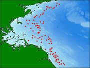
Browse_Graphic:
Browse_Graphic_File_Name:
Browse_Graphic_File_Description:
Thumbnail image showing extent and distribution of data layer coverage.
Browse_Graphic_File_Type: GIF
Browse_Graphic:
Browse_Graphic_File_Name:
Browse_Graphic_File_Description:
Image map showing extent and distribution of data layer coverage.
Browse_Graphic_File_Type: GIF
Data_Set_Credit:
Please review the cross reference information for the original data set credit to Willett (1972). Polly Hastings for digitizing the sample locations; Larry Poppe for creating the shapefile.
Native_Data_Set_Environment:
Microsoft Windows XP Version 5.1 (Build 2600) Service Pack 2; ESRI ArcCatalog 9.2.2.1350
Cross_Reference:
Citation_Information:
Originator: C.F. Willett
Publication_Date: 1972
Title: Summary of the Massachusetts Coastal Mineral Inventory Survey
Edition: 1.0
Series_Information:
Series_Name: Raytheon Company Report
Issue_Identification: Information unavailable from original metadata.
Publication_Information:
Publication_Place: Lexington, MA
Publisher: Raytheon Company
Larger_Work_Citation:
Citation_Information:
Originator: M.G. Fitzgerald
Publication_Date: 1980
Title:
Anthropogenic Influence of the Sedimentary regime of an Urban Estuary - Boston Harbor
Edition: 1.0
Series_Information:
Series_Name: Doctoral Dissertation
Issue_Identification: 297 p.
Publication_Information:
Publication_Place: Woods Hole, MA
Publisher: Woods Hole Oceanographic Institution