Long Island Sound Surficial Sediment Data (LISSEDDATA)

Metadata also available as - [Outline] - [Parseable text] - [XML]

Frequently anticipated questions:


What does this data set describe?

Title: Long Island Sound Surficial Sediment Data (LISSEDDATA)
Abstract:
Many scientific questions and policy issues related to sediments in Long Island Sound require data of historical, regional and interdisciplinary scope. Existent data is often geographically clustered and its references are widely dispersed and not always accessible. Acquisition of new data is expensive and may duplicate previous efforts if a full interpretation of existent data has not occurred. Consequently, the body of existing data needs to be utilized to its maximum so that it can serve as a foundation, baseline, and starting point for further work. An accessible, documented, and simple-to-use compilation of existing data on sediment properties is essential for environmental managers, policy-makers, scientific researchers, and interested members of the public. To this end, we have compiled, edited, and integrated all of the available data on sediment texture and bottom descriptions throughout the Sound in order to produce a regional dataset which will be available to a wide variety of current and potential users. The significant feature of this textural dataset is that it comprehensively contains original data from many heterogeneous sources.
Supplemental_Information:
This dataset is a subset of the original data set released in Long Island Sound Environmental Studies: Open-File Report 98-502.
  1. How might this data set be cited?
    Poppe, L.J., and Paskevich, V.F., 2004, Long Island Sound Surficial Sediment Data (LISSEDDATA): Open-File Report 2004-1003, U.S. Geological Survey, Coastal and Marine Geology Program, Woods Hole Coastal and Marine Science Center, Woods Hole, MA.

    Online Links:

    This is part of the following larger work.

    Poppe, L.J., Paskevich, V.F., Moser, M.S., DiGiacomo-Cohen, M.L., and Christman, E.B., 2004, Sidescan Sonar Imagery and Surficial Geologic Interpretation of the Sea Floor off Branford, Connecticut: Open-File Report 2004-1003, U.S. Geological Survey, Reston, VA.

    Online Links:

    Other_Citation_Details:
    Data are released via CD-ROM media. This digital publication may also be available via the web at pubs.usgs.gov
  2. What geographic area does the data set cover?
    West_Bounding_Coordinate: -73.939000
    East_Bounding_Coordinate: -71.838333
    North_Bounding_Coordinate: 41.422170
    South_Bounding_Coordinate: 40.760510
  3. What does it look like?
    https://pubs.usgs.gov/of/2004/1003/data/seddata/lisseddata.gif (GIF)
    Overview showing the coverage and extent of the Long Island Sound sediment data layer.
  4. Does the data set describe conditions during a particular time period?
    Beginning_Date: 1931
    Ending_Date: 1998
    Currentness_Reference:
    publication date
  5. What is the general form of this data set?
    Geospatial_Data_Presentation_Form: vector digital data
  6. How does the data set represent geographic features?
    1. How are geographic features stored in the data set?
      This is a Vector data set. It contains the following vector data types (SDTS terminology):
      • Entity point (14621)
    2. What coordinate system is used to represent geographic features?
      Horizontal positions are specified in geographic coordinates, that is, latitude and longitude. Latitudes are given to the nearest 0.000001. Longitudes are given to the nearest 0.000001. Latitude and longitude values are specified in Decimal degrees. The horizontal datum used is North American Datum of 1927.
      The ellipsoid used is Clarke 1866.
      The semi-major axis of the ellipsoid used is 6378206.400000.
      The flattening of the ellipsoid used is 1/294.978698.
  7. How does the data set describe geographic features?
    lisseddata
    Shapefile Attribute Table (Source: ESRI)
    FID
    Internal feature number. (Source: ESRI) Sequential unique whole numbers that are automatically generated.
    Shape
    Feature geometry. (Source: ESRI) Coordinates defining the features.
    SEQUENCE__
    Sequential identification number, generated by the database (Excel) as the data were entered; gaps in these sequential numbers are present. (Source: Compilers)
    Range of values
    Minimum:1
    Maximum:14974
    Units:sequential count
    Resolution:1.1
    USGS_DB_ID
    Unique identification number (consisting of 2 characters and 3 numerics) generated in the sedimentation laboratory of the USGS's Woods Hole Science Center for the Atlantic Margin Texture Database. (Source: Data Manager) Characters and numbers
    FIELD_ID
    Sample name or number as assigned in the field (Source: Scientists) Characters and numbers
    REQUESTER
    Name of Principle Investigator or designee requesting analysis from lab (Source: Scientists) Character String containing the names of scientists (usually first letter of first name and last name
    PROJ_NAME
    Project under which samples were taken, or data generated (i.e. NOS Digital Database); sometimes indicates more specific area (Source: Scientists) Character string containg the names of project under which samples were obtained
    SOURCE
    Bibliographic reference in which the data were originally published, or the organization that produced the unpublished data. (Source: Data Manager) Character String usually containing the name of the first author and year of publication
    AREA
    General geographic area from where data were obtained. General enough to easily locate on a state map. (Source: Scientist) Character String
    LATITUDE
    Latitude coordinate of sample location. Attribute measurement resolution variable. (Source: Scientist)
    Range of values
    Minimum:40.76051
    Maximum:41.42217
    Units:Decimal degrees
    LONGITUDE
    Longitude coordinate of sample location. Attribute measurement resolution variable. (Source: Scientist)
    Range of values
    Minimum:-73.939
    Maximum:-71.83833
    Units:Decimal degrees
    DEPTH_M
    Measured depth of water overlying sediment at sample time, not corrected for tides, in meters (Source: Scientist)
    Range of values
    Minimum:2
    Maximum:366
    Units:meters
    Resolution:1
    T_DEPTH
    Top depth of the sample below the sediment-water interface, in cm (Source: Scientist)
    Range of values
    Minimum:0
    Maximum:752
    Units:centimeters
    Resolution:0.5
    B_DEPTH
    Bottom depth of the sample below the sediment-water interface, in cm (Source: Scientist)
    Range of values
    Minimum:0.5
    Maximum:759
    Units:centimeters
    Resolution:0.5
    YEAR
    Calender year sample collected/analyzed (Source: Scientist)
    Range of values
    Minimum:1931
    Maximum:1998
    Units:years
    Resolution:1
    SMPLNG_DEV
    Device used to collect the sample (Source: Scientist)
    ValueDefinition
    SMITH-MCINTYRE W/CAMERAInformation unavailable from original metadata.
    SMITH-MCINTYRE W/OCAMERAInformation unavailable from original metadata.
    MIN. VAN VEENInformation unavailable from original metadata.
    VIBRA COREInformation unavailable from original metadata.
    VAN VEEN GRABInformation unavailable from original metadata.
    VISUAL OBSERVATIONInformation unavailable from original metadata.
    GRAVITY CORERInformation unavailable from original metadata.
    GRAB SAMPLERInformation unavailable from original metadata.
    PETERSON GRABInformation unavailable from original metadata.
    GRAB SAMPLEInformation unavailable from original metadata.
    VIBRA CORERInformation unavailable from original metadata.
    SIZE_TECH
    General description of the particle-size analysis techniques used (Source: Lab Technician) Character String
    LITHOLOGY
    General lithologic description (Source: Scientist) Character String
    LITH_CODE
    Numerical code assigned to lithology based on Shepard's (1954) classification scheme (Source: Data Manager)
    Range of values
    Minimum:1
    Maximum:37
    Resolution:1
    SED_CLASS
    Sediment description based on a rigorous definition based on classification schemes (Source: Data Manager) Character String
    CLASS_SYS
    Description of the system used for classification or their source (Source: Data Manager) Character String
    CLASS_CODE
    Classification code number (from NOS Digital Database) (Source: NOS)
    Range of values
    Minimum:548
    Maximum:568
    Resolution:1
    GRAVEL_PCT
    Gravel content in percent dry weight of the sample (particles with nominal diameters greater than 2 mm; -1 phi and larger) (Source: Lab Manager)
    Range of values
    Minimum:0
    Maximum:100
    Units:percent
    Resolution:0.01
    SAND_PCT
    Sand content in percent dry weight of the sample (particles with nominal diameters less than 2 mm, but greater than or equal to 0.0625 mm ; 0 phi through 4 phi) (Source: Lab Manager)
    Range of values
    Minimum:0
    Maximum:100.49
    Units:percent
    Resolution:0.01
    SILT_PCT
    Silt content in percent dry weight of the sample (particles with nominal diameters less than 0.0625 mm, but greater than or equal to 0.004 mm; 5 phi through 8 phi, inclusive) (Source: Lab Manager)
    Range of values
    Minimum:0
    Maximum:93.2
    Units:percent
    Resolution:0.01
    CLAY_PCT
    Clay content in percent dry weight of the sample (particles with nominal diameters less than 0.004 mm; 9 phi and smaller) (Source: Lab Manager)
    Range of values
    Minimum:0
    Maximum:71.89
    Units:percent
    Resolution:0.01
    FINES_SIL
    Percent dry weight of the sample reported in both the silt and clay fractions (i.e. silt plus clay) (Source: Lab Manager)
    Range of values
    Minimum:0
    Maximum:99.68
    Units:percent
    Resolution:0.01
    MEDIAN
    Middle point in the grain size distribution in phi units (Source: Lab Manager)
    Range of values
    Minimum:-5.13
    Maximum:9.4
    Units:phi
    Resolution:0.01
    MEAN
    Average value in the grain size distribution in phi units (Source: Lab Manager)
    Range of values
    Minimum:-5.07
    Maximum:8.61
    Units:phi
    Resolution:0.01
    STDEV_SORT
    Standard deviation (sorting) | Standard deviation (root mean square of the deviations) of the grain size distribution in phi units (Source: Lab Manager)
    Range of values
    Minimum:0.055
    Maximum:5.1
    Units:phi
    Resolution:0.01
    SKEWNESS
    Skewness (deviation from symmetrical form) of the grain size distribution (Source: Lab Manager)
    Range of values
    Minimum:-0.85
    Maximum:5.82
    Resolution:0.01
    KURTOSIS
    Kurtosis (degree of curvature near the mode) of the grain size distribution (Source: Lab Manager)
    Range of values
    Minimum:-5.2
    Maximum:167.8
    Resolution:0.01
    MODE_1_CLA
    First mode (particle size that occurs the most number of times) in phi units (Source: Lab Manager)
    Range of values
    Minimum:-5.5
    Maximum:9.5
    Units:phi
    Resolution:0.5
    MODE_1_STR
    Modal strength of the first mode in percent (Source: Lab Manager)
    Range of values
    Minimum:11.3
    Maximum:88.9
    Units:percent
    Resolution:.01
    MODE_2_CLA
    Second mode in phi units (Source: Lab Manager)
    Range of values
    Minimum:-5.5
    Maximum:9.8
    Units:phi
    Resolution:.5
    MODE_2_STR
    Modal strength of the second mode in percent (Source: Lab Manager)
    Range of values
    Minimum:4.20
    Maximum:39.09
    Units:percent
    Resolution:0.01
    MODE_3_CLA
    Third mode in phi units (Source: Lab Manager)
    Range of values
    Minimum:-4.5
    Maximum:9.5
    Units:phi
    Resolution:0.5
    MODE_3_STR
    Modal strength of the third mode in percent (Source: Lab Manager)
    Range of values
    Minimum:5.05
    Maximum:15.11
    Units:percent
    Resolution:0.01
    NO_OF_MOD
    Number of modes (Source: Lab Manager)
    Range of values
    Minimum:1
    Maximum:3
    Units:integer count
    Resolution:1
    PHI_STEP
    Phi interval used in analysis (e..g. full phi, half phi) (Source: Lab Technician)
    Range of values
    Minimum:0.5
    Maximum:1
    Units:phi
    Resolution:0.5
    FROM_PHI
    Largest particle size measured, in phi units (Source: Lab Technician)
    Range of values
    Minimum:-5
    Maximum:4
    Units:phi
    Resolution:1
    TO_PHI
    Smallest particle size measured, in phi units (Source: Lab Technician)
    Range of values
    Minimum:-4
    Maximum:16
    Units:phi
    Resolution:1
    PHIM5
    Weight percent of the sample in the -5 phi fraction (nominal diameter of particles greater than or equal to 32 mm, but less than 64 mm); very coarse pebbles (Source: Lab Manager)
    Range of values
    Minimum:7.18
    Maximum:57.44
    Units:percent
    Resolution:0.01
    PHIM4
    Weight percent of the sample in the -4 phi fraction (nominal diameter of particles greater than or equal to 16 mm, but less than 32 mm; coarse pebbles (Source: Lab Manager)
    Range of values
    Minimum:0
    Maximum:84.40
    Units:percent
    Resolution:0.01
    PHIM3
    Weight percent of the sample in the -3 phi fraction (nominal diameter of particles greater than or equal to 8 mm, but less than 16 mm); medium pebbles (Source: Lab Manager)
    Range of values
    Minimum:0
    Maximum:46.74
    Units:percent
    Resolution:0.01
    PHIM2
    Weight percent of the sample in the -2 phi fraction (nominal diameter of particles greater than or equal to 4 mm, but less than 8 mm); fine pebbles (Source: Lab Manager)
    Range of values
    Minimum:0
    Maximum:42.27
    Units:percent
    Resolution:0.01
    PHIM1
    Weight percent of the sample in the -1 phi fraction (nominal diameter of particles greater than or equal to 2 mm, but less than 4 mm); very fine pebbles (granules) (Source: Lab Manager)
    Range of values
    Minimum:0
    Maximum:30.44
    Units:percent
    Resolution:0.01
    PHI_0
    Weight percent of the sample in the 0 phi fraction (nominal diameters of particles greater than or equal to 1 mm, but less than 2 mm); very coarse sand (Source: Lab Manager)
    Range of values
    Minimum:0
    Maximum:51.23
    Units:percent
    Resolution:0.01
    PHI_1
    Weight percent of the sample in the 1 phi fraction (nominal diameter of particles greater than or equal to 0.5 mm, but less than 1 mm); coarse sand (Source: Lab Manager)
    Range of values
    Minimum:0
    Maximum:82.62
    Units:percent
    Resolution:0.01
    PHI_2
    Weight percent of the sample in the 2 phi fraction (nominal diameter of particles greater than or equal to 0.25 mm, but less than 0.5 mm); medium sand (Source: Lab Manager)
    Range of values
    Minimum:0
    Maximum:88.9
    Units:percent
    Resolution:0.01
    PHI_3
    Weight percent of the sample in the 3 phi fraction (nominal diameter of particles greater than or equal to 0.125 mm, but less than 0.25 mm); fine sand (Source: Lab Manager)
    Range of values
    Minimum:0.03
    Maximum:85.40
    Units:percent
    Resolution:0.01
    PHI_4
    Weight percent of the sample in the 4 phi fraction (nominal diameters of particles greater than or equal to .0625 mm, but less than 0.125 mm); very fine sand (Source: Lab Manager)
    Range of values
    Minimum:0
    Maximum:77.73
    Units:percent
    Resolution:0.01
    PHI_5
    Weight percent of the sample in the 5 phi fraction (nominal diameter of particles greater than or equal to 0.031 mm, but less than 0.0625 mm); coarse silt (Source: Lab Manager)
    Range of values
    Minimum:0
    Maximum:69.33
    Units:percent
    Resolution:0.01
    PHI_6
    Weight percent of the sample in the 6 phi fraction (nominal diameter of particles greater than or equal to 0.016 mm, but less than 0.031 mm); medium silt (Source: Lab Manager)
    Range of values
    Minimum:0
    Maximum:37.99
    Units:percent
    Resolution:0.01
    PHI_7
    Weight percent of the sample in the 7 phi fraction (nominal diameter of particles greater than or equal to 0.008 mm, but less than 0.016 mm); fine silt (Source: Lab Manager)
    Range of values
    Minimum:0
    Maximum:27.89
    Units:percent
    Resolution:0.01
    PHI_8
    Weight percent of the sample in the 8 phi fraction (nominal diameter of particles greater than or equal to 0.004 mm, but less than 0.008 mm); very fine silt (Source: Lab Manager)
    Range of values
    Minimum:0
    Maximum:24.37
    Units:percent
    Resolution:0.01
    PHI_9
    Weight percent of the sample in the 9 phi fraction (nominal diameter of particles greater than or equal to 0.002 mm, but less than 0.004 mm); clay (Source: Lab Manager)
    Range of values
    Minimum:-3.87
    Maximum:34.87
    Units:percent
    Resolution:0.01
    PHI_10
    Weight percent of the sample in the 10 phi fraction (nominal diameter of particles greater than or equal to 0.001 mm, but less than 0.002 mm); clay (Source: Lab Manager)
    Range of values
    Minimum:0.01
    Maximum:37.02
    Units:percent
    Resolution:0.01
    PHI_11
    Weight percent of the sample in the 11 phi fraction (nominal diameter of particles greater than or equal to 0.5 mm, but less than 0.001 mm (Source: Lab Manager)
    Range of values
    Minimum:0.01
    Maximum:37.02
    Units:percent
    Resolution:0.01
    CFP11
    Cumulative frequency percent of the 11 phi fraction and coarser (less than 0.001 mm) (Source: Lab Manager)
    Range of values
    Minimum:72.65
    Maximum:101.17
    Units:percent
    Resolution:0.01
    CFP10
    Cumulative frequency percent of the 10 phi fraction and coarser (less than 0.002 mm) (Source: Lab Manager)
    Range of values
    Minimum:62.0
    Maximum:101.17
    Units:percent
    Resolution:0.01
    CFP09
    Cumulative frequency percent of the 9 phi fraction and coarser (less than 0.004 mm) (Source: Lab Manager)
    Range of values
    Minimum:42.8
    Maximum:101.17
    Units:percent
    Resolution:0.01
    CFP08
    | Cumulative frequency percent of the 8 phi fraction and coarser (less than 0.008 mm) (Source: Lab Manager)
    Range of values
    Minimum:28.11
    Maximum:101.17
    Units:percent
    Resolution:0.01
    CFP07
    Cumulative frequency percent of the 7 phi fraction and coarser (less than 0.0016 mm) (Source: Lab Manager)
    Range of values
    Minimum:11.82
    Maximum:101.17
    Units:percent
    Resolution:0.01
    CFP06
    Cumulative frequency percent of the 6 phi fraction and coarser (less than 0.031 mm) (Source: Lab Manager)
    Range of values
    Minimum:6.72
    Maximum:101.17
    Units:percent
    Resolution:0.01
    CFP05
    Cumulative frequency percent of the 5 phi fraction and coarser (less than 0.062 mm) (Source: Lab Manager)
    Range of values
    Minimum:2.98
    Maximum:101.17
    Units:percent
    Resolution:0.01
    CFP04
    Cumulative frequency percent of the 4 phi fraction and coarser (less than 0.125 mm) (Source: Lab Manager)
    Range of values
    Minimum:0.31
    Maximum:101.17
    Units:percent
    Resolution:0.01
    CFP03
    Cumulative frequency percent of the 3 phi fraction and coarser (less than 0.250 mm) (Source: Lab Manager)
    Range of values
    Minimum:0
    Maximum:101.17
    Units:percent
    Resolution:0.01
    CFP02
    Cumulative frequency percent of the 2 phi fraction and coarser (less than 0.5 mm) (Source: Lab Manager)
    Range of values
    Minimum:0
    Maximum:100
    Units:percent
    Resolution:0.01
    CFP01
    Cumulative frequency percent of the 1 phi fraction and coarser (less than 0.1 mm) (Source: Lab Manager)
    Range of values
    Minimum:0
    Maximum:100
    Units:percent
    Resolution:0.01
    CFP00
    Cumulative frequency percent of the 0 phi fraction and coarser (less than 2 mm) (Source: Lab Manage)
    Range of values
    Minimum:0
    Maximum:100
    Units:percent
    Resolution:0.01
    CFPM1
    Cumulative frequency percent of the -1 phi fraction and coarser (less than 4 mm) (Source: Lab Manager)
    Range of values
    Minimum:0
    Maximum:100
    Units:percent
    Resolution:0.01
    CFPM2
    Cumulative frequency percent of the -2 phi fraction and coarser (less than 8 mm) (Source: Lab Manager)
    Range of values
    Minimum:0
    Maximum:100
    Units:percent
    Resolution:0.01
    CFPM3
    Cumulative frequency percent -3 phi fraction and coarser (less than 16 mm) (Source: Lab Manager)
    Range of values
    Minimum:0
    Maximum:100
    Units:percent
    Resolution:0.01
    CFPM4
    Cumulative frequency percent -4 phi fraction and coarser (less than 32 mm) (Source: Lab Manager)
    Range of values
    Minimum:0
    Maximum:100
    Units:percent
    Resolution:0.01
    CFPM5
    Cumulative frequency percent -5 phi fraction and coarser (entire distribution is usually less than 64 mm) (Source: Lab Manager)
    Range of values
    Minimum:0
    Maximum:57.44
    Units:percent
    Resolution:0.01
    ANALYST
    Name (usually first initial and last name) of person who performed the grain size or physical properties analysis (Source: Lab Manager) Character String
    CHN_ANAL
    Description of the laboratory techniques used for total organic carbon, hydrogen, and (or) nitrogen (Source: Lab Manager) Character String
    TOC_UNCOR
    Total organic carbon content in percent dry weight of the bulk sample, uncorrected for salt content (Source: Lab Manager)
    Range of values
    Minimum:0.03
    Maximum:10.40
    Units:percent
    Resolution:0.01
    H_UNCOR
    Hydrogen content in percent dry weight of the bulk sample, uncorrected for salt content (Source: Lab Manager)
    Range of values
    Minimum:0
    Maximum:2.85
    Units:percent
    Resolution:0.01
    N_UNCOR
    Nitrogen content in percent dry weight of the bulk sample, uncorrected for salt content (Source: Lab Manager) Some values are reported as less than (<)
    C_N
    Molar organic carbon/nitrogen ratio of the bulk dried sediment (Source: Lab Manager)
    Range of values
    Minimum:0.155
    Maximum:238.206
    Resolution:0.001
    TOC_COR
    Total organic carbon content in percent dry weight ofthe bulk sample, corrected for salt content (Source: Lab Manager)
    Range of values
    Minimum:0.03
    Maximum:17.0
    Units:percent
    Resolution:0.01
    H_COR
    Hydrogen content in percent dry weight of the bulk sample, corrected for salt (Source: Lab Manager)
    Range of values
    Minimum:0
    Maximum:2.88
    Units:percent
    Resolution:0.01
    N_COR
    Nitrogen content in percent dry weight of the bulk sample, corrected for salt (Source: Lab Manager) Some values are reported as less than (<)
    COMMENTS
    Any further information about sediment analysis for all or specific parameters in this table (Source: Data Manager) Character String

Who produced the data set?

  1. Who are the originators of the data set? (may include formal authors, digital compilers, and editors)
    • L.J. Poppe
    • V.F. Paskevich
  2. Who also contributed to the data set?
    The U.S. Geological Survey must be referenced as the originator of the dataset in any future products or research derived from these data.
  3. To whom should users address questions about the data?
    U.S. Geological Survey
    Attn: Lawrence J. Poppe
    Geologist
    U.S. Geological Survey
    Woods Hole, MA
    USA

    (508) 548-8700 x2314 (voice)
    (508) 457-2310 (FAX)
    lpoppe@usgs.gov

Why was the data set created?

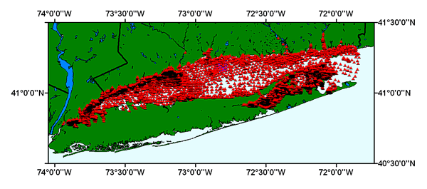
This ArcView shapefile contains the locations of sediment samples collected and analyzed by a number of organizations, and compiled by the U.S. Geological Survey, Woods Hole Science Center. Distribution of this dataset allows the user to visualize the textural information in a Geographic Information System.

How was the data set created?

  1. From what previous works were the data drawn?
    LIS_Final.xls - Published in: L.J. Poppe, M.E. Hastings, M.L. DiGiacomo-Cohen, and Z.J. Mlodzinska, 1998, Surficial Sediment Database: In Poppe, L.J. and Polloni, C. (eds.) Long Island Sound Environmental Studies: Open-File Report 98-502, Chapter 3, CD-ROM. (source 1 of 1)
    Poppe, L.J., Hastings, M.E., DiGiacomo-Cohen, M.L., and Mlodzinska, Z.J., 1998, Surficial Sediment Database: In Poppe, L.J. and Polloni, C. (eds.) Long Island Sound Environmental Studies, Cahpter 3: Open-File Report 98-502, U.S. Geological Survey, Reston, VA.

    Type_of_Source_Media: Microsoft Excel spreadsheet
    Source_Contribution:
    The Excel spreadsheet contains the available data on grain size for the bottom sediments in Long Island Sound The basic structure of the file is a matrix where records are rows representing individual samples and the columns contain information on sample identification, navigation, classifications, analyzed parameters, and comments.
  2. How were the data generated, processed, and modified?
    Date: Mar-2008 (process 1 of 6)
    The Excel spreadsheet was edited to change the PHI field names. The negative PHI values -5 to -1 were changed from PHI-n to PHIMn. This is because ArcView does not allow the '-' in field names and the field names were automatically changed to 'PHI_n'. This resulted in duplicate PHI field names. Making the change before exporting the file eliminated the conversion error and fieldname problems. The modified Excel spreadsheet file, usgsecstdb.xls, was exported as an ASCII text file with tab delimited fields. Person who carried out this activity:
    Lawrence J. Poppe
    U.S. Geological Survey
    Geologist
    U.S. Geological Survey
    Woods Hole, MA
    USA

    (508) 548-8700 x2314 (voice)
    (508) 457-2310 (FAX)
    lpoppe@usgs.gov
    Data sources used in this process:
    • lisseddata.xls
    Data sources produced in this process:
    • lisseddata.txt
    Date: 01-Jul-2003 (process 2 of 6)
    The file, usgsecstdb.txt, was imported into ArcView to create a table. The table was then converted to an ArcView shapefile to be used as a GIS data layer. Person who carried out this activity:
    Lawrence J. Poppe
    U.S. Geological Survey
    Geologist
    U.S. Geological Survey
    Woods Hole, MA
    USA

    (508) 548-8700 x2314 (voice)
    (508) 457-2310 (FAX)
    lpoppe@usgs.gov
    Data sources used in this process:
    • lisseddata.txt
    Data sources produced in this process:
    • lisseddata.shp
    Date: 10-Feb-2017 (process 3 of 6)
    Edits to the metadata were made to fix any errors that MP v 2.9.36 flagged. This is necessary to enable the metadata to be successfully harvested for various data catalogs. In some cases, this meant adding text "Information unavailable" or "Information unavailable from original metadata" for those required fields that were left blank. Other minor edits were probably performed (title, publisher, publication place, etc.). Attempted to modify http to https where appropriate. Removed invalid link in Larger Work Citation. Added ISO 19115 Topic Category keywords. Fixed link to browse graphic. Removed a redundant cross-reference. The source information was incomplete and had to be modified to meet the standard. Minor fixes to the attribute format for some attributes were needed. Added the online link to the data in the distribution section. The metadata date (but not the metadata creator) was edited to reflect the date of these changes. The metadata available from a harvester may supersede metadata bundled within a download file. Compare the metadata dates to determine which metadata file is most recent. Person who carried out this activity:
    U.S. Geological Survey
    Attn: VeeAnn A. Cross
    Marine Geologist
    384 Woods Hole Road
    Woods Hole, MA

    508-548-8700 x2251 (voice)
    508-457-2310 (FAX)
    vatnipp@usgs.gov
    Date: 20-Jul-2018 (process 4 of 6)
    USGS Thesaurus keywords added to the keyword section. Person who carried out this activity:
    U.S. Geological Survey
    Attn: VeeAnn A. Cross
    Marine Geologist
    384 Woods Hole Road
    Woods Hole, MA

    508-548-8700 x2251 (voice)
    508-457-2310 (FAX)
    vatnipp@usgs.gov
    Date: 18-Nov-2019 (process 5 of 6)
    Crossref DOI link was added as the first link in the metadata. Person who carried out this activity:
    U.S. Geological Survey
    Attn: VeeAnn A. Cross
    Marine Geologist
    384 Woods Hole Road
    Woods Hole, MA

    508-548-8700 x2251 (voice)
    508-457-2310 (FAX)
    vatnipp@usgs.gov
    Date: 08-Sep-2020 (process 6 of 6)
    Added keywords section with USGS persistent identifier as theme keyword. Person who carried out this activity:
    U.S. Geological Survey
    Attn: VeeAnn A. Cross
    Marine Geologist
    384 Woods Hole Road
    Woods Hole, MA

    508-548-8700 x2251 (voice)
    508-457-2310 (FAX)
    vatnipp@usgs.gov
  3. What similar or related data should the user be aware of?
    Poppe, L.J., Hastings, M.E., DiGiacomo-Cohen, M.L., Manheim, F.T., and Mlodzinska, Z.J., 1998, LISTEX / LIS_FINAL - Long Island Sound Surficial Sediment Database: Open-File Report 98-502, U.S. Geological Survey, Coastal and Marine Geology Program, Woods Hole Coastal and Marine Science Center, Woods Hole, MA.

    Online Links:

    Other_Citation_Details:
    Data are released via CD-ROM media and are available in the Microsoft Excel spreadsheet format and a tab delimited ASCII text file. This digital publication may also be available via the web at pubs.usgs.gov
    This is part of the following larger work.

    (editor), L.J. Poppe, and (editor), C.F. Polloni, 1998, Long Island Sound Environmental Studies: Open-File Report 98-502, U.S. Geological Survey, Reston, VA.

    Online Links:

    Other_Citation_Details:
    Data are released via CD-ROM media. This digital publication may also be available via the web at pubs.usgs.gov

How reliable are the data; what problems remain in the data set?

  1. How well have the observations been checked?
  2. How accurate are the geographic locations?
    Samples collected prior to about 1990 were navigated by Line of Sight, Sexton, Radar, and Loran (absolute navigational accuracy about 100 m for Loran); samples collected after 1990 were navigated by Differential GPS (navigational accuracy about 10 m).
  3. How accurate are the heights or depths?
  4. Where are the gaps in the data? What is missing?
    This data set is a subset of the complete USGS East Coast Sediment Texture Database, described and released via Open-File Report 98-502, supplemented by all available historical data from other organizations..
  5. How consistent are the relationships among the observations, including topology?
    No additional checks for topological consistency were performed on this data.

How can someone get a copy of the data set?

Are there legal restrictions on access or use of the data?
Access_Constraints: None
Use_Constraints:
Public domain data are freely redistributable with proper metadata and source attribution. Please recognize the U.S. Geological Survey (USGS) as the originator of this dataset.
  1. Who distributes the data set? (Distributor 1 of 1)
    U.S. Geological Survey
    Attn: Lawrence J. Poppe
    Geologist
    U.S. Geological Survey
    Woods Hole, MA
    USA

    (508) 548-8700 x2314 (voice)
    (508) 457-2310 (FAX)
    lpoppe@usgs.gov
  2. What's the catalog number I need to order this data set? Downloadable Data: lisseddata.shp
  3. What legal disclaimers am I supposed to read?
    Although this derived data set and it's lineage dataset have been used by the USGS, no warranty, expressed or implied, is made by the USGS as to the accuracy of the data and/or related materials. The act of distribution shall not constitute any such warranty, and no responsibility is assumed by the USGS in the use of these data or related materials.
  4. How can I download or order the data?
    • Availability in digital form:
      Data format: Five files (lisseddata.shp, lisseddata.dbf, lisseddata.shx, lisseddata.sbn, lisseddata.sbx) in format shapefile (version ArcView 3.2) ESRI point shapefile Size: 16.311
      Network links: https://pubs.usgs.gov/of/2004/1003/data/seddata/lisseddata.zip
    • Cost to order the data: none

  5. What hardware or software do I need in order to use the data set?
    The data are available in the ESRI shapefile format. The user must have Environmental Systems Research Institute's (ESRI) ArcView 3.0 or greater or ArcGIS software to read and process the data file. In lieu of Arcview, the user may utilize another GIS application package capable of importing the data. A free GIS data viewer, ArcExplorer, is available from the ESRI website at www.esri.com/software/arcexplorer/download4.html
    Access to the data and information contained on this CD-ROM was developed using the HyperText Markup Language (HTML) utilized by the World Wide Web (WWW) project. Development of the CD-ROM documentation and user interface in HTML allows a user to access the information by using a variety of WWW information browsers to facilitate browsing and locating information and data. To access the information contained on this disk with a WWW client browser, open the file 'index.htm' at the top level directory of this CD-ROM with your selected browser.
    This CD-ROM should be readable by a variety of operating systems including Windows 95/98/NT, Macintosh and UNIX.

Who wrote the metadata?

Dates:
Last modified: 16-Nov-2021
Metadata author:
U.S. Geological Survey
Attn: Lawrence J. Poppe
Geologist
U.S. Geological Survey
Woods Hole, MA
USA

(508) 548-8700 x2314 (voice)
(508) 457-2310 (FAX)
whsc_data_contact@usgs.gov
Contact_Instructions:
The metadata contact email address is a generic address in the event the metadata contact is no longer with the USGS or the email is otherwise invalid.
Metadata standard:
FGDC Content Standards for Digital Geospatial Metadata (FGDC-STD-001-1998)

This page is <https://cmgds.marine.usgs.gov/catalog/whcmsc/open_file_report/ofr2004-1003/LISSound_srf_sed_metadata.faq.html>
Generated by mp version 2.9.50 on Tue Nov 16 10:06:29 2021