Online Links:
Online Links:
| Range of values | |
|---|---|
| Minimum: | 0 |
| Maximum: | 0 |
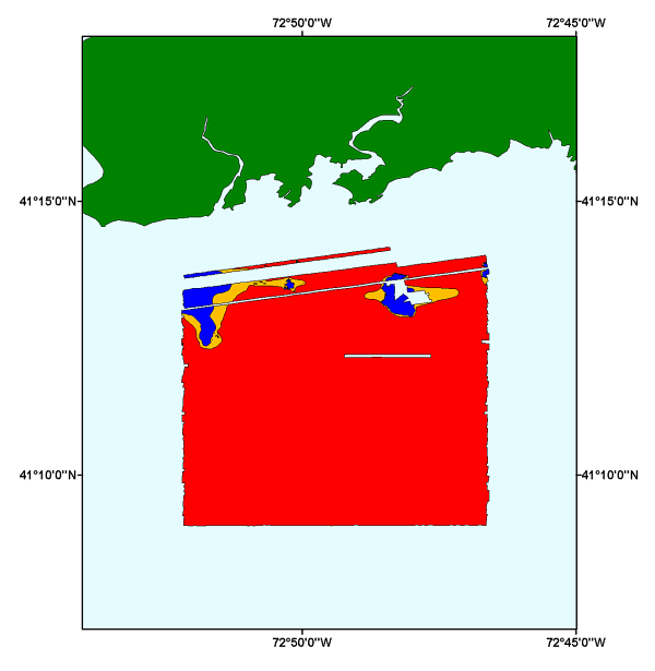
| Value | Definition |
|---|---|
| Erosion or Nondeposition | High energy environment not permitting the accumulation of recent sediments |
| Sorting or Reworking | Moderate energy environment that separates fine-grained sediments from coarser ones by winnowing. |
| Deposition | Lower energy environment allowing the accumulation of modern sediments |
Lawrence J. Poppe, U.S. Geological Survey, must be referenced as the originator of the dataset in any future products or research derived from these data.
To release the interpretation of the sedimentary environments of the sidescan sonar data acquired by National Oceanic and Atmospheric Administration (NOAA) survey H11043. This GIS data layer is a component of the Branford Survey, Long Island Sound GIS database.
Are there legal restrictions on access or use of the data?Access_Constraints: None
Use_Constraints:Public domain data are freely redistributable with proper metadata and source attribution. Please recognize the U.S. Geological Survey (USGS) as the originator of this dataset.
Although these data have been used by the U.S. Geological Survey (USGS), U.S. Department of the Interior (DOI), no warranty expressed or implied is made by the U.S. Geological Survey as to the accuracy of the data. The act of distribution shall not constitute any such warranty, and no responsibility is assumed by the USGS in the use of these data or related materials. Any use of trade, product, or firm names is for descriptive purposes only and does not imply endorsement by the U.S. Government.
| Data format: | Five files: sedenviron.shp, sedenviron.shx, sedenviron.dbf, sedenviron.avl, sedenviron,prj in format SHP (version 3.3) ESRI polygon shapefile Size: 0.209 |
|---|---|
| Network links: |
http://pubs.usgs.gov/of/2004/1003/data/interp/sedenviron/sedenviron.zip http://pubs.usgs.gov/of/2004/1003/data/interp/ |
| Media you can order: |
CD-ROM
(Density 650
Mbytes)
(format ISO 9660)
Note: The user must have a CD-ROM capable of reading an ISO 9660 standard CD-ROM |
These data are available in Environmental Systems Research Institute (ESRI) shapefile format. The user must have ArcGIS or ArcView 3.0 or greater software to read and process the data file. In lieu of ArcView or ArcGIS, the user may utilize another GIS application package capable of importing the data. A free data viewer, ArcExplorer, capable of displaying the data is available from ESRI at www.esri.com.