U.S. Geological Survey East Coast Sediment Texture Database (ECSTDB2011.SHP, 2011)

Metadata also available as - [Outline] - [Parseable text] - [XML]

Frequently anticipated questions:


What does this data set describe?

Title:
U.S. Geological Survey East Coast Sediment Texture Database (ECSTDB2011.SHP, 2011)
Abstract:
This sediment database contains location, description, and texture of samples taken by numerous marine sampling programs. Most of the samples are from the Atlantic Continental Margin of the United States, but some are from as diverse locations as Lake Baikal, Russia, the Hawaiian Islands region, Puerto Rico, the Gulf of Mexico, and Lake Michigan. The database presently contains data for over 26,000 samples, which includes texture data for approximately 3800 samples taken or analyzed by the Atlantic Continental Margin Program (ACMP), a joint U.S. Geological Survey/Woods Hole Oceanographic Institution project conducted from 1962 to 1970. As part of the ACMP, some historical data from samples collected between 1955 and 1962 were also incorporated into the dataset.
  1. How might this data set be cited?
    U.S. Geological Survey, 2011, U.S. Geological Survey East Coast Sediment Texture Database (ECSTDB2011.SHP, 2011): Open-File Report 2005-1001, U.S. Geological Survey, Coastal and Marine Geology Program, Woods Hole Coastal and Marine Science Center, Woods Hole, MA.

    Online Links:

    This is part of the following larger work.

    Poppe, L.J., Williams, S.J., and Paskevich, V.F., 2005, USGS East-Coast Sediment Analysis: Procedures, Database, and GIS Data: Open-File Report 2005-1001, U.S. Geological Survey, Reston, VA.

    Online Links:

  2. What geographic area does the data set cover?
    West_Bounding_Coordinate: -170.520000
    East_Bounding_Coordinate: 123.556830
    North_Bounding_Coordinate: 69.460900
    South_Bounding_Coordinate: -16.232067
  3. What does it look like?
    https://pubs.usgs.gov/of/2005/1001/data/surficial_sediments/ecstdb2011.gif (GIF)
    Location of USGS East Coast surficial sediment samples (ecstdb2011) displayed on world map
  4. Does the data set describe conditions during a particular time period?
    Beginning_Date: 1955
    Ending_Date: Jan-2011
    Currentness_Reference:
    ground condition
  5. What is the general form of this data set?
    Geospatial_Data_Presentation_Form: vector digital data
  6. How does the data set represent geographic features?
    1. How are geographic features stored in the data set?
      This is a Vector data set. It contains the following vector data types (SDTS terminology):
      • Entity point (26080)
    2. What coordinate system is used to represent geographic features?
      Horizontal positions are specified in geographic coordinates, that is, latitude and longitude. Latitudes are given to the nearest 0.000001. Longitudes are given to the nearest 0.000001. Latitude and longitude values are specified in Decimal degrees. The horizontal datum used is D_WGS_1984.
      The ellipsoid used is WGS_1984.
      The semi-major axis of the ellipsoid used is 6378137.000000.
      The flattening of the ellipsoid used is 1/298.257224.
  7. How does the data set describe geographic features?
    ecstdb2011
    Shapefile Attribute Table (Source: ESRI)
    Shape
    Feature geometry. (Source: ESRI) Coordinates defining the features.
    FID
    Internal feature number. (Source: ESRI) Sequential unique whole numbers that are automatically generated.
    GROUP
    Number assigned to data based on source. (Source: USGS East Coast Sediment Texture Database data dictionary)
    ValueDefinition
    1Samples taken before start of the joint USGS/WHOI project.
    2USGS/WHOI Atlantic Continental Margin Program stations
    3Samples analyzed by the USGS Woods Hole Coastal and Marine Science Center Sediment Laboratory
    DB_ID
    Unique identification number generated in the sedimentation laboratory of the USGS's Woods Hole Coastal and Marine Science Center. For samples analyzed after 1980 this identifier consists of 2 characters and 3 numerics (e.g. AS114). For samples analyzed prior to 1980, this identifier consists of 4 numerics possibly followed by as many as 2 characters. (Source: USGS East Coast Sediment Texture Database data dictionary) Information unavailable from original metadata.
    FIELD_NO
    Sample name or number as assigned in the field by the Chief Scientist (Source: USGS East Coast Sediment Texture Database data dictionary) Information unavailable from original metadata.
    PROJECT
    Name of project or project number under which samples were taken or data generated; sometimes project name indicates a more specific area (Source: USGS East Coast Sediment Texture Database data dictionary) Character string of width 254.
    CRUISE_ID
    Name or number of cruise on which sample collected. Historically cruise identifiers were a combination of ship name, year of cruise and cruise leg. In more recent years, cruise identifier is a sequential serial number assigned to field activities within a specific year. (Source: USGS East Coast Sediment Texture Database data dictionary) Character string of width 254.
    CONTACT
    Name of Principal Investigator or Chief Scientist responsible for data collection (usually first initial and last name) when available. (Source: USGS East Coast Sediment Texture Database data dictionary) Character string of width 254.
    AREA
    General geographic area of data collection. Name is general enough to easily locate area on a state map. (Source: USGS East Coast Sediment Texture Database data dictionary) Character string of width 254.
    LATITUDE
    Latitude coordinate, in decimal-degrees, of sample location. South latitude recorded as negative values. (Source: USGS East Coast Sediment Texture Database data dictionary)
    Range of values
    Minimum:-16.2320670
    Maximum:69.4609
    Units:signed decimal degrees
    Resolution:.00000001
    LONGITUDE
    Longitude coordinate, in decimal degrees, of sample location. West longitude is recorded as negative values. (Source: USGS East Coast Sediment Texture Database data dictionary)
    Range of values
    Minimum:-170.52
    Maximum:123.55683
    Units:signed decimal degrees
    Resolution:.00000001
    DEPTH_M
    Measured depth of water overlying sediment at sample time, not corrected for tides, in meters. No data value -9999. (Source: USGS Eastcoast Sediment Texture Database data dictionary)
    Range of values
    Minimum:0.00
    Maximum:6945
    Units:meters
    Resolution:.01
    T_DEPTH
    Top depth of the sample below the sediment-water interface, in centimeters. No data value -9999. (Source: USGS Eastcoast Sediment Texture Database data dictionary)
    Range of values
    Minimum:0
    Maximum:115049
    Units:centimeters
    Resolution:1
    B_DEPTH
    Bottom depth of the sample below the sediment-water interface, in centimeters. No data value -9999. (Source: USGS Eastcoast Sediment Texture Database data dictionary)
    Range of values
    Minimum:0
    Maximum:115054
    Units:centimeters
    Resolution:1
    DEVICE
    Device used to collect the sample. A blank indicates unknown device. (Source: USGS Eastcoast Sediment Texture Database data dictionary)
    ValueDefinition
    1 METER PLANKTON NETInformation unavailable from original metadata.
    1-METER DREDGEInformation unavailable from original metadata.
    3/4 METER PLANKTON NETInformation unavailable from original metadata.
    35MM STEREO CAMERA+DREDInformation unavailable from original metadata.
    ANCHOR DREDGEInformation unavailable from original metadata.
    ANCHOR FLUKESInformation unavailable from original metadata.
    ANCHOR SAMPLEInformation unavailable from original metadata.
    BLAKE TRAWLInformation unavailable from original metadata.
    BOOMERANG CORERInformation unavailable from original metadata.
    BOT DRIFTER SALINOMETERInformation unavailable from original metadata.
    BOTTOM DRIFTERInformation unavailable from original metadata.
    BOTTOM DRIFTER BUGInformation unavailable from original metadata.
    BOTTOM SKIMMERInformation unavailable from original metadata.
    BOX COREInformation unavailable from original metadata.
    BOX SAMPLERInformation unavailable from original metadata.
    CAM GRAB W/O CAM+PLANK TInformation unavailable from original metadata.
    CAMERA SLEDInformation unavailable from original metadata.
    CAMPBELL GRAB W/ CAMERAInformation unavailable from original metadata.
    CAMPBELL GRAB W/O CAMERAInformation unavailable from original metadata.
    CHAIN BAGInformation unavailable from original metadata.
    CHAIN BAG DREDGEInformation unavailable from original metadata.
    CHAIN BAG+PIPE DREDGEInformation unavailable from original metadata.
    CHAIN BAG+SM PIPE DREDGEInformation unavailable from original metadata.
    CHAIN BAG+PIPEInformation unavailable from original metadata.
    CHAIN BAG+PIPE DREDGEInformation unavailable from original metadata.
    CHAIN BAG+SM PIPEInformation unavailable from original metadata.
    CHAIN BAG+SM PIPE DREDGEInformation unavailable from original metadata.
    CHAIN DREDGEInformation unavailable from original metadata.
    CORING TUBE IN MECH ARMInformation unavailable from original metadata.
    D-L SNAPPERInformation unavailable from original metadata.
    D-L SNAPPER + DREDGEInformation unavailable from original metadata.
    D-L SNAPPER + GRAV CORInformation unavailable from original metadata.
    DIETZ-LAFONDInformation unavailable from original metadata.
    DIETZ-LAFOND GRABInformation unavailable from original metadata.
    DIETZ-LAFOND SNAPPERInformation unavailable from original metadata.
    DIGBY DREDGEInformation unavailable from original metadata.
    DIGBY DREDGE W/ CNVS BAGInformation unavailable from original metadata.
    DRAG DREDGEInformation unavailable from original metadata.
    DREDGEInformation unavailable from original metadata.
    Drilled SampleInformation unavailable from original metadata.
    DRILLED SAMPLEInformation unavailable from original metadata.
    EDGERTON CAMERAInformation unavailable from original metadata.
    GOS ANCHOR CHAINInformation unavailable from original metadata.
    GRAB SAMPLERInformation unavailable from original metadata.
    GRAPPLING HOOKInformation unavailable from original metadata.
    GRAVITY CORERInformation unavailable from original metadata.
    HAND SAMPLEInformation unavailable from original metadata.
    Hand SampleInformation unavailable from original metadata.
    HYDROSTATIC COREInformation unavailable from original metadata.
    HYDROSTATIC CORERInformation unavailable from original metadata.
    Hydrostatic CORERInformation unavailable from original metadata.
    IKU GRABInformation unavailable from original metadata.
    JAPANESE DREDGEInformation unavailable from original metadata.
    M-VV GRAB + D-LF SNAPPERInformation unavailable from original metadata.
    M-VV GRAB + GRAVITY COREmodified Van Veen grab sampler and gravity corer
    MECH ARM + CORE DRILLInformation unavailable from original metadata.
    MECH ARM W/ CORERInformation unavailable from original metadata.
    MECH ARM W/ PRY BARInformation unavailable from original metadata.
    MECHANICAL ARMInformation unavailable from original metadata.
    MINIATURE VAN VEENInformation unavailable from original metadata.
    MINIATURE VAN VEEN W/O C.Information unavailable from original metadata.
    MODIFIED PIERCE DREDGEInformation unavailable from original metadata.
    NAInformation unavailable from original metadata.
    NATURALIST DREDGEInformation unavailable from original metadata.
    NISKIN SAMPLERInformation unavailable from original metadata.
    OTHERInformation unavailable from original metadata.
    PAUL CORERInformation unavailable from original metadata.
    PIPE DREDGEInformation unavailable from original metadata.
    PIPE DREDGE AND D-L SNAPInformation unavailable from original metadata.
    PIPE DREDGE, 12 INCHInformation unavailable from original metadata.
    PISTON CORERInformation unavailable from original metadata.
    PONAR SAMPLERInformation unavailable from original metadata.
    PULSE AUGERInformation unavailable from original metadata.
    PUSH CORERInformation unavailable from original metadata.
    Pulse AugerInformation unavailable from original metadata.
    RAKED INTO BASKET W/ ARMInformation unavailable from original metadata.
    RING NETInformation unavailable from original metadata.
    ROCKER DREDGEInformation unavailable from original metadata.
    ROTARY CORERInformation unavailable from original metadata.
    ROTOSONIC CORERInformation unavailable from original metadata.
    SALINOMETER, VANDORN BOTSInformation unavailable from original metadata.
    SCALLOP DREDGEInformation unavailable from original metadata.
    SCOOP FISHInformation unavailable from original metadata.
    SEDIMENT TRAPInformation unavailable from original metadata.
    SHIPEK GRABInformation unavailable from original metadata.
    SMALL VAN VEENsmall Van Veen grab sampler
    SMITH-MAC+MIN W, CAMERAInformation unavailable from original metadata.
    SMITH-MACINTYRE GRABSmith-MacIntyre grab sampler
    SMITH-MACINTYRE W/ CAMERAInformation unavailable from original metadata.
    SMITH-MACINTYRE W/O CAMERAInformation unavailable from original metadata.
    SMITH/MAC AND NISKIN SPLInformation unavailable from original metadata.
    SUBMERSIBLE SAMPLEInformation unavailable from original metadata.
    Submersible SampleInformation unavailable from original metadata.
    TRAWLInformation unavailable from original metadata.
    TRIGGER COREInformation unavailable from original metadata.
    UNKNOWNInformation unavailable from original metadata.
    VAN VEEN AND COREInformation unavailable from original metadata.
    VAN VEEN GRABsample collected with Van Veen grab sampler
    Van Veen Grabsample collected with Van Veen grab sampler
    VIBRA COREInformation unavailable from original metadata.
    VISUAL OBSERVATIONInformation unavailable from original metadata.
    VV GRAB + D-L SNAPPERInformation unavailable from original metadata.
    WATER PUMP ONLYInformation unavailable from original metadata.
    BIG SEABOSS GRABInformation unavailable from original metadata.
    CRAIB CORERInformation unavailable from original metadata.
    DIVER GRABSInformation unavailable from original metadata.
    DIVER PUSH COREInformation unavailable from original metadata.
    DIVER, HANDInformation unavailable from original metadata.
    DIVERS, BY HANDInformation unavailable from original metadata.
    DRILL COREInformation unavailable from original metadata.
    DRILLED COREInformation unavailable from original metadata.
    GRABInformation unavailable from original metadata.
    GRAVITY COREInformation unavailable from original metadata.
    HANDInformation unavailable from original metadata.
    MID-SIZED SEABOSS GRABInformation unavailable from original metadata.
    MINI SEABOSSInformation unavailable from original metadata.
    MINI-SEABOSSInformation unavailable from original metadata.
    PISTON COREInformation unavailable from original metadata.
    PISTON SAMPLER (HYDRAULIC)Information unavailable from original metadata.
    PONAR GRABInformation unavailable from original metadata.
    ROTOSONIC COREInformation unavailable from original metadata.
    SMALL SEABOSS GRABInformation unavailable from original metadata.
    SUBMERSIBLE ARM GRABInformation unavailable from original metadata.
    TEFLON SHOVELInformation unavailable from original metadata.
    TROWELInformation unavailable from original metadata.
    VIBRACOREInformation unavailable from original metadata.
    VIBRACORERInformation unavailable from original metadata.
    WHOI GIANT GRAVITY CORERInformation unavailable from original metadata.
    Character string of width 254
    MONTH_COLL
    Calendar month sample collected. No data value -9999. (Source: USGS Eastcoast Sediment Texture Database data dictionary)
    Range of values
    Minimum:1
    Maximum:12
    Units:month of year
    Resolution:1
    DAY_COLL
    Calendar day sample collected. No data value -9999. (Source: USGS Eastcoast Sediment Texture Database data dictionary)
    Range of values
    Minimum:1
    Maximum:31
    Units:day of month
    Resolution:1
    YEAR_COLL
    Calendar year sample collected. No data value -9999. (Source: USGS Eastcoast Sediment Texture Database data dictionary)
    Range of values
    Minimum:1955
    Maximum:2010
    Units:year
    Resolution:1
    MONTH_ANAL
    Calendar month sample analyzed. No data value -9999. (Source: USGS Eastcoast Sediment Texture Database data dictionary)
    Range of values
    Minimum:1
    Maximum:12
    Units:month of year
    Resolution:1
    DAY_ANAL
    Calendar day sample analyzed. No data value -9999. (Source: USGS Eastcoast Sediment Texture Database data dictionary)
    Range of values
    Minimum:1
    Maximum:31
    Units:day of month
    Resolution:1
    YEAR_ANAL
    Calendar year sample analyzed. No data value -9999. (Source: USGS Eastcoast Sediment Texture Database data dictionary)
    Range of values
    Minimum:1969
    Maximum:2011
    Units:year
    Resolution:1
    WEIGHT
    Weight of dry sample in grams. No data value -9999. (Source: USGS Eastcoast Sediment Texture Database data dictionary)
    Range of values
    Minimum:0.01
    Maximum:9086.1
    Units:grams
    Resolution:.0001
    GRAVEL_PCT
    Gravel content in percent dry weight of the sample (particles with nominal diameters greater than 2 mm; -1 Phi and larger). No data value -9999. (Source: USGS Eastcoast Sediment Texture Database data dictionary)
    Range of values
    Minimum:0.00
    Maximum:100.00
    Units:percent
    Resolution:.01
    SAND_PCT
    Sand content in percent dry weight of the sample (particles with nominal diameters less than 2 mm, but greater than or equal to 0.0625 mm; 0 Phi through 4 Phi). No data value -9999. (Source: USGS Eastcoast Sediment Texture Database data dictionary)
    Range of values
    Minimum:0.00
    Maximum:102
    Units:percent
    Resolution:.01
    SILT_PCT
    Silt content in percent dry weight of the sample (particles with nominal diameters less than 0.0625 mm, but greater than or equal to 0.004 mm; 5 Phi through 8 Phi, inclusive). No data value -9999. (Source: USGS Eastcoast Sediment Texture Database data dictionary)
    Range of values
    Minimum:0.00
    Maximum:100.00
    Units:percent
    Resolution:.01
    CLAY_PCT
    Clay content in percent dry weight of the sample (particles with nominal diameters less than 0.004 mm; 9 Phi and smaller). No data value -9999. (Source: USGS Eastcoast Sediment Texture Database data dictionary)
    Range of values
    Minimum:0.00
    Maximum:94.71
    Units:percent
    Resolution:.01
    CLASSIFICA
    Sediment Classification - Sediment description based on a rigorous definition, usually Shepard (1954) as modified by Schlee (1973) and Poppe and others ( 2005). (Source: USGS East Coast Sediment Texture Database data dictionary)
    ValueDefinition
    BEDROCKSolid rock.
    BOULDERSRocks with diameters greater then 256 mm.
    CLAYSediment whose main phase is less than 0.004 mm.
    CLAYEY SANDSediment whose main phase is sand, but with significant clay.
    CLAYEY SILTSediment whose main phase is silt, but with significant clay.
    GRAVELSediment whose main phase is >2 mm.
    GRAVELLY SEDIMENTSediment whose main phase is >2 mm, but with significant other sediment.
    SANDSediment whose main phase is less than 2 mm, but greater than or equal to 0.062 mm.
    SAND SILT CLAYSediment with significant (over 20 percent) sand, silt, and clay.
    SANDY CLAYSediment whose main phase is clay, but with significant sand.
    SANDY SILTSediment whose main phase is silt, but with significant sand.
    SILTSediment whose main phase is less than 0.062 mm, but greater than or equal to 0.004 mm.
    SILTY CLAYSediment whose main phase is clay, but with significant silt.
    SILTY SANDSediment whose main phase in sand, but with significant silt.
    Character string of width 19.
    MEDIAN
    Middle point in the grain size distribution in phi units. No data value -9999. (Source: USGS Eastcoast Sediment Texture Database data dictionary)
    Range of values
    Minimum:-7.35
    Maximum:10.74
    Units:phi
    Resolution:.01
    MEAN
    Average value in the grain size distribution in phi units. No data value -9999. (Source: USGS Eastcoast Sediment Texture Database data dictionary)
    Range of values
    Minimum:-5.93
    Maximum:10.62
    Units:phi
    Resolution:.01
    STDEV
    Standard deviation (root mean square of the deviations) of the grain size distribution in phi units (sorting). No data value -9999. (Source: USGS Eastcoast Sediment Texture Database data dictionary)
    Range of values
    Minimum:0
    Maximum:7.16
    Units:phi
    Resolution:.01
    SKEWNESS
    Skewness (deviation from symmetrical form) of the grain size distribution in phi units. No data value -9999. Calculated values less than -50 and greater than 50 have been set to -9999 as they are erroneous. (Source: USGS Eastcoast Sediment Texture Database data dictionary)
    Range of values
    Minimum:-14.78
    Maximum:37.19
    Units:phi
    Resolution:.01
    KURTOSIS
    Kurtosis (degree of curvature near the mode) of the grain size distribution in phi units. No data value -9999. Calculated values less than -50 and greater than 50 were set to -9999 as they are erroneous. (Source: USGS Eastcoast Sediment Texture Database data dictionary)
    Range of values
    Minimum:-49.56
    Maximum:49.98
    Units:phi
    Resolution:.01
    MODE1CLASS
    Mode 1 class - First mode (particle size that occurs the most number of times) in phi units. Although values are reported from -5 phi to 11 phi, older datasets recorded values beyond this range and modes can occur outside this range. No data value -9999. (Source: USGS East Coast Sediment Texture Database data dictionary)
    Range of values
    Minimum:-7.500
    Maximum:10.600
    MODE1FREQ
    Mode 1 strength - Modal strength of the first mode in percent. No data value -9999. (Source: USGS East Coast Sediment Texture Database data dictionary)
    Range of values
    Minimum:0.00
    Maximum:100.00
    Units:percent
    Resolution:.01
    MODE2CLASS
    Mode 2 class - Second mode in phi units. Although values are reported from -5 phi to 11 phi, older datasets recorded values beyond this range and modes can occur outside this range. No data value -9999. (Source: USGS East Coast Sediment Texture Database data dictionary)
    Range of values
    Minimum:-7.50
    Maximum:13.40
    Units:phi
    Resolution:.01
    MODE2FREQ
    Mode 2 strength - Modal strength of the second mode in percent. No data value -9999. (Source: USGS East Coast Sediment Texture Database data dictionary)
    Range of values
    Minimum:0.00
    Maximum:60.50
    Units:percent
    Resolution:.01
    MODE3CLASS
    Mode 3 class - Third mode in phi units. Although values are reported from -5 phi to 11 phi, older datasets recorded values beyond this range and modes can occur outside the range. No data value -9999. (Source: USGS East Coast Sediment Texture Database data dictionary)
    Range of values
    Minimum:-6.50
    Maximum:15.40
    Units:phi
    Resolution:.01
    MODE3FREQ
    Mode 3 strength - Modal strength of the third mode in percent. No data value -9999. (Source: USGS East Coast Sediment Texture Database data dictionary)
    Range of values
    Minimum:0
    Maximum:18.15
    Units:percent
    Resolution:.01
    NMODES
    Number of modes. No data value -9999. (Source: USGS East Coast Sediment Texture Database data dictionary)
    Range of values
    Minimum:1
    Maximum:5
    Units:integer count
    Resolution:1
    PHIM5
    -5 Phi - Weight percent of the sample in the -5 Phi fraction and larger (nominal diameter of particles greater than or equal to 32 mm); very coarse pebbles, cobbles, and boulders. No data value -9999. (Source: USGS East Coast Sediment Texture Database data dictionary)
    Range of values
    Minimum:0.00
    Maximum:100.00
    Units:percent
    Resolution:.01
    PHIM4
    -4 Phi - Weight percent of the sample in the -4 Phi fraction (nominal diameter of particles greater than or equal to 16 mm, but less than 32 mm); coarse pebbles. No data value -9999. (Source: USGS East Coast Sediment Texture Database data dictionary)
    Range of values
    Minimum:0.00
    Maximum:100.00
    Units:percent
    Resolution:.01
    PHIM3
    -3 Phi - Weight percent of the sample in the -3 Phi fraction (nominal diameter of particles greater than or equal to 8 mm, but less than 16 mm); medium pebbles. No data value -9999. (Source: USGS East Coast Sediment Texture Database data dictionary)
    Range of values
    Minimum:0.00
    Maximum:100.00
    Units:percent
    Resolution:.01
    PHIM2
    -2 Phi - Weight percent of the sample in the -2 Phi fraction (nominal diameter of particles greater than or equal to 4 mm, but less than 8 mm); fine pebbles. No data value -9999. (Source: USGS East Coast Sediment Texture Database data dictionary)
    Range of values
    Minimum:0
    Maximum:64.43
    Units:percent
    Resolution:.01
    PHIM1
    -1 Phi - Weight percent of the sample in the -1 Phi fraction (nominal diameter of particles greater than or equal to 2 mm, but less than 4 mm); very fine pebbles (granules). No data value -9999. (Source: USGS East Coast Sediment Texture Database data dictionary)
    Range of values
    Minimum:0.00
    Maximum:97.00
    Units:percent
    Resolution:.01
    PHI_0
    0 Phi - Weight percent of the sample in the 0 Phi fraction (nominal diameters of particles greater than or equal to 1 mm, but less than 2 mm); very coarse sand. No data value -9999. (Source: USGS East Coast Sediment Texture Database data dictionary)
    Range of values
    Minimum:0
    Maximum:86.00
    Units:percent
    Resolution:.01
    PHI_1
    1 Phi - Weight percent of the sample in the 1 Phi fraction (nominal diameter of particles greater than or equal to 0.5 mm, but less than 1 mm); coarse sand. No data value -9999. (Source: USGS East Coast Sediment Texture Database data dictionary)
    Range of values
    Minimum:0.00
    Maximum:92.67
    Units:percent
    Resolution:.01
    PHI_2
    2 Phi - Weight percent of the sample in the 2 Phi fraction (nominal diameter of particles greater than or equal to 0.25 mm, but less than 0.5 mm); medium sand. No data value -9999. (Source: USGS East Coast Sediment Texture Database data dictionary)
    Range of values
    Minimum:0.00
    Maximum:96.00
    Units:percent
    Resolution:.01
    PHI_3
    3 Phi - Weight percent of the sample in the 3 Phi fraction (nominal diameter of particles greater than or equal to 0.125 mm, but less than 0.25 mm); fine sand. No data value -9999. (Source: USGS East Coast Sediment Texture Database data dictionary)
    Range of values
    Minimum:0.00
    Maximum:95.92
    Units:percent
    Resolution:.01
    PHI_4
    4 Phi - Weight percent of the sample in the 4 Phi fraction (nominal diameters of particles greater than or equal to .0625 mm, but less than 0.125 mm); very fine sand. No data value -9999. (Source: USGS East Coast Sediment Texture Database data dictionary)
    Range of values
    Minimum:0.00
    Maximum:92.75
    Units:percent
    Resolution:.01
    PHI_5
    5 Phi - Weight percent of the sample in the 5 Phi fraction (nominal diameter of particles greater than or equal to 0.031 mm, but less than 0.0625 mm); coarse silt. No data value -9999. (Source: USGS East Coast Sediment Texture Database data dictionary)
    Range of values
    Minimum:0.00
    Maximum:80.51
    Units:percent
    Resolution:.01
    PHI_6
    6 Phi - Weight percent of the sample in the 6 Phi fraction (nominal diameter of particles greater than or equal to 0.016 mm, but less than 0.031 mm); medium silt. No data value -9999. (Source: USGS East Coast Sediment Texture Database data dictionary)
    Range of values
    Minimum:0.00
    Maximum:68.32
    Units:percent
    Resolution:.01
    PHI_7
    7 Phi - Weight percent of the sample in the 7 Phi fraction (nominal diameter of particles greater than or equal to 0.008 mm, but less than 0.016 mm); fine silt. No data value -9999. (Source: USGS East Coast Sediment Texture Database data dictionary)
    Range of values
    Minimum:0.00
    Maximum:47.57
    Units:percent
    Resolution:.01
    PHI_8
    8 Phi - Weight percent of the sample in the 8 Phi fraction (nominal diameter of particles greater than or equal to 0.004 mm, but less than 0.008 mm); very fine silt. No data value -9999. (Source: USGS East Coast Sediment Texture Database data dictionary)
    Range of values
    Minimum:0.00
    Maximum:47.90
    Units:percent
    Resolution:.01
    PHI_9
    9 Phi - Weight percent of the sample in the 9 Phi fraction (nominal diameter of particles greater than or equal to 0.002 mm, but less than 0.004 mm); coarse clay. No data value -9999. (Source: USGS East Coast Sediment Texture Database data dictionary)
    Range of values
    Minimum:0
    Maximum:45.55
    Units:percent
    Resolution:.01
    PHI_10
    10 Phi - Weight percent of the sample in the 10 Phi fraction (nominal diameter of particles greater than or equal to 0.001 mm, but less than 0.002 mm); medium clay. No data value -9999. (Source: USGS East Coast Sediment Texture Database data dictionary)
    Range of values
    Minimum:0.00
    Maximum:59.53
    Units:percent
    Resolution:.01
    PHI_11
    11 Phi - Weight percent of the sample in the 11 Phi fraction and smaller (nominal diameter of particles less than 0.001 mm); fine clay. No data value -9999. (Source: USGS East Coast Sediment Texture Database data dictionary)
    Range of values
    Minimum:0.00
    Maximum:87.3
    Units:percent
    Resolution:.01
    ANALYST
    Name (usually first initial and last name) of person who performed the grain size or physical properties analysis (Source: USGS East Coast Sediment Texture Database data dictionary) Character string of width 254.
    ANAL_COMM
    Comments on analyses - Any further information about sediment analysis for all or specific parameters in this table (Source: USGS East Coast Sediment Texture Database data dictionary) Character string of width 254.
    LITHOLOGY
    General lithologic description of sample (Source: USGS East Coast Sediment Texture Database data dictionary) Character string of width 254.
    COMMENTS
    Comments on sample collection or lithology (Source: USGS East Coast Sediment Texture Database data dictionary) Character string of width 254.
    Entity_and_Attribute_Overview:
    Location and sediment analysis results for approximately 26,000 samples collected and analyzed by the U.S. Geological Survey, Woods Hole Coastal and Marine Science Center through January 2011. We caution users of this data that in a few samples from some of the older data (from groups 1 and 2) fraction weights and phi weight percents do not add up to 100 +/- 2 percent. This is noted for each affected sample in the Comments section.
    Entity_and_Attribute_Detail_Citation: U.S. Geological Survey

Who produced the data set?

  1. Who are the originators of the data set? (may include formal authors, digital compilers, and editors)
    • U.S. Geological Survey
  2. Who also contributed to the data set?
    The U.S. Geological Survey must be referenced as the originator of the dataset in any future products or research derived from these data.
  3. To whom should users address questions about the data?
    Larry Poppe
    U.S. Geological Survey
    Geologist
    384 Woods Hole Road
    Woods Hole, MA
    USA

    (508) 548-8700 x2314 (voice)
    (508) 457-2310 (FAX)
    lpoppe@usgs.gov

Why was the data set created?

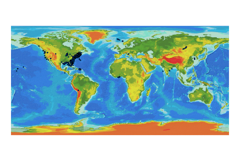
This ArcGIS shapefile contains the locations of marine sediment samples collected and analyzed by the U.S. Geological Survey, Woods Hole Coastal and Marine Science Center starting in 1955 thru January 2011. Distribution of this dataset allows the user the ability to visualize the information in a Geographic Information System.

How was the data set created?

  1. From what previous works were the data drawn?
    ecstdb2011.xls (source 1 of 1)
    U.S. Geological Survey - assumed, unknown, Information unavailable from original metadata..

    Type_of_Source_Media: online
    Source_Contribution:
    This Excel spreadsheet contains the accumulated results of the surficial sediment analysis collected and processed by the U.S. Geological Survey (USGS), Woods Hole Coastal and Marine Science Center (WHCMSC) through January 2011. Data collected from December 2004 through January 2011 were appended to the previously published ecstdb2005.xls spreadsheet. This file has been updated as errors in latitudes and longitudes and other information have been corrected for over 100 samples. This combined spreadsheet was the source of the data converted to the ESRI shapefile.
  2. How were the data generated, processed, and modified?
    Date: 2011 (process 1 of 6)
    Surficial sediment data from December 2004 through January 2011 were recorded in an Excel (version 2003) spreadsheet. This spreadsheet was appended to ecstdb2005.xls. Errors found in the ecstdb2005.xls data were corrected for approximately 100 samples, as well as some errors found in the more recently completed analyses. The Excel file was edited and a comma-delimited text file was generated. The Excel file was imported into ArcMap 9.2 to create a table with the Add XY Data tool. Person who carried out this activity:
    U.S. Geological Survey
    Attn: Katherine McMullen
    Field and Laboratory Technician
    384 Woods Hole Road
    Woods Hole, MA
    USA

    (508) 548-8700 x2277 (voice)
    (508) 457-2310 (FAX)
    kmcmullen@usgs.gov
    Data sources used in this process:
    • ecstdb06.xls
    • ecstdb2005.xls
    Data sources produced in this process:
    • Sheet1$ Events
    • ecstdb2011.txt
    Date: 2011 (process 2 of 6)
    The table was then converted to an ArcGIS shapefile (Data, Export Data) to be used as a GIS data layer using ArcMap 9.2. Person who carried out this activity:
    U.S. Geological Survey
    Attn: Katherine McMullen
    Field and Laboratory Technician
    384 Woods Hole Road
    Woods Hole, MA
    USA

    (508) 548-8700 x2277 (voice)
    (508) 457-2310 (FAX)
    kmcmullen@usgs.gov
    Data sources used in this process:
    • Sheet1$ Events
    Data sources produced in this process:
    • ecstdb2011.shp
    Date: 11-Jan-2017 (process 3 of 6)
    Edits to the metadata were made to fix any errors that MP v 2.9.36 flagged. This is necessary to enable the metadata to be successfully harvested for various data catalogs. In some cases, this meant adding text "Information unavailable" or "Information unavailable from original metadata" for those required fields that were left blank. Other minor edits were probably performed (title, publisher, publication place, etc.). The source information was incomplete and had to be modified to meet the standard. Minor fixes to the attribute format for some attributes were needed. Attempted to modify http to https where appropriate. The metadata date (but not the metadata creator) was edited to reflect the date of these changes. The metadata available from a harvester may supersede metadata bundled within a download file. Compare the metadata dates to determine which metadata file is most recent. Person who carried out this activity:
    U.S. Geological Survey
    Attn: VeeAnn A. Cross
    Marine Geologist
    384 Woods Hole Road
    Woods Hole, MA

    508-548-8700 x2251 (voice)
    508-457-2310 (FAX)
    vatnipp@usgs.gov
    Date: 20-Jul-2018 (process 4 of 6)
    USGS Thesaurus keywords added to the keyword section. Person who carried out this activity:
    U.S. Geological Survey
    Attn: VeeAnn A. Cross
    Marine Geologist
    384 Woods Hole Road
    Woods Hole, MA

    508-548-8700 x2251 (voice)
    508-457-2310 (FAX)
    vatnipp@usgs.gov
    Date: 18-Nov-2019 (process 5 of 6)
    Crossref DOI link was added as the first link in the metadata. Person who carried out this activity:
    U.S. Geological Survey
    Attn: VeeAnn A. Cross
    Marine Geologist
    384 Woods Hole Road
    Woods Hole, MA

    508-548-8700 x2251 (voice)
    508-457-2310 (FAX)
    vatnipp@usgs.gov
    Date: 08-Sep-2020 (process 6 of 6)
    Added keywords section with USGS persistent identifier as theme keyword. Person who carried out this activity:
    U.S. Geological Survey
    Attn: VeeAnn A. Cross
    Marine Geologist
    384 Woods Hole Road
    Woods Hole, MA

    508-548-8700 x2251 (voice)
    508-457-2310 (FAX)
    vatnipp@usgs.gov
  3. What similar or related data should the user be aware of?
    Poppe, L.J., Eliason, A.H., and Hastings, M.E., 2004, A Visual Basic program to generate sediment grain-size statistics and to extrapolate particle distributions: Computers and Geosciences v. 30, no. 7, p. 791-795.

    Online Links:

    Poppe, L.J., Eliason, A.H., and Hastings, M.E., 2003, A Visual Basic program to classify sediments based on gravel-sand-silt-clay ratios: Computers and Geosciences v. 29, no. 6, p. 805-809.

    Online Links:

    Poppe, L.J., and Eliason, A.H., 2008, A Visual Basic program to plot sediment grain-size data on ternary diagrams: Computers and Geosciences v. 34, p. 561-565.

    Online Links:

    Hathaway, J.C., unknown, Data file - Continental Margin Program, Atlantic coast of the United States: Woods Hole Oceanographic Institution Reference No. 71-15 Information unavailable from original metadata..


How reliable are the data; what problems remain in the data set?

  1. How well have the observations been checked?
  2. How accurate are the geographic locations?
    Positional accuracy varies due to different systems, datums, and navigational equipment used over the years.
  3. How accurate are the heights or depths?
    Positional accuracy varies due to different systems, datums, and navigational equipment used over the years. This information comes from the scientist and is sometimes incomplete.
  4. Where are the gaps in the data? What is missing?
    This dataset is complete inasmuch as it contains all the samples processed at the U.S. Geological Survey (USGS), Woods Hole Coastal and Marine Science Center (WHCMSC) Sediment Laboratory through January 2011.
  5. How consistent are the relationships among the observations, including topology?
    No additional checks for topological consistency were performed on this data.

How can someone get a copy of the data set?

Are there legal restrictions on access or use of the data?
Access_Constraints: None
Use_Constraints:
Public domain data from the U.S. Government are freely redistributable with proper metadata and source attribution. Please recognize the U.S. Geological Survey (USGS) as the source of this information.
  1. Who distributes the data set? (Distributor 1 of 3)
    Larry Poppe
    U.S. Geological Survey
    Geologist
    384 Woods Hole Road
    Woods Hole, MA
    USA

    (508) 548-8700 x2314 (voice)
    (508) 457-2310 (FAX)
    lpoppe@usgs.gov
  2. What's the catalog number I need to order this data set? Downloadable Data
  3. What legal disclaimers am I supposed to read?
    Neither the U.S. Government, the Department of the Interior, nor the USGS, nor any of their employees, contractors, or subcontractors, make any warranty, express or implied, nor assume any legal liability or responsibility for the accuracy, completeness, or usefulness of any information, apparatus, product, or process disclosed, nor represent that its use would not infringe on privately owned rights. The act of distribution shall not constitute any such warranty, and no responsibility is assumed by the USGS in the use of these data or related materials. Any use of trade, product, or firm names is for descriptive purposes only and does not imply endorsement by the U.S. Government.
  4. How can I download or order the data?
    • Availability in digital form:
      Data format: A zip file containing the geospatial data, metadata describing the dataset, and a browse graphic showing the data layer coverage and extent. These data are available as a shapefile, an Excel 2003 spreadsheet, and a comma-delimited text file--all within the WinZip. in format Shapefile (version ArcGIS 9.2) ESRI Shapefile Size: 9
      Network links: https://pubs.usgs.gov/of/2005/1001/data/surficial_sediments/ecstdb2011.zip
    • Cost to order the data: None

  5. What hardware or software do I need in order to use the data set?
    These data are available in Environmental Systems Research Institute (ESRI) shapefile format. The user must have ArcGIS or ArcView 3.0 or greater software to read and process the data file. In lieu of ArcView or ArcGIS, the user may utilize another GIS application package capable of importing data. A free data viewer, ArcExplorer, capable of displaying the data is available from ESRI at www.esri.com. The user must have software capable of uncompressing archived zip files, such as WinZip or Pkware. These data are also available in Microsoft Excel 2003 spreadsheet format. The user must have software capable of reading or importing the Excel-formatted data file. These data are also available as a generic ASCII formatted data file. The user must have a software program capable of reading the comma-delimited data file.

  1. Who distributes the data set? (Distributor 2 of 3)
    Larry Poppe
    U.S. Geological Survey
    Geologist
    384 Woods Hole Road
    Woods Hole, MA
    USA

    (508) 548-8700 x2314 (voice)
    (508) 457-2310 (FAX)
    lpoppe@usgs.gov
  2. What's the catalog number I need to order this data set? Downloadable Data
  3. What legal disclaimers am I supposed to read?
    Neither the U.S. Government, the Department of the Interior, nor the USGS, nor any of their employees, contractors, or subcontractors, make any warranty, express or implied, nor assume any legal liability or responsibility for the accuracy, completeness, or usefulness of any information, apparatus, product, or process disclosed, nor represent that its use would not infringe on privately owned rights. The act of distribution shall not constitute any such warranty, and no responsibility is assumed by the USGS in the use of these data or related materials. Any use of trade, product, or firm names is for descriptive purposes only and does not imply endorsement by the U.S. Government.
  4. How can I download or order the data?
  5. What hardware or software do I need in order to use the data set?
    These data are available in Environmental Systems Research Institute (ESRI) shapefile format. The user must have ArcGIS or ArcView 3.0 or greater software to read and process the data file. In lieu of ArcView or ArcGIS, the user may utilize another GIS application package capable of importing data. A free data viewer, ArcExplorer, capable of displaying the data is available from ESRI at www.esri.com. The user must have software capable of uncompressing archived zip files, such as WinZip or Pkware. These data are also available in Microsoft Excel 2003 spreadsheet format. The user must have software capable of reading or importing the Excel-formatted data file. These data are also available as a generic ASCII formatted data file. The user must have a software program capable of reading the comma-delimited data file.

  1. Who distributes the data set? (Distributor 3 of 3)
    Larry Poppe
    U.S. Geological Survey
    Geologist
    384 Woods Hole Road
    Woods Hole, MA
    USA

    508-548-8700 x2314 (voice)
    508-457-2310 (FAX)
    lpoppe@usgs.gov
  2. What's the catalog number I need to order this data set? Downloadable Data
  3. What legal disclaimers am I supposed to read?
    Neither the U.S. Government, the Department of the Interior, nor the USGS, nor any of their employees, contractors, or subcontractors, make any warranty, express or implied, nor assume any legal liability or responsibility for the accuracy, completeness, or usefulness of any information, apparatus, product, or process disclosed, nor represent that its use would not infringe on privately owned rights. The act of distribution shall not constitute any such warranty, and no responsibility is assumed by the USGS in the use of these data or related materials. Any use of trade, product, or firm names is for descriptive purposes only and does not imply endorsement by the U.S. Government.
  4. How can I download or order the data?
  5. What hardware or software do I need in order to use the data set?
    These data are available in Environmental Systems Research Institute (ESRI) shapefile format. The user must have ArcGIS or ArcView 3.0 or greater software to read and process the data file. In lieu of ArcView or ArcGIS, the user may utilize another GIS application package capable of importing data. A free data viewer, ArcExplorer, capable of displaying the data is available from ESRI at www.esri.com. The user must have software capable of uncompressing archived zip files, such as WinZip or Pkware. These data are also available in Microsoft Excel 2003 spreadsheet format. The user must have software capable of reading or importing the Excel-formatted data file. These data are also available as a generic ASCII formatted data file. The user must have a software program capable of reading the comma-delimited data file.

Who wrote the metadata?

Dates:
Last modified: 16-Nov-2021
Metadata author:
Katherine McMullen
U.S. Geological Survey
Field and Laboratory Technician
384 Woods Hole Road
Woods Hole, MA
USA

(508) 548-8700 x2277 (voice)
(508) 457-2310 (FAX)
whsc_data_contact@usgs.gov
Contact_Instructions:
The metadata contact email address is a generic address in the event the metadata contact is no longer with the USGS or the email is otherwise invalid.
Metadata standard:
FGDC Content Standards for Digital Geospatial Metadata (FGDC-STD-001-1998)

This page is <https://cmgds.marine.usgs.gov/catalog/whcmsc/open_file_report/ofr2005-1001/ecstdb2011.shp.faq.html>
Generated by mp version 2.9.50 on Tue Nov 16 10:06:30 2021