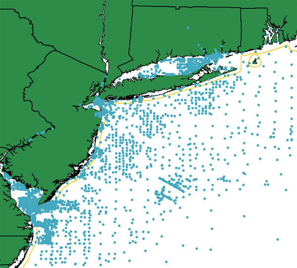
usSEABED FACies data for the New York-New Jersey Region (NYNJ_FAC)

Metadata also available as - [Questions & Answers] - [Parseable text] - [XML]

Metadata:

Identification_Information:
Citation:
Citation_Information:
Originator: U.S. Geological Survey
Publication_Date: 2006
Title:
usSEABED FACies data for the New York-New Jersey Region (NYNJ_FAC)
Edition: 1.0
Geospatial_Data_Presentation_Form: vector digital data
Series_Information:
Series_Name: Open-File Report
Issue_Identification: 2006-1046
Publication_Information:
Publication_Place: Woods Hole Coastal and Marine Science Center, Woods Hole, MA
Publisher: U.S. Geological Survey, Coastal and Marine Geology Program
Online_Linkage: https://doi.org/10.3133/ofr20061046
Online_Linkage: https://pubs.usgs.gov/of/2006/1046/htmldocs/data_catalog.htm
Online_Linkage: https://pubs.usgs.gov/of/2006/1046/data/usseabed/nynj_fac.zip
Larger_Work_Citation:
Citation_Information:
Originator: M.A. Arsenault
Originator: J.A. Reid
Originator: C.J. Jenkins
Originator: S.J. Williams
Originator: L.J. Poppe
Originator: J.M. Reid
Publication_Date: 2006
Title:
Surficial Sediment Character of the New York-New Jersey Offshore Continental Shelf Region: a GIS Compilation
Edition: 1.0
Series_Information:
Series_Name: Open-File Report
Issue_Identification: 2006-1046
Publication_Information:
Publication_Place: Reston, VA
Publisher: U.S. Geological Survey
Online_Linkage: https://pubs.usgs.gov/of/2006/1046/
Description:
Abstract:
The facies data layer (FAC) is a point coverage of known sediment samplings, inspections, and probings from the usSEABED data collection and integrated using the software system dbSEABED.
The facies data layer (FAC) represents concatenated information about components (minerals and rock type), genesis (igneous, metamorphic, carbonate, terrigenous), and other appropriate groupings of information about the seafloor. The facies data are parsed from written descriptions from cores, grabs, photographs, and videos, and may apply only to a subsample as denoted by the Top, Bottom, and SamplePhase fields.
Lack of values in a defined facies field does not necessarily imply lack of the components defining that field, but may imply a lack of data for that field.
Purpose:
To build a digital mapping of the character of the seabed on regional, national and global scales. These data are intended for science researchers, students, policy makers, and the general public. The data can be used with geographic information systems (GIS) software to display geologic and oceanographic information.
Supplemental_Information:
This data layer is a subset of the original usSEABED East Coast data release version 1.0, and is geographically clipped to the greater New York-New Jersey geographical region.
Time_Period_of_Content:
Time_Period_Information:
Single_Date/Time:
Calendar_Date: 2006
Currentness_Reference: publication date
Status:
Progress: Planned
Maintenance_and_Update_Frequency: As needed
Spatial_Domain:
Bounding_Coordinates:
West_Bounding_Coordinate: -75.500000
East_Bounding_Coordinate: -71.000000
North_Bounding_Coordinate: 41.706940
South_Bounding_Coordinate: 38.000000
Keywords:
Theme:
Theme_Keyword_Thesaurus: USGS Metadata Identifier
Theme_Keyword: USGS:0b9275a8-b512-4640-b899-5198431f9e3b
Theme:
Theme_Keyword_Thesaurus: None
Theme_Keyword: analyses
Theme_Keyword: CMGP
Theme_Keyword: Coastal and Marine Geology Program
Theme_Keyword: dbSEABED
Theme_Keyword: descriptions
Theme_Keyword: geology
Theme_Keyword: grain size
Theme_Keyword: Marine Aggregates Resources and Processes
Theme_Keyword: seabed
Theme_Keyword: seafloor
Theme_Keyword: sediment data
Theme_Keyword: texture
Theme_Keyword: U.S. Geological Survey
Theme_Keyword: USGS
Theme_Keyword: usSEABED
Theme_Keyword: Woods Hole Science Center
Theme_Keyword: University of Colorado
Theme_Keyword: Institute of Arctic and Alpine Research
Theme_Keyword: Benthic Habitats (Pacific) Project
Theme_Keyword: Pacific Science Center
Theme_Keyword: WHSC
Theme_Keyword: PSC
Theme_Keyword: INSTAAR
Theme:
Theme_Keyword_Thesaurus: ISO 19115 Topic Category
Theme_Keyword: oceans
Theme_Keyword: location
Theme_Keyword: geoscientificInformation
Theme:
Theme_Keyword_Thesaurus:
NASA/Global Change Master Directory (GCMD) Earth Science Keywords. Version 5.3.3
Theme_Keyword: Oceans
Theme_Keyword: Marine Sediments
Theme_Keyword: Biogenic Sediments
Theme_Keyword: Sediment Chemistry
Theme_Keyword: Sediment Composition
Theme_Keyword: Sediment Textures
Theme_Keyword: Sedimentation
Theme_Keyword: Terrigenous Sediments
Theme:
Theme_Keyword_Thesaurus: USGS Thesaurus
Theme_Keyword: geospatial datasets
Theme_Keyword: sea-floor characteristics
Place:
Place_Keyword_Thesaurus: None
Place_Keyword: New York
Place_Keyword: New Jersey
Place_Keyword: New York Bight
Place_Keyword: Atlantic coast
Place_Keyword: East Coast
Place_Keyword: United States
Place_Keyword: Atlantic Ocean
Access_Constraints: None
Use_Constraints:
Public domain data from the U.S. Government are freely redistributable with proper metadata and source attribution. Please recognize the U.S. Geological Survey (USGS) as the source of this information.
Point_of_Contact:
Contact_Information:
Contact_Person_Primary:
Contact_Person: Matthew A. Arsenault
Contact_Organization: U.S. Geological Survey
Contact_Position: IT Specialist (Data Management)
Contact_Address:
Address_Type: mailing and physical address
Address: 384 Woods Hole Road
City: Woods Hole
State_or_Province: MA
Postal_Code: 02543-1598
Country: USA
Contact_Voice_Telephone: (508) 548-8700 x2354
Contact_Facsimile_Telephone: (508) 457-2310
Contact_Electronic_Mail_Address: marsenault@usgs.gov
Browse_Graphic:
Browse_Graphic_File_Name: https://pubs.usgs.gov/of/2006/1046/browseimages/nynj_fac.jpg
Browse_Graphic_File_Description: Image map showing extent of data layer coverage
Browse_Graphic_File_Type: JPEG
Native_Data_Set_Environment:
Microsoft Windows XP Version 5.1 (Build 2600) Service Pack 2; ESRI ArcCatalog 9.1.0.722
Cross_Reference:
Citation_Information:
Originator: J.M. Reid
Originator: J.A. Reid
Originator: C.J. Jenkins
Originator: M.E. Hastings
Originator: S.J. Williams
Originator: L.J. Poppe
Publication_Date: 2005
Title:
usSEABED: Atlantic Coast Offshore Surficial Sediment Data Release, version 1.0
Edition: 1.0
Series_Information:
Series_Name: Data Series
Issue_Identification: 118
Publication_Information:
Publication_Place: Reston, VA
Publisher: U.S. Geological Survey
Online_Linkage: https://pubs.usgs.gov/ds/2005/118/
Data_Quality_Information:
Attribute_Accuracy:
Attribute_Accuracy_Report:
Accuracy of each attribute is dependent on the accuracy of the lineage data.
Logical_Consistency_Report:
Data in usSEABED are based on the observations and analyses of others, filtered through a unifying and mining software. Each source report varies in type of information/data recorded and format. Only those observations that are recorded can be filtered and mined; only presence (not absence) or information can be noted.
Completeness_Report:
Additional useable data may exist in this area; the authors appreciate any information and leads.
Positional_Accuracy:
Horizontal_Positional_Accuracy:
Horizontal_Positional_Accuracy_Report:
Locational accuracy is dependent on the accuracy of the navigational technique from the individual data sources and may vary widely (e.g., from 0.005km (differential GPS) in more recent surveys to greater than 2 km based on radar, Loran, or dead reckoning in older surveys.) Users of the data should use their own criteria for assessing the accuracy of the locations.
Vertical_Positional_Accuracy:
Vertical_Positional_Accuracy_Report:
Locational accuracy is dependent on the accuracy of the navigational technique from the individual data sources. Users of the data should use their own criteria for assessing the accuracy of the locations.
Lineage:
Source_Information:
Source_Citation:
Citation_Information:
Originator: U.S. Geological Survey
Originator: University of Colorado
Publication_Date: 2005
Title:
ATL_FAC: usSEABED facies data for the entire U.S. Atlantic Coast
Edition: 1.0
Geospatial_Data_Presentation_Form: vector digital data
Series_Information:
Series_Name: Data Series
Issue_Identification: 118
Publication_Information:
Publication_Place: Woods Hole Coastal and Marine Science Center, Woods Hole, MA
Publisher: U.S. Geological Survey, Coastal and Marine Geology Program
Online_Linkage: https://pubs.usgs.gov/ds/2005/118/data/atl_fac.zip
Larger_Work_Citation:
Citation_Information:
Originator: J.M. Reid
Originator: J.A. Reid
Originator: C.J. Jenkins
Originator: M.E. Hastings
Originator: S.J. Williams
Originator: L.J. Poppe
Publication_Date: 2005
Title:
usSEABED: Atlantic Coast Offshore Surficial Sediment Data Release
Edition: 1.0
Series_Information:
Series_Name: Data Series
Issue_Identification: 118
Publication_Information:
Publication_Place: Reston, VA
Publisher: U.S. Geological Survey
Other_Citation_Details:
See separate listing contained within the Larger_Work_Citation of the Source_Citation for specific sources and associated metadata
Online_Linkage: https://pubs.usgs.gov/ds/2005/118/
Type_of_Source_Media: online
Source_Time_Period_of_Content:
Time_Period_Information:
Single_Date/Time:
Calendar_Date: 2005
Source_Currentness_Reference: publication date
Source_Citation_Abbreviation: Information unavailable from original metadata.
Source_Contribution:
point locations, descriptions and analytical data on many different types of sediment and rock materials and benthos for the entire U.S. Atlantic coast
Process_Step:
Process_Description:
The data contained in this report were clipped from the larger citation using the 'Select' tool in the ArcToolbox, and selected using the following criteria: "LATITUDE" >=38 and "LATITUDE" <=42 and "LONGITUDE" <=-71 and "LONGITUDE" >=-75.5
Source_Used_Citation_Abbreviation: ATL_FAC
Process_Date: 2006
Source_Produced_Citation_Abbreviation: NYNJ_FAC
Process_Contact:
Contact_Information:
Contact_Person_Primary:
Contact_Person: Matthew A. Arsenault
Contact_Organization: USGS
Contact_Position: IT Specialist (Data Management)
Contact_Address:
Address_Type: mailing and physical address
Address: 384 Woods Hole Rd, Woods Hole Science Center
City: Woods Hole
State_or_Province: MA
Postal_Code: 02543-1598
Country: USA
Contact_Voice_Telephone: 508-548-8700 x2354
Contact_Facsimile_Telephone: 508-457-2310
Contact_Electronic_Mail_Address: marsenault@usgs.gov
Process_Step:
Process_Description:
Edits to the metadata were made to fix any errors that MP v 2.9.36 flagged. This is necessary to enable the metadata to be successfully harvested for various data catalogs. In some cases, this meant adding text "Information unavailable" or "Information unavailable from original metadata" for those required fields that were left blank. Other minor edits were probably performed (title, publisher, publication place, etc.). Reordered the links in the identification section so a landing page link is first. Attempted to modify http to https where appropriate. Some attributes were incompletely defined and had to be modified to meet the standard. The metadata date (but not the metadata creator) was edited to reflect the date of these changes. The metadata available from a harvester may supersede metadata bundled within a download file. Compare the metadata dates to determine which metadata file is most recent.
Process_Date: 20171020
Process_Contact:
Contact_Information:
Contact_Organization_Primary:
Contact_Organization: U.S. Geological Survey
Contact_Person: VeeAnn A. Cross
Contact_Position: Marine Geologist
Contact_Address:
Address_Type: Mailing and Physical
Address: 384 Woods Hole Road
City: Woods Hole
State_or_Province: MA
Postal_Code: 02543-1598
Contact_Voice_Telephone: 508-548-8700 x2251
Contact_Facsimile_Telephone: 508-457-2310
Contact_Electronic_Mail_Address: vatnipp@usgs.gov
Process_Step:
Process_Description: USGS Thesaurus keywords added to the keyword section.
Process_Date: 20180720
Process_Contact:
Contact_Information:
Contact_Organization_Primary:
Contact_Organization: U.S. Geological Survey
Contact_Person: VeeAnn A. Cross
Contact_Position: Marine Geologist
Contact_Address:
Address_Type: Mailing and Physical
Address: 384 Woods Hole Road
City: Woods Hole
State_or_Province: MA
Postal_Code: 02543-1598
Contact_Voice_Telephone: 508-548-8700 x2251
Contact_Facsimile_Telephone: 508-457-2310
Contact_Electronic_Mail_Address: vatnipp@usgs.gov
Process_Step:
Process_Description: Crossref DOI link was added as the first link in the metadata.
Process_Date: 20191118
Process_Contact:
Contact_Information:
Contact_Organization_Primary:
Contact_Organization: U.S. Geological Survey
Contact_Person: VeeAnn A. Cross
Contact_Position: Marine Geologist
Contact_Address:
Address_Type: Mailing and Physical
Address: 384 Woods Hole Road
City: Woods Hole
State_or_Province: MA
Postal_Code: 02543-1598
Contact_Voice_Telephone: 508-548-8700 x2251
Contact_Facsimile_Telephone: 508-457-2310
Contact_Electronic_Mail_Address: vatnipp@usgs.gov
Process_Step:
Process_Description:
Added keywords section with USGS persistent identifier as theme keyword.
Process_Date: 20200908
Process_Contact:
Contact_Information:
Contact_Organization_Primary:
Contact_Organization: U.S. Geological Survey
Contact_Person: VeeAnn A. Cross
Contact_Position: Marine Geologist
Contact_Address:
Address_Type: Mailing and Physical
Address: 384 Woods Hole Road
City: Woods Hole
State_or_Province: MA
Postal_Code: 02543-1598
Contact_Voice_Telephone: 508-548-8700 x2251
Contact_Facsimile_Telephone: 508-457-2310
Contact_Electronic_Mail_Address: vatnipp@usgs.gov
Spatial_Data_Organization_Information:
Direct_Spatial_Reference_Method: Vector
Point_and_Vector_Object_Information:
SDTS_Terms_Description:
SDTS_Point_and_Vector_Object_Type: Entity point
Point_and_Vector_Object_Count: 3064
Spatial_Reference_Information:
Horizontal_Coordinate_System_Definition:
Geographic:
Latitude_Resolution: 0.000001
Longitude_Resolution: 0.000001
Geographic_Coordinate_Units: Decimal degrees
Geodetic_Model:
Horizontal_Datum_Name: North American Datum of 1927
Ellipsoid_Name: Clarke 1866
Semi-major_Axis: 6378206.400000
Denominator_of_Flattening_Ratio: 294.978698
Entity_and_Attribute_Information:
Detailed_Description:
Entity_Type:
Entity_Type_Label: NYNJ_FAC
Entity_Type_Definition: Shapefile Attribute Table
Entity_Type_Definition_Source: ESRI
Attribute:
Attribute_Label: FID
Attribute_Definition: Internal feature number.
Attribute_Definition_Source: ESRI
Attribute_Domain_Values:
Unrepresentable_Domain:
Sequential unique whole numbers that are automatically generated.
Attribute:
Attribute_Label: Shape
Attribute_Definition: Feature geometry.
Attribute_Definition_Source: ESRI
Attribute_Domain_Values:
Unrepresentable_Domain: Coordinates defining the features.
Attribute:
Attribute_Label: LATITUDE
Attribute_Definition: Latitude coordinate of sample location
Attribute_Definition_Source: source data
Attribute_Domain_Values:
Range_Domain:
Range_Domain_Minimum: Information unavailable from original metadata.
Range_Domain_Maximum: Information unavailable from original metadata.
Attribute_Units_of_Measure: decimal degrees
Attribute:
Attribute_Label: LONGITUDE
Attribute_Definition: Longitude coordinate of sample location
Attribute_Definition_Source: source data
Attribute_Domain_Values:
Range_Domain:
Range_Domain_Minimum: Information unavailable from original metadata.
Range_Domain_Maximum: Information unavailable from original metadata.
Attribute_Units_of_Measure: decimal degrees
Attribute:
Attribute_Label: WATERDEPTH
Attribute_Definition: measured water depth for site (usually uncorrected)
Attribute_Definition_Source: source data
Attribute_Domain_Values:
Range_Domain:
Range_Domain_Minimum: Information unavailable from original metadata.
Range_Domain_Maximum: Information unavailable from original metadata.
Attribute_Units_of_Measure: meters
Attribute:
Attribute_Label: SAMPLETOP
Attribute_Definition: measured subbottom depth information for each point sample
Attribute_Definition_Source: Information unavailable from original metadata.
Attribute_Domain_Values:
Range_Domain:
Range_Domain_Minimum: Information unavailable from original metadata.
Range_Domain_Maximum: Information unavailable from original metadata.
Attribute_Units_of_Measure: meters
Attribute:
Attribute_Label: SAMPLEBASE
Attribute_Definition: measured subbottom depth information for each point sample
Attribute_Definition_Source: Information unavailable from original metadata.
Attribute_Domain_Values:
Range_Domain:
Range_Domain_Minimum: Information unavailable from original metadata.
Range_Domain_Maximum: Information unavailable from original metadata.
Attribute_Units_of_Measure: meters
Attribute:
Attribute_Label: DATASETKEY
Attribute_Definition: Unique sequential numeric key to SRC file
Attribute_Definition_Source: dbSEABED processing software
Attribute_Domain_Values:
Unrepresentable_Domain: Information unavailable from original metadata.
Attribute:
Attribute_Label: SITEKEY
Attribute_Definition: Unique sequential numeric key to SRC file
Attribute_Definition_Source: dbSEABED processing software
Attribute_Domain_Values:
Unrepresentable_Domain: Information unavailable from original metadata.
Attribute:
Attribute_Label: SAMPLEKEY
Attribute_Definition: Unique sequential numeric key to SRC file
Attribute_Definition_Source: dbSEABED processing software
Attribute_Domain_Values:
Unrepresentable_Domain: Information unavailable from original metadata.
Attribute:
Attribute_Label: SAMPLER
Attribute_Definition: Equipment used to collect samples
Attribute_Definition_Source: Original data source
Attribute_Domain_Values:
Unrepresentable_Domain: Information unavailable from original metadata.
Attribute:
Attribute_Label: CARBONATE
Attribute_Definition: Carbonate, including finest to coarsest sampled fractions
Attribute_Definition_Source: Information unavailable from original metadata.
Attribute_Domain_Values:
Unrepresentable_Domain: Information unavailable from original metadata.
Attribute:
Attribute_Label: SAMPLEPHAS
Attribute_Definition:
Sample Phase; records whether the results are for the whole, bulk sediment or just to some special part
Attribute_Definition_Source: dbSEABED processing software
Attribute_Domain_Values:
Unrepresentable_Domain:
Output as a word-based description that may involve numerics. This field will need to be selected against when GIS mappings of the bulk sediment characters are being mapped. Only blank entries should be included in such a mapping.
Attribute:
Attribute_Label: SITE
Attribute_Definition: Information unavailable from original metadata.
Attribute_Definition_Source: Information unavailable from original metadata.
Attribute_Domain_Values:
Unrepresentable_Domain: Information unavailable from original metadata.
Attribute:
Attribute_Label: DATATYPE
Attribute_Definition: Information unavailable from original metadata.
Attribute_Definition_Source: Information unavailable from original metadata.
Attribute_Domain_Values:
Unrepresentable_Domain: Information unavailable from original metadata.
Attribute:
Attribute_Label: TERRIGENOU
Attribute_Definition: Information unavailable from original metadata.
Attribute_Definition_Source: Information unavailable from original metadata.
Attribute_Domain_Values:
Unrepresentable_Domain: Information unavailable from original metadata.
Attribute:
Attribute_Label: IGNEOUS
Attribute_Definition: Information unavailable from original metadata.
Attribute_Definition_Source: Information unavailable from original metadata.
Attribute_Domain_Values:
Unrepresentable_Domain: Information unavailable from original metadata.
Attribute:
Attribute_Label: VOLCANIC
Attribute_Definition: Information unavailable from original metadata.
Attribute_Definition_Source: Information unavailable from original metadata.
Attribute_Domain_Values:
Unrepresentable_Domain: Information unavailable from original metadata.
Attribute:
Attribute_Label: METAMORPHI
Attribute_Definition: Information unavailable from original metadata.
Attribute_Definition_Source: Information unavailable from original metadata.
Attribute_Domain_Values:
Unrepresentable_Domain: Information unavailable from original metadata.
Attribute:
Attribute_Label: MINERALIZE
Attribute_Definition: Information unavailable from original metadata.
Attribute_Definition_Source: Information unavailable from original metadata.
Attribute_Domain_Values:
Unrepresentable_Domain: Information unavailable from original metadata.
Attribute:
Attribute_Label: AUTHFEMN
Attribute_Definition: Information unavailable from original metadata.
Attribute_Definition_Source: Information unavailable from original metadata.
Attribute_Domain_Values:
Unrepresentable_Domain: Information unavailable from original metadata.
Attribute:
Attribute_Label: OOZE
Attribute_Definition: Information unavailable from original metadata.
Attribute_Definition_Source: Information unavailable from original metadata.
Attribute_Domain_Values:
Unrepresentable_Domain: Information unavailable from original metadata.
Attribute:
Attribute_Label: CARBON
Attribute_Definition: Information unavailable from original metadata.
Attribute_Definition_Source: Information unavailable from original metadata.
Attribute_Domain_Values:
Unrepresentable_Domain: Information unavailable from original metadata.
Attribute:
Attribute_Label: GEOCHEMSIG
Attribute_Definition: Information unavailable from original metadata.
Attribute_Definition_Source: Information unavailable from original metadata.
Attribute_Domain_Values:
Unrepresentable_Domain: Information unavailable from original metadata.
Attribute:
Attribute_Label: FORAMS
Attribute_Definition: Information unavailable from original metadata.
Attribute_Definition_Source: Information unavailable from original metadata.
Attribute_Domain_Values:
Unrepresentable_Domain: Information unavailable from original metadata.
Attribute:
Attribute_Label: OTHERCALCP
Attribute_Definition: Information unavailable from original metadata.
Attribute_Definition_Source: Information unavailable from original metadata.
Attribute_Domain_Values:
Unrepresentable_Domain: Information unavailable from original metadata.
Attribute:
Attribute_Label: SILCPELAG
Attribute_Definition: Information unavailable from original metadata.
Attribute_Definition_Source: Information unavailable from original metadata.
Attribute_Domain_Values:
Unrepresentable_Domain: Information unavailable from original metadata.
Attribute:
Attribute_Label: SHELL
Attribute_Definition: Information unavailable from original metadata.
Attribute_Definition_Source: Information unavailable from original metadata.
Attribute_Domain_Values:
Unrepresentable_Domain: Information unavailable from original metadata.
Attribute:
Attribute_Label: CORAL
Attribute_Definition: Information unavailable from original metadata.
Attribute_Definition_Source: Information unavailable from original metadata.
Attribute_Domain_Values:
Unrepresentable_Domain: Information unavailable from original metadata.
Attribute:
Attribute_Label: HARDPLANT
Attribute_Definition: Information unavailable from original metadata.
Attribute_Definition_Source: Information unavailable from original metadata.
Attribute_Domain_Values:
Unrepresentable_Domain: Information unavailable from original metadata.
Overview_Description:
Entity_and_Attribute_Overview:
Values of -99 for any field are indications that there was no data available.
Entity_and_Attribute_Detail_Citation: U.S. Geological Survey
Distribution_Information:
Distributor:
Contact_Information:
Contact_Person_Primary:
Contact_Person: Matthew A. Arsenault
Contact_Organization: U.S. Geological Survey
Contact_Position: IT Specialist (Data Management)
Contact_Address:
Address_Type: mailing and physical address
Address: 384 Woods Hole Rd.
City: Woods Hole
State_or_Province: MA
Postal_Code: 02543-1598
Country: USA
Contact_Voice_Telephone: (508) 548-8700 x2354
Contact_Facsimile_Telephone: (508) 457-2310
Contact_Electronic_Mail_Address: marsenault@usgs.gov
Resource_Description: Downloadable Data
Distribution_Liability:
Although this data set has been used by the U.S. Geological Survey (USGS), no warranty, expressed or implied, is made by the USGS as to the accuracy of the data and/or related materials. The act of distribution shall not constitute any such warranty, and no responsibility is assumed by the USGS in the use of these data or related materials. Trade, firm, or product names and other references to non-USGS products and services are provided for information only and do not constitute endorsement or warranty, express or implied, by the USGS, USDOI, or U.S. Government, as to their suitability, content, usefulness, functioning, completeness, or accuracy.
Standard_Order_Process:
Digital_Form:
Digital_Transfer_Information:
Format_Name: ASCII
Format_Information_Content:
Text file containing data input to usSEABED. Fields are comma separated values. First record of file contains field names.
File_Decompression_Technique: no compression applied
Transfer_Size: 19.1
Digital_Transfer_Option:
Online_Option:
Computer_Contact_Information:
Network_Address:
Access_Instructions: Downloadable thru the WWW
Offline_Option:
Offline_Media: CD-ROM
Recording_Capacity:
Recording_Density: 650
Recording_Density_Units: Mbytes
Recording_Format: ISO 9660
Digital_Form:
Digital_Transfer_Information:
Format_Name: SHP
Format_Version_Number: Information unavailable from original metadata.
Format_Specification: ESRI Shapefile
Format_Information_Content:
The SHP file contains the geospatial data. The SHX file contains the index of the geospatial data. The DBF file contains the attribute data in dBASE format. The PRJ file contains the coordinate system information (optional). The AVL file contains the legend information (optional). The SBN and SBX files contain the spatial index of the geospatial data (optional). The XML file contains the metadata describing the data set <data set name>.shp.xml. An ASCII version of the metadata file. A browse graphic showing the data layer coverage and extent (optional).
File_Decompression_Technique: winzip
Digital_Transfer_Option:
Online_Option:
Computer_Contact_Information: Access_Instructions: Downloadable thru the WWW
Offline_Option:
Offline_Media: CD-ROM
Recording_Capacity:
Recording_Density: 650
Recording_Density_Units: Mbytes
Recording_Format: ISO 9660
Fees: None
Technical_Prerequisites:
These data are available in Environmental Systems Research Institute (ESRI) shapefile format. The user must have ArcGIS® or ArcView® 3.0 or greater software to read and process the data file. In lieu of ArcView or ArcGIS, the user may utilize another GIS application package capable of importing the data. A free data viewer, arcexplorer, capable of displaying the data is available from ESRI at www.esri.com.
Metadata_Reference_Information:
Metadata_Date: 20240318
Metadata_Contact:
Contact_Information:
Contact_Person_Primary:
Contact_Person: Matthew A. Arsenault
Contact_Organization: U.S. Geological Survey
Contact_Position: IT Specialist (Data Management)
Contact_Address:
Address_Type: mailing and physical address
Address: 384 Woods Hole Rd.
City: Woods Hole
State_or_Province: MA
Postal_Code: 02543-1598
Country: USA
Contact_Voice_Telephone: (508) 548-8700 x2354
Contact_Facsimile_Telephone: (508) 457-2310
Contact_Electronic_Mail_Address: whsc_data_contact@usgs.gov
Contact_Instructions:
The metadata contact email address is a generic address in the event the person is no longer with USGS. (updated on 20240318)
Metadata_Standard_Name: FGDC Content Standards for Digital Geospatial Metadata
Metadata_Standard_Version: FGDC-STD-001-1998
Metadata_Time_Convention: local time
Metadata_Access_Constraints: None
Metadata_Use_Constraints: None

This page is <https://cmgds.marine.usgs.gov/catalog/whcmsc/open_file_report/ofr2006-1046/nynj_fac_metadata.html>
Generated by mp version 2.9.51 on Mon Mar 25 16:05:25 2024