Online Links:
Online Links:
Value | Definition |
---|---|
1 | USGS field activity 05001 conducted in 2005 |
2 | USGS field activity 06001 conducted in 2006 |
Value | Definition |
---|---|
1 | USGS Research Vessel RAFAEL |
Value | Definition |
---|---|
3 | EdgeTech FSSB-424 chirp profiles (4-24 kHz) |
5 | Knudsen 320b chirp system (3.5-12 kHz) |
This shapefile represents the trackline along which seismic profile data collected aboard the R/V RAFAEL during USGS field activities 05001 and 06001 in Apalachicola Bay and St. George Sound, Florida. The seismic data that were collected from the R/V RAFAEL were acquired differently in 2005 than in 2006. During the first seven survey days of the 2005 field season (Julian days 076-083) a Knudsen 320 b chirp profiler (3.5-12 kHz) was used and during the remaining part of the 2005 season a towed Edgetech FSSB 424 (2-24 kHz) system was used. In 2006, the Edgetech FSSB 424 was used for the entire field season, but it was mounted on a pole rather than being towed on a cable. In 2005 both the Knudsen and Edgetech seismic data were logged in SEG-Y format using Delph Seismic +. In 2006 the Edgetech seismic data were logged in SEG-Y format using SBLogger. The purpose of these data is to manage the filenames and geographic locations of seismic profile images that are hyperlinked to each trackline.
Are there legal restrictions on access or use of the data?Access_Constraints: None
Use_Constraints:These data should not be used at resolutions for which they are not intended. Public domain data from the U.S. Government are freely redistributable with proper metadata and source attribution. Please recognize the U.S. Geological Survey (USGS) as the source of this information.
Although this data set has been used by the U.S. Geological Survey (USGS), no warranty, expressed or implied, is made by the USGS as to the accuracy of the data and/or related materials. The act of distribution shall not constitute any such warranty, and no responsibility is assumed by the USGS in the use of these data or related materials. Any use of trade, product, or firm names is for descriptive purposes only and does not imply endorsement by the U.S. Government.
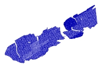
Data format: | Trackline navigation for seismic-reflection profiles in format SHP (version ArcGIS 9.2) ESRI polyline shapefile Size: 1 |
---|---|
Network links: |
http://pubs.usgs.gov/of/2006/1381/GIS/shapefiles/SeismicLines.zip |
Media you can order: | DVD-ROM (Density 4.75 Gbytes) (format UDF) |
The data are available in Environmental Systems Research Institute (ESRI) shapefile format. The user must have ArcGIS or ArcView 3.3 or greater software to read and process the data file. In lieu of ArcView or ArcGIS, the user may utilize another GIS application package capable of importing data. A free data viewer, ArcExplorer, capable of displaying the data is available from ESRI at www.esri.com.