10 meter bathymetric contours of the Cape Ann - Salisbury Beach MA Survey Area (BATHCNTR_10M, geographic, WGS84)

Metadata also available as - [Questions & Answers] - [Parseable text] - [XML]

Metadata:

Identification_Information:
Citation:
Citation_Information:
Originator: U.S. Geological Survey
Publication_Date: 2008
Title:
10 meter bathymetric contours of the Cape Ann - Salisbury Beach MA Survey Area (BATHCNTR_10M, geographic, WGS84)
Edition: 1.0
Geospatial_Data_Presentation_Form: vector digital data
Series_Information:
Series_Name: Open-File Report
Issue_Identification: 2007-1373
Publication_Information:
Publication_Place:
Woods Hole Coastal and Marine Science Center, Woods Hole, Massachusetts
Publisher: U.S. Geological Survey, Coastal and Marine Geology Program
Online_Linkage: https://doi.org/10.3133/ofr20071373
Online_Linkage: Larger_Work_Citation:
Citation_Information:
Originator: Walter A. Barnhardt
Originator: Brian D. Andrews
Originator: Seth D. Ackerman
Originator: Wayne E. Baldwin
Originator: Christopher J. Hein
Publication_Date: 2008
Title:
High-Resolution Geological Mapping of the Inner Continental Shelf: Cape Ann to Salisbury Beach, Massachusetts.
Edition: 1.0
Series_Information:
Series_Name: Open-File Report
Issue_Identification: 2007-1373
Publication_Information:
Publication_Place: Reston, VA
Publisher: U.S. Geological Survey
Online_Linkage: http://pubs.usgs.gov/of/2007/1373/
Description:
Abstract:
These data were collected under a cooperative agreement with the Massachusetts Office of Coastal Zone Management (CZM) and the U.S. Geological Survey, Coastal and Marine Geology Program, Woods Hole Science Center. Initiated in 2003, the primary objective of this program is to develop regional geologic framework information for management of coastal and marine resources. Accurate data and maps of sea-floor geology are important first steps toward protecting fish habitat, delineating marine reserves, and assessing environmental changes due to natural or human impacts. The project is focused on the inshore waters (5-30m deep) of Massachusetts between the New Hampshire border and Cape Cod Bay. Data collected for the mapping cooperative have been released in a series of USGS Open-File Reports http://woodshole.er.usgs.gov/project-pages/coastal_mass/html/current_map.html). This spatial dataset is from the Cape Ann to Salisbury Beach Massachusetts project area. They were collected in two separate surveys in 2004 and 2005 and cover approximately 325 square kilometers of the inner continental shelf. High resolution bathymetry and backscatter intensity were collected in 2004 and 2005. Seismic profile data, sediment samples and bottom photography were collected to ground-truth the acoustic geophysical data were collected in 2005.
Purpose:
The purpose of these data is to provide reference depth contours at ten meter intervals for the merged bathymetric data that covers both the nearshore and offshore survey areas.
Time_Period_of_Content:
Time_Period_Information:
Range_of_Dates/Times:
Beginning_Date: 20040223
Ending_Date: 20050916
Currentness_Reference:
ground condition of two date ranges: 20040223 to 20040316 and 20050908 to 20050916
Status:
Progress: Complete
Maintenance_and_Update_Frequency: None planned
Spatial_Domain:
Bounding_Coordinates:
West_Bounding_Coordinate: -70.805125
East_Bounding_Coordinate: -70.597044
North_Bounding_Coordinate: 42.874633
South_Bounding_Coordinate: 42.675142
Keywords:
Theme:
Theme_Keyword_Thesaurus: USGS Metadata Identifier
Theme_Keyword: USGS:c53d5f8b-adc4-4f39-8812-db06e8155c3d
Theme:
Theme_Keyword_Thesaurus: None
Theme_Keyword: U.S. Geological Survey
Theme_Keyword: USGS
Theme_Keyword: Coastal and Marine Geology Program
Theme_Keyword: CMGP
Theme_Keyword: Woods Hole Science Center
Theme_Keyword: WHSC
Theme_Keyword: Bathymetry
Theme_Keyword: Seafloor
Theme_Keyword: Marine Geology
Theme_Keyword: Swath Bathymetry
Theme_Keyword: polyline shapefile
Theme_Keyword: field activity serial number 05005
Theme_Keyword: field activity serial number 04015
Theme_Keyword: Science Applications International Corporation
Theme_Keyword: Contours
Theme:
Theme_Keyword_Thesaurus: ISO 19115 Topic Category
Theme_Keyword: oceans
Theme_Keyword: geoscientificInformation
Theme_Keyword: elevation
Theme_Keyword: imageryBaseMapsEarthCover
Theme:
Theme_Keyword_Thesaurus: USGS Thesaurus
Theme_Keyword: bathymetry
Theme_Keyword: contouring
Theme_Keyword: sea-floor characteristics
Theme_Keyword: geospatial datasets
Place:
Place_Keyword_Thesaurus: None
Place_Keyword: United States
Place_Keyword: North America
Place_Keyword: Atlantic Ocean
Place_Keyword: Gulf of Maine
Place_Keyword: Bigelow Bight
Place_Keyword: Merrimack River
Place_Keyword: Ipswich Bay
Place_Keyword: Massachusetts
Place_Keyword: Cape Ann
Place_Keyword: Salisbury Beach
Place_Keyword: Plum Island
Stratum:
Stratum_Keyword_Thesaurus: None
Stratum_Keyword: Seafloor
Stratum_Keyword: sea floor
Temporal:
Temporal_Keyword_Thesaurus: None
Temporal_Keyword: 2004
Temporal_Keyword: 2005
Access_Constraints: None
Use_Constraints:
Public domain data from the U.S. Government are freely redistributable with proper metadata and source attribution. Please recognize the U.S. Geological Survey (USGS) as the source of this information.
Point_of_Contact:
Contact_Information:
Contact_Person_Primary:
Contact_Person: Brian Andrews
Contact_Organization: U.S. Geological Survey
Contact_Position: Geographer
Contact_Address:
Address_Type: mailing and physical address
Address: 384 Woods Hole Rd.
City: Woods Hole
State_or_Province: MA
Postal_Code: 02543-1598
Country: USA
Contact_Voice_Telephone: 508-548-8700 x2348
Contact_Facsimile_Telephone: 508-457-2310
Contact_Electronic_Mail_Address: bandrews@usgs.gov
Browse_Graphic:
Browse_Graphic_File_Name: Browse_Graphic_File_Description: thumbnail image of 10 meter bathymetric contours
Browse_Graphic_File_Type: JPEG
Native_Data_Set_Environment:
Microsoft Windows 2000 Version 5.2 (Build 3790) Service Pack 2; ESRI ArcCatalog 9.2.6.1500
Cross_Reference:
Citation_Information:
Originator: Walter A. Barnhardt
Originator: Brian D. Andrews
Originator: Bradford Butman
Publication_Date: 2006
Title:
High-Resolution Mapping of the Inner Continental Shelf: Nahant to Gloucester, Massachusetts
Series_Information:
Series_Name: Open-File Report
Issue_Identification: 2005-1293
Publication_Information:
Publication_Place: Reston, VA
Publisher: U.S. Geological Survey
Online_Linkage: http://pubs.usgs.gov/of/2005/1293/
Cross_Reference:
Citation_Information:
Originator: Seth D. Ackerman
Originator: Bradford Butman
Originator: Walter A. Barnhardt
Originator: William W. Danforth
Originator: James M. Crocker
Publication_Date: 2006
Title:
High-Resolution Geologic Mapping of the Inner Continental Shelf: Boston Harbor and Approaches, Massachusetts
Series_Information:
Series_Name: Open-File Report
Issue_Identification: 2006-1008
Publication_Information:
Publication_Place: Reston, VA
Publisher: U.S. Geological Survey
Online_Linkage: http://pubs.usgs.gov/of/2006/1008/
Data_Quality_Information:
Logical_Consistency_Report:
Bathymetric contours were simplified and smoothed to increase cartographic quality of contours.
Completeness_Report:
Small depth contours less than 100 meters in length were removed for cartographic quality.
Lineage:
Process_Step:
Process_Description:
Calculate depth contour feature class at 10m contour intervals from input grid CABATH5m. Used the Contour Surface Tool within ArcGIS 9.2 Spatial Analyst Tools. Used 10 meter analysis cell size to generalize smoother contours.
Source_Used_Citation_Abbreviation: cabath5m (This publication)
Process_Date: 200712
Process_Contact:
Contact_Information:
Contact_Person_Primary:
Contact_Person: Brian Andrews
Contact_Organization: U.S. Geological Survey
Contact_Position: Geographer
Contact_Address:
Address_Type: mailing and physical address
Address: 384 Woods Hole Rd.
City: Woods Hole
State_or_Province: MA
Postal_Code: 02543-1598
Country: USA
Contact_Voice_Telephone: 508-548-8700 x2348
Contact_Facsimile_Telephone: 508-457-2310
Contact_Electronic_Mail_Address: bandrews@usgs.gov
Process_Step:
Process_Description:
Output depth contours were simplified using the Simplify Line tool in ArcGIS 9.2 Data Management Toolbox. The Simplify Line parameters included the Simplification Algorithm = BEND_SIMPLIFY, Simplification Tolerance Reference Baseline ="100 Meters" , RESOLVE_ERRORS KEEP_COLLAPSED_POINTS CHECK.
Process_Date: 200712
Process_Contact:
Contact_Information:
Contact_Person_Primary:
Contact_Person: Brian Andrews
Contact_Organization: U.S. Geological Survey
Contact_Position: Geographer
Contact_Address:
Address_Type: mailing and physical address
Address: 384 Woods Hole Rd
City: Woods Hole
State_or_Province: MA
Postal_Code: 02543-1598
Country: USA
Contact_Voice_Telephone: 508-548-8700 x2348
Contact_Facsimile_Telephone: 508-457-2310
Contact_Electronic_Mail_Address: bandrews@usgs.gov
Process_Step:
Process_Description:
The simplified contours were then smoothed to enhance cartographic display. The SmoothLine tool in ArcGIS 9.2 ArcToolbox was used to smooth the polyline with following parameters: Smoothing Algorithm= BEZIER_INTERPOLATION, Handling Topological Errors=NO_CHECK.
Process_Date: 200712
Process_Contact:
Contact_Information:
Contact_Person_Primary:
Contact_Person: Brian Andrews
Contact_Organization: U.S. Geological Survey
Contact_Position: Geographer
Contact_Address:
Address_Type: mailing and physical address
Address: 384 Woods Hole Rd
City: Woods Hole
State_or_Province: MA
Postal_Code: 02543-1598
Country: USA
Contact_Voice_Telephone: 508-548-8700 x2348
Contact_Facsimile_Telephone: 508-457-2310
Contact_Electronic_Mail_Address: bandrews@usgs.gov
Process_Step:
Process_Description:
Export feature class "BathCntr_10m" from ArcMap 9.2 file geodatabase to "BathyCntr_10m.shp" shapefile using "Feature Class To Shapefile (multiple)" in ArcCatalog (ver 9.2) Conversion Toolbox. Environmental settings during conversion set output coordinate system as Geographic coordinate system WGS84.
Process_Date: 200806
Process_Contact:
Contact_Information:
Contact_Person_Primary:
Contact_Person: Brian Andrews
Contact_Organization: U.S. Geological Survey
Contact_Position: Geographer
Contact_Address:
Address_Type: mailing and physical address
Address: 384 Woods Hole Rd
City: Woods Hole
State_or_Province: MA
Postal_Code: 02543-1598
Country: USA
Contact_Voice_Telephone: 508-548-8700 x2348
Contact_Facsimile_Telephone: 508-457-2310
Contact_Electronic_Mail_Address: bandrews@usgs.gov
Process_Step:
Process_Description:
Edits to the metadata were made to fix any errors that MP v 2.9.30 flagged. This is necessary to enable the metadata to be successfully harvested for various data catalogs. In some cases, this meant adding text "Information unavailable" or "Information unavailable from original metadata" for those required fields that were left blank. Other minor edits were probably performed (title, publisher, publication place, etc.). The metadata date (but not the metadata creator) was edited to reflect the date of these changes. The metadata available from a harvester may supersede metadata bundled within a download file. Compare the metadata dates to determine which metadata file is most recent.
Process_Date: 20151105
Process_Contact:
Contact_Information:
Contact_Organization_Primary:
Contact_Organization: U.S. Geological Survey
Contact_Person: VeeAnn A. Cross
Contact_Position: Marine Geologist
Contact_Address:
Address_Type: mailing and physical address
Address: 384 Woods Hole Rd.
City: Woods Hole
State_or_Province: MA
Postal_Code: 02543
Contact_Voice_Telephone: 508-548-8700 x2251
Contact_Facsimile_Telephone: 508-457-2310
Contact_Electronic_Mail_Address: vatnipp@usgs.gov
Process_Step:
Process_Description: USGS Thesaurus keywords added to the keyword section.
Process_Date: 20180720
Process_Contact:
Contact_Information:
Contact_Organization_Primary:
Contact_Organization: U.S. Geological Survey
Contact_Person: VeeAnn A. Cross
Contact_Position: Marine Geologist
Contact_Address:
Address_Type: Mailing and Physical
Address: 384 Woods Hole Road
City: Woods Hole
State_or_Province: MA
Postal_Code: 02543-1598
Contact_Voice_Telephone: 508-548-8700 x2251
Contact_Facsimile_Telephone: 508-457-2310
Contact_Electronic_Mail_Address: vatnipp@usgs.gov
Process_Step:
Process_Description: Crossref DOI link was added as the first link in the metadata.
Process_Date: 20191118
Process_Contact:
Contact_Information:
Contact_Organization_Primary:
Contact_Organization: U.S. Geological Survey
Contact_Person: VeeAnn A. Cross
Contact_Position: Marine Geologist
Contact_Address:
Address_Type: Mailing and Physical
Address: 384 Woods Hole Road
City: Woods Hole
State_or_Province: MA
Postal_Code: 02543-1598
Contact_Voice_Telephone: 508-548-8700 x2251
Contact_Facsimile_Telephone: 508-457-2310
Contact_Electronic_Mail_Address: vatnipp@usgs.gov
Process_Step:
Process_Description:
Added keywords section with USGS persistent identifier as theme keyword.
Process_Date: 20200908
Process_Contact:
Contact_Information:
Contact_Organization_Primary:
Contact_Organization: U.S. Geological Survey
Contact_Person: VeeAnn A. Cross
Contact_Position: Marine Geologist
Contact_Address:
Address_Type: Mailing and Physical
Address: 384 Woods Hole Road
City: Woods Hole
State_or_Province: MA
Postal_Code: 02543-1598
Contact_Voice_Telephone: 508-548-8700 x2251
Contact_Facsimile_Telephone: 508-457-2310
Contact_Electronic_Mail_Address: vatnipp@usgs.gov
Spatial_Data_Organization_Information:
Direct_Spatial_Reference_Method: Vector
Point_and_Vector_Object_Information:
SDTS_Terms_Description:
SDTS_Point_and_Vector_Object_Type: String
Point_and_Vector_Object_Count: 310
Spatial_Reference_Information:
Horizontal_Coordinate_System_Definition:
Geographic:
Latitude_Resolution: 0.000001
Longitude_Resolution: 0.000001
Geographic_Coordinate_Units: Decimal degrees
Geodetic_Model:
Horizontal_Datum_Name: D_WGS_1984
Ellipsoid_Name: WGS_1984
Semi-major_Axis: 6378137.000000
Denominator_of_Flattening_Ratio: 298.257224
Vertical_Coordinate_System_Definition:
Depth_System_Definition:
Depth_Datum_Name: mean lower low water
Depth_Resolution: 10
Depth_Distance_Units: meters
Depth_Encoding_Method: Attribute values
Entity_and_Attribute_Information:
Detailed_Description:
Entity_Type:
Entity_Type_Label: BathCntr_10m
Entity_Type_Definition: 10 meter bathymetric Contours
Entity_Type_Definition_Source: USGS
Attribute:
Attribute_Label: Shape
Attribute_Definition: Feature geometry.
Attribute_Definition_Source: ESRI
Attribute_Domain_Values:
Unrepresentable_Domain: Coordinates defining the features.
Attribute:
Attribute_Label: ID
Attribute_Definition: Internal identification number
Attribute_Definition_Source: ESRI
Attribute_Domain_Values:
Unrepresentable_Domain: Information unavailable from original metadata.
Attribute:
Attribute_Label: CONTOUR
Attribute_Definition: Depth below mean lower low water of contour.
Attribute_Definition_Source: USGS
Attribute_Domain_Values:
Range_Domain:
Range_Domain_Minimum: -10
Range_Domain_Maximum: -90
Attribute_Units_of_Measure: meters below mean lower low water
Attribute:
Attribute_Label: FID
Attribute_Definition: Internal feature number.
Attribute_Definition_Source: ESRI
Attribute_Domain_Values:
Unrepresentable_Domain:
Sequential unique whole numbers that are automatically generated.
Attribute:
Attribute_Label: Shape_Leng
Attribute_Definition:
Length of feature in meters (UTM 19, WGS84) automatically calculated in the geodatabase.
Attribute_Definition_Source: ESRI
Attribute_Domain_Values:
Unrepresentable_Domain: Information unavailable from original metadata.
Overview_Description:
Entity_and_Attribute_Overview:
The order of attributes in the attribute table may be different than the order of the Entity_and_Attribute_Information: Detailed_Description in this metadata file.
Entity_and_Attribute_Detail_Citation: U.S. Geological Survey
Distribution_Information:
Distributor:
Contact_Information:
Contact_Person_Primary:
Contact_Person: Brian Andrews
Contact_Organization: U.S. Geological Survey, Woods Hole Science Center
Contact_Position: Geographer
Contact_Address:
Address_Type: mailing and physical address
Address: 384 Woods Hole Rd.
City: Woods Hole
State_or_Province: MA
Postal_Code: 02543
Country: USA
Contact_Voice_Telephone: 508-548-8700 x2348
Contact_Electronic_Mail_Address: bandrews@usgs.gov
Resource_Description: Downloadable Data
Distribution_Liability:
Neither the U.S. Government, the Department of the Interior, nor the USGS, nor any of their employees, contractors, or subcontractors, make any warranty, express or implied, nor assume any legal liability or responsibility for the accuracy, completeness, or usefulness of any information, apparatus, product, or process disclosed, nor represent that its use would not infringe on privately owned rights. The act of distribution shall not constitute any such warranty, and no responsibility is assumed by the USGS in the use of these data or related materials. Any use of trade, product, or firm names is for descriptive purposes only and does not imply endorsement by the U.S. Government.
Standard_Order_Process:
Digital_Form:
Digital_Transfer_Information:
Format_Name: SHP
Format_Version_Number: ArcGIS 9.2
Format_Specification: ESRI polyline shapefile
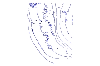
Format_Information_Content: 10 meter depth contours
File_Decompression_Technique: WinZip
Transfer_Size: 0.5
Digital_Transfer_Option:
Online_Option:
Computer_Contact_Information: Access_Instructions: Data can be downloaded via the World Wide Web (WWW)
Offline_Option:
Offline_Media: DVD-ROM
Recording_Capacity:
Recording_Density: 4.75
Recording_Density_Units: Gbytes
Recording_Format: UDF
Fees: none
Technical_Prerequisites:
These data are available as a shapefile in Environmental Systems Research Institute (ESRI) format. The shapefile is distributed in a compressed format as a WinZip (ver. 9.0) To utilize these data, the user must be able to uncompress the WinZip file and have software capable of viewing ESRI shapefiles.
Metadata_Reference_Information:
Metadata_Date: 20240318
Metadata_Contact:
Contact_Information:
Contact_Person_Primary:
Contact_Person: Brian Andrews
Contact_Organization: U.S. Geological Survey
Contact_Position: Geographer
Contact_Address:
Address_Type: mailing and physical address
Address: 384 Woods Hole Rd.
City: Woods Hole
State_or_Province: MA
Postal_Code: 02543-1598
Country: USA
Contact_Voice_Telephone: 508-548-8700 x2348
Contact_Facsimile_Telephone: 508-457-2310
Contact_Electronic_Mail_Address: whsc_data_contact@usgs.gov
Contact_Instructions:
The metadata contact email address is a generic address in the event the person is no longer with USGS. (updated on 20240318)
Metadata_Standard_Name: FGDC Content Standards for Digital Geospatial Metadata
Metadata_Standard_Version: FGDC-STD-001-1998
Metadata_Time_Convention: local time

This page is <https://cmgds.marine.usgs.gov/catalog/whcmsc/open_file_report/ofr2007-1373/BathCntr_10m.shp.html>
Generated by mp version 2.9.51 on Mon Mar 25 16:05:26 2024