Survey lines along which EdgeTech 512i chirp seismic-reflection data were collected by the U.S. Geological Survey in the Cape Ann - Salisbury Beach, MA survey area (SEISMICTRACKLINE, Geographic, WGS84)

Metadata also available as - [Questions & Answers] - [Parseable text] - [XML]

Metadata:

Identification_Information:
Citation:
Citation_Information:
Originator: U.S. Geological Survey
Publication_Date: 2008
Title:
Survey lines along which EdgeTech 512i chirp seismic-reflection data were collected by the U.S. Geological Survey in the Cape Ann - Salisbury Beach, MA survey area (SEISMICTRACKLINE, Geographic, WGS84)
Edition: 1.0
Geospatial_Data_Presentation_Form: vector digital data
Series_Information:
Series_Name: Open-File Report
Issue_Identification: 2007-1373
Publication_Information:
Publication_Place:
Woods Hole Coastal and Marine Science Center, Woods Hole, Massachusetts
Publisher: U.S. Geological Survey, Coastal and Marine Geology Program
Online_Linkage: https://doi.org/10.3133/ofr20071373
Online_Linkage: Larger_Work_Citation:
Citation_Information:
Originator: Walter A. Barnhardt
Originator: Brian D. Andrews
Originator: Seth D. Ackerman
Originator: Wayne E. Baldwin
Originator: Christopher J. Hein
Publication_Date: 2008
Title:
High-Resolution Geological Mapping of the Inner Continental Shelf: Cape Ann to Salisbury Beach, Massachusetts.
Edition: 1.0
Series_Information:
Series_Name: Open-File Report
Issue_Identification: 2007-1373
Publication_Information:
Publication_Place: Reston, VA
Publisher: U.S. Geological Survey
Online_Linkage: http://pubs.usgs.gov/of/2007/1373/
Description:
Abstract:
These data were collected under a cooperative agreement with the Massachusetts Office of Coastal Zone Management (CZM) and the U.S. Geological Survey, Coastal and Marine Geology Program, Woods Hole Science Center. Initiated in 2003, the primary objective of this program is to develop regional geologic framework information for the management of coastal and marine resources. Accurate data and maps of sea-floor geology are important first steps toward protecting fish habitat, delineating marine reserves, and assessing environmental changes due to natural or human impacts. The project is focused on the inshore waters (5-30 m deep) of Massachusetts between the New Hampshire border and Cape Cod Bay. Data collected for the mapping cooperative have been released in a series of USGS Open-File Reports <(http://woodshole.er.usgs.gov/project-pages/coastal_mass/html/current_map.html>). This spatial dataset is from the Cape Ann and Salisbury Beach Massachusetts project area. The data collected in two separate surveys in 2004 and 2005 and cover approximately 325 square kilometers of the inner continental shelf. High resolution bathymetry and backscatter intensity were collected in 2004 and 2005. Seismic profile data, sediment samples and bottom photography were also collected in 2005.
Purpose:
This data set contains trackline navigation for approximately 1100 km of EdgeTech 512i chirp seismic-reflection data collected by the U.S. Geological Survey during a 2005 cruise offshore of Massachusetts between Cape Ann and Salisbury Beach.
Time_Period_of_Content:
Time_Period_Information:
Range_of_Dates/Times:
Beginning_Date: 20050908
Ending_Date: 20050920
Currentness_Reference: ground condition
Status:
Progress: Complete
Maintenance_and_Update_Frequency: None planned
Spatial_Domain:
Bounding_Coordinates:
West_Bounding_Coordinate: -70.806938
East_Bounding_Coordinate: -70.594713
North_Bounding_Coordinate: 42.882736
South_Bounding_Coordinate: 42.666825
Keywords:
Theme:
Theme_Keyword_Thesaurus: USGS Metadata Identifier
Theme_Keyword: USGS:a9aaa70d-ba2d-49cc-834e-d6c475d0dbc5
Theme:
Theme_Keyword_Thesaurus: None
Theme_Keyword: U.S. Geological Survey
Theme_Keyword: USGS
Theme_Keyword: Coastal and Marine Geology Program
Theme_Keyword: CMGP
Theme_Keyword: Woods Hole Science Center
Theme_Keyword: WHSC
Theme_Keyword: Seafloor
Theme_Keyword: Marine Geology
Theme_Keyword: WHSC field activity serial number 05005
Theme_Keyword: seismic profile
Theme_Keyword: navigation tracklines
Theme_Keyword: seismic navigation
Theme_Keyword: seismic reflection
Theme_Keyword: chirp
Theme_Keyword: EdgeTech
Theme_Keyword: 512i
Theme_Keyword: R/V Connecticut
Theme:
Theme_Keyword_Thesaurus: ISO 19115 Topic Category
Theme_Keyword: oceans
Theme_Keyword: location
Theme:
Theme_Keyword_Thesaurus: USGS Thesaurus
Theme_Keyword: navigational data
Theme_Keyword: marine geophysics
Theme_Keyword: geospatial datasets
Place:
Place_Keyword_Thesaurus: None
Place_Keyword: North America
Place_Keyword: United States
Place_Keyword: Atlantic Ocean
Place_Keyword: Gulf of Maine
Place_Keyword: Bigelow Bight
Place_Keyword: Merrimack River
Place_Keyword: Ipswich Bay
Place_Keyword: Massachusetts
Place_Keyword: Cape Ann
Place_Keyword: Salisbury Beach
Place_Keyword: Plum Island
Stratum:
Stratum_Keyword_Thesaurus: None
Stratum_Keyword: Seafloor
Stratum_Keyword: Subsurface
Stratum_Keyword: sea floor
Temporal:
Temporal_Keyword_Thesaurus: None
Temporal_Keyword: 2005
Access_Constraints: None
Use_Constraints:
Public domain data from the U.S. Government are freely redistributable with proper metadata and source attribution. Please recognize the U.S. Geological Survey as the source of this information.
Point_of_Contact:
Contact_Information:
Contact_Person_Primary:
Contact_Person: Brian Andrews
Contact_Organization: U.S. Geological Survey
Contact_Position: Geographer
Contact_Address:
Address_Type: mailing and physical address
Address: 384 Woods Hole Rd.
City: Woods Hole
State_or_Province: MA
Postal_Code: 02543-1598
Country: USA
Contact_Voice_Telephone: 508-548-8700 x2348
Contact_Facsimile_Telephone: 508-457-2310
Contact_Electronic_Mail_Address: bandrews@usgs.gov
Browse_Graphic:
Browse_Graphic_File_Name: Browse_Graphic_File_Description:
EdgeTech 512i trackline navigation offshore of Massachusetts between Cape Ann and Salisbury Beach
Browse_Graphic_File_Type: JPEG
Native_Data_Set_Environment:
Microsoft Windows XP Version 5.1 (Build 2600) Service Pack 3; ESRI ArcCatalog 9.2.6.1500
Cross_Reference:
Citation_Information:
Originator: John Stockwell
Publication_Date: 2008
Title: CWP/SU: Seismic Uni*x
Publication_Information:
Publication_Place: Golden, CO
Publisher: Center for Wave Phenomena - Colorado School of Mines
Online_Linkage: http://www.cwp.mines.edu/cwpcodes/index.html
Cross_Reference:
Citation_Information:
Originator: Paul Henkart
Publication_Date: 2007
Title: SIOSEIS
Publication_Information:
Publication_Place: LaJolla, CA
Publisher:
Scripps Institution of Oceanography, University of California - San Diego
Online_Linkage: http://sioseis.ucsd.edu/index.html
Cross_Reference:
Citation_Information:
Originator: Michael W. Norris and Alan K. Faichney
Publication_Date: 2002
Title: SEGY Rev.1 Data Exchange Format1
Publication_Information:
Publication_Place: Tulsa, OK
Publisher: Society of Exploration Geophysicists
Online_Linkage:
Cross_Reference:
Citation_Information:
Originator: Walter A. Barnhardt
Originator: Brian D. Andrews
Originator: Bradford Butman
Publication_Date: 2006
Title:
High-Resolution Mapping of the Inner Continental Shelf: Nahant to Gloucester, Massachusetts
Series_Information:
Series_Name: Open-File Report
Issue_Identification: 2005-1293
Publication_Information:
Publication_Place: Reston, VA
Publisher: U.S. Geological Survey
Online_Linkage: http://pubs.usgs.gov/of/2005/1293/
Cross_Reference:
Citation_Information:
Originator: Seth D. Ackerman
Originator: Bradford Butman
Originator: Walter A. Barnhardt
Originator: William W. Danforth
Originator: James M. Crocker
Publication_Date: 2006
Title:
High-Resolution Geologic Mapping of the Inner Continental Shelf: Boston Harbor and Approaches, Massachusetts
Series_Information:
Series_Name: Open-File Report
Issue_Identification: 2006-1008
Publication_Information:
Publication_Place: Reston, VA
Publisher: U.S. Geological Survey
Online_Linkage: http://pubs.usgs.gov/of/2006/1008/
Data_Quality_Information:
Attribute_Accuracy:
Attribute_Accuracy_Report: All attributes were checked in a consistent manner.
Logical_Consistency_Report:
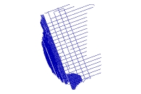
Any spurious data points were removed during processing. For each seismic trackline there is one seismic-profile image that is hyperlinked by the field 'Image'. No duplicates exist.
Completeness_Report:
Sections of tracklines where navigation was recorded but no seismic data were logged are not included.
Positional_Accuracy:
Horizontal_Positional_Accuracy:
Horizontal_Positional_Accuracy_Report:
The SB-0512i was towed approximately 10 m astern and approximately 3 m below the sea surface. RTK-GPS navigation was obtained from the receiver mounted above the interferometric sonar head, but seismic towfish layback was not accounted for. The layback of the towfish adds additional uncertainty due to changes in angle and scope of the tow cable in response to sea state and vessel speed. Based upon horizontal offsets between the fish and GPS receiver, GPS accuracies, and fish motion behind the vessel, the resulting positional accuracy is assumed to be ± 20 m.
Lineage:
Source_Information:
Source_Citation:
Citation_Information:
Originator: U.S. Geological Survey
Publication_Date: unpublished material
Title: Raw data acquisition
Other_Citation_Details:
The source citation information is inferred from other information in the metadata and was not part of the original metadata file.
Type_of_Source_Media: Information unavailable from original metadata.
Source_Time_Period_of_Content:
Time_Period_Information:
Range_of_Dates/Times:
Beginning_Date: 20050908
Ending_Date: 20050920
Source_Currentness_Reference:
Information unavailable from original metadata but assumed to be ground condition.
Source_Citation_Abbreviation: Raw data
Source_Contribution:
Seismic-reflection data acquisition at sea (2005): Chirp seismic data were collected using an EdgeTech Geo-Star FSSB sub-bottom profiling system and an SB-0512i towfish (0.5-12 kHz) on the R/V Connecticut of Groton, CT. Delph Seismic+Plus acquisition software (Triton Elics International Inc.) was used to control the Geo-Star topside unit and digitally log trace data in the SEG-Y rev. 1 standard format. Data were acquired using a 0.25-s shot rate, a 9-ms pulse length, and a 0.5 to 6 kHz frequency sweep. Trace lengths were adjusted to account for changes in water depth, and consequently ranged between 100 and 200 ms. Tracklines are spaced between 100 and 1500 m apart in the shore parallel direction and about 1 km apart in the shore perpendicular direction.
Process_Step:
Process_Description:
A script was run that used Seismic Unix (version 4.1) to read the SEG-Y files, write a Seismic Unix file, and extract SEG-Y trace header information, which included shot number, longitude, latitude, year, Julian day, and time of day (UTC). Geographic coordinates were converted to UTM zone 19 coordinates using Proj (version 4.6.0). Before saving the header information to a text file, the data were filtered using AWK (no version) to save only unique shot point locations. In addition, a separate text file containing even 500 shot intervals was saved. The 500 shot text file maintains the start and end shots, which may not necessarily be unique fixes. A 500 shot interval was chosen because it corresponds to the annotation interval provided along the top of the seismic-reflection profile JPEG images, which are included in the 'GIS\hyperlink_images' folder.
Process_Date: 200708
Process_Contact:
Contact_Information:
Contact_Person_Primary:
Contact_Person: Wayne Baldwin
Contact_Organization: U.S. Geological Survey
Contact_Position: Marine Geologist
Contact_Address:
Address_Type: mailing and physical address
Address: 384 Woods Hole Rd
City: Woods Hole
State_or_Province: MA
Postal_Code: 02543-1598
Country: USA
Contact_Voice_Telephone: 508-548-8700 x2226
Contact_Facsimile_Telephone: 508-457-2310
Contact_Electronic_Mail_Address: wbaldwin@usgs.gov
Process_Step:
Process_Description:
Text files for each seismic line were concatenated into two comma-delimited text files, one containing unique shot point positions ('SeismicShot_unique.csv', which is provided in the zip-compressed package of the shapefile 'SeismicShot_500.shp'), and another containing the 500 shot intervals.
Process_Date: 200708
Process_Contact:
Contact_Information:
Contact_Person_Primary:
Contact_Person: Wayne Baldwin
Contact_Organization: U.S. Geological Survey
Contact_Position: Marine Geologist
Contact_Address:
Address_Type: mailing and physical address
Address: 384 Woods Hole Rd
City: Woods Hole
State_or_Province: MA
Postal_Code: 02543-1598
Country: USA
Contact_Voice_Telephone: 508-548-8700 x2226
Contact_Facsimile_Telephone: 508-457-2310
Contact_Electronic_Mail_Address: wbaldwin@usgs.gov
Process_Step:
Process_Description:
Both concatenated, comma-delimited text files were imported into ArcMap (version 9.2) and saved as points in ESRI shapefile and file geodatabase feature class formats. During import into the file geodatabase, point positions were projected to meters, UTM, Zone 19, WGS84.
Process_Date: 200708
Process_Contact:
Contact_Information:
Contact_Person_Primary:
Contact_Person: Wayne Baldwin
Contact_Organization: U.S. Geological Survey
Contact_Position: Marine Geologist
Contact_Address:
Address_Type: mailing and physical address
Address: 384 Woods Hole Rd
City: Woods Hole
State_or_Province: MA
Postal_Code: 02543-1598
Country: USA
Contact_Voice_Telephone: 508-548-8700 x2226
Contact_Facsimile_Telephone: 508-457-2310
Contact_Electronic_Mail_Address: wbaldwin@usgs.gov
Process_Step:
Process_Description:
The shapefile containing unique shot point positions was used as an input for VACExtras (version 1.97), a VB collection of tools developed by VeeAnn Cross (USGS-WHSC), which converts point data to a new polyline shapefile, based on record order. The 'LineName' field was used to define which points were used to generate each polyline feature. Using Xtools Pro for ArcGIS desktop (version 4.1.0), the length of each polyline segment was calculated and included in two new attribute fields, 'Length' and 'Shape_Leng', specifying UTM, Zone 19 N, WGS84 kilometers and meters, respectively. Prior to importing a copy of the polyline shapefile into the file geodatabase to create a file geodatabase feature class, the 'Shape_Leng' attribute field was deleted because it was automatically replaced and recalculated with identical name and units (meters); During import into the file geodatabase, polyline features were projected to meters, UTM, Zone 19, WGS84.
Process_Date: 200708
Process_Contact:
Contact_Information:
Contact_Person_Primary:
Contact_Person: Wayne Baldwin
Contact_Organization: U.S. Geological Survey
Contact_Position: Marine Geologist
Contact_Address:
Address_Type: mailing and physical address
Address: 384 Woods Hole Rd
City: Woods Hole
State_or_Province: MA
Postal_Code: 02543-1598
Country: USA
Contact_Voice_Telephone: 508-548-8700 x2226
Contact_Facsimile_Telephone: 508-457-2310
Contact_Electronic_Mail_Address: wbaldwin@usgs.gov
Process_Step:
Process_Description:
Edits to the metadata were made to fix any errors that MP v 2.9.30 flagged. This is necessary to enable the metadata to be successfully harvested for various data catalogs. In some cases, this meant adding text "Information unavailable" or "Information unavailable from original metadata" for those required fields that were left blank. The source citation information is inferred from other information in the metadata and was not part of the original metadata file. Other minor edits were probably performed (title, publisher, publication place, etc.). The metadata date (but not the metadata creator) was edited to reflect the date of these changes. The metadata available from a harvester may supersede metadata bundled within a download file. Compare the metadata dates to determine which metadata file is most recent.
Process_Date: 20151106
Process_Contact:
Contact_Information:
Contact_Organization_Primary:
Contact_Organization: U.S. Geological Survey
Contact_Person: VeeAnn A. Cross
Contact_Position: Marine Geologist
Contact_Address:
Address_Type: mailing and physical address
Address: 384 Woods Hole Rd.
City: Woods Hole
State_or_Province: MA
Postal_Code: 02543
Contact_Voice_Telephone: 508-548-8700 x2251
Contact_Facsimile_Telephone: 508-457-2310
Contact_Electronic_Mail_Address: vatnipp@usgs.gov
Process_Step:
Process_Description: USGS Thesaurus keywords added to the keyword section.
Process_Date: 20180720
Process_Contact:
Contact_Information:
Contact_Organization_Primary:
Contact_Organization: U.S. Geological Survey
Contact_Person: VeeAnn A. Cross
Contact_Position: Marine Geologist
Contact_Address:
Address_Type: Mailing and Physical
Address: 384 Woods Hole Road
City: Woods Hole
State_or_Province: MA
Postal_Code: 02543-1598
Contact_Voice_Telephone: 508-548-8700 x2251
Contact_Facsimile_Telephone: 508-457-2310
Contact_Electronic_Mail_Address: vatnipp@usgs.gov
Process_Step:
Process_Description: Crossref DOI link was added as the first link in the metadata.
Process_Date: 20191118
Process_Contact:
Contact_Information:
Contact_Organization_Primary:
Contact_Organization: U.S. Geological Survey
Contact_Person: VeeAnn A. Cross
Contact_Position: Marine Geologist
Contact_Address:
Address_Type: Mailing and Physical
Address: 384 Woods Hole Road
City: Woods Hole
State_or_Province: MA
Postal_Code: 02543-1598
Contact_Voice_Telephone: 508-548-8700 x2251
Contact_Facsimile_Telephone: 508-457-2310
Contact_Electronic_Mail_Address: vatnipp@usgs.gov
Process_Step:
Process_Description:
Added keywords section with USGS persistent identifier as theme keyword.
Process_Date: 20200908
Process_Contact:
Contact_Information:
Contact_Organization_Primary:
Contact_Organization: U.S. Geological Survey
Contact_Person: VeeAnn A. Cross
Contact_Position: Marine Geologist
Contact_Address:
Address_Type: Mailing and Physical
Address: 384 Woods Hole Road
City: Woods Hole
State_or_Province: MA
Postal_Code: 02543-1598
Contact_Voice_Telephone: 508-548-8700 x2251
Contact_Facsimile_Telephone: 508-457-2310
Contact_Electronic_Mail_Address: vatnipp@usgs.gov
Spatial_Data_Organization_Information:
Direct_Spatial_Reference_Method: Vector
Point_and_Vector_Object_Information:
SDTS_Terms_Description:
SDTS_Point_and_Vector_Object_Type: String
Point_and_Vector_Object_Count: 226
Spatial_Reference_Information:
Horizontal_Coordinate_System_Definition:
Geographic:
Latitude_Resolution: 0.000001
Longitude_Resolution: 0.000001
Geographic_Coordinate_Units: Decimal degrees
Geodetic_Model:
Horizontal_Datum_Name: D_WGS_1984
Ellipsoid_Name: WGS_1984
Semi-major_Axis: 6378137.000000
Denominator_of_Flattening_Ratio: 298.257224
Entity_and_Attribute_Information:
Detailed_Description:
Entity_Type:
Entity_Type_Label: SeismicTrackLine
Entity_Type_Definition: Trackline for seismic profiles
Entity_Type_Definition_Source: USGS
Attribute:
Attribute_Label: Shape
Attribute_Definition: Feature geometry.
Attribute_Definition_Source: ESRI
Attribute_Domain_Values:
Unrepresentable_Domain: Coordinates defining the features
Attribute:
Attribute_Label: FileName
Attribute_Definition: Name of seismic data file
Attribute_Definition_Source: USGS
Attribute_Domain_Values:
Unrepresentable_Domain: Information unavailable from original metadata.
Attribute:
Attribute_Label: Image
Attribute_Definition: Name of seismic profile JPEG image used as hyperlink
Attribute_Definition_Source: USGS
Attribute_Domain_Values:
Unrepresentable_Domain: Information unavailable from original metadata.
Attribute:
Attribute_Label: Year
Attribute_Definition: Calendar year data were collected
Attribute_Definition_Source: USGS
Attribute_Domain_Values:
Unrepresentable_Domain: Information unavailable from original metadata.
Attribute:
Attribute_Label: JD
Attribute_Definition: Julian day data were collected
Attribute_Definition_Source: USGS
Attribute_Domain_Values:
Unrepresentable_Domain: Information unavailable from original metadata.
Attribute:
Attribute_Label: VehicleID
Attribute_Definition: Survey vessel name
Attribute_Definition_Source: USGS
Attribute_Domain_Values:
Unrepresentable_Domain: Information unavailable from original metadata.
Attribute:
Attribute_Label: Length
Attribute_Definition: Length of seismic profile in kilometers (UTM Zone 19N, WGS84)
Attribute_Definition_Source: USGS
Attribute_Domain_Values:
Unrepresentable_Domain: Information unavailable from original metadata.
Attribute:
Attribute_Label: SurveyID
Attribute_Definition: WHSC field activity number
Attribute_Definition_Source: USGS
Attribute_Domain_Values:
Unrepresentable_Domain: Information unavailable from original metadata.
Attribute:
Attribute_Label: DeviceID
Attribute_Definition: Sonar device used to collect seismic-reflection data
Attribute_Definition_Source: USGS
Attribute_Domain_Values:
Unrepresentable_Domain: Information unavailable from original metadata.
Attribute:
Attribute_Label: FID
Attribute_Definition: Internal feature number
Attribute_Definition_Source: ESRI
Attribute_Domain_Values:
Unrepresentable_Domain:
Sequential unique whole numbers that are automatically generated
Attribute:
Attribute_Label: Shape_Leng
Attribute_Definition: Length of trackline segment in meters (UTM Zone 19N, WGS84)
Attribute_Definition_Source: USGS
Attribute_Domain_Values:
Unrepresentable_Domain: Information unavailable from original metadata.
Distribution_Information:
Distributor:
Contact_Information:
Contact_Person_Primary:
Contact_Person: Brian Andrews
Contact_Organization: U.S. Geological Survey, Woods Hole Science Center
Contact_Position: Geographer
Contact_Address:
Address_Type: mailing and physical address
Address: 384 Woods Hole Rd.
City: Woods Hole
State_or_Province: MA
Postal_Code: 02543
Country: USA
Contact_Voice_Telephone: 508-548-8700 x2348
Contact_Electronic_Mail_Address: bandrews@usgs.gov
Resource_Description: Downloadable Data
Distribution_Liability:
Neither the U.S. Government, the Department of the Interior, nor the USGS, nor any of their employees, contractors, or subcontractors, make any warranty, express or implied, nor assume any legal liability or responsibility for the accuracy, completeness, or usefulness of any information, apparatus, product, or process disclosed, nor represent that its use would not infringe on privately owned rights. The act of distribution shall not constitute any such warranty, and no responsibility is assumed by the USGS in the use of these data or related materials. Any use of trade, product, or firm names is for descriptive purposes only and does not imply endorsement by the U.S. Government.
Standard_Order_Process:
Digital_Form:
Digital_Transfer_Information:
Format_Name: SHP
Format_Version_Number: ArcGIS 9.2
Format_Specification: ESRI polyline shapefile
Format_Information_Content:
Trackline navigation for EdgeTech 512i Chirp seismic-reflection profiles collected by the U.S. Geological Survey offshore of Massachusetts between Cape Ann and Salisbury Beach
File_Decompression_Technique: Use WinZip or pkUnzip
Transfer_Size: 5.34
Digital_Transfer_Option:
Online_Option:
Computer_Contact_Information: Access_Instructions: Data can be downloaded via the World Wide Web (WWW)
Offline_Option:
Offline_Media: DVD-ROM
Recording_Capacity:
Recording_Density: 4.75
Recording_Density_Units: Gbytes
Recording_Format: UDF
Fees: none
Technical_Prerequisites:
This zip file contains data available in Environmental Systems Research Institute (ESRI) point shapefile format. The user must have ArcGIS or ArcView 3.0 or greater software to read and process the data file. In lieu of ArcView or ArcGIS, the user may utilize another GIS application package capable of importing the data. A free data viewer, ArcExplorer, capable of displaying the data is available from ESRI at www.esri.com.
Metadata_Reference_Information:
Metadata_Date: 20240318
Metadata_Contact:
Contact_Information:
Contact_Person_Primary:
Contact_Person: Brian Andrews
Contact_Organization: U.S. Geological Survey
Contact_Position: Geographer
Contact_Address:
Address_Type: mailing and physical address
Address: 384 Woods Hole Rd.
City: Woods Hole
State_or_Province: MA
Postal_Code: 02543-1598
Country: USA
Contact_Voice_Telephone: 508-548-8700 x2348
Contact_Facsimile_Telephone: 508-457-2310
Contact_Electronic_Mail_Address: whsc_data_contact@usgs.gov
Contact_Instructions:
The metadata contact email address is a generic address in the event the person is no longer with USGS. (updated on 20240318)
Metadata_Standard_Name: FGDC Content Standards for Digital Geospatial Metadata
Metadata_Standard_Version: FGDC-STD-001-1998
Metadata_Time_Convention: local time

This page is <https://cmgds.marine.usgs.gov/catalog/whcmsc/open_file_report/ofr2007-1373/SeismicTrackLine.shp.html>
Generated by mp version 2.9.51 on Mon Mar 25 16:05:26 2024