Online Links:
Online Links:
| Range of values | |
|---|---|
| Minimum: | 0 |
| Maximum: | 254 |
Online Links:
Online Links:
| Access_Constraints | None |
|---|---|
| Use_Constraints | Data are not intended for navigational use. The intended scale for these data is 1:25,000. Public domain data from the U.S. Government are freely redistributable with proper metadata and source attribution. Please recognize the U.S. Geological Survey (USGS) as the source of this information. |
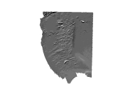
| Data format: | WinZip file containing ArcRaster hillshade of bathymetric data collected in the Cape Ann to Salisbury Beach Survey Area. in format AIG (version ArcGIS 9.2) ESRI Raster GRID format Size: 5.0 |
|---|---|
| Network links: |
http://pubs.usgs.gov/of/2007/1373/GIS/raster/bathymetry/cabath5mhs.zip |
| Media you can order: |
DVD-ROM
(Density 4.75
Gbytes)
(format UDF)
Note: None |