JPEG images of seismic data collected off the southern shore of Martha's Vineyard, MA, 2007

Metadata also available as - [Questions & Answers] - [Parseable text] - [XML]

Metadata:

Identification_Information:
Citation:
Citation_Information:
Originator: U.S. Geological Survey
Publication_Date: 2009
Title:
JPEG images of seismic data collected off the southern shore of Martha's Vineyard, MA, 2007
Edition: 1.0
Geospatial_Data_Presentation_Form: raster digital data
Series_Information:
Series_Name: Open-File Report
Issue_Identification: 2008-1288
Publication_Information:
Publication_Place: Woods Hole Coastal and Marine Science Center, Woods Hole, MA
Publisher: U.S. Geological Survey, Coastal and Marine Geology Program
Online_Linkage: https://doi.org/10.3133/ofr20081288
Online_Linkage: https://pubs.usgs.gov/of/2008/1288/html/gis.html
Online_Linkage: Larger_Work_Citation:
Citation_Information:
Originator: Denny, J.F.
Originator: Danforth, W.W.
Originator: Foster, D.S.
Originator: Sherwood, C.R.
Publication_Date: 2009
Title:
Geophysical Data Collected off the South Shore of Martha's Vineyard, Massachusetts
Edition: 1.0
Geospatial_Data_Presentation_Form: online
Series_Information:
Series_Name: Open-File Report
Issue_Identification: 2008-1288
Publication_Information:
Publication_Place: Reston, VA
Publisher: U.S. Geological Survey
Online_Linkage: https://pubs.usgs.gov/of/2008/1288/
Description:
Abstract:
The USGS Woods Hole Science Center conducted a nearshore geophysical survey offshore of the southern coast of Martha's Vineyard, in the vicinity of the Martha's Vineyard Coastal Observatory (MVCO) in August 2007. This mapping program was part of a larger research effort supporting the Office of Naval Research (ONR) Ripples Directed-Research Initiative (DRI) studies at MVCO by providing data collection and modeling. The geophysical data will be used to provide initial conditions for wave and circulation models for the study area. Ultimately, geophysical mapping, oceanographic measurements and modeling will help to improve our understanding of coastal sediment-transport processes.
The geophysical mapping utilized a suite of high-resolution instrumentation to map the surficial sediment distribution, depth and sub-surface geology: dual-frequency 100/500 KHz sidescan-sonar system, 234-KHz interferometric sonar, and 500 Hz -12 KHz chirp sub-bottom profiler. The survey was conducted aboard the M/V Megan Miller August 9-13, 2007. The study area covers 35 square kilometers from about 0.2 km to 5-km offshore of the south shore of Martha's Vineyard, and ranges in depth from ~ 5 to 20 meters.
Purpose:
JPEG images of each seismic profile were generated in order to incorporate images of the seismic data into Geographic Information System (GIS) projects and data archives utilizing HTML. These JPEG images represent 680 km of seismic data collected in 2007. This format is universal and yields an easily viewable image of the seismic profiles. Each profile image is hyperlinked to its corresponding trackline navigation contained within a polyline shapefile (seismic_trknav.shp), shot-point locations are available in a point shapefiles (seismic__500sht.shp, seismic__100sht.shp, and seismic__sht.shp). These data are available in an ESRI ArcMap project, as well as separate .zip archives (https://pubs.usgs.gov/pubs/of/2008/1288/GIS_catalog/).
Time_Period_of_Content:
Time_Period_Information:
Range_of_Dates/Times:
Beginning_Date: 20070809
Ending_Date: 20070813
Currentness_Reference: ground condition
Status:
Progress: Complete
Maintenance_and_Update_Frequency: None planned
Spatial_Domain:
Bounding_Coordinates:
West_Bounding_Coordinate: -70.600292
East_Bounding_Coordinate: -70.511213
North_Bounding_Coordinate: 41.347370
South_Bounding_Coordinate: 41.301252
Keywords:
Theme:
Theme_Keyword_Thesaurus: USGS Metadata Identifier
Theme_Keyword: USGS:54b239b5-0184-4a7d-aee7-d12b44820a8e
Theme:
Theme_Keyword_Thesaurus: None
Theme_Keyword: U.S. Geological Survey
Theme_Keyword: USGS
Theme_Keyword: Woods Hole Science Center
Theme_Keyword: WHSC
Theme_Keyword: Coastal and Marine Geology Program
Theme_Keyword: CMGP
Theme_Keyword: Field Activity Number 07011
Theme_Keyword: R/V Megan Miller
Theme_Keyword: JPG
Theme_Keyword: JPEG
Theme_Keyword: seismic-reflection
Theme_Keyword: SEG-Y
Theme_Keyword: profiles
Theme_Keyword: seismic
Theme_Keyword: subbottom
Theme_Keyword: image
Theme_Keyword: chirp
Theme_Keyword: EdgeTech SB-0512i
Theme_Keyword: JSF
Theme:
Theme_Keyword_Thesaurus: ISO 19115 Topic Category
Theme_Keyword: geoscientificinformation
Theme_Keyword: oceans
Theme:
Theme_Keyword_Thesaurus: USGS Thesaurus
Theme_Keyword: sub-bottom profiling
Theme_Keyword: image collections
Theme_Keyword: marine geophysics
Place:
Place_Keyword_Thesaurus: None
Place_Keyword: North America
Place_Keyword: Southeastern Massachusetts
Place_Keyword: Martha's Vineyard
Place_Keyword: Cape Cod
Place_Keyword: Elizabeth Islands
Place_Keyword: Atlantic Ocean
Place_Keyword: United States
Place_Keyword: Northeast United States
Place_Keyword: Atlantic Ocean
Access_Constraints: None
Use_Constraints:
The U.S. Geological Survey asks to be referenced as the originator of the dataset in any future publications.
Point_of_Contact:
Contact_Information:
Contact_Person_Primary:
Contact_Person: Jane Denny
Contact_Organization: U.S. Geological Survey
Contact_Position: Geologist
Contact_Address:
Address_Type: mailing and physical address
Address: 384 Woods Hole Rd.
City: Woods Hole
State_or_Province: MA
Postal_Code: 02543-1598
Contact_Voice_Telephone: (508) 548-8700x2311
Contact_Facsimile_Telephone: 5084572310
Contact_Electronic_Mail_Address: jdenny@usgs.gov
Browse_Graphic:
Browse_Graphic_File_Name: Browse_Graphic_File_Description: JPEG image of seismic-reflection profile
Browse_Graphic_File_Type: JPEG
Native_Data_Set_Environment:
Microsoft Windows XP Version 5.1 (Build 2600) Service Pack 3; ESRI ArcCatalog 9.2.6.1500
Cross_Reference:
Citation_Information:
Originator: Paul Henkart
Publication_Date: 2007
Title: SIOSEIS
Geospatial_Data_Presentation_Form: document
Publication_Information:
Publication_Place: LaJolla, CA
Publisher:
Scripps Institution of Oceanography, University of California - San Diego
Online_Linkage: http://sioseis.ucsd.edu/index.html
Cross_Reference:
Citation_Information:
Originator: John Stockwell
Publication_Date: 2007
Title: Seismic Un*x
Geospatial_Data_Presentation_Form: document
Publication_Information:
Publication_Place: Golden, CO
Publisher: Center for Wave Phenomena - Colorado School of Mines
Online_Linkage: http://www.cwp.mines.edu/cwpcodes/index.html
Data_Quality_Information:
Logical_Consistency_Report:
Processed seismic data were converted to JPEG format for ease of seismic trace display. Quality control was conducted during processing.
Completeness_Report:
All acquired seismic data were processed and JPEG images produced. Line 92 was saved as l91f1_001 during acquisition.
Positional_Accuracy:
Horizontal_Positional_Accuracy:
Horizontal_Positional_Accuracy_Report:
The EdgeTech SB-0512i was towed approximately 5 meters astern and approximately 1.5 meters below the sea surface. A GPS navigation receiver was mounted on the seismic sled to provide seismic navigation. GPS positions were sent, via radio modem, to a receiver positioned on the aft roof of the acquisition van aboard the R/V Megan Miller. GPS positions were sent directly to the EdgeTech J-Star seismic acquisition software. The horizontal accuracy of GPS is assumed to be ± 10 m (http://www.navcen.uscg.gov/).
Lineage:
Source_Information:
Source_Citation:
Citation_Information:
Originator: Information unavailable from original metadata - assumed USGS
Publication_Date: unknown
Title: Information unavailable from original metadata
Type_of_Source_Media: Information unavailable from original metadata
Source_Time_Period_of_Content:
Time_Period_Information:
Range_of_Dates/Times:
Beginning_Date: 20070809
Ending_Date: 20070813
Source_Currentness_Reference: ground condition
Source_Citation_Abbreviation: Information unavailable from original metadata
Source_Contribution:
Approximately 680 km of high-resolution chirp seismic-reflection profiles were collected using an EdgeTech Geo-Star FSSB sub-bottom profiling system and an SB-0512i towfish (0.5-12 kHz) mounted on a catamaran and towed off the stern of the R/V Megan Miller. Edgetech J-Star seismic acquisition software was used to control the Geo-Star topside unit and digitally log trace data in the EdgeTech JSF format (http://www.edgetech.com/productlinemarine.html). Data were acquired using a 0.25-s shot rate, 5-ms pulse length and a 0.5-to-8.0 kHz swept frequency. Recorded trace lengths were approximately 250-ms. Trackline spacing varied from 40 meters in water depths less than 15 meters to 70-meter spacing in water depths greater than 15 meters. Shore perpendicular tracklines spacing ranged from 500 m to 1 km apart.
Process_Step:
Process_Description:
A C program, jsf2segy, created at the USGS Woods Hole was used to convert the Edgetech JSF format files to SEG-Y. Scripts utilizing SIOSEIS (version 2007.8) were then executed in order to remove sea surface heave and mute the water column within seismic traces by: 1)automatically picking the sea floor by identifying peak amplitudes within a vertical window; 2)smoothing sea floor picks using an along track filter approximating the period of sea surface heave (the filter window was set to use 60 traces); 3)creating a series of difference values between the raw and smoothed seafloor picks for each trace; 4)shifting traces up or down according to the difference values; and 5) muting each trace between time zero and the time of the smoothed sea floor pick, thus removing noise within the water column. Changes to the traces within each profile were saved to new "heave corrected" SEG-Y files. An additional SIOSEIS script was executed to apply an automatic gain control (AGC) to the heave corrected SEG-Y files, resulting in more uniform amplitudes throughout the record (SIOSEIS, 2007).
Software: SIOSEIS 2007.8
Process_Date: 2007
Process_Contact:
Contact_Information:
Contact_Person_Primary:
Contact_Person: Dave Foster
Contact_Organization: U.S. Geological Survey
Contact_Position: Geologist
Contact_Address:
Address_Type: mailing and physical address
Address: 384 Woods Hole Rd.
City: Woods Hole
State_or_Province: MA
Postal_Code: 02543-1598
Contact_Voice_Telephone: (508) 548-8700x2271
Contact_Facsimile_Telephone: 5084572310
Contact_Electronic_Mail_Address: dfoster@usgs.gov
Process_Step:
Process_Description:
A C-Shell script using Seismic Unix (version 4.1) to read the SEG-Y files and plot the data as 8-bit gray scale Postscript files using the Seismic Unix 'psimage' algorithm was then executed. All images were created with a horizontal scale of 200 traces per inch. The profiles contain 50 milliseconds of Two-Way Travel Time within an 8-inch vertical window, yielding 6.25 milliseconds per inch. Postscript images were converted to JPEG format using the UNIX ImageMagick (version 5.5.6).
Software: Seismic Unix 4.1, ImageMagick 5.5.6
Process_Date: 2007
Process_Contact:
Contact_Information:
Contact_Person_Primary:
Contact_Person: Dave Foster
Contact_Organization: U.S. Geological Survey
Contact_Position: Geologist
Contact_Address:
Address_Type: mailing and physical address
Address: 384 Woods Hole Rd.
City: Woods Hole
State_or_Province: MA
Postal_Code: 02543-1598
Contact_Voice_Telephone: (508) 548-8700x2271
Contact_Facsimile_Telephone: 5084572310
Contact_Electronic_Mail_Address: dfoster@usgs.gov
Process_Step:
Process_Description:
Edits to the metadata were made to fix any errors that MP v 2.9.36 flagged. This is necessary to enable the metadata to be successfully harvested for various data catalogs. In some cases, this meant adding text "Information unavailable" or "Information unavailable from original metadata" for those required fields that were left blank. Other minor edits were probably performed (title, publisher, publication place, etc.). Reordered the links in the identification section so a landing page link is first. Attempted to modify http to https where appropriate. The source information was incomplete and had to be modified to meet the standard. The distribution format name was modified in an attempt to be more consistent with other metadata files of the same data format. The metadata date (but not the metadata creator) was edited to reflect the date of these changes. The metadata available from a harvester may supersede metadata bundled within a download file. Compare the metadata dates to determine which metadata file is most recent.
Process_Date: 20171020
Process_Contact:
Contact_Information:
Contact_Organization_Primary:
Contact_Organization: U.S. Geological Survey
Contact_Person: VeeAnn A. Cross
Contact_Position: Marine Geologist
Contact_Address:
Address_Type: Mailing and Physical
Address: 384 Woods Hole Road
City: Woods Hole
State_or_Province: MA
Postal_Code: 02543-1598
Contact_Voice_Telephone: 508-548-8700 x2251
Contact_Facsimile_Telephone: 508-457-2310
Contact_Electronic_Mail_Address: vatnipp@usgs.gov
Process_Step:
Process_Description: USGS Thesaurus keywords added to the keyword section.
Process_Date: 20180720
Process_Contact:
Contact_Information:
Contact_Organization_Primary:
Contact_Organization: U.S. Geological Survey
Contact_Person: VeeAnn A. Cross
Contact_Position: Marine Geologist
Contact_Address:
Address_Type: Mailing and Physical
Address: 384 Woods Hole Road
City: Woods Hole
State_or_Province: MA
Postal_Code: 02543-1598
Contact_Voice_Telephone: 508-548-8700 x2251
Contact_Facsimile_Telephone: 508-457-2310
Contact_Electronic_Mail_Address: vatnipp@usgs.gov
Process_Step:
Process_Description: Crossref DOI link was added as the first link in the metadata.
Process_Date: 20191118
Process_Contact:
Contact_Information:
Contact_Organization_Primary:
Contact_Organization: U.S. Geological Survey
Contact_Person: VeeAnn A. Cross
Contact_Position: Marine Geologist
Contact_Address:
Address_Type: Mailing and Physical
Address: 384 Woods Hole Road
City: Woods Hole
State_or_Province: MA
Postal_Code: 02543-1598
Contact_Voice_Telephone: 508-548-8700 x2251
Contact_Facsimile_Telephone: 508-457-2310
Contact_Electronic_Mail_Address: vatnipp@usgs.gov
Process_Step:
Process_Description:
Added keywords section with USGS persistent identifier as theme keyword.
Process_Date: 20200908
Process_Contact:
Contact_Information:
Contact_Organization_Primary:
Contact_Organization: U.S. Geological Survey
Contact_Person: VeeAnn A. Cross
Contact_Position: Marine Geologist
Contact_Address:
Address_Type: Mailing and Physical
Address: 384 Woods Hole Road
City: Woods Hole
State_or_Province: MA
Postal_Code: 02543-1598
Contact_Voice_Telephone: 508-548-8700 x2251
Contact_Facsimile_Telephone: 508-457-2310
Contact_Electronic_Mail_Address: vatnipp@usgs.gov
Spatial_Data_Organization_Information:
Direct_Spatial_Reference_Method: Raster
Raster_Object_Information:
Raster_Object_Type: Pixel
Distribution_Information:
Distributor:
Contact_Information:
Contact_Person_Primary:
Contact_Person: Jane Denny
Contact_Organization: U.S. Geological Survey
Contact_Position: Geologist
Contact_Address:
Address_Type: mailing and physical address
Address: 384 Woods Hole Rd.
City: Woods Hole
State_or_Province: MA
Postal_Code: 02543-1598
Contact_Voice_Telephone: (508) 548-8700x2311
Contact_Facsimile_Telephone: 5084572310
Contact_Electronic_Mail_Address: jdenny@usgs.gov
Resource_Description: Downloadable Data
Distribution_Liability:
Neither the U.S. Government, the Department of the Interior, nor the USGS, nor any of their employees, contractors, or subcontractors, make any warranty, express or implied, nor assume any legal liability or responsibility for the accuracy, completeness, or usefulness of any information, apparatus, product, or process disclosed, nor represent that its use would not infringe on privately owned rights. The act of distribution shall not constitute any such warranty, and no responsibility is assumed by the USGS in the use of these data or related materials.
Any use of trade, product, or firm names is for descriptive purposes only and does not imply endorsement by the U.S. Government.
Standard_Order_Process:
Digital_Form:
Digital_Transfer_Information:
Format_Name: JPEG
Format_Information_Content:
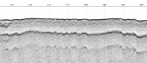
WinZip (version 9.0) compressed JPEG images of processed Edgetech SB-512i seismic-reflection profiles and associated metadata
File_Decompression_Technique: Use WinZip or pkUnzip
Transfer_Size: 139
Digital_Transfer_Option:
Online_Option:
Computer_Contact_Information: Access_Instructions: Data can be downloaded via the World Wide Web (WWW)
Fees: none
Custom_Order_Process:
Digital copies of these chirp seismic data may also be obtained in the SEG-Y Rev. 1 standard format upon request. The data would be packaged on DVD, and contain the chirp-processed, envelope traces.
Technical_Prerequisites: These JPEG data can be viewed with any image viewing software.
Metadata_Reference_Information:
Metadata_Date: 20240318
Metadata_Contact:
Contact_Information:
Contact_Person_Primary:
Contact_Person: Jane Denny
Contact_Organization: U.S. Geological Survey
Contact_Position: Geologist
Contact_Address:
Address_Type: mailing and physical address
Address: 384 Woods Hole Rd.
City: Woods Hole
State_or_Province: MA
Postal_Code: 02543-1598
Contact_Voice_Telephone: (508) 548-8700x2311
Contact_Facsimile_Telephone: 5084572310
Contact_Electronic_Mail_Address: whsc_data_contact@usgs.gov
Contact_Instructions:
The metadata contact email address is a generic address in the event the person is no longer with USGS. (updated on 20240318)
Metadata_Standard_Name: FGDC Content Standards for Digital Geospatial Metadata
Metadata_Standard_Version: FGDC-STD-001-1998
Metadata_Time_Convention: local time
Metadata_Access_Constraints: None
Metadata_Use_Constraints: None

This page is <https://cmgds.marine.usgs.gov/catalog/whcmsc/open_file_report/ofr2008-1288/seisimage.html>
Generated by mp version 2.9.51 on Mon Mar 25 16:05:26 2024