Seismic-reflection profile tracklines that are located adjacent to vibracores collected by the U.S. Geological Survey within Apalachicola Bay, Florida (Seismic_Cores_INT.shp, 2005-2007)

Metadata also available as - [Outline] - [Parseable text] - [XML]

Frequently anticipated questions:


What does this data set describe?

Title:
Seismic-reflection profile tracklines that are located adjacent to vibracores collected by the U.S. Geological Survey within Apalachicola Bay, Florida (Seismic_Cores_INT.shp, 2005-2007)
Abstract:
In 2007, the U.S. Geological Survey collected 24 vibracores within Apalachicola Bay, Florida. The vibracores were collected using a Rossfelder electric percussive (P-3) vibracore system during a cruise on the R/V Gilbert. Selection of the core sites was based on a geophysical survey that was conducted during 2005 and 2006 in collaboration with the National Oceanic and Atmospheric Administration’s (NOAA) Coastal Services Center (CSC) and the Apalachicola Bay National Estuarine Research Reserve. Available data include the vibracore data logs and photographs, select seismic-reflection profiles (from the geophysical survey), and core-derived data including: grain size analyses, radiocarbon ages, microfossil counts, and sedimentological interpretations. The long-term goal of this study is to provide maps, data, and assistance to the Apalachicola Bay National Estuarine Research Reserve in their effort to monitor and understand the geology and ecology of Apalachicola Bay Estuary. These data will inform coastal managers charged with resource preservation.
  1. How might this data set be cited?
    U.S. Geological Survey, 2009, Seismic-reflection profile tracklines that are located adjacent to vibracores collected by the U.S. Geological Survey within Apalachicola Bay, Florida (Seismic_Cores_INT.shp, 2005-2007): Open-File Report 2009-1031, U.S. Geological Survey, Coastal and Marine Geology Program, Woods Hole Coastal and Marine Science Center, Woods Hole, MA.

    Online Links:

    This is part of the following larger work.

    Twichell, D., Pendleton, E., Poore, R., Osterman, L., and Kelso, K., 2009, Vibracore, Radiocarbon, Microfossil, and Grain-Size Data from Apalachicola Bay, Florida: Open-File Report 2009-1031, U.S. Geological Survey, Reston, VA.

    Online Links:

  2. What geographic area does the data set cover?
    West_Bounding_Coordinate: -85.074083
    East_Bounding_Coordinate: -84.831367
    North_Bounding_Coordinate: 29.727917
    South_Bounding_Coordinate: 29.605850
  3. What does it look like?
    http://pubs.usgs.gov/of/2009/1031/images/Seis_track.jpg (JPEG)
    Seismic reflection profiles that are adjacent to vibracore locations within Apalachicola Bay, Florida
  4. Does the data set describe conditions during a particular time period?
    Beginning_Date: 14-Mar-2005
    Ending_Date: 26-May-2007
    Currentness_Reference:
    ground condition of three separate time periods: 20050314 to 20050413; 20060529 to 20060627; and 20070522 to 20070526
  5. What is the general form of this data set?
    Geospatial_Data_Presentation_Form: vector digital data
  6. How does the data set represent geographic features?
    1. How are geographic features stored in the data set?
      This is a Vector data set. It contains the following vector data types (SDTS terminology):
      • String (19)
    2. What coordinate system is used to represent geographic features?
      Horizontal positions are specified in geographic coordinates, that is, latitude and longitude. Latitudes are given to the nearest 0.000001. Longitudes are given to the nearest 0.000001. Latitude and longitude values are specified in Decimal degrees. The horizontal datum used is D_WGS_1984.
      The ellipsoid used is WGS_1984.
      The semi-major axis of the ellipsoid used is 6378137.000000.
      The flattening of the ellipsoid used is 1/298.257224.
  7. How does the data set describe geographic features?
    Seismic_Cores_INT
    Navigation lines for seismic-reflection data collected during USGS field activities 06001 and 05001 (Source: USGS)
    FID
    Internal feature number. (Source: ESRI) Sequential unique whole numbers that are automatically generated.
    Shape
    Feature geometry. (Source: ESRI) Coordinates defining the features.
    LineName
    name of survey line assigned for identification purposes (Source: USGS) Information unavailable from original metadata.
    ImageTitle
    Name of seismic profile image that coincides with the survey line. (Source: USGS) Information unavailable from original metadata.
    SurveyID
    ID used to identify the survey during which the data were collected. (Source: USGS)
    ValueDefinition
    2USGS field activity 06001 conducted in 2006
    VehicleID
    Identification number identifying vehicle (survey platform) used to collect the data. (Source: USGS)
    ValueDefinition
    1USGS Research Vessel RAFAEL
    2USGS Autonomous Surface Vehicle (ASV) IRIS
    DeviceID
    Identification number used to distinguish the type of acoustic sensor (Device) used to collect the data. (Source: USGS)
    ValueDefinition
    3EdgeTech FSSB-424 chirp profiles (4-24 kHz)
    SHAPE_Leng
    Length of trackline in meters (UTM zone 16; WGS84) (Source: ESRI) Information unavailable from original metadata.

Who produced the data set?

  1. Who are the originators of the data set? (may include formal authors, digital compilers, and editors)
    • U.S. Geological Survey
  2. Who also contributed to the data set?
  3. To whom should users address questions about the data?
    David C. Twichell
    U.S. Geological Survey
    Oceanographer
    384 Woods Hole Rd.
    Woods Hole, MA

    (508) 548-8700x2266 (voice)
    (508) 457-2310 (FAX)
    dtwichell@usgs.gov

Why was the data set created?

This dataset contains trackline navigation for seismic reflection profiles (collected in 2005 and 2006; published by Twichell and others, 2007) that are adjacent to vibracores collected by the U.S. Geological Survey during a 2007 cruise within Apalachicola Bay, Florida. These data are included to give the vibracores greater stratigraphic context.Seismic-reflection profile images (JPEG) are hotlinked to this trackline navigation file.

How was the data set created?

  1. From what previous works were the data drawn?
    USGS (source 1 of 1)
    Twichell, D.C., Andrews, B.D., Edmiston, H.L., and Stevenson, W.R., 2007, Geophysical Mapping of Oyster Habitats in a Shallow Estuary; Apalachicola Bay, Florida: Open-File Report 2006-1381, U.S. Geological Survey, Reston, VA.

    Online Links:

    Type_of_Source_Media: disc
    Source_Contribution:
    In order to give the vibracore data greater stratigraphic context, seismic images and trackline data from the geophysical survey completed in 2006 are included in this report (Twichell and others, 2007). Twenty-four vibracores were collected within Apalachicola Bay, Florida during May 2007. Vibracore sites were selected based on the identification of target areas. These target areas were chosen from the analysis of geophysical data collected during 2005 and 2006 in collaboration with the National Oceanic and Atmospheric Administration’s (NOAA) Coastal Services Center (CSC) and the Apalachicola Bay National Estuarine Research Reserve (Twichell and others, 2007). The vibracores were collected using a Rossfelder electric percussive (P-3) vibracore system. The cores were collected in a 7.62 cm (3 in) diameter by 6.10 m (20 ft) long aluminum tube with a copper core catcher riveted to the bottom. The vibracoring rig was mounted, deployed, and recovered on the port side of the R/V Gilbert. The ship was anchored from the bow and stern to maintain ship position as a hydraulic crane deployed and recovered the coring rig. Following recovery, the bottom of the core was capped with a plastic cap, water was drained from the top of the core barrel by drilling a hole in the aluminum tube immediately above the sediment/water interface, and the pipe was cut at the sediment/water interface. Each core was cut into one-meter sections (measuring down from the sediment/water interface) on the boat deck, the ends were capped, each section labeled, and stored on deck for transport. Core sections for all 24 vibracores were transported to the U.S. Geological Survey Florida Integrated Science Center (FISC) where the 1-meter core sections were split in half (lengthwise) in the FISC core laboratory. One half of each core section was preserved and archived in a clear plastic sleeve with the ends taped shut to minimize moisture loss. The other half, the working half, of the core was used for visual descriptions, photographs, and eventually sub-sampling for radiocarbon, microfossil, and grain-size analysis.
  2. How were the data generated, processed, and modified?
    Date: 2008 (process 1 of 5)
    The original seismic trackline shapefiles (from the Autonomous Surface Vehicle (ASV) and the R/V Rafael) were edited and merged in ArcMap (version 9.3) to include only the tracklines that were adjacent to vibracore sites. A new field was added to the shapefile to include a relative path to the seismic image location. This allows the seismic images (in JPEG format) to be readily hyperlinked to the tracklines in ArcGIS. Only one ASV trackline is included in the seismic trackline file in this report: LineName 'apallchicola015'. Person who carried out this activity:
    Elizabeth A. Pendleton
    U.S. Geological Survey
    Geologist
    384 Woods Hole Rd.
    Woods Hole, MA

    (508) 548-8700x2259 (voice)
    (508) 457-2310 (FAX)
    ependleton@usgs.gov
    Date: 01-Jul-2016 (process 2 of 5)
    Edits to the metadata were made to fix any errors that MP v 2.9.32 flagged. This is necessary to enable the metadata to be successfully harvested for various data catalogs. In some cases, this meant adding text "Information unavailable" or "Information unavailable from original metadata" for those required fields that were left blank. Other minor edits were probably performed (title, publisher, publication place, etc.). The time period of content data format had to be fixed. The time period of content of the dataset was edited to match the time period of content of the source contribution. Minor fixes to the attribute format for some attributes were needed. The metadata date (but not the metadata creator) was edited to reflect the date of these changes. The metadata available from a harvester may supersede metadata bundled within a download file. Compare the metadata dates to determine which metadata file is most recent. Person who carried out this activity:
    U.S. Geological Survey
    Attn: VeeAnn A. Cross
    Marine Geologist
    384 Woods Hole Rd.
    Woods Hole, MA

    508-548-8700 x2251 (voice)
    508-457-2310 (FAX)
    vatnipp@usgs.gov
    Date: 20-Jul-2018 (process 3 of 5)
    USGS Thesaurus keywords added to the keyword section. Person who carried out this activity:
    U.S. Geological Survey
    Attn: VeeAnn A. Cross
    Marine Geologist
    384 Woods Hole Road
    Woods Hole, MA

    508-548-8700 x2251 (voice)
    508-457-2310 (FAX)
    vatnipp@usgs.gov
    Date: 18-Nov-2019 (process 4 of 5)
    Crossref DOI link was added as the first link in the metadata. Person who carried out this activity:
    U.S. Geological Survey
    Attn: VeeAnn A. Cross
    Marine Geologist
    384 Woods Hole Road
    Woods Hole, MA

    508-548-8700 x2251 (voice)
    508-457-2310 (FAX)
    vatnipp@usgs.gov
    Date: 08-Sep-2020 (process 5 of 5)
    Added keywords section with USGS persistent identifier as theme keyword. Person who carried out this activity:
    U.S. Geological Survey
    Attn: VeeAnn A. Cross
    Marine Geologist
    384 Woods Hole Road
    Woods Hole, MA

    508-548-8700 x2251 (voice)
    508-457-2310 (FAX)
    vatnipp@usgs.gov
  3. What similar or related data should the user be aware of?
    Twichell, D., Andrews, B., Edmiston, H., and Stevenson, W., 2007, Geophysical Mapping of Oyster Habitats in a Shallow Estuary; Apalachicola Bay, Florida: U.S. Geological Survey Open-File Report 2006-1381, U.S. Geological Survey, Reston, VA.

    Online Links:


How reliable are the data; what problems remain in the data set?

  1. How well have the observations been checked?
  2. How accurate are the geographic locations?
    Survey lines from the SB-0512i that was towed behing the R/V Rafael are thought to have an accuacy of +/-20 meters, primarily because the towfish layback was not accounted for. Survey lines collected from the ASV (Autonomous Surface Vehicle) are expected to have higher accuracy due to the close mounted real-time kinematic GPS receiver. These data are likely accurate to +/- 5 meters.
  3. How accurate are the heights or depths?
  4. Where are the gaps in the data? What is missing?
    Of the 921 seismic-reflection lines collected in 2005 and 2006 (Twichell and others, 2007), only 19 were selected for inclusion in this report. These 19 seismic images and tracklines represent the seismic-reflection profiles that were adjacent to the 24 vibracores collected in 2007. All vibracores were collected from the R/V Gilbert using a Rossfelder vibracore. One vibracore was collected at each of the 23 predetermined locations, with the exception of site 18. Two cores were collected here because the first core (App07-18A) was recovered without a core catcher on the end, and several centimeters of the sample were lost. A second core was taken (App07-18B) at site 18, and both cores were processed and preserved. Core 18A is not shown on the seismic-reflection profile, because core 18B is a more complete sample from the same site.
  5. How consistent are the relationships among the observations, including topology?
    Seismic-reflection profiles that were adjacent to 24 vibracores collected in 2007 in Apalachicola Bay, FL were available from a published geophysical dataset (Twichell and others, 2007). Only the tracklines and profiles within the near vicinty (50 meters) of a vibracore were chosen for inclusion in this report.

How can someone get a copy of the data set?

Are there legal restrictions on access or use of the data?
Access_Constraints None
Use_Constraints The Public domain data from the U.S. Government are freely redistributable with proper metadata and source attribution. Please recognize the U.S. Geological Survey as the originator of the dataset.
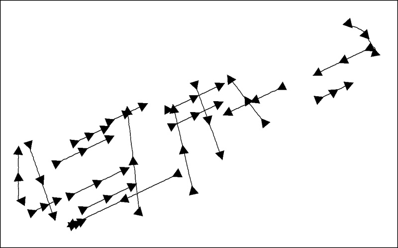
  1. Who distributes the data set? (Distributor 1 of 1)
    David C. Twichell
    U.S. Geological Survey
    Oceanographer
    384 Woods Hole Rd.
    Woods Hole, MA

    (508) 548-8700x2266 (voice)
    (508) 457-2310 (FAX)
    dtwichell@usgs.gov
  2. What's the catalog number I need to order this data set? Downloadable Data
  3. What legal disclaimers am I supposed to read?
    Neither the U.S. Government, the Department of the Interior, nor the USGS, nor any of their employees, contractors, or subcontractors, make any warranty, express or implied, nor assume any legal liability or responsibility for the accuracy, completeness, or usefulness of any information, apparatus, product, or process disclosed, nor represent that its use would not infringe on privately owned rights. The act of distribution shall not constitute any such warranty, and no responsibility is assumed by the USGS in the use of these data or related materials. Any use of trade, product, or firm names is for descriptive purposes only and does not imply endorsement by the U.S. Government.
  4. How can I download or order the data?
    • Availability in digital form:
      Data format: This WinZip (version 9.0) file contains a shapefile of 512i seismic-reflection profile trackline navigation collected during 2005 and 2006; only the tracklines that are adjacent to vibracore locations from within Apalachicola Bay, Florida are included and the associated metadata. in format Shapefile (version ArcGIS 9.3) Size: 0.08
      Network links: http://pubs.usgs.gov/of/2009/1031/data_catalog/Seismic_Tracks_Profiles/seismic_trks.zip
      Media you can order: DVD-ROM (Density 4.75 Gbytes) (format UDF)
    • Cost to order the data: None

  5. What hardware or software do I need in order to use the data set?
    This zip file contains data available in Environmental Systems Research Institute (ESRI) point shapefile format. The user must have ArcGIS or ArcView 3.0 or greater software to read and process the data file. In lieu of ArcView or ArcGIS, the user may utilize another GIS application package capable of importing the data. A free data viewer, ArcExplorer, capable of displaying the data is available from ESRI at www.esri.com.

Who wrote the metadata?

Dates:
Last modified: 18-Mar-2024
Metadata author:
Elizabeth A. Pendleton
U.S. Geological Survey
Geologist
384 Woods Hole Road
Woods Hole, MA
USA

508-548-8700 x2259 (voice)
(508)-457-2310 (FAX)
whsc_data_contact@usgs.gov
Contact_Instructions:
The metadata contact email address is a generic address in the event the person is no longer with USGS. (updated on 20240318)
Metadata standard:
FGDC Content Standards for Digital Geospatial Metadata (FGDC-STD-001-1998)

This page is <https://cmgds.marine.usgs.gov/catalog/whcmsc/open_file_report/ofr2009-1031/Seismic_Cores_INT.shp.faq.html>
Generated by mp version 2.9.51 on Mon Mar 25 16:05:27 2024