Online Links:
Online Links:
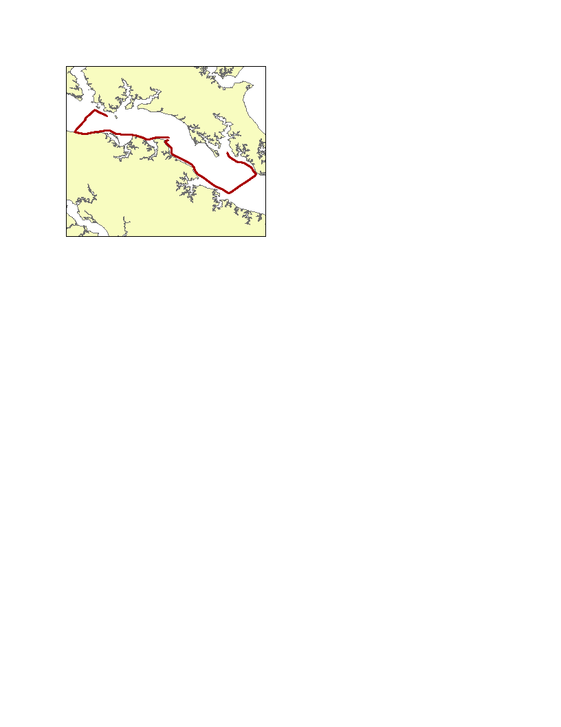
| Range of values | |
|---|---|
| Minimum: | -76.856267 |
| Maximum: | -76.3627 |
| Units: | decimal degrees |
| Range of values | |
|---|---|
| Minimum: | 38.004733 |
| Maximum: | 38.23115 |
| Units: | decimal degrees |
| Range of values | |
|---|---|
| Minimum: | 1.6 |
| Maximum: | 18.6 |
| Units: | meters |
| Range of values | |
|---|---|
| Minimum: | 0.1 |
| Maximum: | 25.5 |
| Units: | degrees Celsius |
files=`ls *.gps | cut -d. -f1`
for file in $files
do
awk -f awkhold $file.gps $file >> resnav_jd251.txt
done

AWK script "awkhold":
BEGIN {
FS = ","
}
{
FS = ","
ARGC = 2
depth = -9999
temp = -9999
if ($1=="$GPRMC")
{
utctime = $2
date = $10
latdeg = substr($4,1,2)
latmin = substr($4,3,6)
declat = latdeg + (latmin/60)
londeg = substr($6,1,3)
lonmin = substr($6,4,6)
declon = -1 * (londeg + (lonmin/60))
if (NR==1) {
holddepth = -9999
holdtemp = -9999
}
else {
printf("%9.6f, %9.6f, %s, %s, %5.1f, %5.1f, %s\n", holddeclon, holddeclat, >holdutctime, holddate, holddepth, holdtemp, ARGV[2])
}
holdutctime = substr(utctime,1,2)":"substr(utctime,3,2)":"substr(utctime,5,2)
holddate = date
holddeclon = declon
holddeclat = declat
holddepth = -9999
holdtemp = -9999
}
if ($1=="$SDDPT")
{
depthreal = $2
holddepth = depthreal
}
if ($1=="$SDMTW")
{
tempreal = $2
holdtemp = tempreal
}
}
END {
printf("%9.6f, %9.6f, %s, %s, %5.1f, %5.1f, %s\n", holddeclon, holddeclat, >holdutctime, holddate, holddepth, holdtemp, ARGV[2])
}
Person who carried out this activity:
schema.ini:
[resnav_jd251.txt]
Format=CSVDelimited
ColNameHeader=True
Col1=longitude Double
Col2=latitude Double
Col3=gpstime Text Width 8
Col4=gpsdate Text Width 10
Col5=depth float
Col6=temp_c float
Col7=linename Text Width 11
Person who carried out this activity:
| Access_Constraints | None. |
|---|---|
| Use_Constraints | The public domain data from the U.S. Government are freely redistributable with proper metadata and source attribution. Please recognize the U.S. Geological Survey as the originator of the dataset. |
| Data format: | This WinZip file contains the point shapefile as well as the associated metadata files. in format Shapefile (version ArcGIS 9.2) Size: 0.167 |
|---|---|
| Network links: |
http://pubs.usgs.gov/of/2009/1151/data/navigation/resistivity/resgpspnts_jd251.zip http://pubs.usgs.gov/of/2009/1151/html/catalog.html |
| Media you can order: | DVD-ROM (Density 4.75 GBytes) (format UDF) |