Esri Format Binary Grid of the Merged Bathymetry and Elevation Data from the Corsica River Estuary, Maryland For Use with USGS Cruise 07005 (COMBELEV)

Metadata also available as - [Questions & Answers] - [Parseable text] - [XML]

Metadata:

Identification_Information:
Citation:
Citation_Information:
Originator: VeeAnn A. Cross
Publication_Date: 2011
Title:
Esri Format Binary Grid of the Merged Bathymetry and Elevation Data from the Corsica River Estuary, Maryland For Use with USGS Cruise 07005 (COMBELEV)
Geospatial_Data_Presentation_Form: raster digital data
Series_Information:
Series_Name: Open-File Report
Issue_Identification: 2010-1094
Publication_Information:
Publication_Place: Woods Hole Coastal and Marine Science Center, Woods Hole, MA
Publisher: U.S. Geological Survey, Coastal and Marine Geology Program
Online_Linkage: https://doi.org/10.3133/ofr20101094
Online_Linkage: https://pubs.usgs.gov/of/2010/1094/html/catalog.html
Online_Linkage: https://pubs.usgs.gov/of/2010/1094/data/basemap/elevation.zip
Larger_Work_Citation:
Citation_Information:
Originator: VeeAnn A. Cross
Originator: John F. Bratton
Originator: Charles R. Worley
Originator: John Crusius
Originator: Kevin D. Kroeger
Publication_Date: 2011
Title:
Continuous resistivity profiling data from the Corsica River Estuary, Maryland
Series_Information:
Series_Name: Open-File Report
Issue_Identification: 2010-1094
Publication_Information:
Publication_Place: Reston, VA
Publisher: U.S. Geological Survey
Online_Linkage: https://pubs.usgs.gov/of/2010/1094/
Description:
Abstract:
Submarine groundwater discharge (SGD) into Maryland's Corsica River Estuary was investigated as part of a larger study to determine the importance of nutrient delivery to Chesapeake Bay via this pathway. Resource managers are concerned about nutrients that are entering the estuary via submarine groundwater discharge from this primarily agricultural watershed that may be contributing to eutrophication, harmful algal blooms, and fish kills. An interdisciplinary U.S. Geological Survey (USGS) science team conducted field operations in the estuary in April and May 2007. Techniques used included continuous resistivity profiling (CRP), piezometer sampling, seepage meter measurements, and collection of a radon tracer time series. Better understanding of the style, locations, and rates of groundwater discharge could lead to improved models and mitigation strategies for estuarine nutrient over-enrichment in the Corsica River Estuary, and other similar settings. More information on the field work can be accessed from the Woods Hole Coastal and Marine Science Center Field Activity webpage: https://cmgds.marine.usgs.gov/fan_info.php?fan=2007-005-FA.
Purpose:
The purpose of this dataset is to provide a seamless elevation/bathymetry grid as a basemap layer for the work in the Corsica River Estuary.
Time_Period_of_Content:
Time_Period_Information:
Single_Date/Time:
Calendar_Date: 2011
Currentness_Reference: publication date
Status:
Progress: Complete
Maintenance_and_Update_Frequency: None planned
Spatial_Domain:
Bounding_Coordinates:
West_Bounding_Coordinate: -76.160718
East_Bounding_Coordinate: -76.060537
North_Bounding_Coordinate: 39.121622
South_Bounding_Coordinate: 39.034459
Keywords:
Theme:
Theme_Keyword_Thesaurus: USGS Metadata Identifier
Theme_Keyword: USGS:4b9eba69-0291-4c67-882a-96754c364991
Theme:
Theme_Keyword_Thesaurus: None
Theme_Keyword: U.S. Geological Survey
Theme_Keyword: USGS
Theme_Keyword: Coastal and Marine Geology Program
Theme_Keyword: CMGP
Theme_Keyword: Woods Hole Coastal and Marine Science Center
Theme_Keyword: WHCMSC
Theme_Keyword: bathymetry
Theme_Keyword: NOAA's Ocean Service, Special Projects
Theme_Keyword: hydrographic survey
Theme_Keyword: estuary
Theme_Keyword: estuarine bathymetry
Theme_Keyword: elevation
Theme_Keyword: digital elevation model
Theme_Keyword: DEM
Theme_Keyword: raster
Theme_Keyword: National Elevation Dataset
Theme_Keyword: NED
Theme_Keyword: LIDAR
Theme_Keyword: Light Detection And Ranging
Theme_Keyword: NOAA Coastal Services Center
Theme_Keyword: ESRI binary grid
Theme_Keyword: National Oceanic and Atmospheric Administration
Theme:
Theme_Keyword_Thesaurus: ISO 19115 Topic Category
Theme_Keyword: inlandWaters
Theme_Keyword: oceans
Theme_Keyword: imageryBaseMapsEarthCover
Theme_Keyword: elevation
Theme:
Theme_Keyword_Thesaurus: USGS Thesaurus
Theme_Keyword: bathymetry
Theme_Keyword: topography
Theme_Keyword: sea-floor characteristics
Theme_Keyword: geospatial datasets
Place:
Place_Keyword_Thesaurus: None
Place_Keyword: North America
Place_Keyword: North Atlantic
Place_Keyword: United States
Place_Keyword: Maryland
Place_Keyword: Corsica River Estuary
Place_Keyword: Chesapeake Bay
Access_Constraints: None.
Use_Constraints:
The public domain data from the U.S. Government are freely redistributable with proper metadata and source attribution. Please recognize the U.S. Geological Survey and the National Oceanic and Atmospheric Administration (NOAA) National Ocean Service (NOS) as the originators of the individual datasets. These data are not to be used for navigation.
Point_of_Contact:
Contact_Information:
Contact_Person_Primary:
Contact_Person: VeeAnn A. Cross
Contact_Organization: U.S. Geological Survey
Contact_Position: Marine Geologist
Contact_Address:
Address_Type: mailing and physical address
Address: Woods Hole Coastal and Marine Science Center
Address: 384 Woods Hole Rd.
City: Woods Hole
State_or_Province: MA
Postal_Code: 02543-1598
Contact_Voice_Telephone: (508) 548-8700 x2251
Contact_Facsimile_Telephone: (508) 457-2310
Contact_Electronic_Mail_Address: vatnipp@usgs.gov
Browse_Graphic:
Browse_Graphic_File_Name: Browse_Graphic_File_Description:
Thumbnail image of the color-coded relief in the Corsica River Estuary area.
Browse_Graphic_File_Type: GIF
Native_Data_Set_Environment:
Microsoft Windows XP Version 5.1 (Build 2600) Service Pack 3; ESRI ArcCatalog 9.2.6.1500
Cross_Reference:
Citation_Information:
Originator:
Department of Commerce (DOC), National Oceanic and Atmospheric Administration (NOAA), National Ocean Service (NOS), Special Projects (SP)
Publication_Date: 1998
Title:
Chesapeake Bay, VA/MD (M130) Bathymetric Digital Elevation Model (30 meter resolution) Derived From Source Hydrographic Survey Soundings Collected by NOAA
Geospatial_Data_Presentation_Form: raster digital data
Publication_Information:
Publication_Place: Silver Spring, MD
Publisher: NOAA's Ocean Service, Special Projects (SP)
Online_Linkage: http://estuarinebathymetry.noaa.gov/
Cross_Reference:
Citation_Information:
Originator: U.S. Geological Survey (USGS), EROS Data Center
Publication_Date: 1999
Title: National Elevation Dataset
Geospatial_Data_Presentation_Form: raster digital data
Publication_Information:
Publication_Place: Sioux Falls, SD
Publisher: U.S. Geological Survey
Online_Linkage: http://ned.usgs.gov/
Online_Linkage: http://seamless.usgs.gov/
Cross_Reference:
Citation_Information:
Originator: NOAA Coastal Services Center Coastal Remote Sensing Program
Publication_Date: 20070613
Title: 2003 Maryland LIDAR mapping project
Geospatial_Data_Presentation_Form: raster digital data
Other_Citation_Details: Time period of content is 20030301 to 20031130
Online_Linkage: http://www.csc.noaa.gov/ldart
Online_Linkage: http://www.csc.noaa.gov/lidar
Data_Quality_Information:
Logical_Consistency_Report:
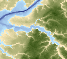
The focus of this dataset is the bathymetry, so that dataset was given priority when combining the datasets. The individual datasets were not checked for errors prior to combining the datasets. Both land elevation datasets (NED and the LIDAR) use the same vertical datum - NAVD88. The bathymetry dataset metadata specified the vertical coordinate system as being referenced to the local tidal datum at the time of the hydrographic survey. These surveys ranged from 1859 to 1993 in the Chesapeake Bay area. No attempt was made to adjust between the two vertical datums represented by these 3 datasets.
Completeness_Report:
By combining the three individual datasets, a complete elevation surface for the study area was derived.
Positional_Accuracy:
Horizontal_Positional_Accuracy:
Horizontal_Positional_Accuracy_Report:
This grid is a combination of three different datasets with three different horizontal accuracies. For the LIDAR data, the metadata reports the horizontal accuracy as "The horizontal coordinate values were designed to meet NSSDA accuracy for data at 1:2400 scale." The metadata for the NED elevation data does not specify a horizontal accuracy. The Chesapeake Estuarine bathymetry dataset metadata reports the horizontal accuracy as "The horizontal accuracy of the DEM is expressed as an estimated root mean square error (RMSE). The estimate of the RMSE is based upon horizontal accuracy tests of the source soundings used to generate the DEM. As a first approximation the locational accuracy of the source soundings are 0.0015 m at source "Smooth Sheet" scale (120 m @ 1:80,000 to 15 m @ 1:10,000). Smooth Sheets are maps generated as a principle product of each (historic) hydrographic survey with fully corrected soundings plotted on them. Digital elevation models comply with the National Map Accuracy Standards (NMAS) accuracy requirements. The positional accuracy is estimated at 3 meters."
Vertical_Positional_Accuracy:
Vertical_Positional_Accuracy_Report:
This grid is a combination of three different datasets with three different vertical accuracies. For the LIDAR data, the metadata reports the vertical accuracy as "The RMSE value of 14.3 cm at the 95% confidence level was determined by an independent accuracy assessment conducted by Dewberry LLC according to the contract specifications. These specifications followed FEMA Appendix A guidelines regarding assessing vertical accuracy. For data accurate to within 18.5 cm RMSE, the guidelines recommended a minimum of 20 independent check points be located in each of 5 different land cover categories: Grass/Ground, High Grass/Crops, Brush/Low Trees, Forest, and Urban/Pavement. A total of 125 points were used for the assessments. These points were surveyed by a licensed land surveyor and provided a positional location and elevation with an accuracy that exceeded the predicted accuracy of the LIDAR data. The entire accuracy reports can be found at <http://dnrweb.dnr.state.md.us/gis/data/lidar>. The RMSE value is 14.3 cm. See the Vertical Positional Accuracy Report section for more information." The metadata for the NED elevation data does not specify a vertical accuracy. The Chesapeake Estuarine bathymetry dataset metadata reports the vertical accuracy as "The vertical RMSE statistic is used to describe the vertical accuracy of a DEM. It encompasses both random and systematic errors introduced during production of the data. The RMSE is encoded in element number 5 of record C of the DEM. This accuracy estimate includes components related to quantization of the source soundings (1.3 to 0.15 m), the systematic editing of the source data (1percentor 0.10m), un-sampled bathymetric features (estimated at less than 5percentof depth), time related changes (erosion, deposition, and seismic shifts), and dredging operations (cut and fill). It is estimated that the accuracy of the Bathymetric DEMs is 2 percent of depth or 1 meter for depths grater than 20 meters and 2 percent of depth or 0.20 meters for depths shallower than 20 meters. THESE DEMs SHOULD NOT BE USED FOR NAVIGATION.
There are three types of DEM vertical errors: blunder, systematic, and random. These errors are reduced in magnitude by editing but cannot be completely eliminated. Blunders are errors of major proportions and are easily identified and removed during interactive editing. Systematic errors follow some fixed pattern and are introduced by data collection procedures and systems. Systematic error artifacts include vertical unsampled elevation shifts, relative spacing of the source soundings, misinterpretation of terrain surface caused by softness or poor reflectivity and by the resolution of the collected soundings (feet, feet and fractions, fathoms, fathoms and fractions, meters, tenths of meters etc.). Random errors result from unknown or accidental causes. The 1 degree (DSQ) DEMs are generated from 30 m grids on UTM projection. The RMSE difference between these surfaces is an estimate of the vertical accuracy of the DSQ DEMs."
Lineage:
Source_Information:
Source_Citation:
Citation_Information:
Originator: U.S. Geological Survey (USGS), EROS Data Center
Publication_Date: 1999
Title: National Elevation Dataset
Geospatial_Data_Presentation_Form: raster digital data
Publication_Information:
Publication_Place: Sioux Falls, SD
Publisher: U.S. Geological Survey
Online_Linkage: http://ned.usgs.gov/
Online_Linkage: http://seamless.usgs.gov/
Type_of_Source_Media: online
Source_Time_Period_of_Content:
Time_Period_Information:
Single_Date/Time:
Calendar_Date: 1999
Source_Currentness_Reference: publication date
Source_Citation_Abbreviation: NED
Source_Contribution: This dataset provided the bulk of the on land elevation data.
Source_Information:
Source_Citation:
Citation_Information:
Originator: NOAA Coastal Services Center Coastal Remote Sensing Program
Publication_Date: 20070613
Title: 2003 Maryland LIDAR mapping project
Geospatial_Data_Presentation_Form: raster digital data
Online_Linkage: http://www.csc.noaa.gov/ldart
Online_Linkage: http://www.csc.noaa.gov/lidar
Type_of_Source_Media: online
Source_Time_Period_of_Content:
Time_Period_Information:
Range_of_Dates/Times:
Beginning_Date: 20030301
Ending_Date: 20031130
Source_Currentness_Reference: ground condition
Source_Citation_Abbreviation: LIDAR
Source_Contribution:
The LIDAR data provided the higher resolution land data and helped bridge the small gap between the NED elevation data and the bathymetry data.
Source_Information:
Source_Citation:
Citation_Information:
Originator:
Department of Commerce (DOC), National Oceanic and Atmospheric Administration (NOAA), National Ocean Service (NOS), Special Projects (SP)
Publication_Date: 1998
Title:
Chesapeake Bay, VA/MD (M130) Bathymetric Digital Elevation Model (30 meter resolution) Derived From Source Hydrographic Survey Soundings Collected by NOAA
Geospatial_Data_Presentation_Form: raster digital data
Publication_Information:
Publication_Place: Silver Spring, MD
Publisher: NOAA's Ocean Service, Special Projects (SP)
Online_Linkage: http://estuarinebathymetry.noaa.gov/
Type_of_Source_Media: online
Source_Time_Period_of_Content:
Time_Period_Information:
Range_of_Dates/Times:
Beginning_Date: 1859
Ending_Date: 1993
Source_Currentness_Reference: ground condition
Source_Citation_Abbreviation: bathy
Source_Contribution:
This dataset provided all the bathymetric data in the study area.
Process_Step:
Process_Description:
The NED was downloaded in an ESRI binary grid format in a WinZip file. Once extracted, the grid ned_37057094 was created. These original grids are in a geographic coordinate system, NAD83, with a vertical datum of NAVD88. The cell size of these grids is 0.000278 decimal degrees. These files cover the land portion of the area of interest. The cell values where water occurs is usually set to 0 - not true elevation (bathymetry) values. This process step and all subsequent process steps were carried out by the same person - VeeAnn A. Cross.
Process_Date: 200705
Source_Produced_Citation_Abbreviation: ned_37057094
Process_Contact:
Contact_Information:
Contact_Person_Primary:
Contact_Person: VeeAnn A. Cross
Contact_Organization: U.S. Geological Survey
Contact_Position: Marine Geologist
Contact_Address:
Address_Type: mailing and physical address
Address: Woods Hole Coastal and Marine Science Center
Address: 384 Woods Hole Rd.
City: Woods Hole
State_or_Province: MA
Postal_Code: 02543-1598
Contact_Voice_Telephone: (508) 548-8700 x2251
Contact_Facsimile_Telephone: (508) 457-2310
Contact_Electronic_Mail_Address: vatnipp@usgs.gov
Process_Step:
Process_Description:
The LIDAR was downloaded as a binary floating-point raster dataset. This data file was converted to an ESRI binary grid format using ArcMap 9.1 - ArcToolbox - Conversion Tools - To Raster - Float to Raster. The input dataset was vatnipp17193.flt with the output grid named FloatTo_vatn1. Additionally, the resulting grid needed the projection defined. Based on the metadata, the projection is Geographic, NAD83. This definition was accomplished in ArcMap 9.1 - ArcToolbox - Data Management Tools - Projections and Transformations - Define Projection. The input dataset was FloatTo_vatn1 and the coordinate system chose was GCS_North_American_1983.
Source_Used_Citation_Abbreviation: vatnipp17193.flt
Process_Date: 200706
Source_Produced_Citation_Abbreviation: FloatTo_vatn1
Process_Step:
Process_Description:
The Chesapeake Estuarine bathymetry dataset was downloaded in DEM format. Chesapeake Bay actually required 3 separate DEM's. For the Corsica River Estuary the northernmost of those DEM's covered the area of interest. This file was M130_39076C2_BIG3.dem. The original projection of the data is UTM, Zone 18, NAD27 with a cell size of 30 meters. The vertical datum for the bathymetry is referenced to local tidal datum at the time of the hydrographic surveys that make up the dataset. The vertical unit is meters. The Digital Elevation Model (DEM) estuarine files needed to be converted from the USGS DEM format to ESRI grid format. To do that, ArcMap 9.0 - ArcToolbox - Conversion Tools - To Raster - DEM to Raster. The output data type is float, with the Z-factor left to the default value of 1.
Source_Used_Citation_Abbreviation: M130_39076C2_BIG3.dem
Process_Date: 200608
Source_Produced_Citation_Abbreviation: big3
Process_Step:
Process_Description:
The estuarine bathymetry grids then needed to be projected to UTM, Zone 18, NAD83 - basically just a datum transformation. To do this, ArcMap 9.0 - Data Management Tools - Projections and Transformations - Raster - Project Raster. The geographic transformation used was NAD_1927_to NAD_1980_NADCON. The resampling method was bilinear.
Source_Used_Citation_Abbreviation: big3
Process_Date: 2006
Source_Produced_Citation_Abbreviation: big3_nad83
Process_Step:
Process_Description:
The LIDAR grid data was projected from Geographic, NAD83 to UTM, Zone 18, NAD83. This was accomplished with ArcMap 9.2 - ArcToolbox - Data Management Tools - Projections and Transformations - Raster - Project Raster. Parameters as follows: input raster: floatto_vatn1; input coordinate system - GCS_North_American_1983; output raster: csc_utm18; output coordinate system: NAD_1983_UTM_Zone_18N; resampling technique: bilinear. Remainder of the parameters were left to the default. No transformation was necessary.
Source_Used_Citation_Abbreviation: floatto_vatn1
Process_Date: 200911
Source_Produced_Citation_Abbreviation: csc_utm18
Process_Step:
Process_Description:
The NED elevation dataset was projected from the geographic, NAD83 to UTM, Zone 18, NAD83. This was accomplished from ArcInfo command line of ArcGIS 9.1. The command line used to do this was:
NED_UTM18 = project(ned_37057094, geog2utm, bilinear).
Effectively what this does is project ned_37057094 using the parameters supplied in the file geog2utm using a bilinear interpolation method. The contents of geog2utm are as follows:
INPUT
PROJECTION GEOGRAPHIC
UNITS DD
DATUM NAD83
PARAMETERS
OUTPUT
PROJECTION UTM
UNITS METERS
ZONE 18
DATUM NAD83
PARAMETERS
END
Source_Used_Citation_Abbreviation: ned_37057094
Process_Date: 200705
Source_Produced_Citation_Abbreviation: NED_UTM18
Process_Step:
Process_Description:
With all the individual datasets in ESRI binary grid format, projection UTM, NAD83, I want to combine the datasets. I do this using raster calculator in ArcMap 9.2 using the following command: merge([big3_nad83], [csc_utm18], [ned_utm18]) Using raster calculator and the merge command, the order of the grids listed is important. The first grid listed has highest priority and will overwrite any values in the same location from the other grids. The second grid listed will overwrite any values in the same location of any grid that comes after it in the list. So in this case, the estuarine bathymetry dataset was assigned priority 1, the LIDAR data priority 2, and to fill in any remaining gaps, the NED data were used. This creates a temporary raster dataset. Then within the table of contents in ArcMap, I right mouse click and select Data - Make Permanent. The resulting output grid is combelev.
Source_Used_Citation_Abbreviation: big3_nad83
Source_Used_Citation_Abbreviation: csc_utm18
Source_Used_Citation_Abbreviation: ned_utm18
Process_Date: 200911
Source_Produced_Citation_Abbreviation: combelev
Process_Step:
Process_Description:
Edits to the metadata were made to fix any errors that MP v 2.9.36 flagged. This is necessary to enable the metadata to be successfully harvested for various data catalogs. In some cases, this meant adding text "Information unavailable" or "Information unavailable from original metadata" for those required fields that were left blank. Other minor edits were probably performed (title, publisher, publication place, etc.). Attempted to modify http to https where appropriate. Reordered the links in the identification section to have a landing page link as the first link. Updated the link to the field activity. The distribution format name was modified in an attempt to be more consistent with other metadata files of the same data format. The metadata date (but not the metadata creator) was edited to reflect the date of these changes. The metadata available from a harvester may supersede metadata bundled within a download file. Compare the metadata dates to determine which metadata file is most recent.
Process_Date: 20171016
Process_Contact:
Contact_Information:
Contact_Organization_Primary:
Contact_Organization: U.S. Geological Survey
Contact_Person: VeeAnn A. Cross
Contact_Position: Marine Geologist
Contact_Address:
Address_Type: Mailing and Physical
Address: 384 Woods Hole Road
City: Woods Hole
State_or_Province: MA
Postal_Code: 02543-1598
Contact_Voice_Telephone: 508-548-8700 x2251
Contact_Facsimile_Telephone: 508-457-2310
Contact_Electronic_Mail_Address: vatnipp@usgs.gov
Process_Step:
Process_Description: USGS Thesaurus keywords added to the keyword section.
Process_Date: 20180720
Process_Contact:
Contact_Information:
Contact_Organization_Primary:
Contact_Organization: U.S. Geological Survey
Contact_Person: VeeAnn A. Cross
Contact_Position: Marine Geologist
Contact_Address:
Address_Type: Mailing and Physical
Address: 384 Woods Hole Road
City: Woods Hole
State_or_Province: MA
Postal_Code: 02543-1598
Contact_Voice_Telephone: 508-548-8700 x2251
Contact_Facsimile_Telephone: 508-457-2310
Contact_Electronic_Mail_Address: vatnipp@usgs.gov
Process_Step:
Process_Description: Crossref DOI link was added as the first link in the metadata.
Process_Date: 20191118
Process_Contact:
Contact_Information:
Contact_Organization_Primary:
Contact_Organization: U.S. Geological Survey
Contact_Person: VeeAnn A. Cross
Contact_Position: Marine Geologist
Contact_Address:
Address_Type: Mailing and Physical
Address: 384 Woods Hole Road
City: Woods Hole
State_or_Province: MA
Postal_Code: 02543-1598
Contact_Voice_Telephone: 508-548-8700 x2251
Contact_Facsimile_Telephone: 508-457-2310
Contact_Electronic_Mail_Address: vatnipp@usgs.gov
Process_Step:
Process_Description:
Added keywords section with USGS persistent identifier as theme keyword.
Process_Date: 20200908
Process_Contact:
Contact_Information:
Contact_Organization_Primary:
Contact_Organization: U.S. Geological Survey
Contact_Person: VeeAnn A. Cross
Contact_Position: Marine Geologist
Contact_Address:
Address_Type: Mailing and Physical
Address: 384 Woods Hole Road
City: Woods Hole
State_or_Province: MA
Postal_Code: 02543-1598
Contact_Voice_Telephone: 508-548-8700 x2251
Contact_Facsimile_Telephone: 508-457-2310
Contact_Electronic_Mail_Address: vatnipp@usgs.gov
Spatial_Data_Organization_Information:
Direct_Spatial_Reference_Method: Raster
Raster_Object_Information:
Raster_Object_Type: Grid Cell
Row_Count: 319
Column_Count: 285
Vertical_Count: 1
Spatial_Reference_Information:
Horizontal_Coordinate_System_Definition:
Planar:
Grid_Coordinate_System:
Grid_Coordinate_System_Name: Universal Transverse Mercator
Universal_Transverse_Mercator:
UTM_Zone_Number: 18
Transverse_Mercator:
Scale_Factor_at_Central_Meridian: 0.999600
Longitude_of_Central_Meridian: -75.000000
Latitude_of_Projection_Origin: 0.000000
False_Easting: 500000.000000
False_Northing: 0.000000
Planar_Coordinate_Information:
Planar_Coordinate_Encoding_Method: row and column
Coordinate_Representation:
Abscissa_Resolution: 30.000000
Ordinate_Resolution: 30.000000
Planar_Distance_Units: meters
Geodetic_Model:
Horizontal_Datum_Name: North American Datum of 1983
Ellipsoid_Name: Geodetic Reference System 80
Semi-major_Axis: 6378137.000000
Denominator_of_Flattening_Ratio: 298.257222
Vertical_Coordinate_System_Definition:
Altitude_System_Definition:
Altitude_Datum_Name: North American Vertical Datum of 1988
Altitude_Resolution: 0.1
Altitude_Distance_Units: meters
Altitude_Encoding_Method:
Explicit elevation coordinate included with horizontal coordinates
Depth_System_Definition:
Depth_Datum_Name:
referenced to local tidal datum at the time of the hydrogaphic survey
Depth_Resolution: 0.1
Depth_Distance_Units: meters
Depth_Encoding_Method: Explicit depth coordinate included with horizontal coordinates
Distribution_Information:
Distributor:
Contact_Information:
Contact_Person_Primary:
Contact_Person: VeeAnn A. Cross
Contact_Organization: U.S. Geological Survey
Contact_Position: Marine Geologist
Contact_Address:
Address_Type: mailing and physical address
Address: Woods Hole Coastal and Marine Science Center
Address: 384 Woods Hole Rd.
City: Woods Hole
State_or_Province: MA
Postal_Code: 02543-1598
Contact_Voice_Telephone: (508) 548-8700 x2251
Contact_Facsimile_Telephone: (508) 457-2310
Contact_Electronic_Mail_Address: vatnipp@usgs.gov
Resource_Description: Downloadable Data
Distribution_Liability:
Neither the U.S. government, the Department of the Interior, nor the USGS, nor any of their employees, contractors, or subcontractors, make any warranty, express or implied, nor assume any legal liability or responsibility for the accuracy, completeness, or usefulness of any information, apparatus, product, or process disclosed, nor represent that its use would not infringe on privately owned rights. The act of distribution shall not constitute any such warranty, and no responsibility is assumed by the USGS in the use of these data or related materials. Any use of trade, product, or firm names is for descriptive purposes only and does not imply endorsement by the U.S. Government.
Standard_Order_Process:
Digital_Form:
Digital_Transfer_Information:
Format_Name: AIG
Format_Version_Number: ArcGIS 9.2
Format_Information_Content:
The WinZip (version 9.0) files contains the ESRI binary grid as well as the associated metadata files.
Transfer_Size: 0.383
Digital_Transfer_Option:
Online_Option:
Computer_Contact_Information:
Offline_Option:
Offline_Media: DVD-ROM
Recording_Capacity:
Recording_Density: 4.75
Recording_Density_Units: GBytes
Recording_Format: UDF
Fees: none
Technical_Prerequisites:
The data are provided in a WinZip compressed file. The user must have software capable of uncompressing the archive. Additionally, once uncompressed the data are in the ESRI binary grid format. The user must have software capable of displaying this data format. The binary grid is actually made up of two folders, an info folder and the folder with the grid name. Both folders, and their relative path structure are necessary to fully utilize the data.
Metadata_Reference_Information:
Metadata_Date: 20240318
Metadata_Contact:
Contact_Information:
Contact_Person_Primary:
Contact_Person: VeeAnn A. Cross
Contact_Organization: U.S. Geological Survey
Contact_Position: Marine Geologist
Contact_Address:
Address_Type: mailing and physical address
Address: Woods Hole Coastal and Marine Science Center
Address: 384 Woods Hole Rd.
City: Woods Hole
State_or_Province: MA
Postal_Code: 02543-1598
Contact_Voice_Telephone: (508) 548-8700 x2251
Contact_Facsimile_Telephone: (508) 457-2310
Contact_Electronic_Mail_Address: whsc_data_contact@usgs.gov
Contact_Instructions:
The metadata contact email address is a generic address in the event the person is no longer with USGS. (updated on 20240318)
Metadata_Standard_Name: FGDC Content Standards for Digital Geospatial Metadata
Metadata_Standard_Version: FGDC-STD-001-1998
Metadata_Time_Convention: local time

This page is <https://cmgds.marine.usgs.gov/catalog/whcmsc/open_file_report/ofr2010-1094/combelevmeta.html>
Generated by mp version 2.9.51 on Mon Mar 25 16:05:30 2024