2010-012-FA_MOSAIC_GE.tif - Composite sidescan-sonar mosaic collected by the U.S. Geological Survey in Woods Hole, MA offshore of the Gulf Islands, MS, 2010 (UTM Zone 16N GeoTIFF)

Metadata also available as - [Outline] - [Parseable text] - [XML]

Frequently anticipated questions:


What does this data set describe?

Title:
2010-012-FA_MOSAIC_GE.tif - Composite sidescan-sonar mosaic collected by the U.S. Geological Survey in Woods Hole, MA offshore of the Gulf Islands, MS, 2010 (UTM Zone 16N GeoTIFF)
Abstract:
In 2010, the U.S. Geological Survey in Woods Hole, MA and St. Petersburg, FL, in partnership with the U.S. Army Corps of Engineers, Mobile District conducted geologic mapping to characterize the seafloor and shallow subsurface stratigraphy offshore of the Gulf Islands of Mississippi. The mapping was carried out during two cruises in March, 2010 on the R/V Tommy Munro of Biloxi, MS. Data were acquired with the following equipment: an SEA Ltd SwathPlus interferometric sonar (both 234 kHz and 468 kHz systems), a Klein 3000 and a Klein 3900 dual frequency sidescan-sonar, and an Edgetech 512i chirp subbottom profiling system. The long-term goal of this mapping effort is to produce high-quality, high-resolution geologic maps and geophysical interpretations that can be utilized to identify sand resources within the region and better understand the Holocene evolution and anticipate future changes in this coastal system. More information on the field work can be accessed from the Woods Hole Coastal and Marine Science Center Field Activity webpage https://cmgds.marine.usgs.gov/fan_info.php?fan=2010-012-FA or the St. Petersburg Coastal and Marine Geology InfoBank https://walrus.wr.usgs.gov/infobank/m/m210gm/html/m-2-10-gm.meta.html.
  1. How might this data set be cited?
    U.S. Geological Survey, 2011, 2010-012-FA_MOSAIC_GE.tif - Composite sidescan-sonar mosaic collected by the U.S. Geological Survey in Woods Hole, MA offshore of the Gulf Islands, MS, 2010 (UTM Zone 16N GeoTIFF): Open-File Report 2010-1178, U.S. Geological Survey, Coastal and Marine Geology Program, Woods Hole Coastal and Marine Science Center, Woods Hole, MA.

    Online Links:

    This is part of the following larger work.

    Pendleton, Elizabeth A., Baldwin, Wayne E., Danforth, William W., Dewitt, Nancy T., Forde, Arnell S., Foster, David S., Kelso, Kyle W., Pfeiffer, William R., Turecek, Aaron M., Flocks, James G., and Twichell, David C., 2011, Geophysical Data from offshore of the Gulf Islands National Seashore, Cat Island to Western Horn Island, Mississippi: Open-File Report 2010-1178, U.S. Geological Survey, Reston, VA.

    Online Links:

  2. What geographic area does the data set cover?
    West_Bounding_Coordinate: -88.861109
    East_Bounding_Coordinate: -88.708409
    North_Bounding_Coordinate: 30.231742
    South_Bounding_Coordinate: 30.169244
  3. What does it look like?
    https://pubs.usgs.gov/of/2010/1178/GIS_catalog/Sidescan/2010-012-FA/SS_GE_2010_012.png (PNG)
    grey scale image of sidescan-sonar mosaic
  4. Does the data set describe conditions during a particular time period?
    Beginning_Date: 05-Mar-2010
    Ending_Date: 17-Mar-2010
    Currentness_Reference:
    Data were not collected on 20100310, and 20100312-20100314 due to weather conditions, crew changes, or survey location.
  5. What is the general form of this data set?
    Geospatial_Data_Presentation_Form: remote-sensing image
  6. How does the data set represent geographic features?
    1. How are geographic features stored in the data set?
      This is a Raster data set. It contains the following raster data types:
      • Dimensions 6700 x 14600 x 1, type Pixel
    2. What coordinate system is used to represent geographic features?
      Grid_Coordinate_System_Name: Universal Transverse Mercator
      Universal_Transverse_Mercator:
      UTM_Zone_Number: 16
      Transverse_Mercator:
      Scale_Factor_at_Central_Meridian: 0.999600
      Longitude_of_Central_Meridian: -87.000000
      Latitude_of_Projection_Origin: 0.000000
      False_Easting: 500000.000000
      False_Northing: 0.000000
      Planar coordinates are encoded using row and column
      Abscissae (x-coordinates) are specified to the nearest 1.000000
      Ordinates (y-coordinates) are specified to the nearest 1.000000
      Planar coordinates are specified in meters
      The horizontal datum used is D_WGS_1984.
      The ellipsoid used is WGS_1984.
      The semi-major axis of the ellipsoid used is 6378137.000000.
      The flattening of the ellipsoid used is 1/298.257224.
  7. How does the data set describe geographic features?
    Entity_and_Attribute_Overview:
    There are no attributes associated with a GeoTIFF image. Image pixel values contain acoustic reflectivity values normalized to an 8-bit data range (0-255). Low-backscatter is represented by dark tones (low values) and high-backscatter is represented by bright tones (high values). The background color is set to 255 and can be turned off without removing data values.
    Entity_and_Attribute_Detail_Citation: U.S. Geological Survey

Who produced the data set?

  1. Who are the originators of the data set? (may include formal authors, digital compilers, and editors)
    • U.S. Geological Survey
  2. Who also contributed to the data set?
  3. To whom should users address questions about the data?
    David C. Twichell
    U.S. Geological Survey
    Geologist
    384 Woods Hole Road
    Woods Hole, MA
    USA

    508-548-8700 x2266 (voice)
    508-457-2310 (FAX)
    dtwichell@usgs.gov

Why was the data set created?

This GeoTIFF (Tagged Image File Format) contains sidescan sonar data that were collected in March 2010. These data are used to define the sea-floor morphology offshore of the Gulf Islands in Mississippi.

How was the data set created?

  1. From what previous works were the data drawn?
    Information unavailable from original metadata (source 1 of 1)
    Information unavailable from original metadata - assumed USGS, unknown, Information unavailable from original metadata.

    Type_of_Source_Media: disc
    Source_Contribution:
    Sidescan-sonar (acoustic-backscatter) data during the first leg (2010-012-FA) were acquired with a Klein 3000 dual-frequency sidescan-sonar system (100 and 500 kHz), which was towed approximately 3 m astern from a starboard-side davit. Klein SonarPro acquisition software was used to log the data digitally at a sample rate resulting in raw pixel resolutions of approximately 0.18 and 0.14 m in the across-track and along-track directions, respectively. Horizontal offset values between the sidescan fish and DGPS antenna were provided to SonarPro, which calculated fish position dynamically during acquisition. The Klein system produced useable data over swath widths of 200-m during leg 2010-012-FA.
  2. How were the data generated, processed, and modified?
    Date: 2010 (process 1 of 6)
    Within XSonar Software (version: 2.0) a median filtering routine (Malinverno and others, 1990) was applied to the raw sidescan-sonar data (.xtf) to remove speckle noise; the filter was 4 pixels across track by 3 pixels along track. The data were further processed to correct for fish altitude, slant and beam artifacts, and then merged with the navigation (Danforth, 1997). Odd and even sidescan sonar lines were mapped separately out of XSonar at 1 meter/pixel resolution. Sidescan areas were defined within the cruise domain such that the sonar images mapped in XSonar would be no larger than 150 Mb. Person who carried out this activity:
    Elizabeth A. Pendleton
    U.S. Geological Survey
    Geologist
    384 Woods Hole Rd.
    Woods Hole, MA

    (508) 548-8700x2259 (voice)
    (508) 457-2310 (FAX)
    ependleton@usgs.gov
    Date: 2010 (process 2 of 6)
    The odd and even area files were imported into PCI Geomatica Software (version 10.1) to be digitally mosaicked together using PCI's OrthoEngine and procedures described in Paskevich (1996). The mosaicking process produces an enhanced, geographically correct, sidescan-sonar mosaic with 1 meter/pixel resolution. The composite mosaic was exported as a GeoTIFF image. Person who carried out this activity:
    Elizabeth A. Pendleton
    U.S. Geological Survey
    Geologist
    384 Woods Hole Rd.
    Woods Hole, MA

    (508) 548-8700x2259 (voice)
    (508) 457-2310 (FAX)
    ependleton@usgs.gov
    Date: 30-Oct-2017 (process 3 of 6)
    Edits to the metadata were made to fix any errors that MP v 2.9.36 flagged. This is necessary to enable the metadata to be successfully harvested for various data catalogs. In some cases, this meant adding text "Information unavailable" or "Information unavailable from original metadata" for those required fields that were left blank. Other minor edits were probably performed (title, publisher, publication place, etc.). Had to fix the title to correspond to this dataset. Attempted to modify http to https where appropriate. Added a landing page link as the first link in the identification section. Updated the link to the field activity. Online links were added to a cross-references. The source information was incomplete and had to be modified to meet the standard. The distribution format name was modified in an attempt to be more consistent with other metadata files of the same data format. The metadata date (but not the metadata creator) was edited to reflect the date of these changes. The metadata available from a harvester may supersede metadata bundled within a download file. Compare the metadata dates to determine which metadata file is most recent. Person who carried out this activity:
    U.S. Geological Survey
    Attn: VeeAnn A. Cross
    Marine Geologist
    384 Woods Hole Road
    Woods Hole, MA

    508-548-8700 x2251 (voice)
    508-457-2310 (FAX)
    vatnipp@usgs.gov
    Date: 20-Jul-2018 (process 4 of 6)
    USGS Thesaurus keywords added to the keyword section. Person who carried out this activity:
    U.S. Geological Survey
    Attn: VeeAnn A. Cross
    Marine Geologist
    384 Woods Hole Road
    Woods Hole, MA

    508-548-8700 x2251 (voice)
    508-457-2310 (FAX)
    vatnipp@usgs.gov
    Date: 18-Nov-2019 (process 5 of 6)
    Crossref DOI link was added as the first link in the metadata. Person who carried out this activity:
    U.S. Geological Survey
    Attn: VeeAnn A. Cross
    Marine Geologist
    384 Woods Hole Road
    Woods Hole, MA

    508-548-8700 x2251 (voice)
    508-457-2310 (FAX)
    vatnipp@usgs.gov
    Date: 08-Sep-2020 (process 6 of 6)
    Added keywords section with USGS persistent identifier as theme keyword. Person who carried out this activity:
    U.S. Geological Survey
    Attn: VeeAnn A. Cross
    Marine Geologist
    384 Woods Hole Road
    Woods Hole, MA

    508-548-8700 x2251 (voice)
    508-457-2310 (FAX)
    vatnipp@usgs.gov
  3. What similar or related data should the user be aware of?
    Danforth, W.W., O'Brien, T.F., and Schwab, W.C., 1991, USGS image processing system: near real-time mosaicking of high-resolution sidescan-sonar data: Sea Technology Jan. 1991, Sea Technology, Arlington, VA.

    Danforth, William W., 1997, XSonar/ShowImage: A complete system for rapid sidescan-sonar processing and display.: Open-File Report 97-686, U.S. Geological Survey, Reston, VA.

    Online Links:

    Malinverno, A., Edwards, M., and Ryan, W.B.F., 1990, Processing of SeaMARC swath sonar data.: Journal of Oceanic Engineering 15, Journal of Oceanic Engineering, Picayune MS.

    Paskevich, V.F., 1996, MAPIT: An improved method for mapping digital sidescan sonar data using the Woods Hole Image Processing System (WHIPS) Software: Open-File Report 96-281, U.S. Geological Survey, Reston, VA.

    Online Links:


How reliable are the data; what problems remain in the data set?

  1. How well have the observations been checked?
  2. How accurate are the geographic locations?
    These data were navigated with a Differential Global Positioning System (DGPS) mounted above the interferometric sonar head. Unless noted, all DGPS data are referenced to WGS84. The layback distance between towed sidescan sonar fish and the mounted GPS antennae were measured on the ship and the correction was applied in the Klein SonarPro acquisition software.The differential GPS is accurate within 1 to 2 meters. The layback of the towfish adds additional uncertainty due to changes in angle and scope of the tow cable in response to sea state and vessel speed. The total horizontal uncertainty is + or - 10 meters.
  3. How accurate are the heights or depths?
  4. Where are the gaps in the data? What is missing?
    All available data within the mosaic area were used to create the backscatter mosaic.
  5. How consistent are the relationships among the observations, including topology?
    All sidescan data were collected during USGS-WHCMSC cruise 2010-012-FA using a Klein 3000 dual frequency sidescan-sonar towfish and an Octopus F180 Attitude and Positioning System. Quality control was conducted during processing of the data. Any spurious data or artifacts were removed or minimized.

How can someone get a copy of the data set?

Are there legal restrictions on access or use of the data?
Access_Constraints None
Use_Constraints Public domain data from the U.S. Government are freely redistributable with proper metadata and source attribution. Please recognize the U.S. Geological Survey as the originator of the dataset.
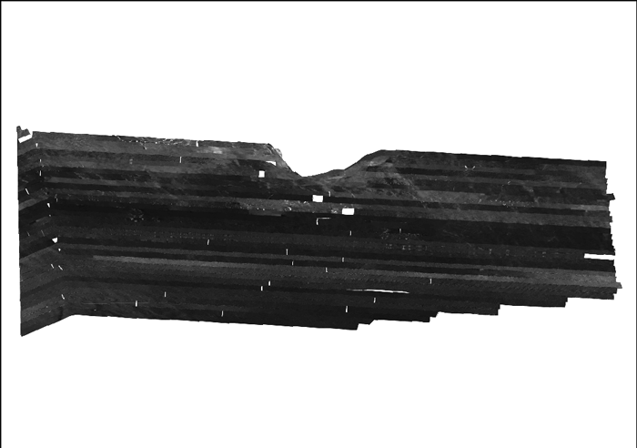
  1. Who distributes the data set? (Distributor 1 of 1)
    Elizabeth A. Pendleton
    U.S. Geological Survey
    Geologist
    384 Woods Hole Rd.
    Woods Hole, MA

    (508) 548-8700x2259 (voice)
    (508) 457-2310 (FAX)
    ependleton@usgs.gov
  2. What's the catalog number I need to order this data set? Downloadable Data
  3. What legal disclaimers am I supposed to read?
    Neither the U.S. Government, the Department of the Interior, nor the USGS, nor any of their employees, contractors, or subcontractors, make any warranty, express or implied, nor assume any legal liability or responsibility for the accuracy, completeness, or usefulness of any information, apparatus, product, or process disclosed, nor represent that its use would not infringe on privately owned rights. The act of distribution shall not constitute any such warranty, and no responsibility is assumed by the U.S. Geological Survey in the use of these data or related materials. Any use of trade, product, or firm names is for descriptive purposes only and does not imply endorsement by the U.S. Government.
  4. How can I download or order the data?
  5. What hardware or software do I need in order to use the data set?
    This zip file contains a GeoTIFF image. To utilize these data, the user must have an image viewer, image processing or GIS software package capable of importing a GeoTIFF image.

Who wrote the metadata?

Dates:
Last modified: 18-Mar-2024
Metadata author:
Elizabeth A. Pendleton
U.S. Geological Survey
Geologist
384 Woods Hole Rd.
Woods Hole, MA

(508) 548-8700x2259 (voice)
(508) 457-2310 (FAX)
whsc_data_contact@usgs.gov
Contact_Instructions:
The metadata contact email address is a generic address in the event the person is no longer with USGS. (updated on 20240318)
Metadata standard:
FGDC Content Standards for Digital Geospatial Metadata (FGDC-STD-001-1998)

This page is <https://cmgds.marine.usgs.gov/catalog/whcmsc/open_file_report/ofr2010-1178/2010-012-FA_MOSAIC_GE.faq.html>
Generated by mp version 2.9.51 on Mon Mar 25 16:05:32 2024