Swath bathymetry collected by the U.S. Geological Survey in Woods Hole, MA and St. Petersburg, FL offshore of the Gulf Islands, MS, 2010 (ESRI binary grid, tmunro_50m)

Metadata also available as - [Outline] - [Parseable text] - [XML]

Frequently anticipated questions:


What does this data set describe?

Title:
Swath bathymetry collected by the U.S. Geological Survey in Woods Hole, MA and St. Petersburg, FL offshore of the Gulf Islands, MS, 2010 (ESRI binary grid, tmunro_50m)
Abstract:
In 2010, the U.S. Geological Survey in Woods Hole, MA and St. Petersburg, FL, in partnership with the U.S. Army Corps of Engineers, Mobile District conducted geologic mapping to characterize the seafloor and shallow subsurface stratigraphy offshore of the Gulf Islands of Mississippi. The mapping was carried out during two cruises in March, 2010 on the R/V Tommy Munro of Biloxi, MS. Data were acquired with the following equipment: an SEA Ltd SwathPlus interferometric sonar (both 234 kHz and 468 kHz systems), a Klein 3000 and a Klein 3900 dual frequency sidescan-sonar, and an Edgetech 512i chirp subbottom profiling system. The long-term goal of this mapping effort is to produce high-quality, high-resolution geologic maps and geophysical interpretations that can be utilized to identify sand resources within the region and better understand the Holocene evolution and anticipate future changes in this coastal system. More information on the field work can be accessed from the Woods Hole Coastal and Marine Science Center Field Activity webpage https://cmgds.marine.usgs.gov/fan_info.php?fan=2010-012-FA or the St. Petersburg Coastal and Marine Geology InfoBank https://walrus.wr.usgs.gov/infobank/m/m210gm/html/m-2-10-gm.meta.html.
  1. How might this data set be cited?
    U.S. Geological Survey, 2011, Swath bathymetry collected by the U.S. Geological Survey in Woods Hole, MA and St. Petersburg, FL offshore of the Gulf Islands, MS, 2010 (ESRI binary grid, tmunro_50m): Open-File Report 2010-1178, U.S. Geological Survey, Coastal and Marine Geology Program, Woods Hole Coastal and Marine Science Center, Woods Hole, MA.

    Online Links:

    This is part of the following larger work.

    Pendleton, Elizabeth A., Baldwin, Wayne E., Danforth, William W., Dewitt, Nancy T., Forde, Arnell S., Foster, David S., Kelso, Kyle W., Pfeiffer, William R., Turecek, Aaron M., Flocks, James G., and Twichell, David C., 2011, Geophysical Data from offshore of the Gulf Islands National Seashore, Cat Island to Western Horn Island, Mississippi: Open-File Report 2010-1178, U.S. Geological Survey, Reston, VA.

    Online Links:

  2. What geographic area does the data set cover?
    West_Bounding_Coordinate: -89.083910
    East_Bounding_Coordinate: -88.635118
    North_Bounding_Coordinate: 30.231222
    South_Bounding_Coordinate: 30.125219
  3. What does it look like?
    https://pubs.usgs.gov/of/2010/1178/GIS_catalog/Bathy/bathy_grd.png (PNG)
    50-m swath bathymetric grid offshore of the Gulf Islands, MS
  4. Does the data set describe conditions during a particular time period?
    Beginning_Date: 04-Mar-2010
    Ending_Date: 29-Mar-2010
    Currentness_Reference:
    Data were not collected on 20100310, 20100312-20100314, 20100318, and 20100321-20100326 due to weather conditions, crew changes, or survey location.
  5. What is the general form of this data set?
    Geospatial_Data_Presentation_Form: raster digital data
  6. How does the data set represent geographic features?
    1. How are geographic features stored in the data set?
      This is a Raster data set. It contains the following raster data types:
      • Dimensions 221 x 861 x 1, type Grid Cell
    2. What coordinate system is used to represent geographic features?
      Grid_Coordinate_System_Name: Universal Transverse Mercator
      Universal_Transverse_Mercator:
      UTM_Zone_Number: 16
      Transverse_Mercator:
      Scale_Factor_at_Central_Meridian: 0.999600
      Longitude_of_Central_Meridian: -87.000000
      Latitude_of_Projection_Origin: 0.000000
      False_Easting: 500000.000000
      False_Northing: 0.000000
      Planar coordinates are encoded using row and column
      Abscissae (x-coordinates) are specified to the nearest 50.000000
      Ordinates (y-coordinates) are specified to the nearest 50.000000
      Planar coordinates are specified in meters
      The horizontal datum used is D_WGS_1984.
      The ellipsoid used is WGS_1984.
      The semi-major axis of the ellipsoid used is 6378137.000000.
      The flattening of the ellipsoid used is 1/298.257224.
      Vertical_Coordinate_System_Definition:
      Depth_System_Definition:
      Depth_Datum_Name: Mean lower low water
      Depth_Resolution: 0.1
      Depth_Distance_Units: meters
      Depth_Encoding_Method: Implicit coordinate
  7. How does the data set describe geographic features?

Who produced the data set?

  1. Who are the originators of the data set? (may include formal authors, digital compilers, and editors)
    • U.S. Geological Survey
  2. Who also contributed to the data set?
  3. To whom should users address questions about the data?
    David C. Twichell
    U.S. Geological Survey
    Oceanographer
    384 Woods Hole Rd.
    Woods Hole, MA

    (508) 548-8700x2266 (voice)
    (508) 457-2310 (FAX)
    dtwichell@usgs.gov

Why was the data set created?

This grid represents approximately 270 square km of bathymetric data that were collected in 2010. These data are used to define the sea-floor morphology offshore of the Gulf Islands in Mississippi.

How was the data set created?

  1. From what previous works were the data drawn?
    Information unavailable from original metadata (source 1 of 1)
    U.S. Geological Survey, unknown, Information unavailable from original metadata.

    Type_of_Source_Media: disc
    Source_Contribution:
    Swath data acquisition at sea (2010): These bathymetric data were collected with 2 SEA Ltd Swathplus interferometric sonars (a 234 kHz and a 468 kHz system) mounted on the portside of the R/V Tommy Munro of Biloxi, MS. The Woods Hole Coastal and Marine Science Center acquired data with the 234 kHz system between March 4, 2010 and March 17, 2010. The St. Petersburg Coastal and Marine Science Center acquired data with the 468 kHz system between March 19, 2010 and March 29, 2010. All data were acquired with SwathPlus Software (version: 3.6.5). Tracklines are spaced 150 m apart in the shore parallel direction.
  2. How were the data generated, processed, and modified?
    Date: 2010 (process 1 of 8)
    SwathPlus Software (version: 3.7.0) was used to acquire the raw swath data (*.sxr) and output a processed soundings file (*.sxp). Several bathy filters were applied to the processed file within SwathPlus to remove erroneous soundings and reduce the density of the data. Corrections were also applied for speed of sound changes (using sound velocity profiles), ship motion, GPS antennae offsets, and transducer depth and angle below the surface. Bathy filters included a low amplitude (100), range (1-m below the surface), box (2-m to avoid nadir), alongtrack 1 (depth difference of 10-m, window size 10-m, and learn rate of 0.6), alongtrack 2 (depth difference of 1-m, window size 1-m, and learn rate of 0.9), and a mean filter (0.1-m). Person who carried out this activity:
    Elizabeth A. Pendleton
    U.S. Geological Survey
    Geologist
    384 Woods Hole Rd.
    Woods Hole, MA

    (508) 548-8700x2259 (voice)
    (508) 457-2310 (FAX)
    ependleton@usgs.gov
    Date: 2010 (process 2 of 8)
    CARIS (version: HIPS and SIPS 6.1; service pack 2) was used to import the processed bathy files (*.sxp) from SwathPlus format to CARIS HDCS data format using the conversion utility. The data were corrected for errors in soundings due to additional sound refraction not accounted for by sound velocity profiles using the CARIS refraction editor. These artifacts can be recognized in a cross-swath profile of a relatively flat patch of sea floor. When viewing the swath data across a profile, the sea floor will appear to have a "frown" or "smile" when in fact the data should be flat across the profile. Insufficient and/or erroneous sound velocity information, which is usually due to too widely spaced or non-existent velocity profiles within an area, results in an under or over-estimate of water depth which increases with distance from the center of the swath. The bathymetric data were also corrected to mean lower low water (MLLW) using a discrete tidal-zoning model (DTZ) developed by NOAA/NOS's Hydrographic Planning Team (Huang, personal communication, 2010) (<http://www.tidesandcurrents.noaa.gov/hydro.html>). The DTZ model corrects differences in tidal phase and amplitude between the survey area and observations made at NOS tide gauges at Gulfport Harbor (8745557) and Pascagoula NOAA Lab (8741533). The tidal zone models were imported into CARIS (version: HIPS and SIPS 6.1) as text files and used to correct tidal observations for each survey. Once the tidal zone model was imported into CARIS using the tide editor, the tidal range and phase offsets were applied and remerged in CARIS(version: HIPS and SIPS 6.1), making all the soundings relative to MLLW. A 5-meter base surface of tide corrected bathymetric soundings was created in CARIS, then exported as ASCII x,y,z data. Person who carried out this activity:
    Elizabeth A. Pendleton
    U.S. Geological Survey
    Geologist
    384 Woods Hole Rd.
    Woods Hole, MA

    (508) 548-8700x2259 (voice)
    (508) 457-2310 (FAX)
    ependleton@usgs.gov
    Data sources used in this process:
    • CARIS (version: HIPS and SIPS 6.1; service pack 2)
    Date: 2010 (process 3 of 8)
    The 5-m ASCII x,y,z file (for each cruise; St. Pete and WHCMSC) was gridded in GMT (version: 4.2.1; Wessel and Smith, 1998) using 'blockmedian' with a cell size of 50 meters. This routine was conducted to minimize edge effects in the 'surface' gridding routine because these data were collected at approximately 40-50% seafloor coverage. Next a tension spline routine (at 0.1) in GMT was used ('surface') to create a netCDF grid. Person who carried out this activity:
    Elizabeth A. Pendleton
    U.S. Geological Survey
    Geologist
    384 Woods Hole Rd.
    Woods Hole, MA

    (508) 548-8700 x2259 (voice)
    (508) 457-2310 (FAX)
    ependleton@usgs.gov
    Date: 12-Aug-2010 (process 4 of 8)
    The GMT grid (*.grd) was then converted to an ESRI Binary Grid via Mirone (version 1.5.0; Luis, 2007) and MATLAB R2007b (version 7.5.0.342) - save grid as - ArcGIS binary grid. The projection was defined in ArcMap (version: 9.3) using Data Management Tools - Projections and Transformations - Define Projection: UTM, zone 16N, WGS84 Datum. Person who carried out this activity:
    Elizabeth A. Pendleton
    U.S. Geological Survey
    Geologist
    U.S. Geological Survey
    Woods Hole, MA

    (508)-548-8700 x2259 (voice)
    (508)-457-2310 (FAX)
    ependleton@usgs.gov
    Date: 30-Oct-2017 (process 5 of 8)
    Edits to the metadata were made to fix any errors that MP v 2.9.36 flagged. This is necessary to enable the metadata to be successfully harvested for various data catalogs. In some cases, this meant adding text "Information unavailable" or "Information unavailable from original metadata" for those required fields that were left blank. Other minor edits were probably performed (title, publisher, publication place, etc.). Attempted to modify http to https where appropriate. Added a landing page link as the first link in the identification section. Updated the link to the field activity. The source information was incomplete and had to be modified to meet the standard. The distribution format name was modified in an attempt to be more consistent with other metadata files of the same data format. The metadata date (but not the metadata creator) was edited to reflect the date of these changes. The metadata available from a harvester may supersede metadata bundled within a download file. Compare the metadata dates to determine which metadata file is most recent. Person who carried out this activity:
    U.S. Geological Survey
    Attn: VeeAnn A. Cross
    Marine Geologist
    384 Woods Hole Road
    Woods Hole, MA

    508-548-8700 x2251 (voice)
    508-457-2310 (FAX)
    vatnipp@usgs.gov
    Date: 20-Jul-2018 (process 6 of 8)
    USGS Thesaurus keywords added to the keyword section. Person who carried out this activity:
    U.S. Geological Survey
    Attn: VeeAnn A. Cross
    Marine Geologist
    384 Woods Hole Road
    Woods Hole, MA

    508-548-8700 x2251 (voice)
    508-457-2310 (FAX)
    vatnipp@usgs.gov
    Date: 18-Nov-2019 (process 7 of 8)
    Crossref DOI link was added as the first link in the metadata. Person who carried out this activity:
    U.S. Geological Survey
    Attn: VeeAnn A. Cross
    Marine Geologist
    384 Woods Hole Road
    Woods Hole, MA

    508-548-8700 x2251 (voice)
    508-457-2310 (FAX)
    vatnipp@usgs.gov
    Date: 08-Sep-2020 (process 8 of 8)
    Added keywords section with USGS persistent identifier as theme keyword. Person who carried out this activity:
    U.S. Geological Survey
    Attn: VeeAnn A. Cross
    Marine Geologist
    384 Woods Hole Road
    Woods Hole, MA

    508-548-8700 x2251 (voice)
    508-457-2310 (FAX)
    vatnipp@usgs.gov
  3. What similar or related data should the user be aware of?
    Huang, Lijuan, 20100226, NOAA/NOS Hydrographic Planning Team (HPT) tide zone model.

    Online Links:

    Luis, J. F., 2007, Mirone: A multi-purpose tool for exploring grid data.: Computers and Geosciences 33, Elsevier, Amsterdam.

    Wessel, P., and Smith, W.H.F., 1998, New, improved version of the Generic Mapping Tools released: EOS Transactions 79, American Geophysical Union, Washington, DC.

    Online Links:


How reliable are the data; what problems remain in the data set?

  1. How well have the observations been checked?
  2. How accurate are the geographic locations?
    These data were navigated with a Differential Global Positioning System (DGPS); they are accurate to +/- 1 to 2 meters, horizontally. Unless noted, all DGPS data are referenced to WGS84, and distance between sidemounted interferometric sonar and GPS antennae are corrected.
  3. How accurate are the heights or depths?
    The theoretical vertical resolution of the SEA Ltd SwathPlus interferometric sonar is 1 % of water depth, approximately 0.1 m within the study area. An Octopus F180 Attitude and Positioning system was used to correct for vessel roll, pitch, heave, and yaw during the first leg, 2010-012FA, whereas an Octopus F190 Attitude and Positioning system was used during the second leg, 10cct02. Tidal offsets were corrected with a NOAA tide zone model and referenced to mean lower low water (MLLW). Errors associated with the tidal zone model could be less than or equal to the tidal range for this area which is ~0.4 m. The gridding algorithm and cell size used on these data could introduce errors as great as 3 m along the edges of the Gulfport Ship Channel. Gridding-induced errors are likely much smaller (< 0.5 m) for most of the study area where slopes are less than 1 degree. Changes in ship draft due to water and fuel usage were not considered.
  4. Where are the gaps in the data? What is missing?
    All shore parallel survey lines were incorporated. Tie (shore perpendicular) lines were not used in grid generation. The R/V Tommy Munro was contracted for the month of March 2010. The Woods Hole Coastal and Marine Science Center acquired data onboard between March 4 and March 17, 2010. Bathy data were acquired on 20100304-20100309; 20100311;20100315-20100317. Day gaps in acquisition were due to inclement weather or seismic tieline acquisition. The St. Petersburg Coastal and Marine Science Center acquired data onboard the R/V Tommy Munro between March 19 and March 29, 2010. Bathy data for this dataset were acquired on 201003019-20100320; 20100327-2010329. Day gaps in acquisition were due to inclement weather or data acquisition in another survey area.
  5. How consistent are the relationships among the observations, including topology?
    Spurious data points were removed during processing.

How can someone get a copy of the data set?

Are there legal restrictions on access or use of the data?
Access_Constraints None
Use_Constraints Not to be used for navigation. The Public domain data from the U.S. Government are freely redistributable with proper metadata and source attribution. Please recognize the U.S. Geological Survey as the originator of the dataset.
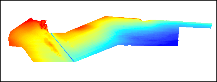
  1. Who distributes the data set? (Distributor 1 of 1)
    Elizabeth A. Pendleton
    U.S. Geological Survey
    Geologist
    384 Woods Hole Rd.
    Woods Hole, MA

    (508) 548-8700x2259 (voice)
    (508) 457-2310 (FAX)
    ependleton@usgs.gov
  2. What's the catalog number I need to order this data set? Downloadable Data
  3. What legal disclaimers am I supposed to read?
    Neither the U.S. Government, the Department of the Interior, nor the USGS, nor any of their employees, contractors, or subcontractors, make any warranty, express or implied, nor assume any legal liability or responsibility for the accuracy, completeness, or usefulness of any information, apparatus, product, or process disclosed, nor represent that its use would not infringe on privately owned rights. The act of distribution shall not constitute any such warranty, and no responsibility is assumed by the USGS in the use of these data or related materials. Any use of trade, product, or firm names is for descriptive purposes only and does not imply endorsement by the U.S. Government.
  4. How can I download or order the data?
    • Availability in digital form:
      Data format: The zip (WinZip version 14.5) file contains an ESRI binary grid of bathymetric data at 50-meter resolution in format AIG (version ArcGIS 9.3) Size: 1
      Network links: https://pubs.usgs.gov/of/2010/1178/GIS_catalog/Bathy/bathy_grd.zip
      Media you can order: DVD-ROM (Density 4.75 Gbytes) (format UDF)
    • Cost to order the data: None

  5. What hardware or software do I need in order to use the data set?
    The grid contained in the .zip file is available as an ESRI binary grid. To utilize this data, the user must have a GIS software package capable of reading an ESRI binary grid.

Who wrote the metadata?

Dates:
Last modified: 18-Mar-2024
Metadata author:
Elizabeth A. Pendleton
U.S. Geological Survey
Geologist
384 Woods Hole Road
Woods Hole, MA
USA

508-548-8700 x2259 (voice)
(508)-457-2310 (FAX)
whsc_data_contact@usgs.gov
Contact_Instructions:
The metadata contact email address is a generic address in the event the person is no longer with USGS. (updated on 20240318)
Metadata standard:
FGDC Content Standards for Digital Geospatial Metadata (FGDC-STD-001-1998)

This page is <https://cmgds.marine.usgs.gov/catalog/whcmsc/open_file_report/ofr2010-1178/tmunro_50m.faq.html>
Generated by mp version 2.9.51 on Mon Mar 25 16:05:32 2024