Any spurious data points were removed during processing. For each seismic trackline there is one seismic-profile image that is hyperlinked by the field 'ImageName'. No duplicates exist.
Horizontal_Positional_Accuracy:
Horizontal_Positional_Accuracy_Report:
Field activity 2009-002-FA: The SB-0512i was mounted on a catamaran sled and towed at the sea surface approximately 30 - 40 m astern of the M/V Megan T. Miller. Position data were provided by a Global Positioning System (GPS) navigation receiver mounted on the catamaran, and data were transmitted to the acquisition computer on the vessel via a 2.4 GHz radio link. Technical difficulties during portions of 2009-002-FA caused the GPS system mounted on the catamaran to malfunction, so DGPS navigation was obtained from a receiver mounted on top of the acquisition van (This applies to portions of l1f1, l1f3, l155f1, l158f1, l223f1, l269f1, and all of l156f1 - l157f2, l224f1 - l238f1, l243f1 - l257f1, l270f1 - l372f1). Layback positions, which account for the linear distance between the shipboard DGPS receiver and the towed catamaran vehicle, were calculated trigonometrically during post-processing (see processing step 3). While the vehicle mounted GPS antenna was operational, positional accuracy is assumed to be ± 10 m. While the vehicle mounted GPS was not operational, positional accuracy is assumed to be ± 20 m; increased uncertainty arises because layback calculations do not account for fish motion behind the vessel, which is caused by sea state and vessel speed induced changes in the angle and scope of the tow cable.
Field activity 2010-004-FA: The SB-0512i was mounted on a catamaran sled and towed at the sea surface approximately 30 - 40 m astern of the M/V Megan T. Miller. Technical difficulties during portions of 2010-004-FA caused the GPS system mounted on the catamaran to malfunction, so DGPS navigation was obtained from a receiver mounted above on top of the acquisition van (this applies to a portion of l63f1 and subsequent data collected over Julian days 138 - 140). Layback positions, which account for the linear distance between the shipboard DGPS receiver and the towed catamaran vehicle, were calculated trigonometrically during post-processing (see processing step 3). While the vehicle mounted GPS antenna was operational, positional accuracy is assumed to be ± 10 m. While the vehicle mounted GPS antenna was not operational, positional accuracy is assumed to be ± 20 m; increased uncertainty arises because layback calculations do not account for fish motion behind the vessel, which is caused by sea state and vessel speed induced changes in the angle and scope of the tow cable.
Field activity 2011-004-FA: The SB-0512i was mounted on a catamaran sled and towed at the sea surface approximately 50 m astern of the M/V Scarlett Isabella. Position data were provided by a Global Positioning System (GPS) navigation receiver mounted on the catamaran, and data were transmitted to the acquisition computer on the vessel via a 2.4 GHz radio link. Positional accuracy is assumed to be ± 10 m.
Source_Information:
Source_Citation:
Citation_Information:
Originator: U.S. Geological Survey
Publication_Date: Unpublished Material
Title: raw seismic navigation
Type_of_Source_Media: disc
Source_Time_Period_of_Content:
Time_Period_Information:
Range_of_Dates/Times:
Beginning_Date: 20090528
Ending_Date: 20110514
Source_Currentness_Reference:
ground condition of individual surveys on the following dates: 20090528-20090618; 20100515-20100520; 20110513-20110514
Source_Citation_Abbreviation: none
Source_Contribution:
Seismic-reflection data acquisition 2009-002-FA: Chirp seismic data were collected using an EdgeTech Geo-Star FSSB sub-bottom profiling system and an SB-0512i towfish (0.5-12 kHz), which was mounted on a catamaran and towed astern of the M/V Megan T. Miller of Port Jefferson, NY. Chesapeake Technologies' SonarWiz (v.4.04.0031) seismic acquisition software was used to control the Geo-Star topside unit, digitally log trace data in the SEG-Y Rev. 1 format (IEEE floating point), and record GPS navigation coordinates to the SEG-Y trace headers (in arc seconds of Latitude and Longitude, multiplied by a scalar of 100). Over Julian days 148 - 158 (Files l1f1 - l154f1) data were acquired using a 0.12-s shot rate, a 20-ms pulse length, and a 0.7 to 12 kHz frequency sweep. File l155f1 was acquired using a 0.12-s shot rate, a 30-ms pulse length, and a 0.5 - 7.2 kHz frequency sweep. Data over Julian days 159 - 169 were acquired using a 0.12-s shot rate, a 20-ms pulse length, and a 2 - 12 kHz frequency sweep. Traces were recorded in depth, assuming a constant sound velocity of 1500 m/s, with trace lengths of approximately 66 m (1250 samples/trace and .000053-s sample interval), 198 m (3744 samples/trace and .000053-s sample interval), and 132 m (2492 samples/trace and .000053-s sample interval) for the respective acquisition configurations.
Seismic-reflection data acquisition 2010-004-FA: Chirp seismic data were collected using an EdgeTech Geo-Star FSSB sub-bottom profiling system and an SB-0512i towfish (0.5-12 kHz), which was mounted on a catamaran and towed astern of the M/V Megan T. Miller of Port Jefferson, NY. Chesapeake Technologies' SonarWiz (v.4.04.0111) seismic acquisition software was used to control the Geo-Star topside unit, digitally log trace data in the SEG-Y Rev. 1 format (IEEE floating point), and record GPS navigation coordinates to the SEG-Y trace headers (in arc seconds of Latitude and Longitude, multiplied by a scalar of 100). Data were acquired using a 0.25-s shot rate, a 5-ms pulse length, and a 0.5 to 8 kHz frequency sweep. Recorded trace lengths were approximately 100 ms (2170 samples/trace and .000046-s sample interval).
Seismic-reflection data acquisition 2011-004-FA: Chirp seismic data were collected using an EdgeTech Geo-Star FSSB sub-bottom profiling system and an SB-0512i towfish (0.5-12 kHz), which was mounted on a catamaran and towed astern of the M/V Scarlett Isabella of Cape May, NJ. Chesapeake Technologies' SonarWiz (v.5.03.0016) seismic acquisition software was used to control the Geo-Star topside unit, digitally log trace data in the SEG-Y Rev. 1 format (IEEE floating point), and record GPS navigation coordinates to the SEG-Y trace headers (in arc seconds of Latitude and Longitude, multiplied by a scalar of 100). Data were acquired using a 0.25-s shot rate, a 5-ms pulse length, and a 0.5 to 8 kHz frequency sweep. Recorded trace lengths were approximately 200 ms (4340 samples/trace and .000046-s sample interval).
Process_Step:
Process_Description:
SIOSEIS (version 2010.2.25) was used to read SEG-Y files, renumber shots starting from one, and write out new SEG-Y files. The original shot numbers, which were assigned by SonarWiz sequentially over the duration of an acquisition session despite SEG-Y file changes, are preserved in the raw SEG-Y data.
Process_Date: 201110
Process_Contact:
Contact_Information:
Contact_Person_Primary:
Contact_Person: Wayne Baldwin
Contact_Organization: U.S. Geological Survey
Contact_Position: Geologist
Contact_Address:
Address_Type: mailing and physical address
Address: 384 Woods Hole Rd
City: Woods Hole
State_or_Province: MA
Postal_Code: 02543-1598
Country: USA
Contact_Voice_Telephone: 508-548-8700 x2226
Contact_Facsimile_Telephone: 508-457-2310
Contact_Electronic_Mail_Address: [email protected]
Process_Step:
Process_Description:
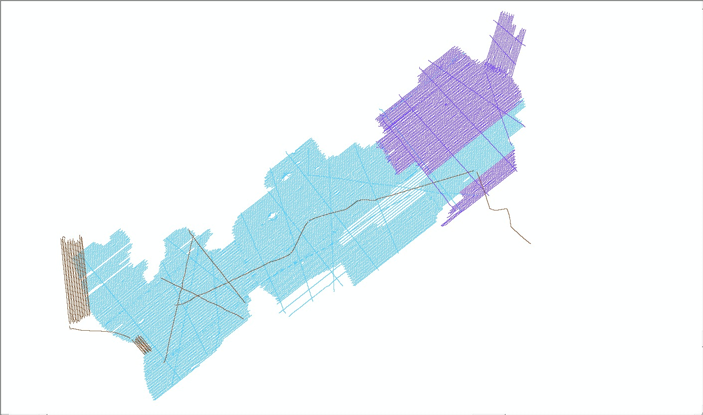
Seismic Unix (version 4.2) was used to read renumbered SEG-Y files, write a Seismic Unix file, and extract SEG-Y trace header information, including shot number, longitude, latitude, year, Julian day, and time of day (UTC). Header information from each SEG-Y file was saved to text files after an AWK (no version) filter was used to maintain the first and last shots, shots at multiples of 100, and shots with unique navigation coordinates. Geographic coordinates (WGS84) were converted to UTM zone 19 coordinates (WGS84) using Proj (version 4.6.0). End shots and shots at multiples of 100 may not have unique navigation coordinates. Separate text files containing the first and last shots and even 500 shot intervals were also saved. A 500 shot interval was chosen because it corresponds to the annotation interval provided along the top of the seismic-reflection profile images, which are included in the '2009-002-FA', '2010-004-FA', and '2011-004-FA' folders within 'GIS\hyperlink_images\'.
During 2009-002-FA, erroneous coordinates were intermittently recorded to the SEG-Y trace headers due to technical difficulties with the GPS systems. In these instances (portions of l1f1, l1f3, l155f1, l158f1, l223f1, l269f1, and all of l156f1 - l157f2, l224f1 - l238f1, l243-l245f1, l288f1 - l299f1), scripts utilizing AWK (no version), Proj (version 4.6.0), and the Unix commands egrep, join, sort, and cat were used to replace coordinates in the text files created by the process described above with correct navigation from HYPACK raw files. The following steps were perfomed for each effected file, over the specific time periods containing bad navigation: 1) navigation data were extracted from HYPACK raw files, creating a text file containing fields for Longitude, Latitude, and Julian day/UTC time (JD:HH:MM:SS); 2) records for the first and last shots, shots at multiples of 100, and the first record for each UTC second (files generally contain 4-5 shots per UTC second since the chirp shot rate is 4 Hz, while navigation update frequency is 1 Hz) were extracted from the original text files, and saved to new text files, only maintaining fields for LineName, ImageName, Shot, Year, and Julian day/UTC time (JD:HH:MM:SS); 3) files from the two previous steps were joined using the common field Julian day/UTC time (JD:HH:MM:SS); and 4) Geographic coordinates (WGS84) were converted to UTM zone 19 coordinates (WGS84) using Proj (version 4.6.0). The corrected navigation text files were substituted for the effected portions of the original data.
Process_Date: 201110
Process_Contact:
Contact_Information:
Contact_Person_Primary:
Contact_Person: Wayne Baldwin
Contact_Organization: U.S. Geological Survey
Contact_Position: Geologist
Contact_Address:
Address_Type: mailing and physical address
Address: 384 Woods Hole Rd
City: Woods Hole
State_or_Province: MA
Postal_Code: 02543-1598
Country: USA
Contact_Voice_Telephone: 508-548-8700 x2226
Contact_Facsimile_Telephone: 508-457-2310
Contact_Electronic_Mail_Address: [email protected]
Process_Step:
Process_Description:
An AWK (no version) script was used to apply layback to seismic navigation acquired during portions of the 2009-002-FA and 2010-004-FA surveys when shipboard DGPS was used in lieu of the non-operational GPS receiver mounted on the towed catamaran vehicle. (This includes portions of l1f1, l1f3, l155f1, l158f1, l223f1, l269f1, and all of l156f1 - l157f2, l224f1 - l238f1, l243f1 - l257f1, l270f1 - l372f1 collected on 2009-002-FA; and a portion of l63f1 and subsequent data collected over Julian days 138 - 140 on 2010-004-FA. Attributes oldEast and oldNorth in the table 'BB_SeismicShot_unique.csv', which is included in the zip compressed version of the shapefile 'BB_SeismicShot_500.shp', document pre-layback shot/trace positions). The script utilized a read-and-do loop to calculate and apply layback offsets to trace positions.
During the initial loop through the script: 1) easting and northing coordinates (UTM Zone 19, WGS84) for the first five traces of input navigation were read and easting and northing differentials between the consecutive positions were calculated; 2) the signs (+/-) of the differential values were compared to a look-up table to determine the appropriate conversion of the arc tangent (atan2(dy,dx)) angle between consecutive positions to a polar azimuth; 3) the average of the polar azimuths was calculated; 4) the sine and cosine of the average azimuth was calculated and multiplied by the linear distance between the catamaran and the shipboard DGPS receiver (33 m during 2009-002-FA, 31 or 37 m during 2010-004-FA), providing absolute values for easting and northing offsets, respectively; 5) a look-up table was used to determine the quadrant of the average azimuth and appropriately add or subtract the calculated offsets to the easting and northing coordinates of the first three input traces, producing final layback positions for those traces; 6) layback and original easting and northing coordinates for the three adjusted traces were printed to a new layback navigation file that also retained additional attributes input records; and 7) easting and northing coordinates of the fourth and fifth traces, the three azimuths computed between traces two, three, four, and five, and the average azimuth were held as input for calculations conducted in the subsequent loop.
During subsequent loops through the script: 1) easting and northing coordinates for three additional traces from input navigation were read, and easting and northing differentials were calculated between the consecutive positions, including the last trace position held from the previous loop; 2) three new polar azimuths were calculated using the differential values, then a new average azimuth was calculated from the three that were held, the new three, and the average held from the previous loop (the previously calculated average was factored into the new average to smooth "kinks" along the layback navigation that can result from significantly different average azimuths calculated from one loop to the next); 3) new layback offset values were computed, and applied to the easting and northing coordinates of the last two traces input during the previous loop, and the fist trace input during the present loop; 4) layback and original easting and northing coordinates for the three adjusted traces were appended to the layback navigation file started in the previous loop; and 5) easting and northing coordinates of the second and third traces, the three new azimuths, and the average azimuth from the present loop were held as input for calculations conducted in the subsequent loop.
Near the end of the input navigation file: 1) if less than three traces were present during a new loop, the layback offsets calculated during the previous loop were applied to remaining trace coordinates; 2) layback and original easting and northing coordinates for the remaining adjusted traces were appended to the layback navigation file; and 3) the script reached its end, closed, and saved the layback navigation file.
In this fashion, the script approximated a moving window, in which the average of six trace-to-trace azimuths was used to calculate layback offsets for three central trace positions. Exceptions were at the start of a file, where the first three input trace positions were adjusted using offsets calculated from the average of only four azimuths, and possibly at the end of a file, where remaining traces may have been adjusted using the offsets calculated during the previous loop.
Process_Date: 201110
Process_Contact:
Contact_Information:
Contact_Person_Primary:
Contact_Person: Wayne Baldwin
Contact_Organization: U.S. Geological Survey
Contact_Position: Geologist
Contact_Address:
Address_Type: mailing and physical address
Address: 384 Woods Hole Rd
City: Woods Hole
State_or_Province: MA
Postal_Code: 02543-1598
Country: USA
Contact_Voice_Telephone: 508-548-8700 x2226
Contact_Facsimile_Telephone: 508-457-2310
Contact_Electronic_Mail_Address: [email protected]
Process_Step:
Process_Description:
Text files containing unique shot point positions for each seismic line (including the layback-adjusted SB-512i lines from 2009-002-FA and 2010-004-FA) were concatenated into a comma-delimited text file ('BB_SeismicShot_unique.csv', which is provided in the zip-compressed package of the shapefile 'BB_SeismicShot_500.shp'). AWK was used to add and populate attribute fields 'SurveyID', 'DeviceID', and 'VehicleID', then the text file was imported into ArcMap (version 9.3) using 'Add XY data' and saved as points (Geographic, WGS84) in the Esri shapefile format.
Process_Date: 201110
Process_Contact:
Contact_Information:
Contact_Person_Primary:
Contact_Person: Wayne Baldwin
Contact_Organization: U.S. Geological Survey
Contact_Position: Geologist
Contact_Address:
Address_Type: mailing and physical address
Address: 384 Woods Hole Rd
City: Woods Hole
State_or_Province: MA
Postal_Code: 02543-1598
Country: USA
Contact_Voice_Telephone: 508-548-8700 x2226
Contact_Facsimile_Telephone: 508-457-2310
Contact_Electronic_Mail_Address: [email protected]
Process_Step:
Process_Description:
The shapefile containing unique shot point positions, created in the previous step, was used as an input for VACExtras (version 2.1), a VB collection of tools developed by VeeAnn Cross (USGS-WHSC), which converts point data to a new polyline shapefile ('BB_SeismicTrackline.shp'), based on record order. The 'FileName' field was used to define which points were used to generate each polyline feature, and the fields 'ImageName', 'Shot', 'Year', 'JulDay', 'SurveyID', 'DeviceID', and 'Shot_end' were chosen to be included as attributes in the output shapefile. Using XTools Pro (version 7.1.0) for ArcGIS desktop, the length of each polyline segment was calculated and included in the attribute field 'Length_km', specifying UTM, Zone 19 N, WGS84, and kilometers.
Process_Date: 201110
Process_Contact:
Contact_Information:
Contact_Person_Primary:
Contact_Person: Wayne Baldwin
Contact_Organization: U.S. Geological Survey
Contact_Position: Geologist
Contact_Address:
Address_Type: mailing and physical address
Address: 384 Woods Hole Rd
City: Woods Hole
State_or_Province: MA
Postal_Code: 02543-1598
Country: USA
Contact_Voice_Telephone: 508-548-8700 x2226
Contact_Facsimile_Telephone: 508-457-2310
Contact_Electronic_Mail_Address: [email protected]
Process_Step:
Process_Description:
Edits to the metadata were made to fix any errors that MP v 2.9.32 flagged. This is necessary to enable the metadata to be successfully harvested for various data catalogs. In some cases, this meant adding text "Information unavailable" or "Information unavailable from original metadata" for those required fields that were left blank. Other minor edits were probably performed (title, publisher, publication place, etc.). The metadata date (but not the metadata creator) was edited to reflect the date of these changes. The metadata available from a harvester may supersede metadata bundled within a download file. Compare the metadata dates to determine which metadata file is most recent.
Process_Date: 20151208
Process_Contact:
Contact_Information:
Contact_Organization_Primary:
Contact_Organization: U.S. Geological Survey
Contact_Person: VeeAnn A. Cross
Contact_Position: Marine Geologist
Contact_Address:
Address_Type: mailing and physical address
Address: 384 Woods Hole Rd
City: Woods Hole
State_or_Province: MA
Postal_Code: 02543
Contact_Voice_Telephone: 508-548-8700 x2251
Contact_Facsimile_Telephone: 508-457-2310
Contact_Electronic_Mail_Address: [email protected]
Process_Step:
Process_Description: USGS Thesaurus keywords added to the keyword section.
Process_Date: 20180720
Process_Contact:
Contact_Information:
Contact_Organization_Primary:
Contact_Organization: U.S. Geological Survey
Contact_Person: VeeAnn A. Cross
Contact_Position: Marine Geologist
Contact_Address:
Address_Type: Mailing and Physical
Address: 384 Woods Hole Road
City: Woods Hole
State_or_Province: MA
Postal_Code: 02543-1598
Contact_Voice_Telephone: 508-548-8700 x2251
Contact_Facsimile_Telephone: 508-457-2310
Contact_Electronic_Mail_Address: [email protected]
Process_Step:
Process_Description: Crossref DOI link was added as the first link in the metadata.
Process_Date: 20191118
Process_Contact:
Contact_Information:
Contact_Organization_Primary:
Contact_Organization: U.S. Geological Survey
Contact_Person: VeeAnn A. Cross
Contact_Position: Marine Geologist
Contact_Address:
Address_Type: Mailing and Physical
Address: 384 Woods Hole Road
City: Woods Hole
State_or_Province: MA
Postal_Code: 02543-1598
Contact_Voice_Telephone: 508-548-8700 x2251
Contact_Facsimile_Telephone: 508-457-2310
Contact_Electronic_Mail_Address: [email protected]
Process_Step:
Process_Description:
Added keywords section with USGS persistent identifier as theme keyword.
Process_Date: 20200908
Process_Contact:
Contact_Information:
Contact_Organization_Primary:
Contact_Organization: U.S. Geological Survey
Contact_Person: VeeAnn A. Cross
Contact_Position: Marine Geologist
Contact_Address:
Address_Type: Mailing and Physical
Address: 384 Woods Hole Road
City: Woods Hole
State_or_Province: MA
Postal_Code: 02543-1598
Contact_Voice_Telephone: 508-548-8700 x2251
Contact_Facsimile_Telephone: 508-457-2310
Contact_Electronic_Mail_Address: [email protected]