Online Links:
Online Links:
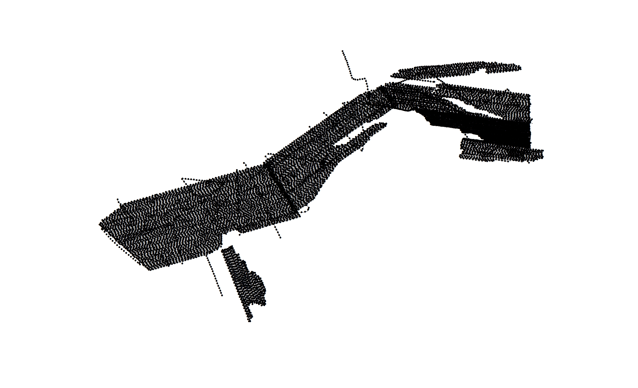
| Range of values | |
|---|---|
| Minimum: | 330352.74 |
| Maximum: | 380410.99 |
| Units: | meters |
| Resolution: | 0.01 |
| Range of values | |
|---|---|
| Minimum: | 4570466.21 |
| Maximum: | 4601005.71 |
| Units: | meters |
| Resolution: | 0.01 |
| Range of values | |
|---|---|
| Minimum: | -71.028392 |
| Maximum: | -70.431711 |
| Units: | decimal degrees |
| Resolution: | 0.000001 |
| Range of values | |
|---|---|
| Minimum: | 41.271214 |
| Maximum: | 41.548081 |
| Units: | decimal degrees |
| Resolution: | 0.000001 |
| Range of values | |
|---|---|
| Minimum: | 1 |
| Maximum: | 47443 |
| Units: | shot number |
| Resolution: | 1.0 |
| Range of values | |
|---|---|
| Minimum: | 2009 |
| Maximum: | 2011 |
| Units: | Calendar year |
| Resolution: | 1 |
| Range of values | |
|---|---|
| Minimum: | 127 |
| Maximum: | 155 |
| Units: | Julian Day |
| Resolution: | 1 |
Online Links:
Online Links:
Online Links:
| Access_Constraints | None |
|---|---|
| Use_Constraints | Public domain data from the U.S. Government are freely redistributable with proper metadata and source attribution. Please recognize the U.S. Geological Survey as the source of this information |
| Data format: | This WinZip file contains shot point navigation at even 500 shot intervals (VS_SeismicSHot_500.shp) for EdgeTech SB-512i chirp seismic-reflection data collected by the U.S. Geological Survey offshore of Massachusetts within Vineyard Sound and associated metadata. The WinZip file also contains a comma delimited file (VS_SeismicShot_Unique.csv), that contains every unique shot point for the same surveys. in format SHP (version ArcGIS 9.3) ESRI point shapefile Size: 40 |
|---|---|
| Network links: |
http://pubs.usgs.gov/of/2012/1006/GIS/shapefile/VS_SeismicShot_500.zip |
| Media you can order: | DVD-ROM (Density 4.75 Gbytes) (format UDF) |