Citation:
Citation_Information:
Originator: Wayne Baldwin
Publication_Date: 2013
Title:
Interpretation of sea-floor geologic units on the Massachusetts inner continental shelf between Nahant and Northern Cape Cod Bay (Nahant_CCB_surfgeol polygon shapefile; Geographic WGS 84)
Geospatial_Data_Presentation_Form: vector digital data
Series_Information:
Series_Name: Open-File Report
Issue_Identification: 2012-1157
Publication_Information:
Publication_Place: Woods Hole Coastal and Marine Science Center, Woods Hole, MA
Publisher: U.S. Geological Survey, Coastal and Marine Geology Program
Online_Linkage: https://doi.org/10.3133/ofr20121157
Online_Linkage:
Larger_Work_Citation:
Citation_Information:
Originator: Pendleton, E.A.
Originator: Baldwin, W.E.
Originator: Barnhardt, W.A.
Originator: Ackerman, S.D.
Originator: Foster, D.S.
Originator: Andrews, B.D.
Originator: Schwab, W.C.
Publication_Date: 2013
Title:
Shallow Geology, Sea-floor Texture, and Physiographic Zones of the Inner Continental Shelf from Nahant to Northern Cape Cod Bay, Massachusetts
Series_Information:
Series_Name: Open-File Report
Issue_Identification: 2012-1157
Publication_Information:
Publication_Place: Reston, Va
Publisher: U.S. Geological Survey
Online_Linkage: http://pubs.usgs.gov/of/2012/1157/
Description:
Abstract:
These data are qualitatively derived interpretive polygon shapefiles and selected source raster data defining surficial geology, sediment type and distribution, and physiographic zones of the sea floor from Nahant to Northern Cape Cod Bay. Much of the geophysical data used to create the interpretive layers were collected under a cooperative agreement among the Massachusetts Office of Coastal Zone Management (CZM), the U.S. Geological Survey (USGS), Coastal and Marine Geology Program, the National Oceanic and Atmospheric Administration (NOAA), and the U.S. Army Corps of Engineers (USACE). Initiated in 2003, the primary objective of this program is to develop regional geologic framework information for the management of coastal and marine resources. Accurate data and maps of seafloor geology are important first steps toward protecting fish habitat, delineating marine resources, and assessing environmental changes because of natural or human effects. The project is focused on the inshore waters of coastal Massachusetts. Data collected during the mapping cooperative involving the USGS have been released in a series of USGS Open-File Reports (
http://woodshole.er.usgs.gov/project-pages/coastal_mass/html/current_map.html). The interpretations released in this study are for an area extending from the southern tip of Nahant to Northern Cape Cod Bay, Massachusetts. A combination of geophysical and sample data including high resolution bathymetry and lidar, acoustic-backscatter intensity, seismic-reflection profiles, bottom photographs, and sediment samples are used to create the data interpretations. Most of the nearshore geophysical and sample data (including the bottom photographs) were collected during several cruises between 2000 and 2008. More information about the cruises and the data collected can be found at the Geologic Mapping of the Seafloor Offshore of Massachusetts Web page:
http://woodshole.er.usgs.gov/project-pages/coastal_mass/.
This data set describes sea-floor geology on the Massachusetts inner shelf between Nahant and Northern Cape Cod Bay. Polygons are used to indicate the areal distribution of sea-floor outcrop for sub-surface stratigraphic units interpreted in high-resolution seismic reflection data. These data are useful for assessing relations between geologic framework, sea-bed morphology, and sediment textural trends.
Time_Period_of_Content:
Time_Period_Information:
Range_of_Dates/Times:
Beginning_Date: 20060804
Ending_Date: 20080507
Currentness_Reference: ground condition
Status:
Progress: Complete
Maintenance_and_Update_Frequency: None planned
Spatial_Domain:
Bounding_Coordinates:
West_Bounding_Coordinate: -70.830053
East_Bounding_Coordinate: -70.154738
North_Bounding_Coordinate: 42.341199
South_Bounding_Coordinate: 41.932552
Keywords:
Theme:
Theme_Keyword_Thesaurus: USGS Metadata Identifier
Theme_Keyword: USGS:12bc5f5d-fb83-499d-bb11-4082d4aec266
Theme:
Theme_Keyword_Thesaurus: None
Theme_Keyword: U.S. Geological Survey
Theme_Keyword: USGS
Theme_Keyword: Coastal and Marine Geology Program
Theme_Keyword: CMGP
Theme_Keyword: Woods Hole Coastal and Marine Science Center
Theme_Keyword: WHCMSC
Theme_Keyword: Massachusetts Office of Coastal Zone Management
Theme_Keyword: CZM
Theme_Keyword: Sea floor
Theme_Keyword: Marine Geology
Theme_Keyword: Seismic-reflection Profiles
Theme_Keyword: field activity number 2006-012-FA
Theme_Keyword: field activity number 2007-001-FA
Theme_Keyword: field activity number 2007-002-FA
Theme_Keyword: field activity number 2008-002-FA
Theme_Keyword: Esri Polygon Shapefile
Theme_Keyword: EdgeTech
Theme_Keyword: 512i
Theme_Keyword: 424
Theme_Keyword: Knudsen
Theme_Keyword: 3200
Theme_Keyword: Seismic Interpretation
Theme_Keyword: Geologic Framework
Theme_Keyword: Surficial Geology
Theme_Keyword: interpretation
Theme:
Theme_Keyword_Thesaurus: ISO 19115 Topic Category
Theme_Keyword: oceans
Theme_Keyword: geoscientificinformation
Theme:
Theme_Keyword_Thesaurus: USGS Thesaurus
Theme_Keyword: scientific interpretation
Theme_Keyword: sea-floor characteristics
Theme_Keyword: marine geology
Theme_Keyword: geospatial datasets
Place:
Place_Keyword_Thesaurus: None
Place_Keyword: Massachusetts Bay
Place_Keyword: Atlantic Ocean
Place_Keyword: Boston Harbor
Place_Keyword: Nahant
Place_Keyword: Boston
Place_Keyword: Hull
Place_Keyword: Boston Harbor Islands
Place_Keyword: Duxbury
Place_Keyword: Provincetown
Place_Keyword: Plymouth
Place_Keyword: Scituate
Place_Keyword: Cohasset
Place_Keyword: Manomet
Place_Keyword: Winthrop
Place_Keyword: Cape Cod Bay
Stratum:
Stratum_Keyword_Thesaurus: General
Stratum_Keyword: Seafloor
Stratum_Keyword: sea floor
Access_Constraints: None
Use_Constraints:
Public domain data from the U.S. Government are freely redistributable with proper metadata and source attribution. Please recognize the U.S. Geological Survey (USGS) as the source of this information.
Additionally, there are limitations associated with qualitative geologic mapping interpretations. Because of the scale (polygon editing was done at scales between 1:8,000 and 1:20,000, depending on the size of the outcrop area) and line spacing of the source seismic profiles, not all changes in seafloor geology are captured. The boundaries of polygons are inferred between seismic lines, and polygon boundaries should be considered an approximation of the location of a change in geology. Further, a constant seismic velocity of 1,500 m/s was assumed for all profiles in all sediment types, which may result in inaccurate depths of stratigraphic units.
Point_of_Contact:
Contact_Information:
Contact_Person_Primary:
Contact_Person: Wayne Baldwin
Contact_Organization: U.S. Geological Survey
Contact_Position: Geologist
Contact_Address:
Address_Type: mailing and physical address
Address: U.S. Geological Survey
Address: 384 Woods Hole Rd.
City: Woods Hole
State_or_Province: MA
Postal_Code: 02543-1598
Country: USA
Contact_Voice_Telephone: 508-548-8700 x2226
Contact_Facsimile_Telephone: 508-457-2310
Contact_Electronic_Mail_Address: [email protected]
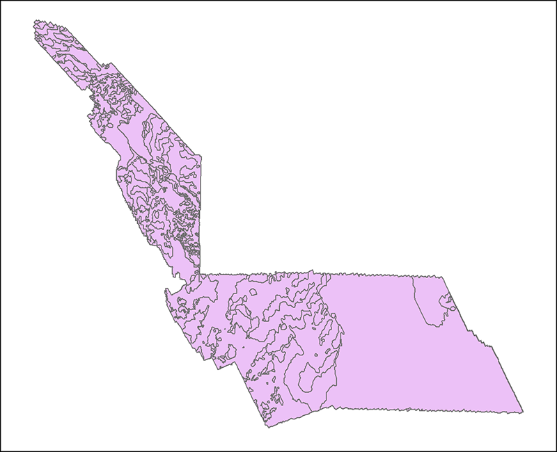
Browse_Graphic:
Browse_Graphic_File_Name:
Browse_Graphic_File_Description:
Interpretation ofsurficial geologic units on the Massachusetts inner shelf between Nahant and northern Cape Cod Bay
Browse_Graphic_File_Type: png
Native_Data_Set_Environment:
Microsoft Windows 7.1 (Build 7601) Service Pack 1; ESRI ArcCatalog 9.3.1.4000
Cross_Reference:
Citation_Information:
Originator: Robert N. Oldale
Originator: Jennifer Bick
Publication_Date: 1987
Title:
Maps and seismic profiles showing geology of the inner continental shelf, Massachusetts Bay, Massachusetts
Series_Information:
Series_Name: U.S. Geological Survey Miscellaneous Field Studies Map
Issue_Identification: MF-1923
Publication_Information:
Publication_Place: Reston, VA
Publisher: U.S. Geological Survey
Other_Citation_Details: 4 sheets
Cross_Reference:
Citation_Information:
Originator: Robert N. Oldale
Originator: Charles J. O'Hara
Publication_Date: 1990
Title:
Maps showing the geology of the inner continental shelf, Cape Cod Bay, Massachusetts
Series_Information:
Series_Name: U.S. Geological Survey Miscellaneous Field Studies
Issue_Identification: Map MF-2118
Publication_Information:
Publication_Place: Reston, VA
Publisher: U.S. Geological Survey
Other_Citation_Details: 4 sheets
Online_Linkage: http://ngmdb.usgs.gov/Prodesc/proddesc_5718.htm