Locations and information for 38 cores (27 from U.S. Geological Survey cruise 2008-008-FA and 11 cores from the Lamont-Doherty Earth Observatory) from offshore Puerto Rico and the U.S. Virgin Islands (geographic, WGS 84)

Metadata also available as - [Questions & Answers] - [Parseable text] - [XML]

Metadata:

Identification_Information:
Citation:
Citation_Information:
Originator: U.S. Geological Survey
Publication_Date: 2014
Title:
Locations and information for 38 cores (27 from U.S. Geological Survey cruise 2008-008-FA and 11 cores from the Lamont-Doherty Earth Observatory) from offshore Puerto Rico and the U.S. Virgin Islands (geographic, WGS 84)
Edition: 1.0
Geospatial_Data_Presentation_Form: vector digital data
Series_Information:
Series_Name: Open-File Report
Issue_Identification: 2014-1277
Publication_Information:
Publication_Place: Woods Hole Coastal and Marine Science Center, Woods Hole, MA
Publisher: U.S. Geological Survey, Coastal and Marine Geology Program
Online_Linkage: https://doi.org/10.3133/ofr20141227
Online_Linkage: Online_Linkage: Larger_Work_Citation:
Citation_Information:
Originator: Shannon K. Hoy
Originator: Jason D. Chaytor
Originator: Uri S. ten Brink
Publication_Date: 2014
Title: Core Data From Offshore Puerto Rico and the U.S. Virgin Islands
Edition: 1.0
Geospatial_Data_Presentation_Form: vector digital data
Series_Information:
Series_Name: Open-File Report
Issue_Identification: 2014-1227
Publication_Information:
Publication_Place: Reston, VA
Publisher: U.S. Geological Survey
Online_Linkage: https://doi.org/10.3133/ofr20141227
Description:
Abstract:
In 2008, as a collaborative effort between Woods Hole Oceanographic Institution and the U.S. Geological Survey, 20 giant gravity cores were collected from areas surrounding Puerto Rico and the U.S. Virgin Islands. The regions sampled have had many large earthquake and landslide events, some of which are believed to have triggered tsunamis. The objective of this coring cruise, carried out aboard the National Oceanic and Atmospheric Administration research vessel Seward Johnson, was to determine the age of several substantial slope failures and seismite layers near Puerto Rico in an effort to map their temporal distribution. Data gathered from the cores collected in 2008 and 11 archive cores from the Lamont-Doherty Earth Observatory are included in this report. These data include lithologic logs, core summary sheets, x-ray fluorescence, wet-bulk density, magnetic susceptibility, grain-size analyses, radiographs, and radiocarbon age dates.
Purpose:
This data set contains spatial information for 27 core sites (full core, grab sample, or both) collected by the U.S. Geological Survey (USGS) in 2008 and 11 archive cores (LDEO) within the area surrounding Puerto Rico and the U.S. Virgin Islands. These data are available in shapefile, comma separated (CSV), and Microsoft Excel (XLS) formats.
Supplemental_Information:
For more information on the USGS cruise, please see: https://cmgds.marine.usgs.gov/fan_info.php?fan=2008-008-FA.
Time_Period_of_Content:
Time_Period_Information:
Range_of_Dates/Times:
Beginning_Date: 19640302
Ending_Date: 20080324
Currentness_Reference:
ground condition; recent cores collected in 2008 supplemented with archived cores collected in the 1960's
Status:
Progress: Complete
Maintenance_and_Update_Frequency: None planned
Spatial_Domain:
Bounding_Coordinates:
West_Bounding_Coordinate: -67.983000
East_Bounding_Coordinate: -64.822830
North_Bounding_Coordinate: 19.767000
South_Bounding_Coordinate: 17.552930
Keywords:
Theme:
Theme_Keyword_Thesaurus: USGS Metadata Identifier
Theme_Keyword: USGS:d7f9cd78-c5ea-4d9f-97ef-258d790371e6
Theme:
Theme_Keyword_Thesaurus: None
Theme_Keyword: U.S. Geological Survey
Theme_Keyword: USGS
Theme_Keyword: Woods Hole Coastal and Marine Science Center
Theme_Keyword: WHCMSC
Theme_Keyword: Coastal and Marine Geology Program
Theme_Keyword: CMGP
Theme_Keyword: cores
Theme_Keyword: gravity cores
Theme_Keyword: Esri point shapefile
Theme_Keyword: Cruise ID SJH08008
Theme_Keyword: WHSC field activity 2008-008-FA
Theme_Keyword: R/V Seward Johnson
Theme_Keyword: radiocarbon ages
Theme_Keyword: grain size
Theme_Keyword: microfossils
Theme_Keyword: multi-sensor core logger
Theme_Keyword: radiographs
Theme_Keyword: x-ray fluorescence
Theme_Keyword: XLS
Theme_Keyword: CSV
Theme_Keyword: LDEO
Theme_Keyword: Lamont-Doherty Earth Observatory
Theme:
Theme_Keyword_Thesaurus: ISO 19115 Topic Category
Theme_Keyword: oceans
Theme_Keyword: geoscientificInformation
Theme:
Theme_Keyword_Thesaurus: USGS Thesaurus
Theme_Keyword: geospatial datasets
Theme_Keyword: drilling and coring
Place:
Place_Keyword_Thesaurus: None
Place_Keyword: Puerto Rico
Place_Keyword: U.S. Virgin Islands
Place_Keyword: Atlantic
Place_Keyword: Caribbean
Place_Keyword: Caribbean Sea
Place_Keyword: Puerto Rico Trench
Place_Keyword: Mona Passage
Place_Keyword: Arecibo Amphitheater
Place_Keyword: Loiza Amphitheater
Place_Keyword: Whiting Basin
Place_Keyword: Virgin Island Basin
Place_Keyword: Anegada Passage
Access_Constraints: None
Use_Constraints:
The Public domain data from the U.S. Government are freely redistributable with proper metadata and source attribution. Please recognize the U.S. Geological Survey as the originator of the dataset.
Point_of_Contact:
Contact_Information:
Contact_Person_Primary:
Contact_Person: Jason D. Chaytor
Contact_Organization: U.S. Geological Survey
Contact_Position: Research Geologist
Contact_Address:
Address_Type: mailing and physical address
Address: 384 Woods Hole Road
City: Woods Hole
State_or_Province: MA
Postal_Code: 02543-1598
Contact_Voice_Telephone: (508) 548-8700 x2351
Contact_Facsimile_Telephone: (508) 457-2310
Contact_Electronic_Mail_Address: jchaytor@usgs.gov
Browse_Graphic:
Browse_Graphic_File_Name: Browse_Graphic_File_Description:
Map of location of cores from offshore Puerto Rico and the U.S. Virgin Islands
Browse_Graphic_File_Type: JPEG
Native_Data_Set_Environment:
Microsoft Windows Vista Version 6.1 (Build 7601) Service Pack 1; ESRI ArcCatalog 9.3.1.4095
Data_Quality_Information:
Attribute_Accuracy:
Attribute_Accuracy_Report:
All attributes were checked to ensure that the data translation from spreadsheet to shapefile and back was correct.
Logical_Consistency_Report:
Any spurious data points were removed during creation of the spreadsheet file. The data are related to whole-core or grab sample determinations.
Completeness_Report:
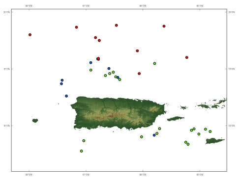
This report contains all the samples collected during 2008. There are missing core numbers because each site was given a number regardless if it was a failure or a success. The 27 successful sites from the R/V Seward Johnson 2008 cruise were: 1, 2, 3, 5, 6, 7, 8, 9, 10, 11, 12, 13, 17, 18, 20, 21, 22, 23, 24, 28, 31, 32, 33, 34, 35, 38, and 40. There are eleven archive cores from LDEO that had radiocarbon age dates in the area of investigation. These were: RC08-115, RC08-116, RC08-118, RC09-38, RC09-39, RC09-40, RC09-42, RC09-43, VM20-002, VM22-18, and VM24-261.
Positional_Accuracy:
Horizontal_Positional_Accuracy:
Horizontal_Positional_Accuracy_Report:
The 2008 latitude and longitude were taken from the R/V Seward Johnson's DGPS system which gives about 20 centimeter accuracy. The location of the archive cores were provided through the NGDC log report. Since these cores were collected in the 1960's we assume they used a LORAN navigation system. The LORAN system has less accuracy than the DGPS. Because of the variety of horizontal datums of the originally collected data, the horizontal datum will be defined as WGS 84 to agree with the most recent and largest concentration of the data.
Vertical_Positional_Accuracy:
Vertical_Positional_Accuracy_Report:
The R/V Seward Johnson was not equipped with a multibeam echosounder during the 2008 cruise. The depths were taken from a 50 m resolution grid bathymetric map with a Instantaneous Sea Level datum (Andrews and others, PR Bathymetry OFR (in prep)). Where cores fell outside the bathymetry map, the depth was taken from the 3.5 kHz echosounder (local surface). The depths for the archive cores were provided through their original report. We cannot be sure of what system was used to get depths, however we compared the reported depth with the same bathymetric grid and the greatest difference in depth was 660 meters for the RC08-118 core. The rest of the archive cores had no more than a 100 meter difference. Because of the variety and uncertainty of the depth information, the vertical datum will be defined as Instantaneous Sea Level, as defined in (Andrews and others, in prep).
Lineage:
Source_Information:
Source_Citation:
Citation_Information:
Originator: NGDC
Publication_Date: Unknown
Title:
Robert Conrad Cruise 08- Preliminary Megascopic Descriptions of Split Cores
Edition: 1.0
Other_Citation_Details:
Original core descriptions provided by Lamont-Doherty Earth Observatory and released by NGDC. MGG id: 01015088
Online_Linkage:
Type_of_Source_Media: Online data download
Source_Time_Period_of_Content:
Time_Period_Information:
Range_of_Dates/Times:
Beginning_Date: 19640521
Ending_Date: 19640523
Source_Currentness_Reference: ground condition
Source_Citation_Abbreviation: NGDC_RC08
Source_Contribution:
Core descriptions, photos, and general information about core site (Latitude, Longitude, Depth, etc.) for RC08-115, RC08-116, and RC08-118.
Source_Information:
Source_Citation:
Citation_Information:
Originator: NGDC
Publication_Date: Unknown
Title:
Robert Conrad Cruise 09- Preliminary Megascopic Descriptions of Split Cores
Edition: 1.0
Other_Citation_Details:
Original core descriptions provided by Lamont-Doherty Earth Observatory and released by NGDC. MGG id: 01015009
Online_Linkage:
Type_of_Source_Media: Online data download
Source_Time_Period_of_Content:
Time_Period_Information:
Range_of_Dates/Times:
Beginning_Date: 19641215
Ending_Date: 19641222
Source_Currentness_Reference: ground condition
Source_Citation_Abbreviation: NGDC_RC09
Source_Contribution:
Core descriptions, photos, and general information about core site (Latitude, Longitude, Depth, etc.) for RC09-38, RC09-39, RC09-40, RC09-42, and RC09-43.
Source_Information:
Source_Citation:
Citation_Information:
Originator: NGDC
Publication_Date: Unknown
Title:
Vema Cruise 20 - Preliminary Megascopic Descriptions of Split Cores
Edition: 1.0
Other_Citation_Details:
Original core descriptions provided by Lamont-Doherty Earth Observatory and released by NGDC. MGG id: 01035020
Online_Linkage:
Type_of_Source_Media: Online data download
Source_Time_Period_of_Content:
Time_Period_Information:
Single_Date/Time:
Calendar_Date: 19640302
Source_Currentness_Reference: ground condition
Source_Citation_Abbreviation: NGDC_VM20
Source_Contribution:
Core descriptions, photos, and general information about core site (Latitude, Longitude, Depth, etc.) for VM20-002.
Source_Information:
Source_Citation:
Citation_Information:
Originator: NGDC
Publication_Date: Unknown
Title:
Vema Cruise 22 - Preliminary Megascopic Descriptions of Split Cores
Edition: 1.0
Other_Citation_Details:
Original core descriptions provided by Lamont-Doherty Earth Observatory and released by NGDC. MGG id: 01035022
Online_Linkage:
Type_of_Source_Media: Online data download
Source_Time_Period_of_Content:
Time_Period_Information:
Single_Date/Time:
Calendar_Date: 19660126
Source_Currentness_Reference: ground condition
Source_Citation_Abbreviation: NGDC_VM22
Source_Contribution:
Core descriptions, photos, and general information about core site (Latitude, Longitude, Depth, etc.) for VM22-18.
Source_Information:
Source_Citation:
Citation_Information:
Originator: NGDC
Publication_Date: Unknown
Title:
Vema Cruise 24 - Preliminary Megascopic Descriptions of Split Cores
Edition: 1.0
Other_Citation_Details:
Original core descriptions provided by Lamont-Doherty Earth Observatory and released by NGDC. MGG id: 01035024
Online_Linkage:
Type_of_Source_Media: Online data download
Source_Time_Period_of_Content:
Time_Period_Information:
Single_Date/Time:
Calendar_Date: 19671210
Source_Currentness_Reference: ground condition
Source_Citation_Abbreviation: NGDC_VM24
Source_Contribution:
Core descriptions, photos, and general information about core site (Latitude, Longitude, Depth, etc.) for VM24-261.
Source_Information:
Source_Citation:
Citation_Information:
Originator: Andrews, B.D.
Originator: ten Brink, U.S.
Originator: Danforth, W.W.
Originator: Chaytor, J.D.
Originator: Granja Burna, J.L.
Originator: Llanes Estrada, P.
Originator: Carbo-Gorosabel, A.
Publication_Date: 2014
Title:
Bathymetric Terrain Model of Puerto Rico Trench and the Northeast Caribbean Region: Marine Geological Investigations
Edition: 1.0
Series_Information:
Series_Name: Open-File Report
Issue_Identification: 2013-1125
Publication_Information:
Publication_Place: Reston, VA
Publisher: U.S. Geological Survey
Online_Linkage: https://doi.org/10.3133/ofr20131125
Type_of_Source_Media: Open File Report
Source_Time_Period_of_Content:
Time_Period_Information:
Single_Date/Time:
Calendar_Date: 2014
Source_Currentness_Reference: publication date
Source_Citation_Abbreviation: PR Bathymetry
Source_Contribution:
The 50 meter grid was used for depth information in the sample area
Source_Information:
Source_Citation:
Citation_Information:
Originator: Shannon K. Hoy
Originator: Jason D. Chaytor
Originator: Uri S. ten Brink
Publication_Date: 2014
Title: Core data from offshore Puerto Rico and the U.S. Virgin Islands
Edition: 1.0
Series_Information:
Series_Name: Open-File Report
Issue_Identification: 2014-1227
Publication_Information:
Publication_Place: Reston, VA
Publisher: U.S. Geological Survey
Online_Linkage: https://pubs.usgs.gov/of/2014/1227/
Type_of_Source_Media: physical samples
Source_Time_Period_of_Content:
Time_Period_Information:
Range_of_Dates/Times:
Beginning_Date: 20080317
Ending_Date: 20080324
Source_Currentness_Reference: ground condition of core collection
Source_Citation_Abbreviation: GGC
Source_Contribution:
The gravity cores collected during U.S. Geological Survey field activity 2008-008-FA. The Woods Hole Oceanographic Giant Gravity Corer (GGC) was used to collect the 20 cores in 2008. The gravity corer is a large diameter (10 centimeter) sampler that collects cores up to 6.5 meters in length. During field activity 2008-008-FA the corer was not rigged with liner longer than approximately 3 meters. Although cores were attempted at 40 core sites, core was recovered at only 20 sites. Seven additional sites yielded only samples (bagged) from the core catcher or cutting head. Of the 20 successful cores, three also have cutter/catcher bag samples.
Process_Step:
Process_Description:
For the 2008 SJ8 cores, core locations from the R/V Seward Johnson's DGPS system were recorded in the PRcore_locations spreadsheet (Microsoft Office Excel 2010) along with water depth information, field notes, cruise information, and core length. Jason Chaytor performed this and the subsequent process steps, unless otherwise noted.
Process_Date: 2013
Process_Contact:
Contact_Information:
Contact_Person_Primary:
Contact_Person: Jason D. Chaytor
Contact_Organization: U.S. Geological Survey
Contact_Position: Research Geologist
Contact_Address:
Address_Type: mailing and physical address
Address: 384 Woods Hole Road
City: Woods Hole
State_or_Province: MA
Postal_Code: 02543-1598
Contact_Voice_Telephone: (508) 548-8700 x2351
Contact_Facsimile_Telephone: (508) 457-2310
Contact_Electronic_Mail_Address: jchaytor@usgs.gov
Process_Step:
Process_Description:
Archive core log sheets were downloaded from NGDC and core information and location were entered into the PRcore_locations spreadsheet (Microsoft Excel 2010). These depths were taken from the original log sheets from the attribute "Corr. depth" which is the "P.D.R depth" converted from fathoms to meters and corrected for sound velocity.
Source_Used_Citation_Abbreviation: NGDC_RC08
Source_Used_Citation_Abbreviation: NGDC_RC09
Source_Used_Citation_Abbreviation: NGDC_VM20
Source_Used_Citation_Abbreviation: NGDC_VM22
Source_Used_Citation_Abbreviation: NGDC_VM24
Process_Date: 2013
Process_Step:
Process_Description:
2008 Gravity core and archive core information was exported from the spreadsheet (Microsoft Office Excel 2010) as a comma-separated value (CSV) file and imported to ArcCatalog (version 9.3) by right clicking on the CSV file and selecting 'create feature class' --> from XY table'. Parameters for import are: X Field- Long_DD and Y Field- Lat_DD. This process created and Esri point shapefile where each sample is a unique record with core specific attributes
Process_Date: 2013
Process_Contact:
Contact_Information:
Contact_Person_Primary:
Contact_Person: Shannon K. Hoy
Contact_Organization: U.S. Geological Survey
Contact_Position: Research Associate
Contact_Address:
Address_Type: mailing and physical address
Address: 384 Woods Hole Road
City: Woods Hole
State_or_Province: MA
Postal_Code: 02543-1598
Contact_Voice_Telephone: (508) 548-8700 x2297
Contact_Facsimile_Telephone: (508) 457-2310
Contact_Electronic_Mail_Address: shoy@usgs.gov
Process_Step:
Process_Description:
Additional fields were added to the point shapefile and populated. These additional fields contain information regarding what subsampling occurred on the core including MSCL, XRF, radiographs, grain-size, and radiocarbon dating. Other fields include the presence or absence of core summary sheets and sample type (core, archive, or bag).
Process_Date: 2013
Process_Contact:
Contact_Information:
Contact_Person_Primary:
Contact_Person: Shannon K. Hoy
Contact_Organization: U.S. Geological Survey
Contact_Position: Research Associate
Contact_Address:
Address_Type: mailing and physical address
Address: 384 Woods Hole Road
City: Woods Hole
State_or_Province: MA
Postal_Code: 02543-1598
Contact_Voice_Telephone: (508) 548-8700 x2297
Contact_Facsimile_Telephone: (508) 457-2310
Contact_Electronic_Mail_Address: shoy@usgs.gov
Process_Step:
Process_Description:
Edits to the metadata were made to fix any errors that MP v 2.9.36 flagged. This is necessary to enable the metadata to be successfully harvested for various data catalogs. In some cases, this meant adding text "Information unavailable" or "Information unavailable from original metadata" for those required fields that were left blank. Other minor edits were probably performed (title, publisher, publication place, etc.). Added additional online links in the Identification section. Updated a cross-reference citation to go from "in prep" to published. In the case of the depth resolution, the value of 9999 was entered to indicate that the original metadata did not contain the required information. Minor fixes to the attribute format for some attributes were needed to meet the standard. The metadata date (but not the metadata creator) was edited to reflect the date of these changes. The metadata available from a harvester may supersede metadata bundled within a download file. Compare the metadata dates to determine which metadata file is most recent.
Process_Date: 20171003
Process_Contact:
Contact_Information:
Contact_Organization_Primary:
Contact_Organization: U.S. Geological Survey
Contact_Person: VeeAnn A. Cross
Contact_Position: Marine Geologist
Contact_Address:
Address_Type: Mailing and Physical
Address: 384 Woods Hole Road
City: Woods Hole
State_or_Province: MA
Postal_Code: 02543-1598
Contact_Voice_Telephone: 508-548-8700 x2251
Contact_Facsimile_Telephone: 508-457-2310
Contact_Electronic_Mail_Address: vatnipp@usgs.gov
Process_Step:
Process_Description: USGS Thesaurus keywords added to the keyword section.
Process_Date: 20180720
Process_Contact:
Contact_Information:
Contact_Organization_Primary:
Contact_Organization: U.S. Geological Survey
Contact_Person: VeeAnn A. Cross
Contact_Position: Marine Geologist
Contact_Address:
Address_Type: Mailing and Physical
Address: 384 Woods Hole Road
City: Woods Hole
State_or_Province: MA
Postal_Code: 02543-1598
Contact_Voice_Telephone: 508-548-8700 x2251
Contact_Facsimile_Telephone: 508-457-2310
Contact_Electronic_Mail_Address: vatnipp@usgs.gov
Process_Step:
Process_Description:
Added keywords section with USGS persistent identifier as theme keyword.
Process_Date: 20200908
Process_Contact:
Contact_Information:
Contact_Organization_Primary:
Contact_Organization: U.S. Geological Survey
Contact_Person: VeeAnn A. Cross
Contact_Position: Marine Geologist
Contact_Address:
Address_Type: Mailing and Physical
Address: 384 Woods Hole Road
City: Woods Hole
State_or_Province: MA
Postal_Code: 02543-1598
Contact_Voice_Telephone: 508-548-8700 x2251
Contact_Facsimile_Telephone: 508-457-2310
Contact_Electronic_Mail_Address: vatnipp@usgs.gov
Spatial_Data_Organization_Information:
Direct_Spatial_Reference_Method: Vector
Point_and_Vector_Object_Information:
SDTS_Terms_Description:
SDTS_Point_and_Vector_Object_Type: Entity point
Point_and_Vector_Object_Count: 38
Spatial_Reference_Information:
Horizontal_Coordinate_System_Definition:
Geographic:
Latitude_Resolution: 0.000001
Longitude_Resolution: 0.000001
Geographic_Coordinate_Units: Decimal degrees
Geodetic_Model:
Horizontal_Datum_Name: D_WGS_1984
Ellipsoid_Name: WGS_1984
Semi-major_Axis: 6378137.000000
Denominator_of_Flattening_Ratio: 298.257224
Vertical_Coordinate_System_Definition:
Depth_System_Definition:
Depth_Datum_Name: Instantaneous Sea Level
Depth_Resolution: 9999
Depth_Distance_Units: meters
Depth_Encoding_Method: Explicit depth coordinate included with horizontal coordinates
Entity_and_Attribute_Information:
Detailed_Description:
Entity_Type:
Entity_Type_Label: PRcore_locations
Entity_Type_Definition:
Esri point shapefile representing the location of 38 samples around Puerto Rico and the U.S. Virgin islands. 27 were collected in 2008 by the U.S. Geological Survey and 11 are archive cores provided by Lamont-Doherty Earth Observatory.
Entity_Type_Definition_Source: U.S. Geological Survey
Attribute:
Attribute_Label: FID
Attribute_Definition: Internal feature number.
Attribute_Definition_Source: Esri
Attribute_Domain_Values:
Unrepresentable_Domain:
Sequential unique whole numbers that are automatically generated.
Attribute:
Attribute_Label: Shape
Attribute_Definition: Feature geometry.
Attribute_Definition_Source: Esri
Attribute_Domain_Values:
Unrepresentable_Domain: Coordinates defining the features.
Attribute:
Attribute_Label: CoreName
Attribute_Definition:
ID name given to core based on cruise number and core site. The GGC stands for giant gravity corer.
Attribute_Definition_Source: USGS and NGDC
Attribute_Domain_Values:
Unrepresentable_Domain: Character string
Attribute:
Attribute_Label: CollectedB
Attribute_Definition: Person or institution that collected cores
Attribute_Definition_Source: USGS
Attribute_Domain_Values:
Enumerated_Domain:
Enumerated_Domain_Value: J. Chaytor
Enumerated_Domain_Value_Definition: Jason D. Chaytor from USGS
Enumerated_Domain_Value_Definition_Source: Information unavailable from original metadata.
Attribute_Domain_Values:
Enumerated_Domain:
Enumerated_Domain_Value: LDEO
Enumerated_Domain_Value_Definition: Archive cores from LDEO published through NGDC
Enumerated_Domain_Value_Definition_Source: NGDC_RC08, NGDC_RC09, NGDC_VM20, NGDC_VM22, and NGDC_VM24
Attribute:
Attribute_Label: DateColl_U
Attribute_Definition:
Month, day, and year of collection (YYYYMMDD) based on UTC time.
Attribute_Definition_Source: USGS
Attribute_Domain_Values:
Unrepresentable_Domain: Character string
Beginning_Date_of_Attribute_Values: 19640302
Ending_Date_of_Attribute_Values: 20080324
Attribute:
Attribute_Label: Depth_m
Attribute_Definition:
water depth (meters) at core location. The resolution of the depth measurement is 2% of the water depth.
Attribute_Definition_Source: USGS
Attribute_Domain_Values:
Range_Domain:
Range_Domain_Minimum: -8372
Range_Domain_Maximum: -1356
Attribute_Units_of_Measure: meters
Attribute:
Attribute_Label: Lat_DD
Attribute_Definition: Latitude of core in decimal degrees (WGS84)
Attribute_Definition_Source: USGS
Attribute_Domain_Values:
Range_Domain:
Range_Domain_Minimum: 17.55293
Range_Domain_Maximum: 19.767
Attribute_Units_of_Measure: signed decimal degrees
Attribute_Measurement_Resolution: 0.000001
Attribute:
Attribute_Label: Long_DD
Attribute_Definition: Longitude of the core in decimal degrees (WGS84)
Attribute_Definition_Source: USGS
Attribute_Domain_Values:
Range_Domain:
Range_Domain_Minimum: -67.983
Range_Domain_Maximum: -64.82283
Attribute_Units_of_Measure: signed decimal degrees
Attribute_Measurement_Resolution: 0.000001
Attribute:
Attribute_Label: Length_cm
Attribute_Definition: total length of core (cm), -9999 means no data available.
Attribute_Definition_Source: USGS
Attribute_Domain_Values:
Range_Domain:
Range_Domain_Minimum: 12.5
Range_Domain_Maximum: 1035
Attribute_Units_of_Measure: centimeters
Attribute_Measurement_Resolution: 0.5
Attribute:
Attribute_Label: Original
Attribute_Definition:
YES or NO; is there original field descriptions of the core or log sheet
Attribute_Definition_Source: USGS
Attribute_Domain_Values:
Unrepresentable_Domain: Character string
Attribute:
Attribute_Label: LogPlot
Attribute_Definition:
YES or NO; is there a core summary sheet of the core created with LogPlot 7
Attribute_Definition_Source: USGS
Attribute_Domain_Values:
Unrepresentable_Domain: Character string
Attribute:
Attribute_Label: MSCL
Attribute_Definition:
YES or NO; are there multi-sensor core logger data for the collected sample
Attribute_Definition_Source: USGS
Attribute_Domain_Values:
Unrepresentable_Domain: Character string
Attribute:
Attribute_Label: XRF
Attribute_Definition:
YES or NO; are there x-ray fluorescence data for the collected core
Attribute_Definition_Source: USGS
Attribute_Domain_Values:
Unrepresentable_Domain: Character string
Attribute:
Attribute_Label: Radiograph
Attribute_Definition: YES or NO; are there radiographs for the sample
Attribute_Definition_Source: USGS
Attribute_Domain_Values:
Unrepresentable_Domain: Character string
Attribute:
Attribute_Label: GrainSize
Attribute_Definition: YES or NO; are there grain-size data for the sample
Attribute_Definition_Source: USGS
Attribute_Domain_Values:
Unrepresentable_Domain: Character string
Attribute:
Attribute_Label: Radiocarbo
Attribute_Definition: YES or NO; are there radiocarbon dates for the sample
Attribute_Definition_Source: USGS
Attribute_Domain_Values:
Unrepresentable_Domain: Character string
Attribute:
Attribute_Label: SmearSlide
Attribute_Definition: YES or NO; are there SmearSlide of the sample
Attribute_Definition_Source: USGS
Attribute_Domain_Values:
Unrepresentable_Domain: Character string
Attribute:
Attribute_Label: Sample
Attribute_Definition:
What type of sample is it: core (2008), bag (2008), core and bag (2008) or archive
Attribute_Definition_Source: USGS
Attribute_Domain_Values:
Unrepresentable_Domain: Character string
Overview_Description:
Entity_and_Attribute_Overview:
All data and fields within this file are related to whole-core determinations. For individual samples within the core, related to radiocarbon age, grain-size, MSCL, XRF, or smear slides, please refer to that sample-based file within the data catalog.
Entity_and_Attribute_Detail_Citation: U.S. Geological Survey
Distribution_Information:
Distributor:
Contact_Information:
Contact_Person_Primary:
Contact_Person: Jason D. Chaytor
Contact_Organization: U.S. Geological Survey
Contact_Position: Research Geologist
Contact_Address:
Address_Type: mailing and physical address
Address: 384 Woods Hole Road
City: Woods Hole
State_or_Province: MA
Postal_Code: 02543-1598
Contact_Voice_Telephone: (508) 548-8700 x2351
Contact_Facsimile_Telephone: (508) 457-2310
Contact_Electronic_Mail_Address: jchaytor@usgs.gov
Resource_Description: Downloadable Data
Distribution_Liability:
Neither the U.S. Government, the Department of the Interior, nor the USGS, nor any of their employees, contractors, or subcontractors, make any warranty, express or implied, nor assume any legal liability or responsibility for the accuracy, completeness, or usefulness of any information, apparatus, product or process disclosed, nor represent that its use would not infringe on privately owned rights. The act of distribution shall not constitute any such warranty, and no responsibility is assumed by the USGS in the use of these data or related materials. Any use of trade, product, or firm names is for descriptive purposes only and does not imply endorsement by the U.S. Government.
Standard_Order_Process:
Digital_Form:
Digital_Transfer_Information:
Format_Name: shapefile
Format_Version_Number: ArcGIS 9.3.1
Format_Specification: Esri Point Shapefile
Format_Information_Content:
The WinZip 18 file contains a shapefile, a Microsoft excel file, and a CSV file of core locations around Puerto Rico and the U.S. Virgin Islands and the associated metadata.
File_Decompression_Technique: Use WinZip or pkUnzip
Transfer_Size: 0.03
Digital_Transfer_Option:
Online_Option:
Computer_Contact_Information:
Digital_Form:
Digital_Transfer_Information:
Format_Name: XLS
Format_Version_Number: Microsoft Excel 2010
Format_Specification: Excel Spreadsheet
Format_Information_Content:
The WinZip file contains a shapefile, a Microsoft excel file, and a CSV file of core locations around Puerto Rico and the U.S. Virgin Islands and the associated metadata.
File_Decompression_Technique: Use WinZip or pkUnzip
Transfer_Size: 0.03
Digital_Transfer_Option:
Online_Option:
Computer_Contact_Information:
Digital_Form:
Digital_Transfer_Information:
Format_Name: CSV
Format_Version_Number: Microsoft Excel 2010
Format_Specification: comma separated value
Format_Information_Content:
The WinZip file contains a shapefile, a Microsoft excel file, and a CSV file of core locations around Puerto Rico and the U.S. Virgin Islands and the associated metadata.
File_Decompression_Technique: Use WinZip or pkUnzip
Transfer_Size: 0.03
Digital_Transfer_Option:
Online_Option:
Computer_Contact_Information:
Fees: None.
Technical_Prerequisites:
Must be able to unzip a WinZip 18 compressed file and view a shapefile, CSV or XLS.
Metadata_Reference_Information:
Metadata_Date: 20211116
Metadata_Contact:
Contact_Information:
Contact_Organization_Primary:
Contact_Organization: U.S. Geological Survey
Contact_Person: Shannon K. Hoy
Contact_Position: Research Associate II
Contact_Address:
Address_Type: mailing and physical address
Address: 384 Woods Hole Road
City: Woods Hole
State_or_Province: MA
Postal_Code: 02543-1598
Country: United States
Contact_Voice_Telephone: (508) 548-8700 x2297
Contact_Facsimile_Telephone: (508) 457-2310
Contact_Electronic_Mail_Address: whsc_data_contact@usgs.gov
Contact_Instructions:
The metadata contact email address is a generic address in the event the metadata contact is no longer with the USGS or the email is otherwise invalid.
Metadata_Standard_Name: FGDC Content Standards for Digital Geospatial Metadata
Metadata_Standard_Version: FGDC-STD-001-1998
Metadata_Time_Convention: local time
Metadata_Access_Constraints: None
Metadata_Use_Constraints: None

This page is <https://cmgds.marine.usgs.gov/catalog/whcmsc/open_file_report/ofr2014-1227/PRcore_locationsmeta.html>
Generated by mp version 2.9.50 on Tue Nov 16 10:06:52 2021