1-m backscatter mosaic in Vineyard and western Nantucket Sounds produced from multiple sidescan-sonar datasets (GeoTIFF Image; UTM, Zone 19N, WGS 84)

Metadata also available as - [Outline] - [Parseable text] - [XML]

Frequently anticipated questions:


What does this data set describe?

Title:
1-m backscatter mosaic in Vineyard and western Nantucket Sounds produced from multiple sidescan-sonar datasets (GeoTIFF Image; UTM, Zone 19N, WGS 84)
Abstract:
Geologic, sediment texture, and physiographic zone maps characterize the sea floor of Vineyard and western Nantucket Sounds, Massachusetts. These maps were derived from interpretations of seismic-reflection profiles, high-resolution bathymetry, acoustic-backscatter intensity, bottom photographs, and surficial sediment samples. The interpretation of the seismic stratigraphy and mapping of glacial and Holocene marine units provided a foundation on which the surficial maps were created. This mapping is a result of a collaborative effort between the U.S. Geological Survey and the Massachusetts Office of Coastal Zone Management to characterize the surface and subsurface geologic framework offshore of Massachusetts.
  1. How might this data set be cited?
    Baldwin, Wayne, 2016, 1-m backscatter mosaic in Vineyard and western Nantucket Sounds produced from multiple sidescan-sonar datasets (GeoTIFF Image; UTM, Zone 19N, WGS 84): Open-File Report 2016-1119, U.S. Geological Survey, Coastal and Marine Geology Program, Woods Hole Coastal and Marine Science Center, Woods Hole, MA.

    Online Links:

    This is part of the following larger work.

    Baldwin, Wayne E., Foster, David S., Pendleton, Elizabeth A., Barnhardt, Walter A., Schwab, William C., Andrews, Brian D., and Ackerman, Seth D., 2016, Shallow Geology, Sea-Floor Texture, and Physiographic Zones of Vineyard and western Nantucket Sounds, Massachusetts: Open-File Report 2016-1119, U.S. Geological Survey, Reston, VA.

    Online Links:

  2. What geographic area does the data set cover?
    West_Bounding_Coordinate: -71.034883
    East_Bounding_Coordinate: -70.428524
    North_Bounding_Coordinate: 41.541741
    South_Bounding_Coordinate: 41.318511
  3. What does it look like?
    https://pubs.usgs.gov/of/2016/1119/GIS_catalog/SourceData/backscatter/vns_bsmos_1m.png (PNG)
    Composite backscatter mosaic image
  4. Does the data set describe conditions during a particular time period?
    Beginning_Date: 01-Jan-2001
    Ending_Date: 31-Aug-2011
    Currentness_Reference:
    ground condition
  5. What is the general form of this data set?
    Geospatial_Data_Presentation_Form: remote sensing image
  6. How does the data set represent geographic features?
    1. How are geographic features stored in the data set?
      This is a Raster data set. It contains the following raster data types:
      • Dimensions 23790 x 50210 x 1, type Pixel
    2. What coordinate system is used to represent geographic features?
      Grid_Coordinate_System_Name: Universal Transverse Mercator
      Universal_Transverse_Mercator:
      UTM_Zone_Number: 19
      Transverse_Mercator:
      Scale_Factor_at_Central_Meridian: 0.999600
      Longitude_of_Central_Meridian: -69.000000
      Latitude_of_Projection_Origin: 0.000000
      False_Easting: 500000.000000
      False_Northing: 0.000000
      Planar coordinates are encoded using row and column
      Abscissae (x-coordinates) are specified to the nearest 1.000000
      Ordinates (y-coordinates) are specified to the nearest 1.000000
      Planar coordinates are specified in meters
      The horizontal datum used is D_WGS_1984.
      The ellipsoid used is WGS_1984.
      The semi-major axis of the ellipsoid used is 6378137.000000.
      The flattening of the ellipsoid used is 1/298.257224.
  7. How does the data set describe geographic features?
    Entity_and_Attribute_Overview:
    There are no attributes associated with this 8-bit GeoTIFF image. Image pixel values contain acoustic reflectivity values normalized to an 8-bit data range (0-255) with the data range 0-254 and 255 being no data. Although most of the small slivers and data gaps within the mosaic have a value of 254. Low-backscatter is represented by dark tones (low values) and high-backscatter is represented by bright tones (high values).
    Entity_and_Attribute_Detail_Citation: U.S. Geological Survey

Who produced the data set?

  1. Who are the originators of the data set? (may include formal authors, digital compilers, and editors)
    • Wayne Baldwin
  2. Who also contributed to the data set?
  3. To whom should users address questions about the data?
    Wayne Baldwin
    U.S. Geological Survey
    Geologist
    384 Woods Hole Rd.
    Woods Hole, MA
    USA

    508-548-8700 x2226 (voice)
    508-457-2310 (FAX)
    wbaldwin@usgs.gov

Why was the data set created?

This backscatter intensity mosaic was created as a single continuous image of the acoustic reflectivity of the sea floor of Vineyard and western Nantucket Sounds. Generally, higher backscatter values (light tones) represent rock, boulders, cobbles, gravel, and coarse sand. Lower values (dark tones) usually represent fine sand and muddy sediment. In this final form and at the input resolutions, these data helped define the sediment texture and distribution maps presented as interpretive data layers in USGS OFR 2016-1119.

How was the data set created?

  1. From what previous works were the data drawn?
    Poppe and others, 2007 (source 1 of 6)
    Poppe, L.J., Ackerman, S.D., Foster, D.S., Blackwood, D.S., Butman, B., Moser, M.S., and Stewart, H.F., 2007, Sea-floor character and surface processes in the vicinity of Quicks Hole, Elizabeth Islands, Massachusetts: Open-File Report 2006-1357, U.S. Geological Survey, Reston, VA.

    Online Links:

    Type_of_Source_Media: online
    Source_Contribution:
    This publication provides the source multibeam bathymetry for the Quicks Hole area. Two 29-foot launches deployed from the NOAA Ship Thomas Jefferson were used to acquire bathymetric and backscatter data during 2004. The multibeam bathymetric data were collected with hull-mounted 455-kHz RESON 8125 and 240-kHz RESON 8101 systems. The sidescan-sonar data were acquired with a hull-mounted Klein 5250 system operating at 100 kHz. Sediment samples and bottom photos were collected aboard the R/V Rafael with a modified Van Veen grab sampler and SEABOSS, respectively.
    Poppe and others, 2010 (source 2 of 6)
    Poppe, L.J., McMullen, K.Y., Foster, D.S., Blackwood, D.S., Williams, S.J., Ackerman, S.D., Moser, M.S., and Glomb, K.A., 2010, Geological interpretation of the sea floor offshore of Edgartown, Massachusetts: Open-File Report 2009-1001, U.S. Geological Survey, Reston, VA.

    Online Links:

    Type_of_Source_Media: online
    Source_Contribution:
    This publication provides the source geophysical (backscatter and bathymetry) and bottom photographs and sediment samples in the vicinity of Edgartown. Two 29-foot launches deployed from the NOAA Ship Thomas Jefferson were used to acquire bathymetric and backscatter data during 2004. The multibeam bathymetric data were collected with hull-mounted 455-kHz RESON 8125 and 240-kHz RESON 8101 systems. The sidescan-sonar data were acquired with a hull-mounted Klein 5250 system operating at 100 kHz. Sediment samples and bottom photos were collected aboard the R/V Rafael with a modified Van Veen grab sampler and SEABOSS, respectively.
    Pendleton and others, 2012 (source 3 of 6)
    Pendleton, E.A., Twichell, D.C., Foster, D.S., Worley, C.R, Irwin, B.J., and Danforth, W.W., 2012, High-resolution geophysical data from the sea floor surrounding the Western Elizabeth Islands, Massachusetts: Open-File Report 2011-1184, U.S. Geological Survey, Reston, VA.

    Online Links:

    Type_of_Source_Media: online
    Source_Contribution:
    This report provided swath bathymetry for the area of Vineyard Sound surrounding the western Elizabeth Islands. Surveying was conducted aboard the RV Rafael in September 2010. Interferometric-sonar, sidescan-sonar, and chirp seismic-reflection systems were deployed simultaneously during the cruise. Bathymetric sounding data were collected with an SEA SWATHplus 234-kilohertz (kHz) interferometric sonar system. Sidescan-sonar (acoustic-backscatter) data were acquired with a Klein 3000 dual-frequency (100 and 500 kHz) sidescan-sonar system.
    Andrews and others, 2014 (source 4 of 6)
    Andrews, B.D., Ackerman, S.D., Baldwin, W.E., Foster, D.S., and Schwab, W.C., 2014, High-Resolution Geophysical Data from the Inner Continental Shelf: Vineyard Sound, Massachusetts: Open-File Report 2012-1006, U.S. Geological Survey, Reston, VA.

    Online Links:

    Type_of_Source_Media: online
    Source_Contribution:
    This report provided swath bathymetry for Vineyard and western Nantucket Sounds. The mapping was conducted during research cruises aboard the Megan T. Miller (2009 and 2010) and the Scarlett Isabella (2011). Bathymetric data were acquired using a Systems Engineering and Assessment, Ltd. (SEA) SWATHplus-M 234-kilohertz (kHz) interferometric sonar system; acoustic backscatter data were collected with a Klein 3000 dual-frequency sidescan-sonar (132 and 445 kHz).
    Pendleton and others, 2014 (source 5 of 6)
    Pendleton, E.A., Andrews, B.D., Danforth, W.W., and Foster, D.S., 2014, High-resolution geophysical data collected aboard the U.S. Geological Survey research vessel Rafael to supplement existing datasets from Buzzards Bay and Vineyard Sound, Massachusetts: Open-File Report 2013-1020, U.S. Geological Survey, Reston, VA.

    Online Links:

    Type_of_Source_Media: online
    Source_Contribution:
    This report provided swath bathymetry and acoustic backscatter for shallow zones along the nearshore and across Middle Ground, L'Hommediue, Hedge Fence, and Squash Meadow shoals within Vineyard and western Nantucket Sounds. These areas were surveyed with the RV Rafael in 2011. Swath bathymetry and backscatter data were collected with an SEA SWATHplus 234-kilohertz (kHz) interferometric sonar system. Towed sidescan sonar acoustic-backscatter data were acquired with a Klein 3000 dual-frequency (100 and 500 kHz) sidescan-sonar system.
    Poppe and others, 2008 (source 6 of 6)
    Poppe, L.J., McMullen, K.Y., Foster, D.S., Blackwood, D.S., Williams, S.J., Ackerman, S.D., Barnum, S.R., and Brennan, R.T., 2008, Sea-floor character and sedimentary processes in the vicinity of Woods Hole, Massachusetts: Open File Report 2008-1004, U.S. Geological Survey, Reston, VA.

    Online Links:

    Type_of_Source_Media: online
    Source_Contribution:
    This publication provides multibeam bathymetry for Woods Hole. Two 29-foot launches deployed from the NOAA Ship Whiting were used to acquire bathymetric and backscatter data during 2001. The bathymetric data were collected with a hull-mounted 240-kHz RESON 8101 shallow-water system aboard launch 1005. The sidescan-sonar data were acquired with a hull-mounted Klein T-5000 system operating at 455 kHz aboard launch 1014.
  2. How were the data generated, processed, and modified?
    Date: 2013 (process 1 of 6)
    Collected the input datasets: All the backscatter images came from USGS Open File Reports: USGS OFR 2012-1006 - vs_backscatter_1m.tif USGS OFR 2011-1184 - 2010-003-FA_SSmosaic_MVSound.tif, 2010-003-FA_SSmosaic_Penikese.tif USGS OFR 2006-1357 - h11076_utm19_1mrsss.tif USGS OFR 2008-1004 - h11077_sss100_utm.19.tif USGS OFR 2009-1001 - h11364_2msss_utm19.tif USGS OFR 2013-1020 - Klein_2011-013_1m.tif, Swath_1m.tif Person who carried out this activity:
    Elizabeth A. Pendleton
    U.S. Geological Survey
    Geologist
    U.S. Geological Survey
    Woods Hole, MA
    USA

    508-5488700 x2259 (voice)
    508-457-2310 (FAX)
    ependleton@usgs.gov
    Data sources used in this process:
    • Pope and others, 2007; Poppe and others, 2008; Poppe and others, 2010; Pendleton and others, 2012; Andrews and others, 2012; Pendleton and others, 2014
    Date: 2013 (process 2 of 6)
    All of the input images were loaded into PCI Geomatica 2013 OrthoEngine (version 2013 SP2 2013-6-10) and mosaicked into a composite backscatter GeoTIFF (BuzzBay_mosaic1m.tif). The brightness levels were adjusted within PCI Geomatica OrthoEngine using the color balance tool on the final mosaic backscatter GeoTIFF image. Person who carried out this activity:
    Elizabeth A. Pendleton
    U.S. Geological Survey
    Geologist
    U.S. Geological Survey
    Woods Hole, MA
    USA

    508-5488700 x2259 (voice)
    508-457-2310 (FAX)
    ependleton@usgs.gov
    Data sources used in this process:
    • All input tiff mosaics
    Date: 2014 (process 3 of 6)
    The final mosaic backscatter GeoTIFF image was clipped in ArcGIS (9.3.1) using a polygon feature class to remove portions of the input data within Buzzards Bay (ArcToolbox > Data Management Tools > Clip (with output extent set to polygon feature and use input features for Clipping Geometry checked)). Person who carried out this activity:
    Wayne Baldwin
    U.S. Geological Survey
    Geologist
    384 Woods Hole Rd.
    Woods Hole, MA
    USA

    508-548-8700 x2226 (voice)
    508-457-2310 (FAX)
    wbaldwin@usgs.gov
    Data sources used in this process:
    • final composite mosaic and polygon outline of final mosaic extent
    Date: 20-Jul-2018 (process 4 of 6)
    USGS Thesaurus keywords added to the keyword section. Person who carried out this activity:
    U.S. Geological Survey
    Attn: VeeAnn A. Cross
    Marine Geologist
    384 Woods Hole Road
    Woods Hole, MA

    508-548-8700 x2251 (voice)
    508-457-2310 (FAX)
    vatnipp@usgs.gov
    Date: 30-Jan-2019 (process 5 of 6)
    Fixed a broken link and added the DOI link. Person who carried out this activity:
    U.S. Geological Survey
    Attn: VeeAnn A. Cross
    Marine Geologist
    384 Woods Hole Road
    Woods Hole, MA

    508-548-8700 x2251 (voice)
    508-457-2310 (FAX)
    vatnipp@usgs.gov
    Date: 08-Sep-2020 (process 6 of 6)
    Added keywords section with USGS persistent identifier as theme keyword. Person who carried out this activity:
    U.S. Geological Survey
    Attn: VeeAnn A. Cross
    Marine Geologist
    384 Woods Hole Road
    Woods Hole, MA

    508-548-8700 x2251 (voice)
    508-457-2310 (FAX)
    vatnipp@usgs.gov
  3. What similar or related data should the user be aware of?
    U.S. Geological Survey, 2013, Geologic Mapping of the Seafloor Offshore of Massachusetts: U.S. Geological Survey, Coastal and Marine Geology Program, Woods Hole Coastal and Marine Science Center, Woods Hole, MA.

    Online Links:

    Other_Citation_Details:
    Geologic mapping of the Massachusetts inner continental shelf is a cooperative effort that was initiated in 2003 by the U.S. Geological Survey (USGS) and the Massachusetts Office of Coastal Zone Management (CZM). The National Oceanic and Atmospheric Administration (NOAA-NOS) is also an important partner and contributes hydrographic data that are integrated into the maps. The overall goal of this cooperative is to determine the geologic framework of the sea floor inside the 3-mile limit of State waters, using high-resolution geophysical techniques, sediment sampling, and sea-floor photography. These topographic and bathymetric source data related to the composite backscatter image are cited in detail in the source citation section of this metadata file.

How reliable are the data; what problems remain in the data set?

  1. How well have the observations been checked?
    Image pixel values contain acoustic reflectivity values normalized to an 8-bit data range (0-255). Low-backscatter is represented by dark tones (low values) and high-backscatter is represented by bright tones (high values).
  2. How accurate are the geographic locations?
    The horizontal accuracy of sidescan sonar backscatter is assumed to be 10 meters according to the reports from which the input data were obtained. The mosaicking process in PCI used to combine all the source backscatter mosaics could introduce additional horizontal errors. This composite backscatter intensity mosaic is assumed to be horizontally accurate to within 50-meters, as additional errors could have been introduced during resampling, horizontal projections, and mosaicking within PCI.
  3. How accurate are the heights or depths?
  4. Where are the gaps in the data? What is missing?
    This mosaic includes sidescan sonar backscatter data collected during several cruises in Vineyard and western Nantucket Sounds. The input mosaics can be viewed by visiting the websites listed in the source information. Not all of the sources used to create the composite bathymetry grid (vns10m_navd88) were used for the backscatter mosaic.
  5. How consistent are the relationships among the observations, including topology?
    This backscatter mosaic was created from several backscatter datasets that were processed and published as TIFF images (see Source Information for the individual input images). The source images were enhanced by stretching and color balancing, then the individual images were combined to create a seamless backscatter mosaic. You can download the source data listed in the source contributions.

How can someone get a copy of the data set?

Are there legal restrictions on access or use of the data?
Access_Constraints None
Use_Constraints Public domain data from the U.S. Government are freely redistributable with proper metadata and source attribution. Please recognize the U.S. Geological Survey (USGS) as the source of this information.
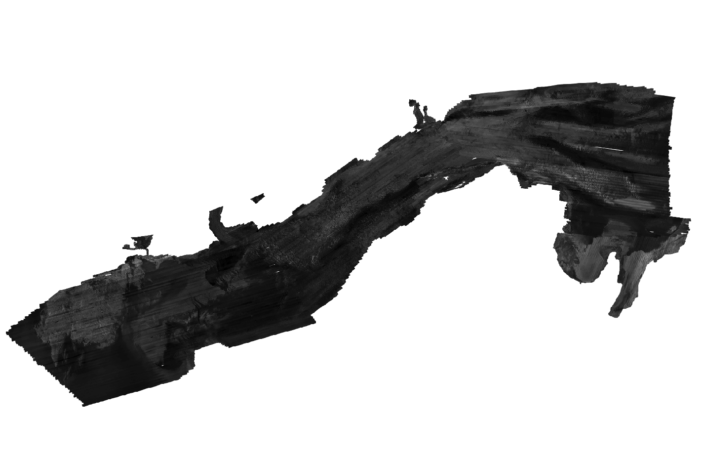
  1. Who distributes the data set? (Distributor 1 of 1)
    Wayne Baldwin
    U.S. Geological Survey
    Geologist
    384 Woods Hole Rd.
    Woods Hole, MA
    USA

    508-548-8700 x2226 (voice)
    508-457-2310 (FAX)
    wbaldwin@usgs.gov
  2. What's the catalog number I need to order this data set? vns_bsmos_1m.zip from USGS Open File report 2016-1119. WinZip v. 14.5 file contains a GeoTIFF image with a world file (and associated metadata) of backscatter data collected in Vineyard and western Nantucket Sounds.
  3. What legal disclaimers am I supposed to read?
    Neither the U.S. Government, the Department of the Interior, nor the USGS, nor any of their employees, contractors, or subcontractors, make any warranty, express or implied, nor assume any legal liability or responsibility for the accuracy, completeness, or usefulness of any information, apparatus, product, or process disclosed, nor represent that its use would not infringe on privately owned rights. The act of distribution shall not constitute any such warranty, and no responsibility is assumed by the U.S. Geological Survey in the use of these data or related materials. Any use of trade, product, or firm names is for descriptive purposes only and does not imply endorsement by the U.S. Government
  4. How can I download or order the data?
  5. What hardware or software do I need in order to use the data set?
    The image contained in the zip file is available as a GeoTIFF with a world file. To utilize this data, the user must have an image viewer, or an image processing or GIS software package capable of importing a TIFF image.

Who wrote the metadata?

Dates:
Last modified: 18-Mar-2024
Metadata author:
Wayne Baldwin
U.S. Geological Survey
Geologist
384 Woods Hole Rd.
Woods Hole, MA
USA

508-548-8700 x2226 (voice)
508-457-2310 (FAX)
whsc_data_contact@usgs.gov
Contact_Instructions:
The metadata contact email address is a generic address in the event the person is no longer with USGS. (updated on 20240318)
Metadata standard:
FGDC Content Standards for Digital Geospatial Metadata (FGDC-STD-001-1998)

This page is <https://cmgds.marine.usgs.gov/catalog/whcmsc/open_file_report/ofr2016-1119/vns_bsmos_1m.tif.faq.html>
Generated by mp version 2.9.51 on Mon Mar 25 16:05:45 2024